Hiking the Monkey Rock Trail in Lake Tahoe, Nevada
Distance: 2.6 miles / 4.2 km
The Monkey Rock Trail, on the Nevada side of Lake Tahoe, is a beautiful, short, and easy day hike that climbs to a panoramic viewpoint above Crystal Bay and Incline Village, where hikers can see a one-of-a-kind man-made rock carving known locally as Monkey Rock!
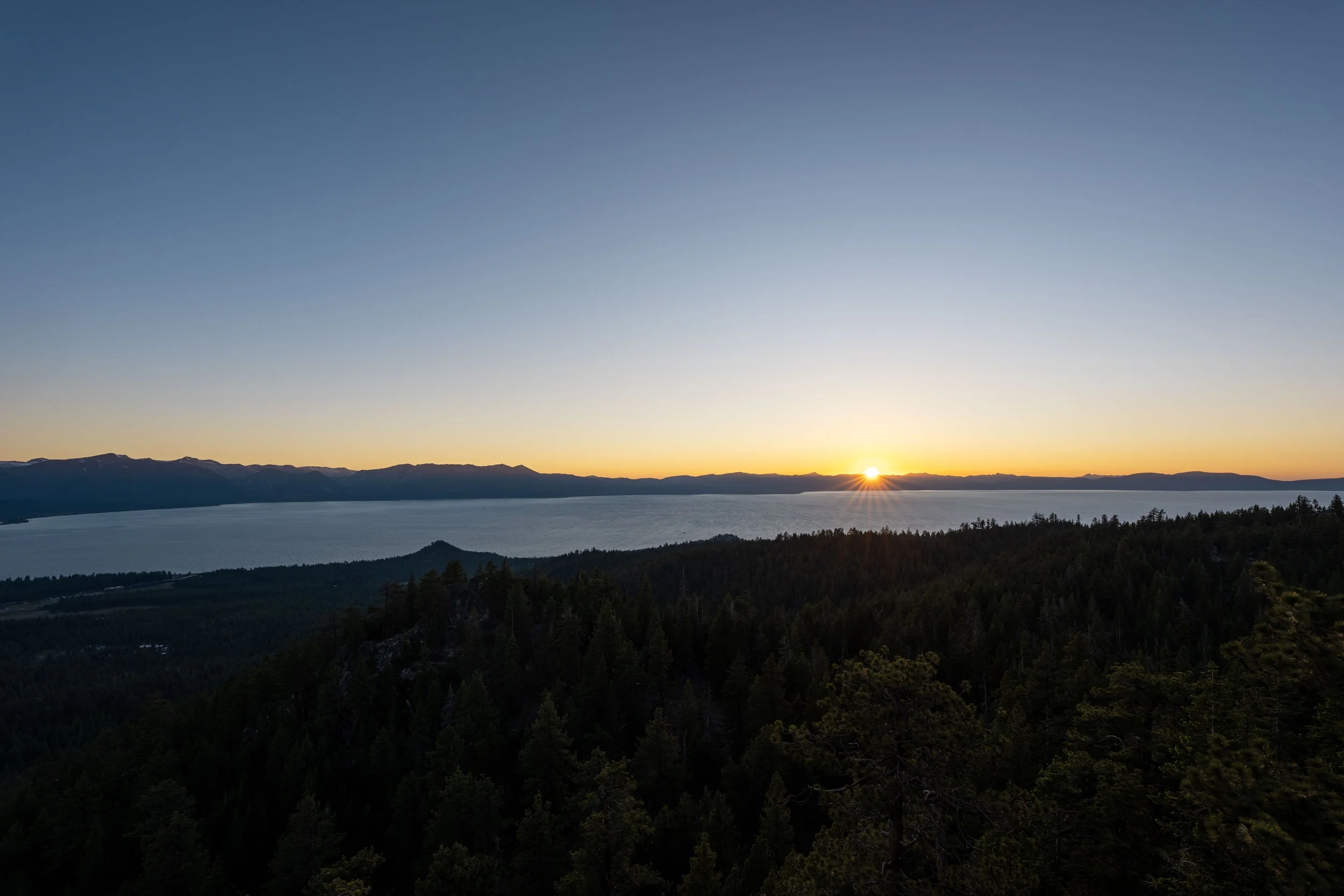
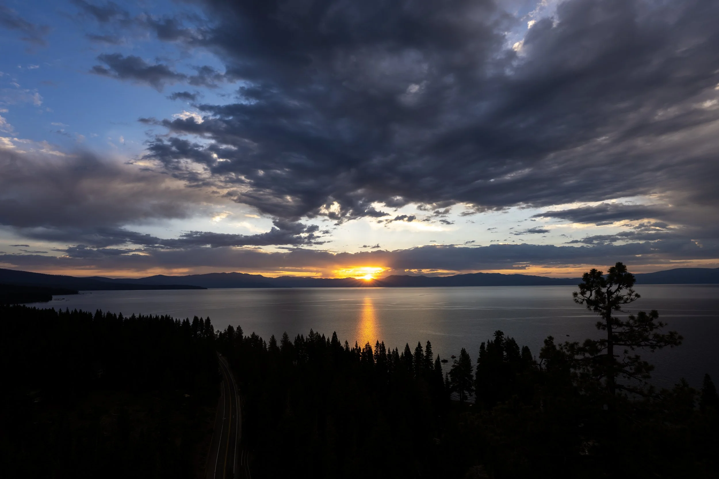
To add to this, the Monkey Rock Trail is arguably the best sunset hike in Lake Tahoe, as the west-facing viewpoint at the summit offers expansive views of both the lake and the sunset over the northern Sierra Nevadas to the west, and the short 1.3-mile (2.1 km) hike back after sunset is very manageable before it gets completely dark.
This is all to say that I have hiked the Monkey Rock Trail many times, and sunset is the only time of day I recommend visiting because it is simply the most beautiful time to be there! If sunset is something you’re considering, be sure to bring a good headlamp to ensure a safe hike back down, which can also come in handy on countless other amazing sunset hikes on the Nevada side of Lake Tahoe, including the Castle Rock Trail and the Captain Pomin Rock Trail, to name a few!
Monkey Rock Trailhead Parking
Parking for Monkey Rock Trail is located at the Tunnel Creek Trailhead, a joint parking area that serves a number of different adventures, including the Flume Trail, the Tahoe East Shore Trail, and countless others up in the Spooner Lake Backcountry.
That said, the Tunnel Creek Trailhead is a paid parking area, and this is very strictly enforced.
However, parking is free after 7 p.m., which is just one more reason the Monkey Rock Trail makes for a great sunset hike!
Google Maps Directions: Money Rock Trailhead (Tunnel Creek)
Hiking Checklist - Lake Tahoe
The Lake Tahoe Basin is Black Bear country, and, as with any area that is home to Black Bears, hiking with or without bear spray is up to your own discretion and comfort level.
With that in mind, here is a complete list of must-have things that you will want for any hike in the Lake Tahoe Basin.
Hiking the Monkey Rock Trail
Walking to the Trailhead
The Monkey Rock Trail begins at the very bottom of Tunnel Creek Road, next to the Tunnel Creek Café, where the hike follows the road for the vast majority of the distance to the viewpoint at the top.
That said, go right on Tunnel Creek Road, just past the entrance to the café, to begin hiking to Monkey Rock, about 1.3 miles (2.1 km) up the hill from this point.
Tunnel Creek Road
Once on Tunnel Creek Road, simply follow the road uphill, and it will arrive at the true trailhead in about 0.2 miles (0.3 km).
Keep in mind that parking is banned along Tunnel Creek Road before the official trailhead.
This is also strictly enforced, just as are the parking fees in the lot below.
Monkey Rock Trailhead
This is where the Monkey Rock Trail officially begins, but the roundtrip distance mentioned at the beginning of this article includes the walk up the paved portion of Tunnel Creek Road to get to this point.
After the trailhead, Tunnel Creek Road transitions from pavement to dirt, where it follows a mostly flat path for about 0.5 miles (0.8 km), until Tunnel Creek Road turns east and away from the lake.
On that note, I believe the Monkey Rock Trail is a great trail-running hike in Lake Tahoe!
If trail running is something you’re considering, I recommend using the shoes I have linked below, as they work well for both hiking and trail running on all the best adventures around Lake Tahoe.
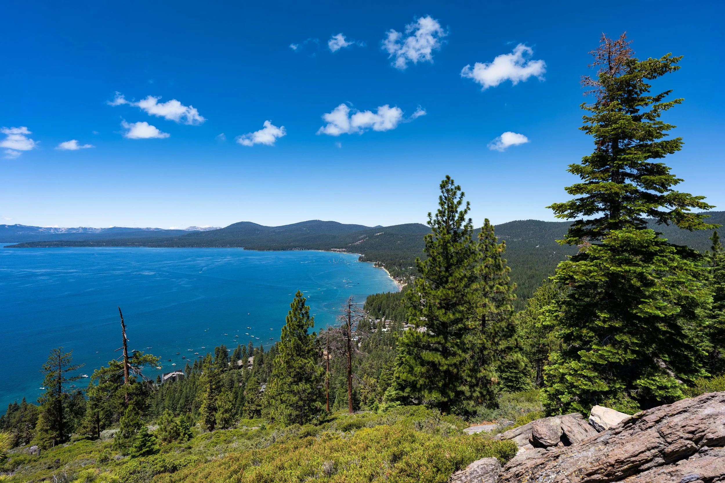
If there’s one thing I hope these photos show, it’s that the Monkey Rock Trail is very exposed from about mid-morning until very late in the evening.
This is why I highly recommend wearing a hooded sun shirt, especially considering the high elevations here and on every trail around the Lake Tahoe Basin.
Monkey Rock-Tahoe East Shore Connector Junction
After 0.7 miles (1.1 km) from the beginning of Tunnel Creek Road, the Monkey Rock Trail passes a short connector that leads down to the popular Tahoe East Shore Trail and Hidden Beach beyond.
Once here, go left to continue up Tunnel Creek Road and begin the much steeper portion of the hike that climbs to the viewpoint at the top.
When Tunnel Creek Road turns sharply to the left (east), away from the lake, the hike up to Monkey Rock gets much steeper than everything up to this point!
That said, the Monkey Rock Trail gains about 350 ft. (107 m) over the next 0.6 miles (1.0 km), but this gets even steeper if you decide to branch off on the cutoff instead of following Tunnel Creek Road a short distance ahead.
Lower Monkey Rock-Monkey Rock Cutoff Junction
After 0.9 miles (1.4 km), the Monkey Rock Trail splits at what is arguably the most important junction on the entire hike!
I say this because both routes lead to the beautiful Monkey Rock viewpoint above, but choosing one over the other is the difference between hiking a very short, steep, direct trail or a much more gradual ascent up the same hill.
That said, hikers are often split, but a great option can be to take the more gradual route up Tunnel Creek Road and the much steeper shortcut on the way back down.
For context, Tunnel Creek Road gains roughly 200 ft. (61 m) over the next 0.3 miles (0.5 km) from this point to the junction at the top, while the cutoff gains the same over 0.1 miles (0.2 km), which is noticeably more challenging!
Either way, I have both routes shown below!
To skip ahead to the Monkey Rock Cutoff Trail, click here.
Regarding my thoughts above, I chose to continue straight on Tunnel Creek Road, taking the much more gradual path up the hill, which is typically the more common approach.
This sharp hairpin may seem like a junction with another trail, but it is really nothing more than an alternate route that parallels Tunnel Creek Road and is commonly used by bikers to get back down.
That said, go left to stay on Tunnel Creek Road toward Monkey Road.
This is the final ascent to the junction where Tunnel Creek Road and the Monkey Rock Trail finally split from one another, just 0.1 miles (0.2 km) before the actual viewpoint.
Monkey Rock-Tunnel Creek Road Junction
After 1.2 miles (1.9 km), Tunnel Creek Road and the Monkey Rock Trail split and head in different directions.
Once here, go left to leave Tunnel Creek Road and begin the final portion of the hike to the panoramic viewpoint above Crystal Bay and Incline Village!
Upper Monkey Rock-Monkey Rock Cutoff Junction
Immediately after leaving Tunnel Creek Road, the Monkey Rock Trail passes the top of the very steep 0.1-mile (0.2 km) shortcut.
This is the route I recommend considering for the hike back down, but to continue hiking toward Monkey Rock, go straight to stay on the much flatter trail to the top of the hill.
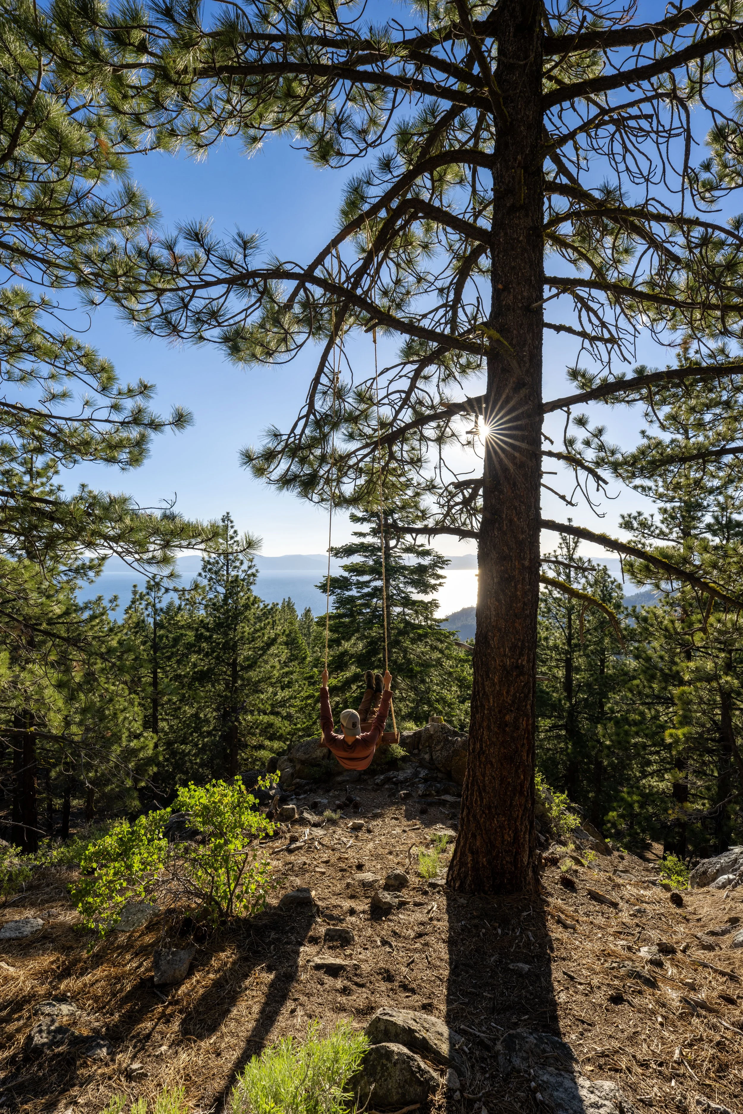
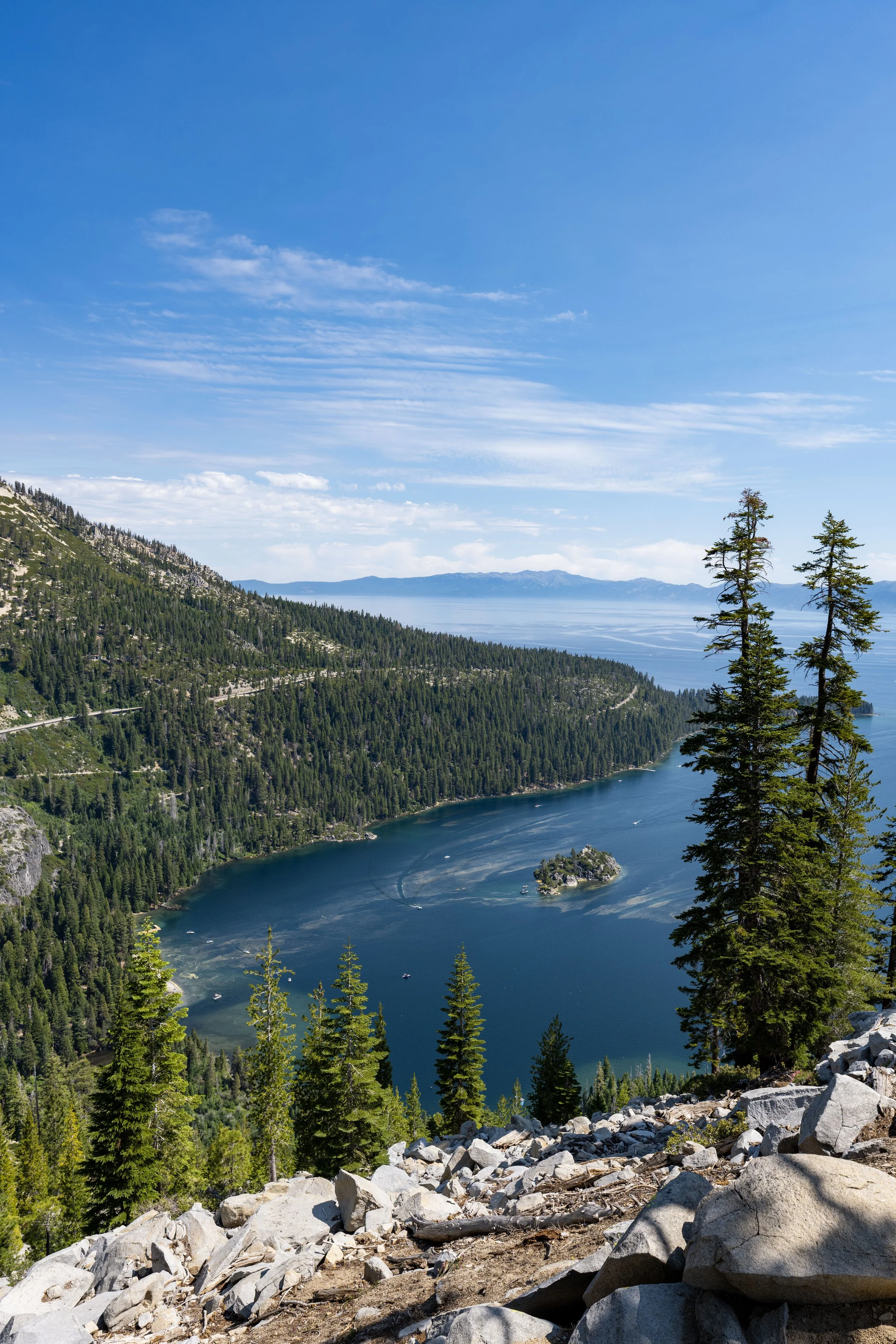
Monkey Rock
This is the end of the Monkey Rock Trail, which looks south toward some of the best and most pristine beaches Lake Tahoe has to offer, while the views to the north and west overlook Crystal Bay, Incline Village, and the state line!
On a clear night, this is exactly where I recommend catching the sunset, which is easily one of the best places to watch the sunset at Lake Tahoe!
Who Carved Monkey Rock?
No, the facial features on Monkey Rock are not 'entirely' natural.
Rather, the origin of the carving is a bit of a mystery, or at least those that know don’t want to come forward.
That said, some locals say it was carved by an Incline Village resident going through a difficult divorce, while others say the rock already resembled a monkey and that only some of its facial features were enhanced.
Either way, Monkey Rock today remains an iconic landmark above North Lake Tahoe today and a must-see if you’re visiting for the first time!
Lower Monkey Rock-Monkey Rock Cutoff Junction
If you decided to go left at the 0.9-mile (1.4 km) mark to follow the 0.1-mile (0.2 km) cutoff up to Monkey Rock, this is the route up the steep hill.
I hope it’s obvious why this very short but steep shortcut is more commonly used on the way back down!
Trekking poles can be very useful since it is so steep!
Upper Monkey Rock-Monkey Rock Cutoff Junction
This is the top of the very quick 200-ft. (61 m) ascent from the 0.9-mile (1.4 km) mark previously shown.
Once here, go left to finish the remaining 0.1-mile (0.2 km) hike past Tunnel Creek Road to the viewpoint and Monkey Rock at the end!
To skip back to this same junction shown previously, click here.
California
Nevada