Hiking the Kanahena Trail on Maui, Hawaiʻi
Distance: 0.9 miles / 1.4 km
The Kanahena Trail on Maui is a short and easy coastal hike within the ʻĀhihi-Kīnaʻu Natural Area Reserve south of Kīhei that follows the shoreline along ʻĀhihi Bay and the youngest lava flows on the island!
Yes, the ʻĀhihi-Kīnaʻu Natural Area Reserve primarily consists of ʻAʻā lava, and these flows, known as the Keoneʻōʻio Lava Field or La Perouse Bay Lava Field, are considered to be the youngest on Maui.
All of this to say, visitors that hike the Kanahena Trail today get to enjoy the beautiful coastal scenery along the lava flow, native Hawaiian plants throughout the hike, and, on the way back, views up the steep slopes of Haleakalā to the north.
Kanahena Trailhead Parking
Parking for the Kanahena Trailhead is located at the ʻĀhihi-Kīnaʻu Natural Area Reserve parking lot.
This means that residents with a valid State of Hawaiʻi ID are exempt from any parking fees, just like ʻĪao Valley and Waiʻānapanapa, but out-of-state residents are required to pay to park, though advance reservations are not required.
Google Maps Directions: Kanahena Trailhead
My Hawaiʻi Hiking Checklist
Hiking the Kanahena Trail
The Kanahena Trail begins on a short 0.1-mile (0.2 km) path that leads directly out to ʻĀhihi Bay.
From the very start of the Kanahena Trail to its far southern end, hikers can find native plants along the trail, which reflects the conservation efforts underway at ʻĀhihi-Kīnaʻu and the fence that surrounds much of it.
To this point, the cattle guard and the fence that the Kanahena Trail initially passes through are designed to keep non-native goats out of the reserve, as they are particularly destructive across Hawaiʻi’s native landscapes, not just here on Maui.
When the Kanahena Trail reaches the water, it follows ʻĀhihi Bay for roughly 0.3 miles (0.5 km) to the end of the hike.
If you look closely, someone can be seen surfing in the photo below!
From this point, the end of the Kanahena Trail can be seen in the distance.
When the Kanahena Trail climbs up off the beach for the first time, the far southern end of the hike is only 0.1 miles (0.2 km) away.
The sign in the distance is the end of the Kanahena Trail.
End of the Trail
This is the end of the Kanahena Trail, which is truly nothing more than a place to look for native plants, enjoy the views looking back toward Haleakalā, and, if you’re lucky, spot a Hawaiian Monk Seal!
That said, do not approach a seal on the shoreline if you see one, and if you are caught, intentionally or unintentionally, getting too close to or harassing one of Hawaiʻi’s endemic monk seals, it is not unlikely that you will be found and prosecuted through video evidence—and yes, ʻĀhihi-Kīnaʻu is heavily monitored by video cameras.
"NOAA and [the Hawaiʻi Department of Land and Natural Resources (DLNR)] recommend, for your safety and the animals’ protection, that everyone stay at least 10 feet (3 meters) from all sea turtles. If maintaining this distance isn’t possible, keep safety in mind and move away from the animal as carefully as possible, avoiding sudden movements and other actions that might disturb the animal."
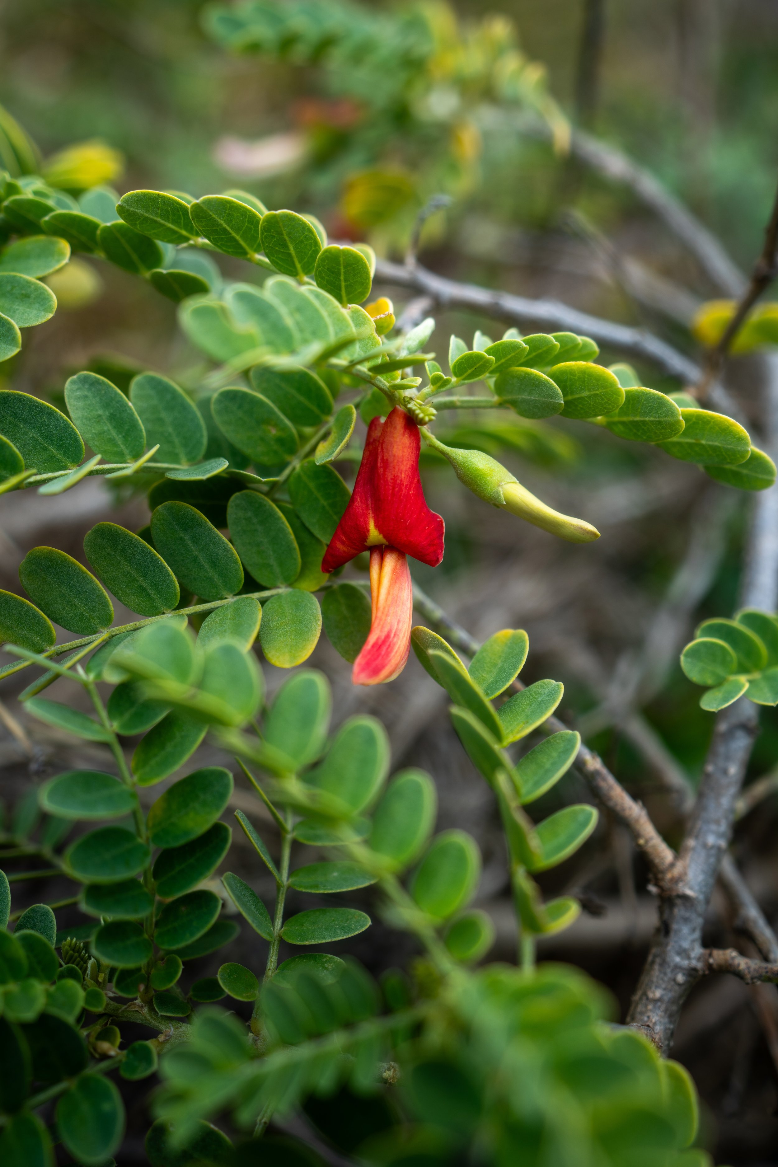
Native Plants on the Kanahena Trail
The Kanahena Trail is one of the most heavily managed coastlines on Maui, meaning this area sees constant conservation efforts, which is why there are so many native species that hikers can find on the short 0.45-mile (0.7 km) trail.
Some of these include ʻAʻaliʻi, Maiapilo, Naupaka, ʻUhaloa, Wiliwili, Kou, and Pōhinahina, to name just a few.
If you would like to learn more about these and many other native Hawaiian plants from across the islands, I encourage you to check out my separate post linked below.
Read My Separate Post: Native Hawaiian Plant Guide