Hiking the Waiheʻe Ridge Trail on Maui, Hawaiʻi
Distance (Roundtrip): 4.4 miles / 7.1 km
Elevation Gain: 1,400 ft. / 427 m
The Waiheʻe Ridge Trail on Maui is a renowned day hike in the West Maui Mountains that is loved by both locals and visitors alike for its dramatic views of Waiheʻe Valley, ʻEke Crater, and Haleakalā to the east!
However, this doesn’t go without saying that Waiheʻe Ridge is just as beautiful as it is popular—meaning the Waiheʻe Ridge Trail is one of the busiest day hikes on Maui.
For this reason, I highly recommend starting the Waiheʻe Ridge Trail early in the morning, which is coincidentally the best time of day to enjoy the prettiest light for taking photos, as the early morning sun on the West Maui Mountains lights up the dramatic landscape for the first time!
Waiheʻe Ridge Trailhead Parking
Parking for the Waiheʻe Ridge Trail is located in a very small parking lot at the top of Maluhia Road, about 0.8 miles (1.3 km) up the hill from the turnoff to Kahekili Highway.
That said, the small parking lot at the top of Maluhia Road often fills up early on most days of the week—especially weekends!
This is why I highly recommend arriving shortly after the trail opens in the morning, or you may have to park in the overflow lot just off Kahekili Highway and walk the extra 0.8 miles (1.3 km) with 400 ft. (122 m) of elevation gain just to reach the Waiheʻe Ridge Trailhead.
Google Maps Directions: Waiheʻe Ridge Trailhead
Hiking the Waiheʻe Ridge Trail
The Waiheʻe Ridge Trail begins up a short but steep 0.1-mile (0.2 km) service road that leads to the Camp Maluhia water tanks at the top of the hill, before it branches off onto the actual trail.
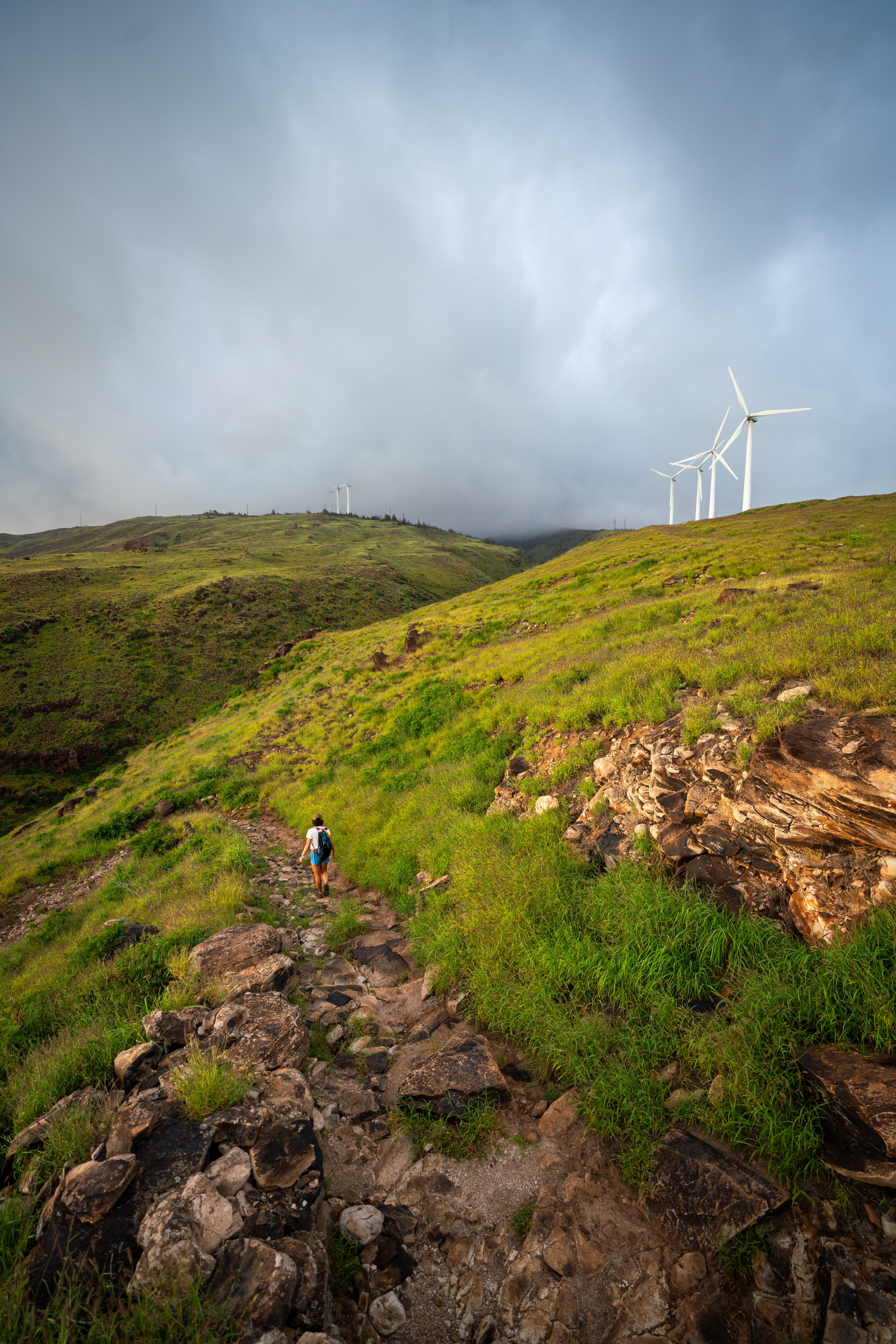
If this first hill says anything, the Waiheʻe Ridge Trail is a near-constant uphill hike, ascending roughly 1,400 ft. (427 m) over the course of 2.2 miles (3.5 km) to the summit of Puʻu Lanilili.
For this reason, I recommend carrying at least 2-3L of water per person—especially during the warmer summer months.
This is where the Waiheʻe Ridge Trail breaks away to the left at the top of the service road.
Some of the trees at the beginning of the Waiheʻe Ridge Trail are Kukui trees, which are canoe plants here in Hawaiʻi, meaning species that were brought with the original Polynesians when the islands were first discovered.
After 0.3 miles (0.5 km), the Waiheʻe Ridge Trail comes to an ungulate-exclusion fence across the trail.
Once here, hikers will find a path on right-hand side of the gate that leads through the fence to the other side.
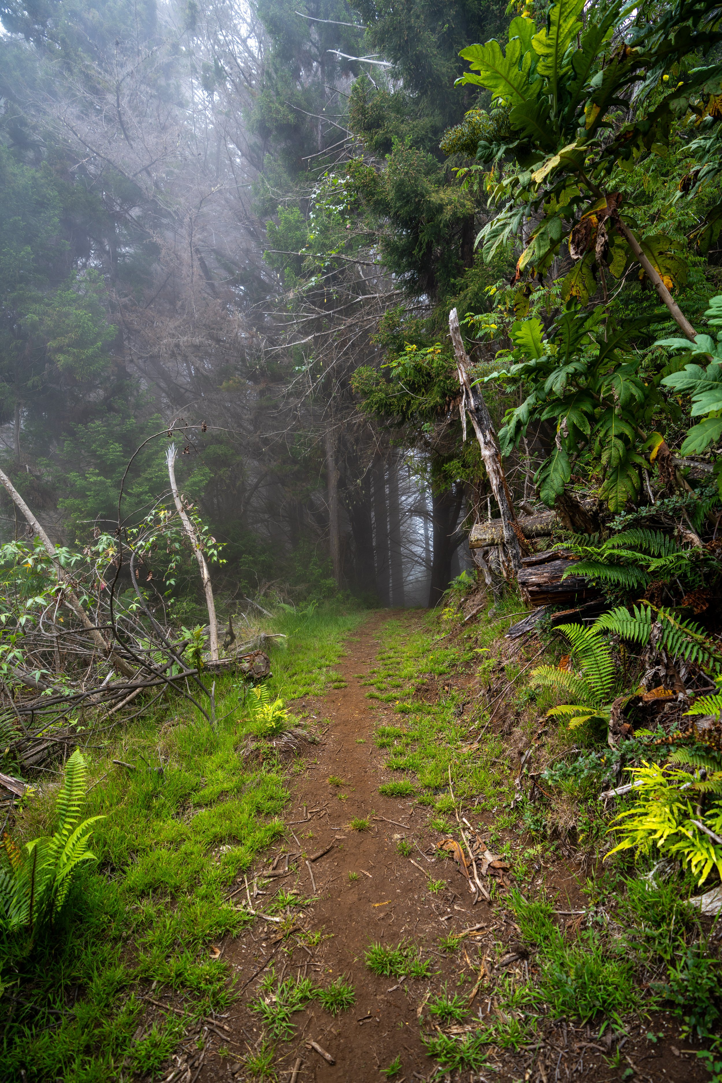
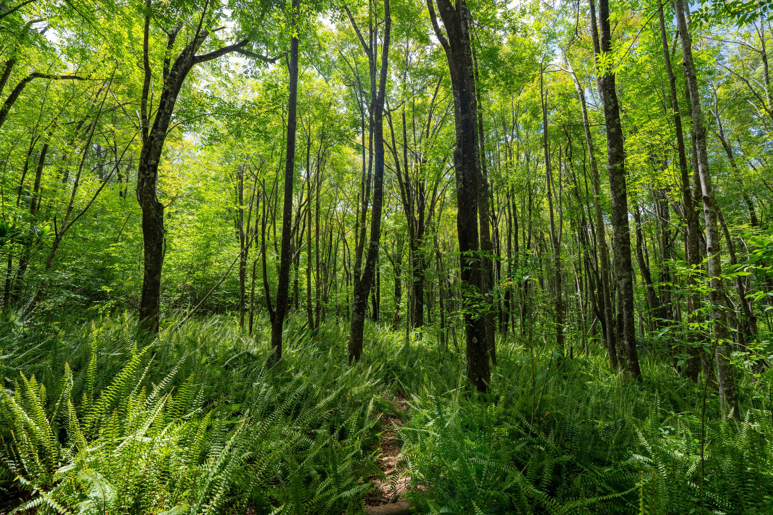
After the fence, the Waiheʻe Ridge Trail winds its way through a mixed Cook Pine–Eucalyptus—Strawberry Guava forest as it climbs above the lower canopy.
These switchbacks at the beginning of the Waiheʻe Ridge Trail are about as easy as the elevation gain gets, meaning the trail becomes a bit steeper after the 1.0-mile (1.6 km) mark, following the Waiheʻe Valley Overlook up ahead.
Spotting ʻŌhiʻa on Hawaiʻi trails is always a nice sign that the trail is reaching higher, more native elevations!
Makamakaʻole Overlook
The Makamakaʻole Overlook is the last switchback before the Waiheʻe Ridge Trail breaks out of the overstory canopy.
In addition, it is here at the bench where hikers can see Makamakaʻole Falls, located just one drainage north of the Waiheʻe Ridge Trail, which is why the two can make great back-to-back hikes for those who are up for a bit of a longer day outside!
This is where the Waiheʻe Ridge Trail leaves the canopy behind.
That said, I recommend wearing a hooded sun shirt for the hike up to Puʻu Lanilili, as there really are few places to find shade from this point to the summit, apart from one short stretch just before the meadow.
Waiheʻe Valley Overlook
After roughly 0.8 miles (1.3 km), the Waiheʻe Ridge Trail reaches the Waiheʻe Valley Overlook, one of the most iconic viewpoints on Maui!
The platform is also a popular turnaround point for many hikers uninterested in continuing to the summit of Puʻu Lanilili, but if the weather is clear, I recommend hiking higher, as the summit is also one of the most beautiful viewpoints on the island!
After the Waiheʻe Valley Overlook, the Waiheʻe Ridge Trail follows a slightly flatter section for the next 0.2 miles (0.3 km).
This is the 1.0-mile (1.6 km) mark, which, in my opinion, signals the end of the easy 'half' of the Waiheʻe Ridge Trail up to this point.
That said, the remaining 1.2 miles (1.9 km) to the summit of Puʻu Lanilili get a bit more challenging as the trail gets steeper.
Some hikers may want to carry trekking poles for the steeper sections up the Waiheʻe Ridge Trail—especially if it has recently been raining!
The trees that can be seen on the hill in the distance are not located on the summit of Lanilili.
Rather, this is the one other section that was previously mentioned, with overstory trees located just before the meadow and the final ascent to the summit.
Just the Kukui trees mentioned in the beginning, these other broad-leafed plants lining the Waiheʻe Ridge Trail are another canoe plant in Hawaiʻi, known as Ti or Kī, and can be found along most of the trail leading up to the summit.
Even though the Waiheʻe Ridge Trail may seem very steep, it is one of the most popular trail-running hikes on Maui, along with the Kahakapao Loop Trail.
For those interested, the shoes linked below are what I trust when trail running in Hawaiʻi, as they work fairly well for both hiking and running on muddy terrain, as long as it’s not overgrown.
The start of these stairs are a nice sign that the trees mentioned previously, followed by the meadow and the final ascent, are not far ahead!
This is the best view to show the Paperbark trees along the trail to the left, the Makamakaʻole Meadow at the low point in the middle, and the summit of Lanilili, just out of view on the right-hand side.
This is the longest, steepest section of stairs on the Waiheʻe Ridge Trail.
After the stairs, the Waiheʻe Ridge Trail becomes much flatter until the final ascent, as it winds its way up to the Paperbark trees and the Makamakaʻole Meadow that immediately follows.
This is where the Waiheʻe Ridge Trail enters a short overstory forest, lined with Paperbark trees, before the meadow.
Makamakaʻole Meadow
The Makamakaʻole Meadow is a very short stretch across a low point in the trail, just below the summit of Puʻu Lanilili.
That said, this section is often muddy when it has been raining recently, particularly in the wetter winter months, which is again why some hikers may want to carry trekking poles on the Waiheʻe Ridge Trail.
After the meadow, the Waiheʻe Ridge Trail begins the final ascent to the summit, climbing about 6 or 7 more switchbacks, depending on how you count, to reach the top.
These endemic ʻŌlapa trees are some of the most beautiful plants up here, especially when the leaves blow in the wind like Aspens on the mainland!
This long, straight stretch is where the Waiheʻe Ridge Trail climbs up to the summit ridge!
This is the top of the summit ridge below Puʻu Lanilili.
The 2.0-mile (3.2 km) mark is a nice sign that the end of the Waiheʻe Ridge Trail is only a short distance ahead!
Puʻu Lanilili
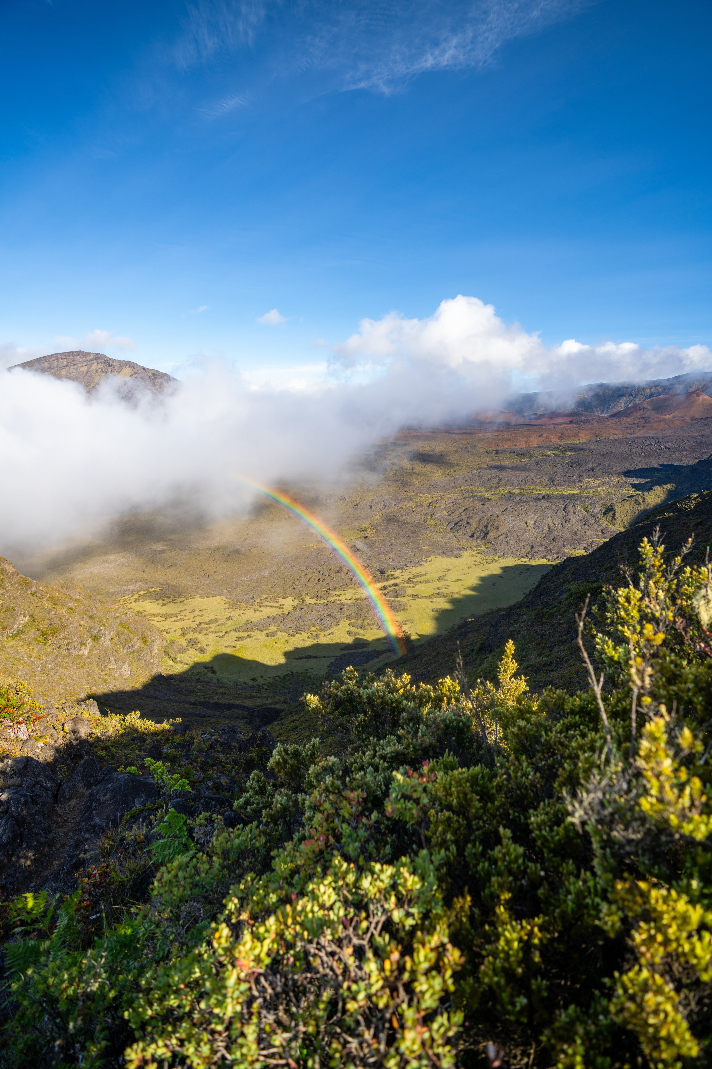
Puʻu Lanilili, or more simply called Lanilili, is the end of the Waiheʻe Ridge Trail at approximately 2,566 ft. (782 m), according to the USGS.
That said, the summit is only about halfway up the West Maui Mountains (Puʻu Kukui), but on a clear day, like in the sunrise photo below, hikers can get amazing views of Waiheʻe Valley, Keahikauō (the circular summit closest to the platform), and ʻEke Crater, one of the most prominent volcanic landmarks on the northeast side of the watershed.
Native Plants on the Waiheʻe Ridge Trail
The Waiheʻe Ridge Trail passes through a number of different zones, so to speak, with the lower elevations consisting primarily of non-native, invasive species, while the upper elevations slowly transition into a more and more native landscape the higher the trail climbs.
That said, the lower elevations are primarily dominated by non-native grasses, Eucalyptus, Cook Pines, Strawberry Guava, and Paperbark trees, but once above the lower forest, the Waiheʻe Ridge Trail encounters many more native plants from the Waiheʻe Valley Overlook and on.
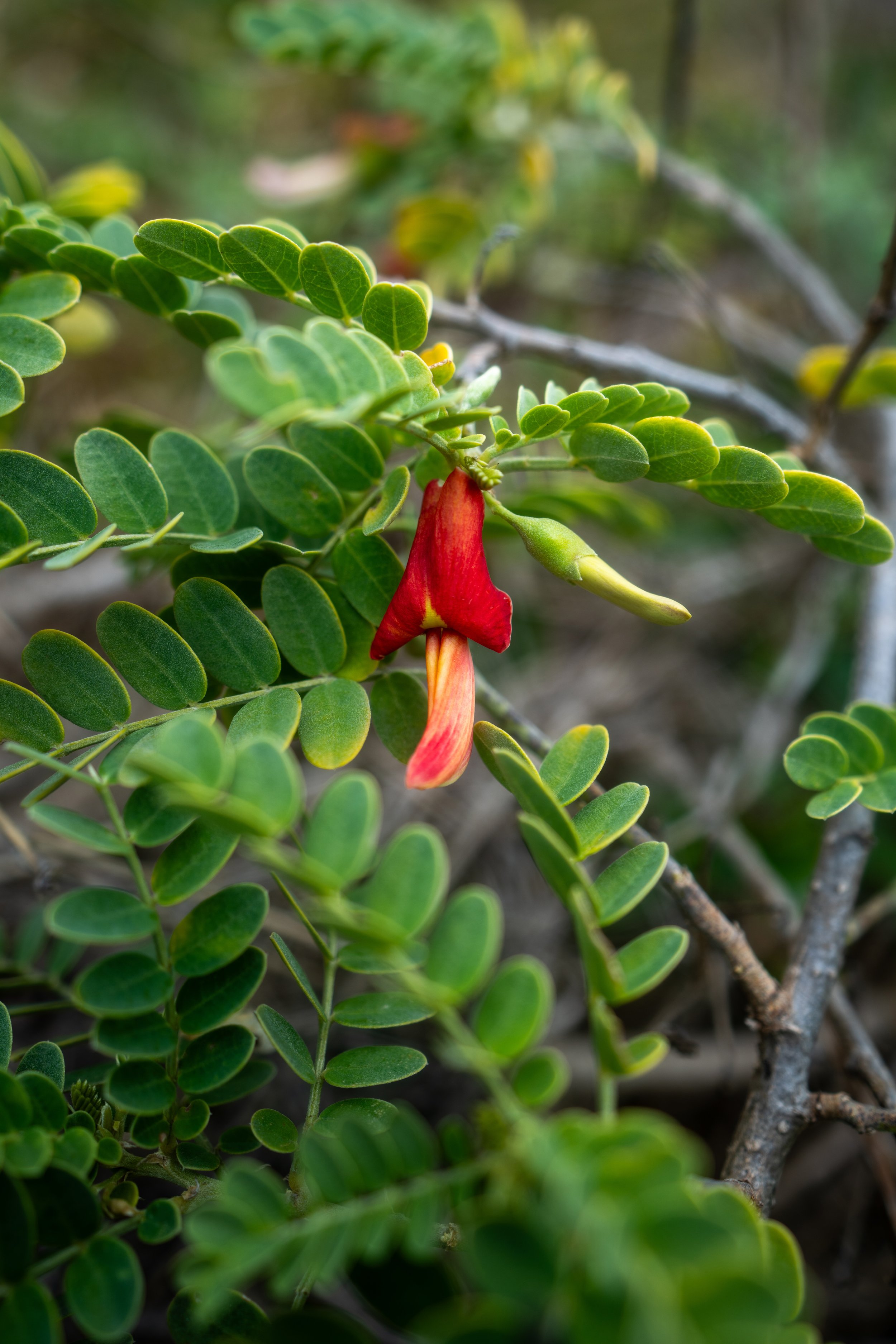
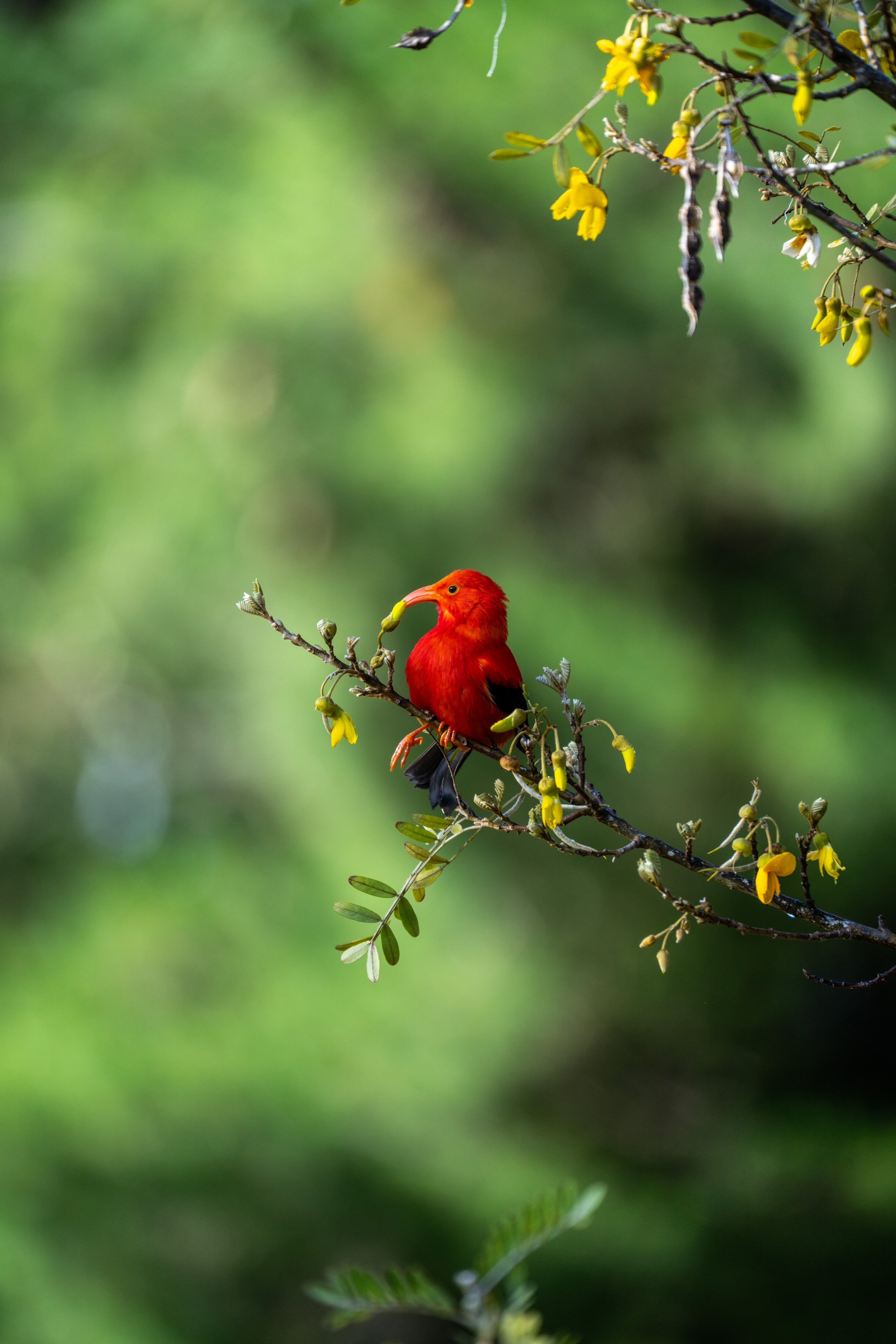
Some of these include ʻŌhiʻa lehua, Kōpiko, Naupaka, Hōʻawa, Kāmakahala, Uki, Akaʻawa, ʻŌlapa, ʻAmaʻu, Palaʻā, ʻIeʻie, and Koa, to truly only name only a few.
If you would like to learn more about these and many other native Hawaiian plants from across the islands, I encourage you to check out my separate post linked below.
Read My Separate Post: Native Hawaiian Plant Guide