Hiking the Lake of the Crags Trail in Grand Teton National Park
Distance (One Way - Lake of the Crags Trail Only): 2.3 miles / 3.7 km
Elevation Gain: ~2,775 ft. / 846 m
The Lake of the Crags Trail in Grand Teton National Park is a beautiful but very steep day hike off the popular Jenny Lake Loop that leads to not one but two stunning alpine lakes located high up in the Teton Range!
That said, I would be remiss if I didn’t stress that the Lake of the Crags Trail is one of the steepest day hikes in Grand Teton National Park! In fact, the average elevation change is about 120 ft. (37 m) every 0.1 miles (0.2 km)!
To put it bluntly, if you’re not in shape, the Lake of the Crags Trail is not for you, and your safety is your responsibility—especially considering that the Lake of the Crags Trail is not maintained by the National Park Service. Rather, it’s what is often called a 'social trail,' much like the popular Delta Lake Trail via Lupine Meadows.
This is all to say that the Lake of the Crags Trail is one of the most beautiful and rewarding day hikes in Grand Teton National Park, but be sure to prepare for a very long uphill adventure, keeping in mind that the relatively short distance off the Jenny Lake Loop Trail is a bad way to estimate the trail’s difficulty. It’s harder than it may initially seem!
Lake of the Crags Trailhead Parking
The Lake of the Crags Trail can begin from a number of different trailheads, but the two most popular are the Jenny Lake Trailhead at the Jenny Lake Visitor Center and the String Lake Trailhead, the same trailhead that also serves the String Lake Loop Trail.
That said, the Jenny Lake Trailhead is one of the top three most competitive trailheads in Grand Teton National Park, next to the Phelps Lake Trailhead and Lupine Meadows, which serves the popular Delta Lake Trail.
This is why it is important to arrive early, even if you plan to park at String Lake, which is easily number four in terms of being one of the most competitive trailheads in the park.
I say all this because parking at the Jenny Lake Visitor Center often fills up in the early morning hours, and by around 8:00–9:00 a.m., visitors are often left to park on Teton Park Road, sometimes up to 0.5 miles (0.8 km) away during the busiest summer months!
Google Maps Directions: Lake of the Crags Trailhead (Jenny Lake) / Lake of the Crags Trailhead (String Lake)
Hiking Checklist - Yellowstone–Tetons
Here is a complete list of must-have things that you will want for any hike in the Yellowstone–Teton area.
Hiking the Lake of the Crags Trail
As previously mentioned, the Lake of the Crags Trail can either begin from the Jenny Lake Trailhead or the String Lake Trailhead in order to reach the unmarked junction located on the far west side of Jenny Lake.
If you are interested in learning more about the Jenny Lake Loop Trail to the start of the true Lake of the Crags Trail, all the details can be found in my separate article linked below.
Read My Separate Post: Jenny Lake Loop Trail
Lake of the Crags-Jenny Lake Loop Junction
This is the Lake of the Crags Trailhead when coming from both directions on the Jenny Lake Loop Trail.
The first photo below is what the Lake of the Crags Trailhead looks like when coming from the Jenny Lake Visitor Center in the clockwise direction, and the second photo is what the same junction looks like when beginning at the String Lake Trailhead in the counterclockwise direction
Read My Separate Post: Jenny Lake Loop Trail
After leaving the popular Jenny Lake Loop behind, the Lake of the Crags Trail starts climbing almost immediately and doesn’t stop for nearly the entire distance to the end!
This is where the Lake of the Crags Trail noticeably gets steeper, just 0.1 miles (0.2 km) up the hill from the Jenny Lake Loop.
After just 0.2 miles (0.3 km), the Lake of the Crags Trail enters the burn scar from the 1999 Alder Fire.
This is important to mention because there is hardly any shade on the entire hike, and it’s why it’s important to hike in a hooded sun shirt in order to stay safe at these higher elevations, which climb to just over 9,500 ft. (2,896 m) at the Lake of the Crags.
This is where the destruction from the 1999 Alder Fire becomes much more apparent.
From the lower elevations of the Lake of the Crags Trail, Inspiration Point can be seen at the mouth of Cascade Canyon in the distance!
For a visual reference, the Lake of the Crags Trail climbs up Hanging Canyon between the two unnamed peaks in the distance in the photo below.
One of the most deceptive things about the beginning of the Lake of the Crags Trail is how easy it can be to be optimistic that the lake is not far beyond Ribbon Cascade, the waterfall coming down the cliff in the distance.
However, that couldn’t be further from the truth, as the Lake of the Crags Trail has false summit after false summit, in a manner of speaking, where you’re really not even close until you’re well beyond Ramshead Lake.
This sharp turn away from the waterfall is the 1.0-mile (1.6 km) mark since leaving the Jenny Lake Loop Trail.
This very short 0.1-mile (0.2 km) section through the trees is truly one of the very few places to find shade on the Lake of the Crags Trail, and, again, it’s why I could not recommend hiking in a hooded sun shirt more!
These views high above Jenny Lake hopefully show just how quickly the Lake of the Crags Trail climbs over a very short distance!
This stand of Douglas Fir and various pines is one of the last areas with any real shade before the Lake of the Crags Trail reaches Ramshead Lake, just before the very end.
As the Lake of the Crags Trail climbs its way up Hanging Canyon, there will be a number of different routes that branch out from one another, mainly because it is a social trail, not a National Park Service trail.
That said, most of the routes up the steep hillside all lead to the same place, but some are significantly easier and more straightforward than others. I highlight those specific ones below.
In any case, this first split is one of the more insignificant ones, as both trails meet again shortly ahead.
This is where both routes come together again, just a few steps from the photo shown above.
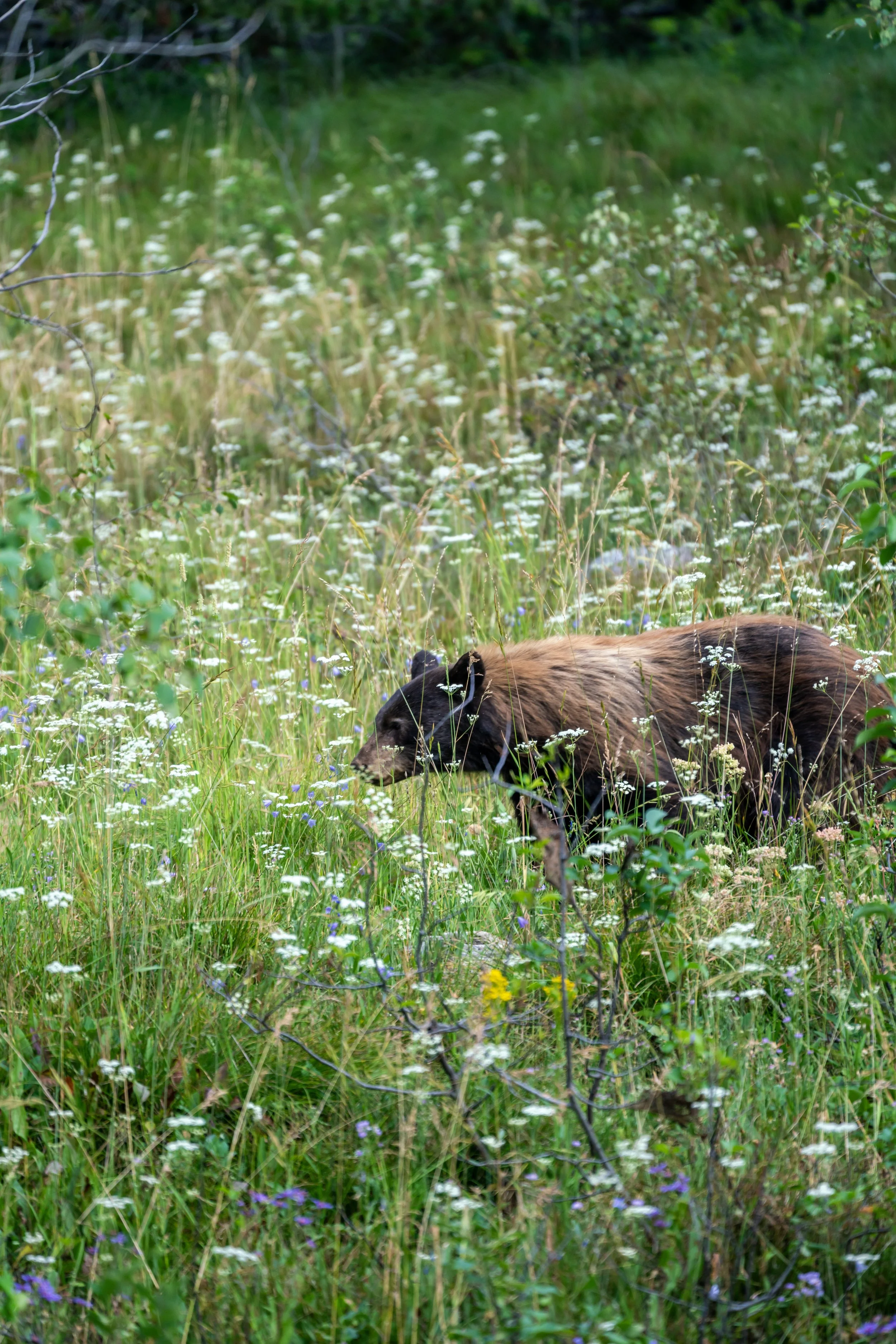
It’s important to mention that even this high up, bear encounters are not uncommon.
In fact, the vast majority of the Black Bears I’ve encountered in Grand Teton National Park have been on steep hillsides, just like the Lake of the Crags Trail here.
This is why it’s always important to come prepared, which also means knowing how to identify the difference between a Black Bear and a Grizzly.
Yes, it really is this steep, and it’s why I strongly recommend bringing trekking poles if you have any doubts, which can be particularly useful for the way back down!
Even after all this climbing, it’s important to know that the end is far from in sight!
When the Lake of the Crags Trail reaches this narrowing, there are two paths that climb their way up the creek.
The first hugs the cliffside on the right, but I recommend going left (straight) toward the creek because it’s an easier and more straightforward route up the mountain.
Regarding my thoughts above, I chose to go left (straight).
At the top of the narrow corridor, both routes come together once again.
Shortly after the trail levels out from the previous steep section, the path splits once again.
That said, I recommend going left at this split as well, because it is an easier route up the boulder field just ahead.
Regarding my thoughts above, I chose to go left on the path that crosses the creek.
If you decided to go right at the split shown above, the trail leads straight into the boulder field on the right-hand side of the photo below, which is why I believe it is a much less preferred route than simply following the trail shown here.
At the top of the hill, the Lake of the Crags Trail will disappear, but to continue up the easiest route to Ramshead Lake, cut straight across the boulder field at an angle toward the cliffside at the next narrowing.
That is where the trail will become obvious again in just a short distance.
This is where the Lake of the Crags Trail continues on the far side of the boulder field.
Then, just a few steps after regaining the trail, walk up the cliffside on the right-hand side of the narrowing, and the path will become obvious again in just a few steps.
Arrowhead Notch
With just 0.1 miles (0.2 km) to go before the Lake of the Crags Trail reaches Ramshead Lake, the trail comes to this very short but steep little scramble.
That said, I think the photos below make it look more challenging than it actually is, and I say this because if you’re used to this type of scrambling across the Mountain West, using your hands may not even be necessary on the way up, as there are countless little ledges you can use to walk your way to the top.
This is where the Lake of the Crags Trail levels out at the top of Arrowhead Notch.
This is where the Lake of the Crags Trail crosses the 2.0-mile (3.2 km) mark since leaving the Jenny Lake Loop Trail.
Ramshead Lake
After a long and very steep 2.1-mile (3.4 km) hike to get to this point, the Lake of the Crags Trail finally reaches Ramshead Lake, the first and lesser-known of the two alpine lakes near the end of the hike.
On that note, this is the first time on the entire trail that hikers can actually see the final hill leading up to the Lake of the Crags, meaning that there are no more false summits from this point to the end!
After Ramshead Lake, the Lake of the Crags Trail continues around the right-hand side.
For a very short stretch, the Lake of the Crags Trail disappears in another boulder field before continuing again on the far side.
This is the easiest route through the big boulders on the far west side of Ramshead Lake.
The very end of the Lake of the Crags Trail is simply a steep talus slope.
That said, this slope tends to be one of the snowiest areas on the entire trail, even to the point where the entire boulder field is covered during the middle of the most beautiful summer hiking months.
However, I did this hike in mid-August, following a very bad snow season across the West, but know that I have also seen this entire final ascent as one big icy slope in the middle of July.
This is why I highly recommend bringing micro-spikes at the very least—especially if you’re planning to visit Grand Teton National Park early in the summer season.
When the boulder field finally levels out, Lake of the Crags can be seen in the distance for the first time on the entire hike!
Lake of the Crags
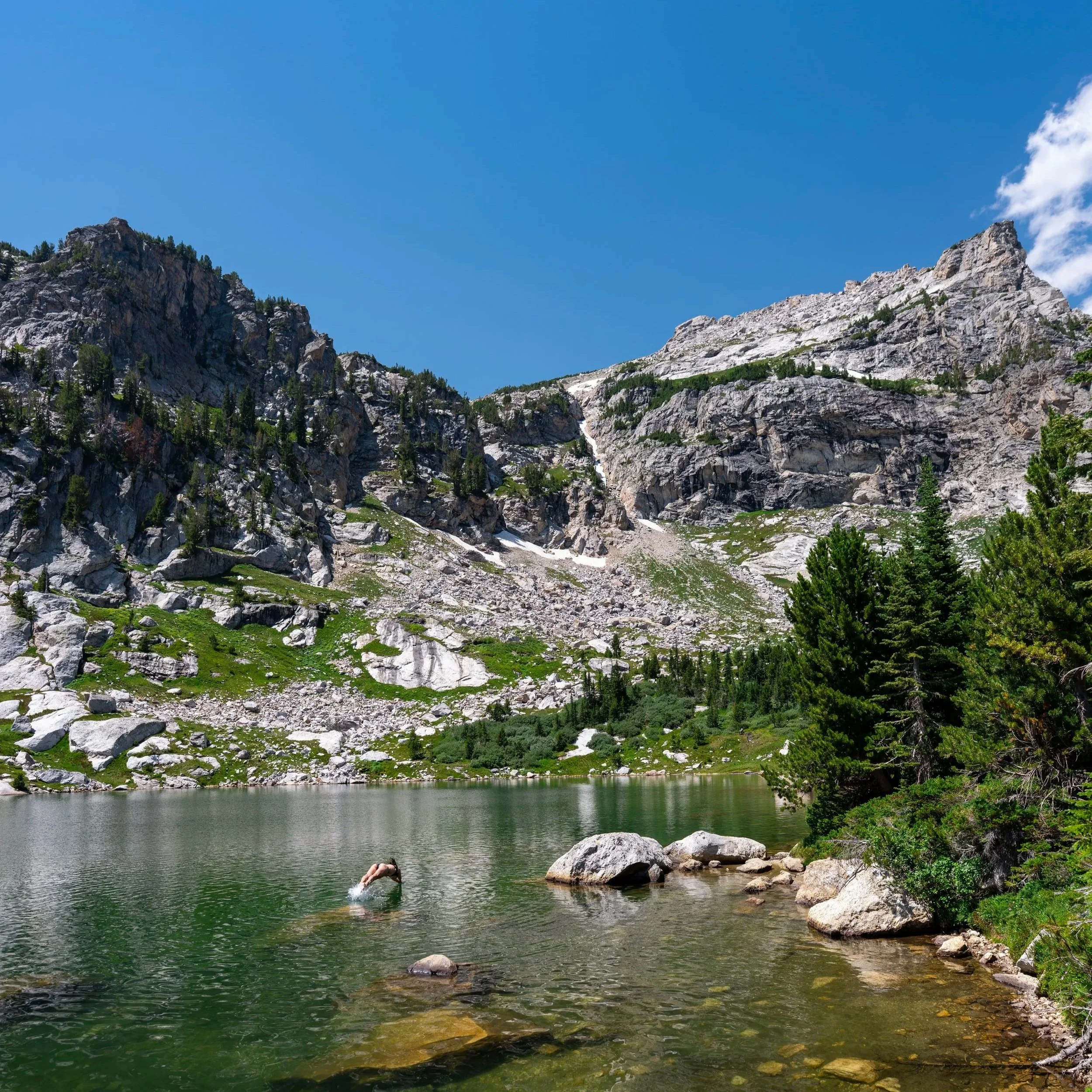
After a long and very steep 2.3-mile (3.7 km) hike since leaving the Jenny Lake Loop, the trail finally ends at the Lake of the Crags Trail!
If you visit early in the day, it’s not unlikely to have the entire lake to yourself, which is truly something special, considering how busy many trails are across much of Grand Teton National Park!