Hiking the Chesler Park Loop Trail in Canyonlands National Park
Distance: 10.7 miles / 17.2 km
The Chesler Park–Joint Trail Loop via Elephant Hill, more commonly known as the Chesler Park Loop Trail, in Canyonlands National Park is, without a doubt, the best day hike in The Needles District to enjoy the best that The Needles has to offer!
I say this because no trail traverses through The Needles like the Chesler Park Loop, as the stunning trail climbs in and out of drainages, squeezes its way through a number of narrow slot canyons and caves, and has countless fun scrambling sections scattered throughout the full loop!
It’s for all these reasons that I believe the Chesler Park Loop Trail is easily one of the best things to do in Canyonlands National Park, especially once the trail reaches the most beautiful section: the Joint Trail!
Now, this all goes without saying that the Chesler Park Loop Trail is certainly one of the more challenging adventures in The Needles. However, I wouldn’t classify it as a technical adventure by any means, which is why I used the word 'fun' to describe the scrambling above.
I say all this because the Chesler Park Loop Trail is a long, remote adventure, but a great option for more experienced, independent hikers who are accustomed to spending all day out on the trail!
How Hard is the Drive to Elephant Hill?
As the road to Elephant Hill turns off the pavement just before The Needles Campground, the last 2.7 miles (4.3 km) of the drive transitions into a gravel, narrow, and sometimes bumpy road.
That said, the Elephant Hill Trailhead is typically accessible to most 2WD vehicles, granted that the road is snow-free and hasn’t been washed out by heavy storms. I say this because this final stretch passes over two separate washes, which can be impassable after summer monsoonal storms.
Chesler Park Loop Trailhead Parking
Parking for the Chesler Park Loop Trail is located at either the Elephant Hill or Joint Trailhead parking areas, with Elephant Hill being much more common since it is typically accessible by way of 2WD.
However, the Chesler Park Loop could also begin at the Joint Trailhead, which is located on the far southern side of the 10.7-mile (17.2 km) loop, but a 4WD is required to access this parking area.
Google Maps Directions: Elephant Hill Trailhead / Joint Trailhead
Hiking Checklist - Canyonlands
Here is a complete list of must-have things that you will want for any hike in Canyonlands National Park.
Hiking the Chesler Park Loop Trail
The Chesler Park Trail begins at the bottom of a short incline, about 0.5 miles (0.8 km) away from Elephant Hill.
On a different note, I hope it goes without saying that the long 10.7-mile (17.2 km) Chesler Park Loop Trail should be hiked first thing in the morning, especially during the hot summer months!
To further this point, it’s more than an 80-mile (129 km) one-way drive out of Moab, meaning that starting the Chesler Park Loop early typically requires a pretty early start.
From the Elephant Hill Trailhead, the Chesler Park Trail begins climbing, which continues gradually for most of the hike into Chesler Park.
However, most of the inclines on the trail are not as significant as this, as simply navigating and staying on the correct trail often proves to be the most challenging part of the hike.
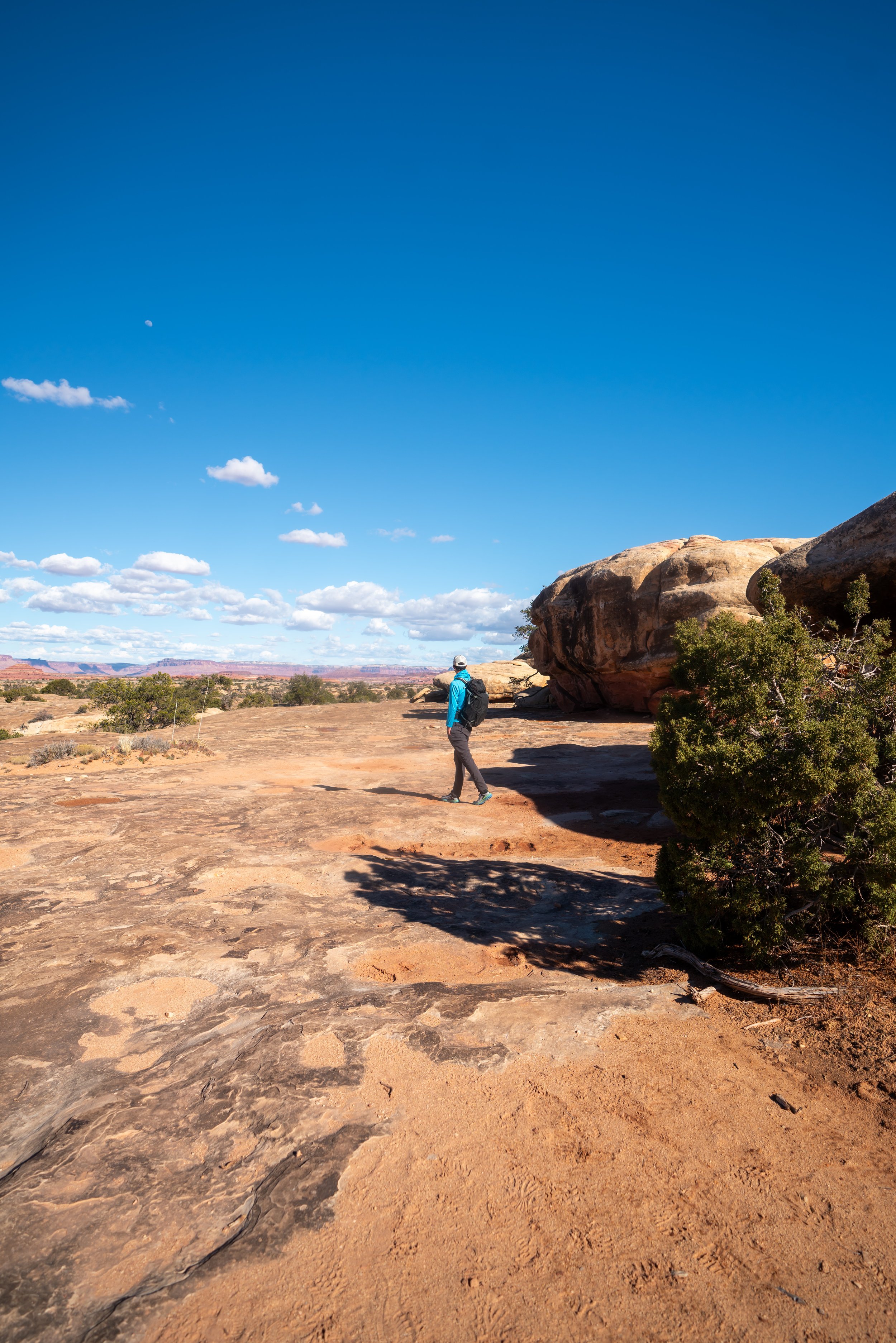
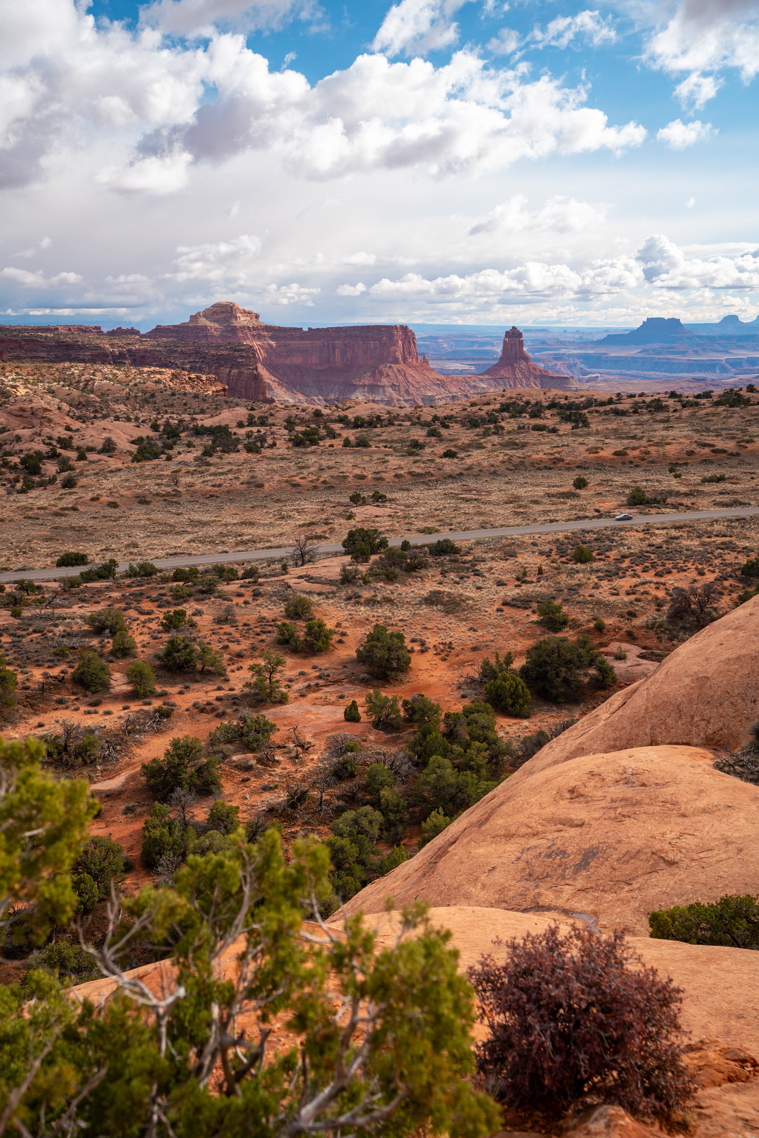
This 'hill,' out of sight just beyond this rock formation in the photo below, is Elephant Hill.
In my experience, these first 2.8 miles (4.5 km) to Chesler Park tend to be the most straightforward to navigate, being that simply making it to the beginning of Chesler Park is a popular turnaround point for many day hikers.
The trail continues to the left around this rock formation.
In my opinion, the best way to break up these first 2.8 miles (4.5 km) to Chesler Park is to think about the trail in thirds.
First, there is the hike up to and around Elephant Hill. Then, there is the hike through Elephant Canyon, which is the next set of Needles off in the distance in the photo below. Finally, there is the last stretch beyond Elephant Canyon and up 'The Escalator' into Chesler Park.
I personally think this helps when much of the terrain can begin to look the same, which is especially true if it’s your first time in The Needles.
Chesler Park-Lost Hiker Junction (The Needles Campground)
At this first junction, go right to stay on the Chesler Park Trail.
The Lost Hiker Trail to the left is a common route to begin for anyone camping at The Needles Campground, the same campground that was located just past the start of the dirt road to Elephant Hill.
Elephant Canyon
This is where the Chesler Park Trail begins the traverse through Elephant Canyon, which can be a little tricky to navigate in spots.
At this point, the Chesler Park Trail makes a hard switchback in the opposite direction and down the stairs in the photo below.
Chesler Park-Druid Arch Junction
Once at the bottom of Elephant Canyon, go straight at the Druid Arch junction, across Elephant Wash, to continue toward Chesler Park.
This climb back out of Elephant Canyon is another notable incline along on the full Chesler Park Loop Trail.
This is when Chesler Park truly becomes visible for the first time.
Chesler Park-Devil’s Kitchen Campground Junction
Just before Chesler Park, the trail will split once again with the Devil’s Kitchen Campground.
Go left here to begin the climb into Chesler Park.
'The Escalator'
'The Escalator' is simply the final climb into Chesler Park.
While it’s not the biggest hill on the entire trail, 'The Escalator' feels like a rite of passage, as the trail makes the narrow entrance between the sandstone spires into the arena of Needles, where Chesler Park opens up at the top.
Chesler Park
At the top of 'The Escalator,' Chesler Park opens up into a relatively flat, grassy pasture, surrounded by beautiful rock formations on all sides.
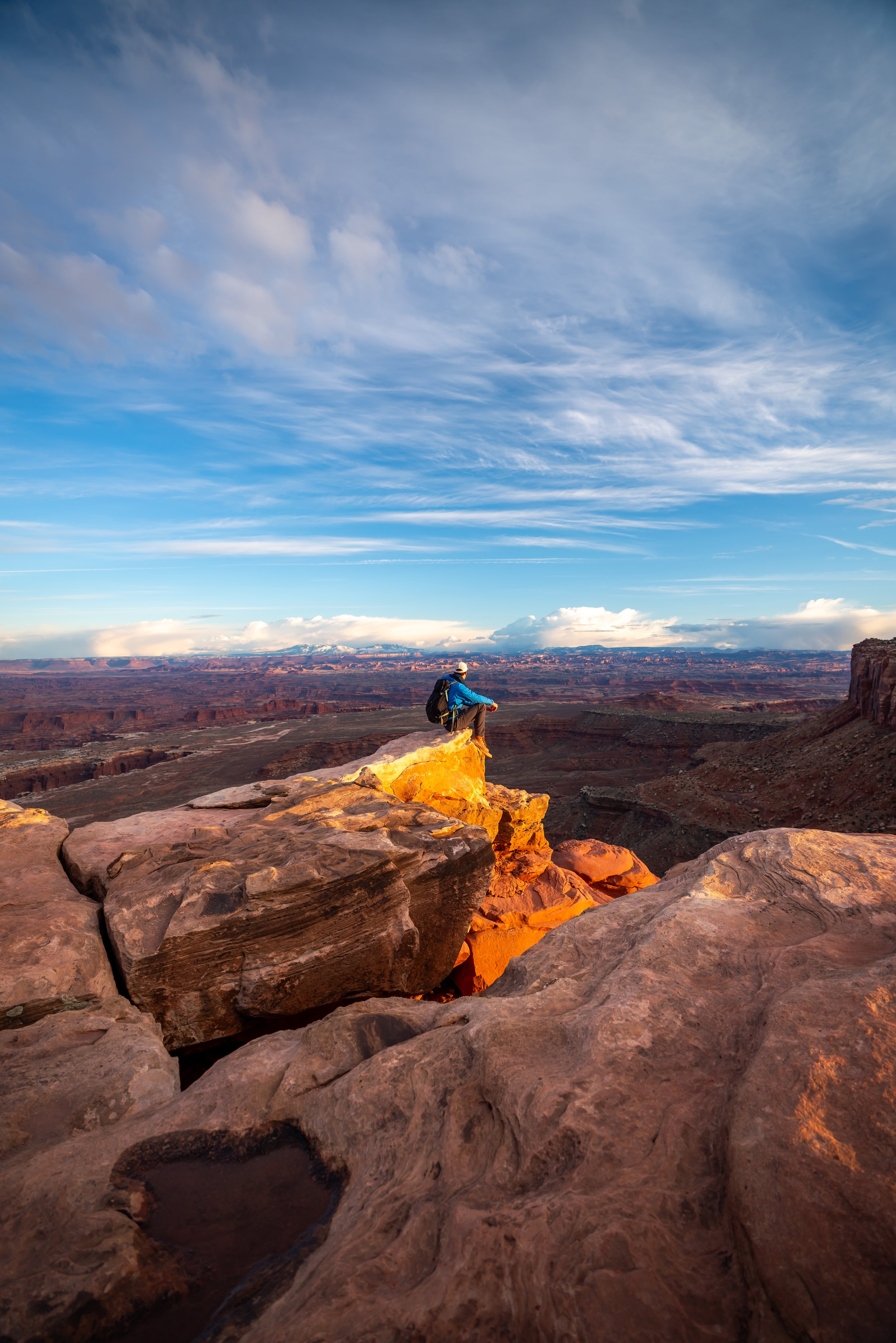
That said, many regard Chesler Park as one of the best places to camp in The Needles, which can be especially true during golden hour, when the first and last light can be seen on the tops of The Needles.
Chesler Park Loop Trail (Devil’s Kitchen Junction)
At the first junction within Chesler Park, you can either go right or left to continue around the Chesler Park Loop Trail.
That said, I chose to go left toward the Joint Trail, as it is generally the most sought-after portion of the entire 10.7-mile (17.2 km) trail.
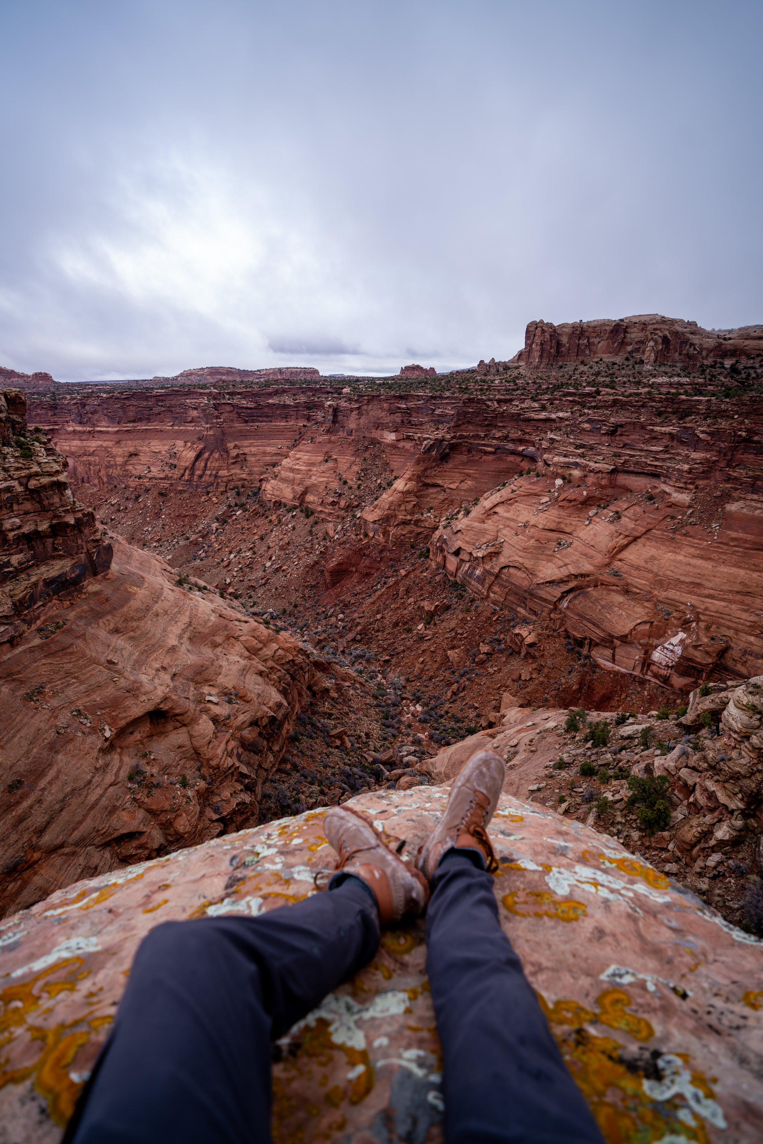
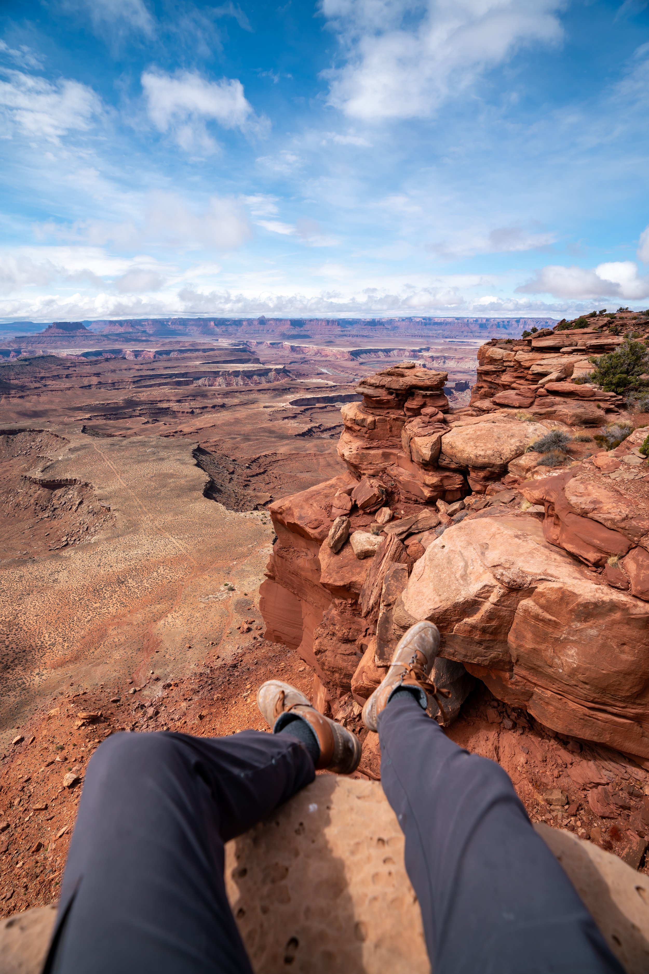
Elephant Canyon Viewpoint
This viewpoint looks out toward Elephant Canyon and the Druid Arch Trail to the east.
Chesler Park-Joint Trail Junction
Toward the far end of Chesler Park, the Chesler Park Loop Trail transitions into the Joint Trail.
Here, go right to continue on the Joint Trail (Chesler Park Loop), where the slot canyon will be found about 0.7 miles (1.1 km) ahead.
Shortly after the start of the Joint Trail, a number of campsites break off of the main trail.
Go left to stay on the Chesler Park Loop Trail.
This is where the Joint Trail makes its descent into the slot canyon and caves below.
Warning
As with any slot canyon or gulch, flash floods and rockfall pose the highest risk to hikers.
Therefore, do not enter the Joint Trail slot canyon during periods of wet weather, which can be especially true during summer monsoonal storms that often sweep across the west during these warmer months.
Yes, the Joint Trail can be a bit tight!
Many, including myself, would agree that these sections of the Joint Trail are the best parts of the entire Chesler Park Loop!
If you are interested in taking good photos, anytime when the sun is high, generally between 11 a.m. to 1 p.m., is when the light is best for photos. This is because when it’s earlier or later in the day, it can be quite dark at the bottom of the canyon.
Toward the end of the slot canyon, the Joint Trail will make a hard right turn through the cave shown below.
I say this because the photo below doesn’t show the alternative path that continues straight if you were to go the wrong way.
In all, the best parts of the Joint Trail only make up about 0.3 miles (0.5 km) of the entire Chesler Park Loop.
On the south side of the slot canyon, the Joint Trail will begin descending down to Chesler Wash, where the Joint Trailhead will be located shortly after.
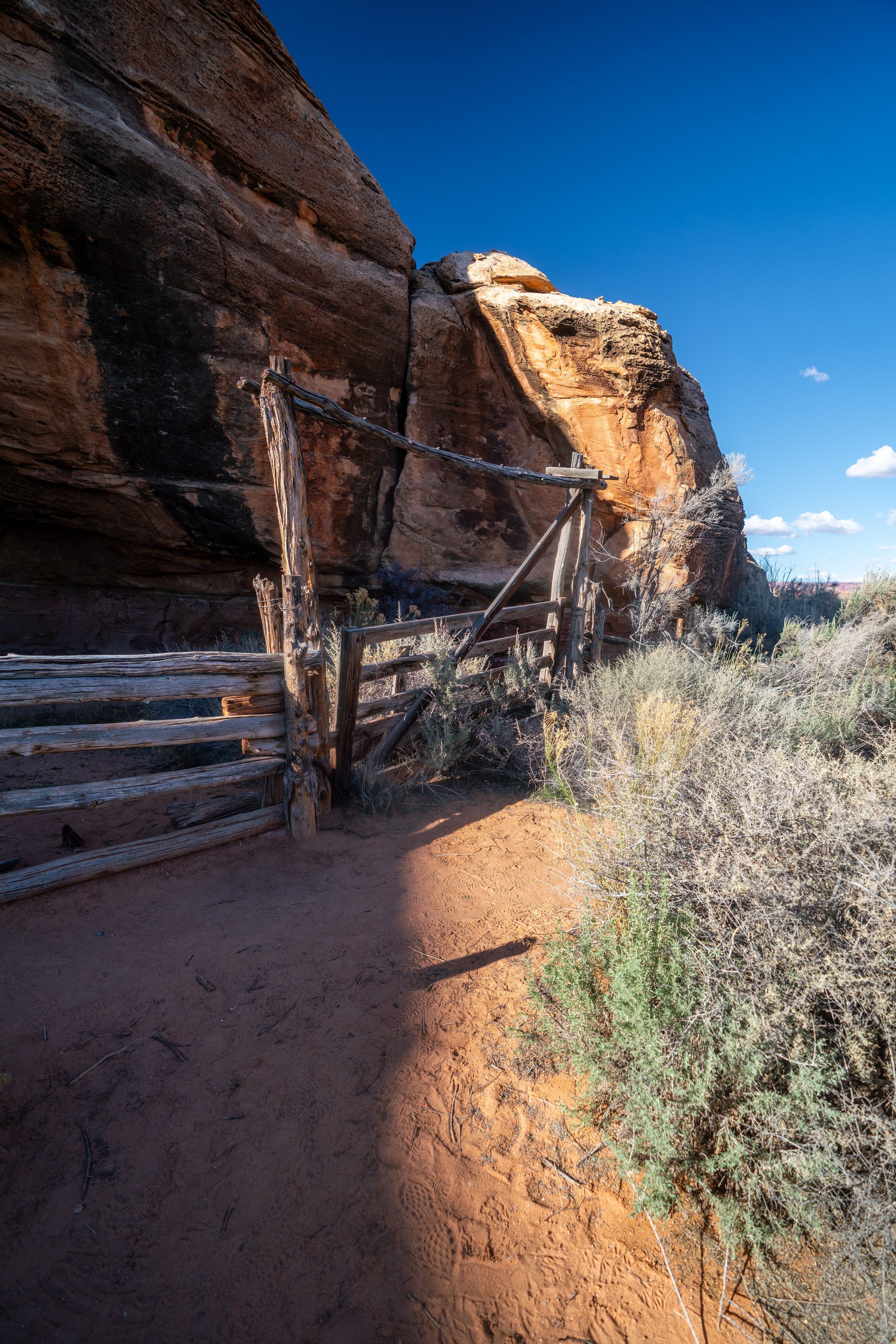
Chesler Wash
This is where the Joint Trail crosses over Chesler Wash.
That said, the wash to the left leads to Virginia Park, a highly safeguarded place in Canyonlands National Park for being one of the only places within the park where cattle were never run.
However, hiking there is only allowed by invite only, and I say all this to encourage responsibility in this beautiful National Park.
This is where the Chesler Park Loop continues on the far side of the wash.
Joint Trailhead
For those with a 4WD vehicle, this is the Joint Trailhead, and it can be a popular off-road destination to begin hiking, closest to the best parts of the entire Chesler Park Loop: the Joint Trail.
In any case, go right to continue on Joint Trail Road, where the Chesler Park Loop continues on the southern side.
Joint Trail Road-Devil’s Lane Junction
When Joint Trail Road meets Devil’s Lane, go right again, and the next Chesler Park Loop junction that branches off of these roads will be found about 0.2 miles (0.3 km) up Devil’s Lane.
Devil’s Lane-Chesler Park Loop Junction
At the next Chesler Park Trail junction, go right to leave the 4WD roads behind.
In my experience, the west side of the Chesler Park Loop, back into Chesler Park, tends to be the most confusing section of the entire trail.
There may be vague or unmarked turns, and generally speaking, the trail is best marked by small rock cairns built by the National Park Service.
Please do not knock over these cairns, as they are there to keep hikers safe!
The Chesler Park Loop continues down in this wash to the left.
Then, the Chesler Park Loop begins a nearly constant, but gradual, 300 ft. (91 m) ascent back into Chesler Park.
This was taken looking back down the small scramble shown above.
On a different note, I could not recommend these road-to-trail running/ hiking shoes any more for an adventure like the Chesler Park Loop Trail, as they are a great choice for many trails across the southern Utah area.
Devil’s Kitchen-Chesler Park Loop Junction
At the Devil’s Kitchen junction, go right to remain on the Chesler Park Loop Trail.
When the Chesler Park Loop comes to this drop, you can either scramble down into the small canyon, or make a hard u-turn to continue down an easier path.
Both routes are shown below.
In my experience, this short but steep hill is the most challenging uphill section on the entire Chesler Park Loop Trail, especially if it’s hot out!
Shortly after the top of the steep hill, the narrow passage back into Chesler Park becomes visible off in the distance.
Chesler Park
This is where the loop enters back into Chesler Park from the west side.
Chesler Park Loop Trail (Devil’s Kitchen Junction)
This is the original Chesler Park-Devil’s Kitchen junction from the beginning of the Chesler Park Loop Trail.
From here, there is only another 2.9 miles (4.7 km) to hike back to the Elephant Hill Trailhead.
Chesler Park Viewpoint ('The Escalator')
This is the Chesler Park Viewpoint, and the view looking to the north down 'The Escalator.'
Chesler Park-Devil’s Kitchen Campground Junction
At the first junction immediately after 'The Escalator,' go right to continue toward Elephant Hill.
Chesler Park-Lost Hiker Junction (The Needles Campground)
At the next junction for The Needles Campground after Elephant Canyon, go left for the Elephant Hill Trailhead, located about 1.5 miles (2.4 km) away.
Elephant Hill Trailhead
In all, the 10.7-mile (17.2 km) Chesler Park Loop Trail via Elephant is one of the best things you can do in The Needles District of Canyonlands National Park.
I say this because even if this is the only adventure you get to, because it’s so long, I truly believe you will have seen the best of The Needles by hiking the full loop!