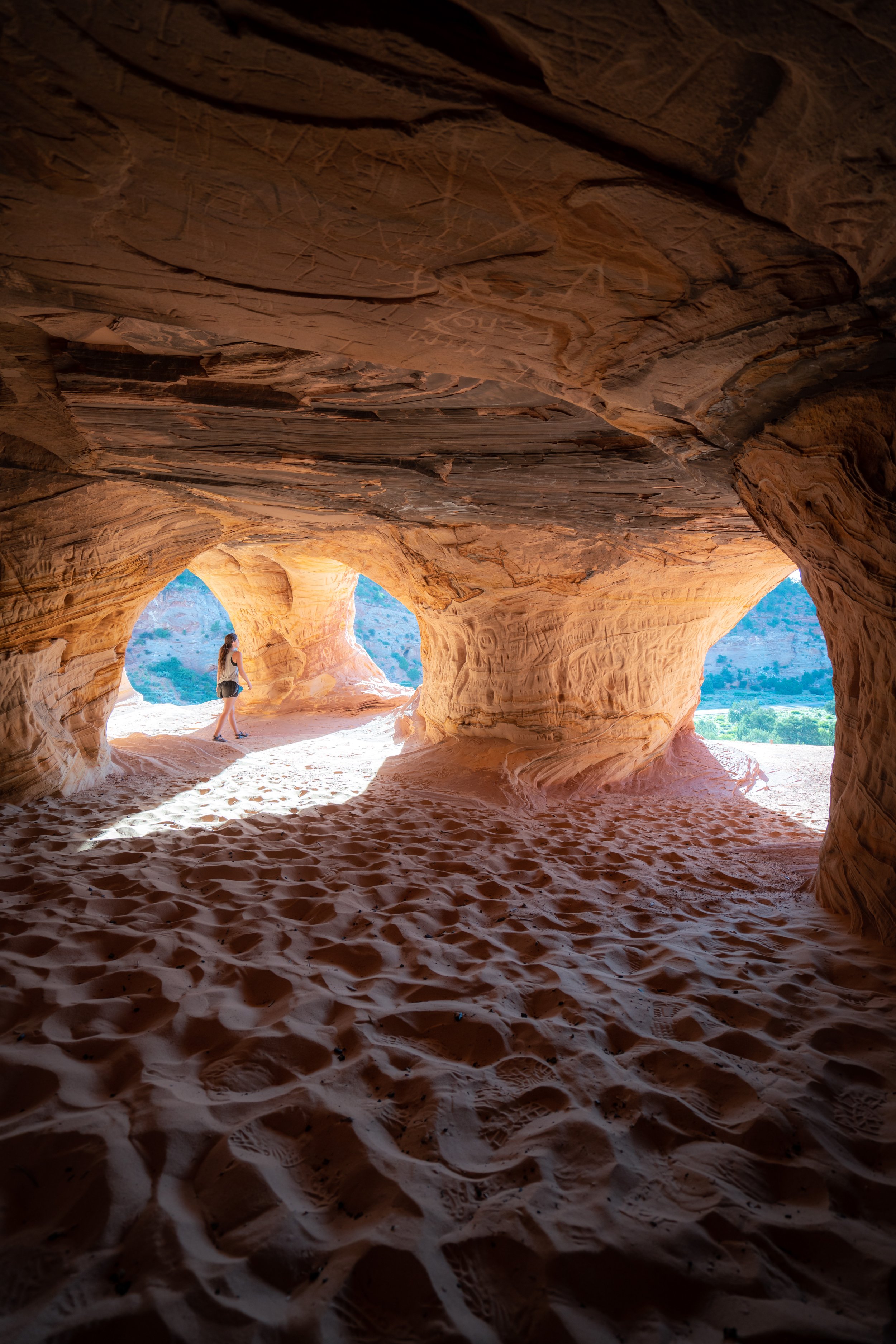
Hiking the Beehive Loop Trail (The New Wave) in Page, Arizona
Distance: 1.5 - 2.7 miles / 2.4 - 4.3 km
The Beehive Loop Trail, commonly referred to as The New Wave, is a short, relatively easy day hike just outside of Page, Arizona, that has earned the nickname "New Wave" for its uniquely similar petrified dunes, which bear a striking resemblance to the true Wave Trail in Coyote Buttes, just to the west.
However, unlike the well-known Wave Trail via Wire Pass, the Beehive Trail does not require a permit, which is what inevitably makes the Beehive Trail a very popular day hike, with the best times to visit being around sunset, as this is when the colors on the petrified dunes really start to come out!
As for the hike itself, the distance above is variable because it entirely depends on whether you decide to hike the optional 0.6-mile (1.0 km) side trail to Grandpa’s Garage or simply stick to the main loop, which totals about 1.5 miles (2.4 km) roundtrip.
Beehive Loop Trailhead Parking
Parking for the Beehive Loop Trail is located in one of two places.
First, there is the official Beehive Trailhead just off Highway 89 near the Beehives Campground, or there is a parking area on the west side of the loop trail, where hikers can park to be closest to one of the most beautiful spots for photos—the spot commonly referred to as The New Wave.
Google Maps Directions: Beehive Loop Trailhead
Southwest Hiking Checklist
Here is a complete list of must-have things that you will want for any hike in the Southwest U.S.
Hiking the Beehive Loop Trail
From the parking area, the Beehive Trail begins by heading straight toward the petrified dune that can be seen in the distance.
This is where the path will split into the loop, about 0.1 miles (0.2 km) into the hike.
These initial sections can be very vague and confusing, but as long as you hike toward the first few buttes that can be seen on the right in the photo below, you're heading in the correct direction.
Beehive Loop Trail
This is where the Beehive Trail splits into the 1.3-mile (2.1 km) loop around the beautiful sandstone 'beehives' that make up the center of the trail.
That said, I truly don’t think it makes much of a difference which direction you decide to hike first.
I chose to go left at the beginning of the loop, in the clockwise direction.
Beehive Loop-Grandpa’s Garage Junction
After just 0.3 miles (0.5 km), the Beehive Loop Trail splits, with a 0.6-mile (1.0 km) out-and-back side trail that leads to Grandpa’s Garage, a hidden cave at the far southern end of the adjacent petrified dune.
This is the trail shown below, but if you'd prefer to skip past this side trail, click below to read ahead.
To skip past the Grandpa’s Garage Trail & Viewpoint, click here.
Grandpa’s Garage Trail
The Grandpa’s Garage Trail initially follows this well-marked path out to the viewpoint on the adjacent petrified dune, about 0.25 miles (0.4 km) away.
This upper area is the viewpoint and end of the maintained side trail, but to continue further toward Grandpa’s Garage, hike up and through the gap shown below.
Once through the gap, the Grandpa’s Garage trail simply follows the easiest path—on or paralleling the crest of the ridge as best as possible—out to the southernmost point, where the cave will be found.
After these first sandstone buttes, simply hike straight toward the second grouping directly ahead.
While it’s certainly not necessary to hike through these buttes, as I have shown here, it is more fun and more beautiful than simply walking around them.
After the second grouping, the Grandpa’s Garage Trail nears the end of the petrified dune, where there will be a short but steep scramble down to the cave at the base of the cliff.
This is the far southern end of the petrified dune.
That said, follow the natural slope down to the right, as the ridge will cliff-out if you simply continue straight.
Grandpa’s Garage
Grandpa’s Garage is the informal name given to the cave at the very far end of the petrified dune, because it clearly has a history of someone using it—possibly working in it or having lived in it—as I found a mattress spring when I first visited.
On that note, be careful when exploring the cave, as there may be glass, old nails, and other things that can certainly go right through a hiking shoe.
Beehive Loop-Grandpa’s Garage Junction
This is the same split in the Beehive Loop Trail shown prior to the Grandpa’s Garage Trail.
That said, go left to continue around the Beehive Loop Trail in the clockwise direction.
To skip back to the beginning of the Grandpa’s Garage Trail, click here.
After the Grandpa’s Garage Trail, the Beehive Loop becomes much easier to navigate, as it simply loops around the steep sandstone buttes that can be seen in the distance.
At the base of this next hill, hike up to pass between the two buttes.
On the far side of the hill, the Beehive Loop Trail enters the best and most beautiful sections of the entire hike!
I say this because this is where there are a number of hidden caves, unique rock formations, and The New Wave, found on the return side of the loop.
While there are certainly many cool places to explore on the inside of the Beehive Loop, I don’t think diving into specific locations is worth it, because exploring and scrambling to find hidden spots on the inner loop is truly half the fun!
The petrified dune on the left side of the photo below is the same as the one on Grandpa’s Garage Trail, but the reason I don’t recommend hiking over to the cave from the Beehive Loop Trail is that the descent off the loop is longer and steeper than it may appear.
This is why I think it’s best and easiest to hike out to the viewpoint before continuing on to the cave, as previously shown.
At the far southern end of the Beehive Loop Trail, hikers can find one of the 'easier' areas to scramble up the cliffs to get a better view.
This can be a great way to find unique angles for photos within the loop, and these upper vantage points make for great places to catch the sunset, which is considerably less busy than sunset at Horseshoe Bend, just down the road.
As the Beehive Trail begins its return loop, it passes several beautiful spots worth exploring just off the main path, including The New Wave, located about 0.2 miles (0.3 km) ahead.
The parking area that can be seen in the photos below is the alternative Beehive Loop Trailhead, which is a nice sign that you’re getting close to The New Wave!
When the Beehive Loop begins to wind its way down toward the flatter sections below, leave the trail here to hike up to The New Wave, just to the right.
This short section is steeper and a bit trickier than the photos may make it appear.
The New Wave
This beautiful sandstone formation is widely regarded as The New Wave, and while this may be one of the best places to take similar photos as the Wave Trail in the Coyote Buttes, it’s certainly not the only place.
That’s why I highly recommend exploring as much of the inner Beehive Loop as you can, as there’s truly no telling how many more beautiful places there are to find—not to mention, enjoy—without the crowds!
Once back on the Beehive Loop, the trail simply continues around the outermost perimeter of the inner buttes.
When the trail reaches the last few buttes in the distance, hike around them to the left to continue on the Beehive Loop Trail.
On the far side of these last buttes, the parking area becomes visible once again, making the end of the hike significantly easier to navigate, as opposed to the beginning, where finding the start of the loop can be a bit tricky.
Beehive Loop Junction
This is the beginning of the Beehive Loop, where the trailhead and parking area are only 0.1 miles (0.2 km) away from this split.
Arizona
Utah


