Hiking the Pink Ledges-Birdseye-Photo Loop Trail in Red Canyon, Utah
Distance: 2.2 miles / 3.5 km
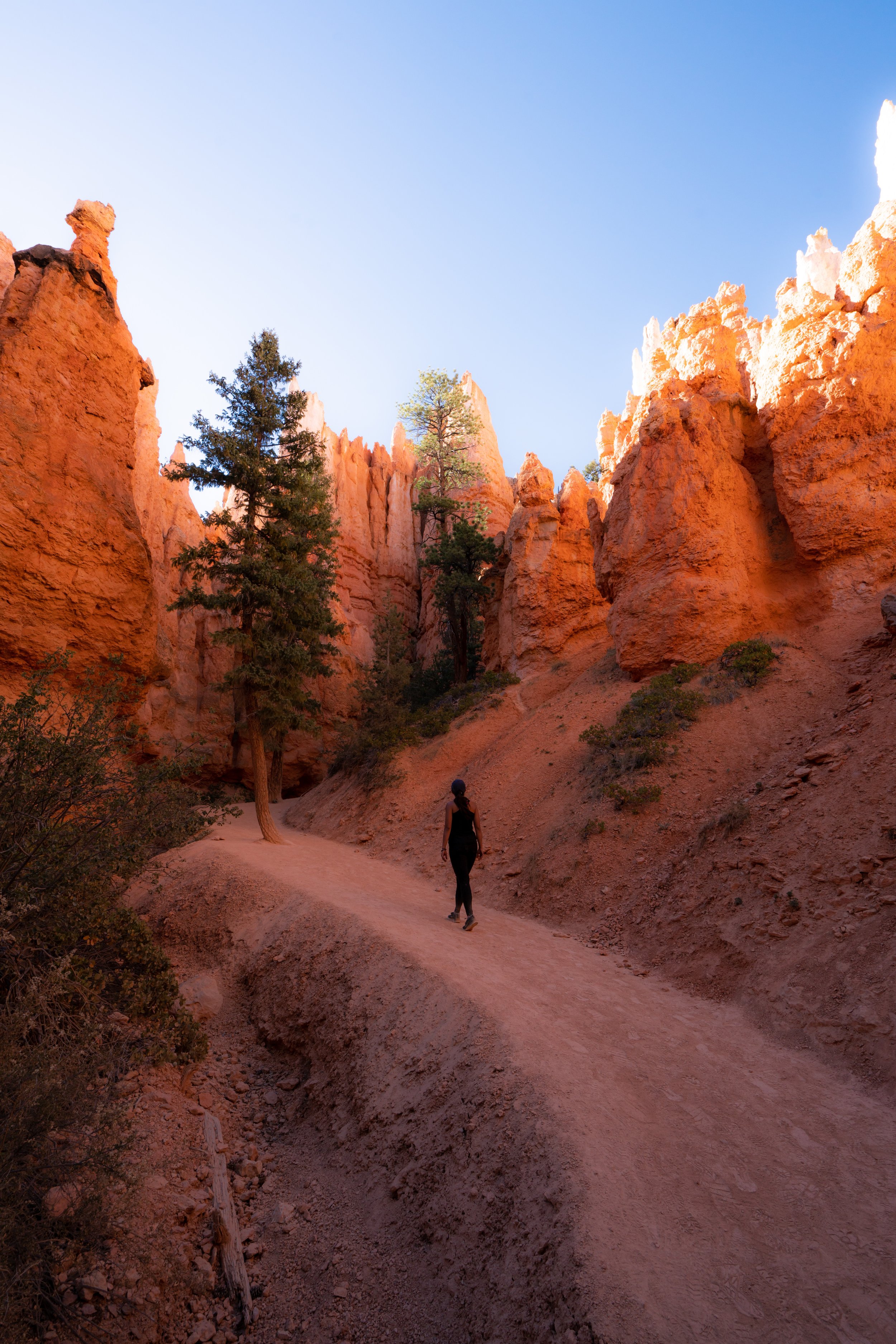
The Pink Ledges-Birdseye-Photo Loop Trail, also called the Red Canyon Loop Trail, is one of the best hidden secrets outside of Bryce Canyon National Park!
The short 2.2-mile (3.5 km) loop is actually the connection of four separate named trails and the Red Canyon Bike Path in the Dixie National Forest, making the full Pink Ledges Loop Trail that visitors know and love.
That being said, most visitors don’t hike the full loop talked about in this post, but one of the best things about Pink Ledges Loop is that there are a number of different trailhead connections to make your hike as short or as long as you please!
Pink Ledges Trailhead Parking
Parking for the Pink Ledges Trailhead is located at the Red Canyon Visitor Center, directly off Highway 12, about 10.3 miles (16.6 km) east of the roundabout in Bryce Canyon City.
Before arriving, know that the Red Canyon Visitor Center has grown in popularity over the years, meaning that parking can be more of a challenge to come by during the busy summer travel season.
With that in mind, I recommend arriving either early or late in the day for the best experience.
Google Maps Directions: Red Canyon Visitor Center
Southwest Hiking Checklist
Here is a complete list of must-have things that you will want for any hike in the Southwest U.S.
Hiking the Pink Ledges-Birdseye-Photo Loop Trail
To hike the full outer loop of the Pink Ledges Trail, I recommend beginning at the far eastern trailhead adjacent to the historical cabin.
The alternative option would be to begin at the bike path or Hoodoo Trailhead, but I personally find that the full loop is best in the counterclockwise direction.
Pink Ledges Trail
Following the historical cabin, the Pink Ledges Trail passes by a number of interpretive markers, which you can pick up a guide for at the Red Canyon Visitor Center.
Pink Ledges-Visitor Center Junction
At this first split, go right to continue on the Pink Ledges Trail, as the other direction is simply a shortcut back down to the visitor center.
This next short stretch is, arguably, the most beautiful section of the entire hike!
Pink Ledges-Hoodoo Loop Junction
Next, the Pink Ledges Trail meets the Hoodoo Loop Trail for a short stretch.
Here, go right on the Hoodoo Loop Trail, as the trail to the left is another path back to the visitor center.
Hoodoo-Birdseye-Golden Wall Junction
This is the beginning of the Birdseye Trail, and it’s the last junction with a shortcut that leads back to the Red Canyon Visitor Center.
That being said, go right to continue on the Birdseye Trail or go straight, then left at the split to return to the visitor center. The trail to the right at the second split is the connection with the Golden Wall Trailhead, located across Highway 12.
Birdseye Trail
Once past the three-way junction above, the Red Canyon Loop continues for the next 0.8 miles (1.3 km) until the Birdseye Trail reaches the Photo Trail junction.
These signs simply indicate different features on the Birdseye Trail.
Birdseye-Photo Junction
Just before Highway 12, the Birdseye Trail meets with the Photo Trail.
That being said, it really makes no difference which direction you choose to go, as they both meet at the same trailhead along the side of the road.
Photo Trail
Personally, I like to go right on the Photo Trail, which only adds about 0.1 miles (0.2 km) compared to the more direct Birdseye Trail.
Photo Viewpoint Junction
This split in the trail is for the short but steep spur trail that leads up to the Photo Viewpoint.
With that in mind, I chose to go right up to the viewpoint, or you can take the trail to the left that leads down to the Photo-Birdseye Trailhead off of Highway 12.
At this upper split, go right for the better of the two viewpoints.
Photo Viewpoint
If you didn’t know any better, one might say that this photo was taken in Bryce Canyon.
However, there are a handful of locations outside of the park, like this spot at the Photo Viewpoint in Red Canyon, that bear a striking resemblance to somewhere inside Bryce Canyon National Park!
This is one reason why I love the Pink Ledges Loop so much, because you get to enjoy the best of the same hoodoos found within the park, without the crowds!
Once back on the main Red Canyon Loop, the trail descends back down to the highway.
Photo-Birdseye Trailhead
This is where the Photo and Birdseye Trails meet at this joint trailhead.
Here, go straight across Highway 12 to find the connection with the Red Canyon Bike Trail.
This is where the Red Canyon Loop continues on the far side of the highway.
Red Canyon Bike Trail
Finally, go left to begin the Red Canyon Bike Trail back to the visitor center.
Red Canyon Bike Path-Golden Wall Junction
The only junction that the bike path meets with on this short 0.5-mile (0.8 km) stretch is Golden Wall Trailhead.
This is the same trailhead referenced earlier when the Hoodoo Loop Trail split with the Birdseye and Golden Wall Trail.
Shortly after the Golden Wall Trailhead, the loop returns to the Red Canyon Visitor Center on the far side of the highway.
That being said, watch out for traffic at both highway crossings, as cars tend to ignore the posted speed limit through this high-traffic area.
Red Canyon Visitor Center
In all, the Pink Ledges-Birdseye-Photo Loop Trail feels like a hidden gem outside of Bryce Canyon National Park, but that goes without saying that the Red Canyon area has seen an inevitable increase in traffic over the years, especially when tour bus operators stop here.
In any case, I highly recommend hiking the loop first thing in the morning for the best experience, which is is also the best time of day to see the red rock light up in the early morning golden light!
Arizona
Utah


