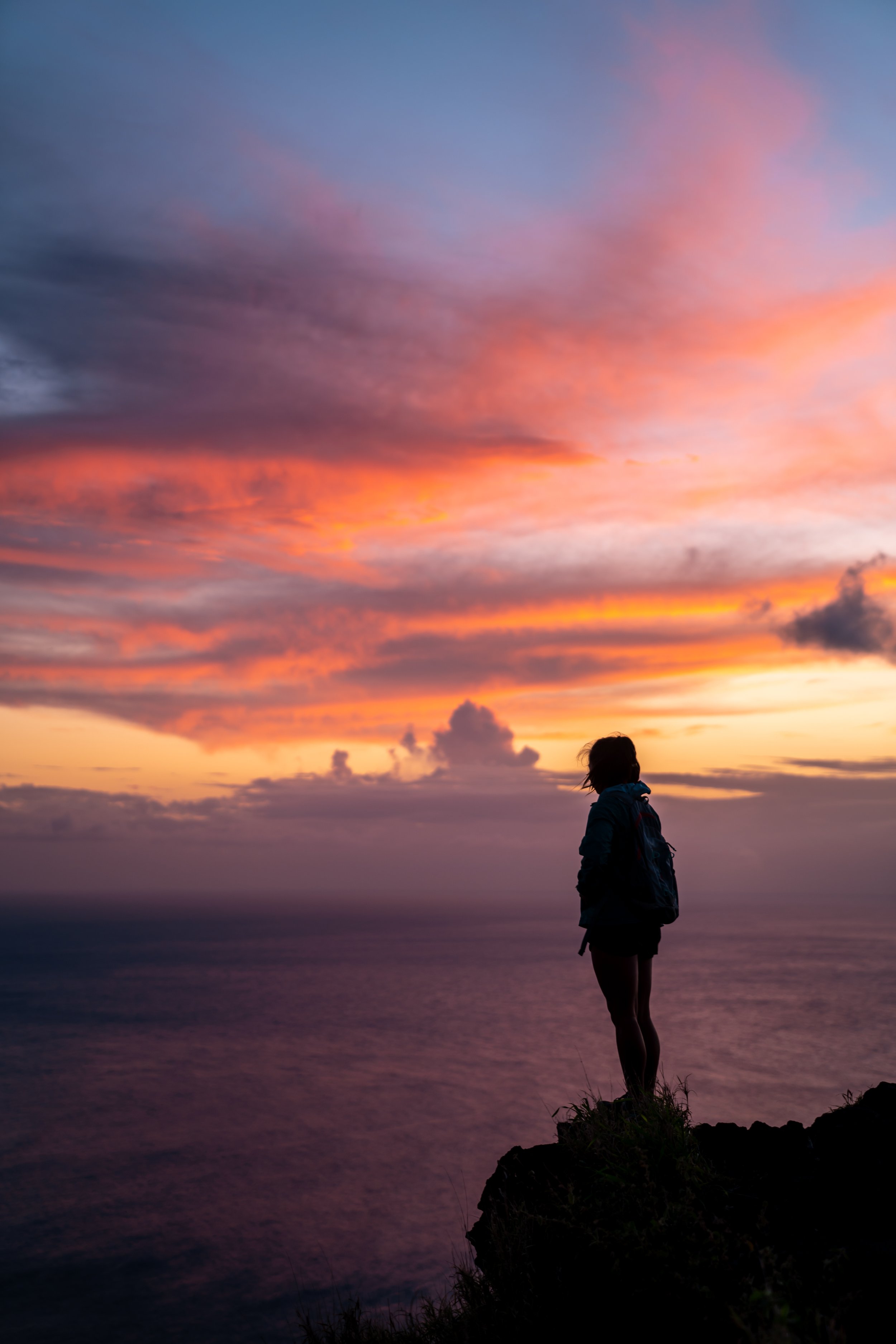
Hiking the Back Lanikai Pillbox Trail (Kaʻiwa Ridge), Oʻahu, Hawaiʻi
Distance (RT via Kamahele Route): 1.7 miles / 2.7 km
Distance (RT via Luika Route): 2.6 miles / 4.2 km
The Back Lanikai Pillbox Trail on the east side of Oʻahu refers to one of a few different routes that climb the slopes of Kaʻiwa Ridge in order to reach the iconic Lanikai Pillboxes!
That said, there is more than one alternative route up Kaʻiwa Ridge, both of which are outlined below. However, I think it’s important to mention that both of the most popular alternative routes to the Lanikai Pillboxes are longer and more challenging than the traditional Lanikai Pillbox Trail from the north, which is why I recommend against either of these two options for anyone visiting Oʻahu.
I say this because both of these alternative routes are often seen as 'locals-only' trails. Throughout my blog, I do my best to provide accurate information with realistic expectations for Hawaiʻi-related content across all topics, which is why I feel it’s important to discourage visitors from venturing out to these more local trailheads.
Back Lanikai Pillbox Trailhead Parking (Kamahele)
Parking for the Kamahele Route up Kaʻiwa Ridge is located near the very end of Kamahele Street, just before the cul-de-sac and the gated community.
That said, do not park in the cul-de-sac near the trailhead, and do not park in a way that blocks the sidewalk, the fire hydrant, or any driveways.
Google Maps Directions: Back Lanikai Pillbox Trailhead (Kamahele)
Hiking the Lanikai Pillbox Trail (Kamahele)
[Not a Recommended Route for Visitors]
If you decide to begin hiking up Kaʻiwa Ridge from the Kamahele Trailhead, do everything you can to be respectful—meaning do not litter, be loud, park illegally, or cause any issues that would draw negative attention to this local trailhead. Just park legally, be nice to the residents, and begin hiking without causing any disturbances.
All that aside, the hike begins up the stairs on the right-hand side of the cul-de-sac.
After a short hike past the stairs, the Back Kaʻiwa Ridge Trail ducks beneath this fence.
After the fence, the steep incline begins!
That said, there really are no breaks from the near-constant uphill on the Kamahele Route up Kaʻiwa Ridge, which is why some hikers may prefer to bring trekking poles—especially for the steep hike back down!
This is the view looking back toward Mt. Olomana, with the Koʻolaus in the background, including Puʻu Lanihuli on the right and Kōnāhuanui to the left of that.
ʻUhaloa is truly one of the few native plants that hikers can find on all sides of Kaʻiwa Ridge.
In addition to poles, I also recommend wearing a good hooded sun shirt, as there is essentially no shade on the Back Lanikai Pillbox Trail, not to mention, Kailua is typically one of the sunnier places on Oʻahu!
The top of the hill in the distance is not the top of Kaʻiwa Ridge.
Rather, it’s a false summit, and the true Kaʻiwa Ridge Trail is located 0.1 miles (0.2 km) beyond that point.
This is the beginning of the final steep hill leading up to the top, meaning all the hills after this point are much milder than these initial sections.
This prominent rock is a nice sign that the steepest parts of the climb up Kaʻiwa Ridge are behind you!
Just after the rock in the photo above, the back way up Kaʻiwa Ridge becomes much flatter as it traverses one final, much easier hill to the ridgeline straight ahead.
This is the final hill before Kamahele Route reaches the true Kaʻiwa Ridge Trail.
Kaʻiwa Ridge (Kamahele-Wailea Point Junction)
This is where the Kamahele Route meets Kaʻiwa Ridge for the first time.
From here, go left at this junction to continue hiking toward the Lanikai Pillboxes, about 0.4 miles (0.6 km) away, as the trail to the right is simply the Wailea Point Route mentioned at the end of this article.
When the Kaʻiwa Ridge Trail reaches this viewpoint, the Upper Lanikai Pillbox can be seen in the distance!
Along this final stretch, the Kaʻiwa Ridge Trail will traverse a few hills, but none are as steep as the Kamahele Route to reach the ridgeline.
I think it’s worth noting that the Kaʻiwa Ridge Trail can be much greener, depending on the time of year.
However, these photos were taken during the drier summer months, which is why the ridge looks so brown.
Just before the Kaʻiwa Ridge Trail reaches the final hill, the trail navigates around the right-hand side of this large rock.
This is the final hill before the Upper Lanikai Pillbox.
Upper Lanikai Pillbox
This is the Upper Lanikai Pillbox, which looks directly out toward Lanikai Beach and the Mokulua Islands just offshore.
That said, the Upper Pillbox is typically the turnaround point for most hikers who come up the main trail that begins off Kaʻelepulu Drive in Lanikai, but if you are interested in continuing farther, the Lower Lanikai Pillbox is only a 0.1-mile (0.2 km) hike down the trail from this point.
Read My Separate Post: Lanikai Pillbox Trail
This is the short 0.1-mile (0.2 km) section on the main Lanikai Pillbox Trail between the Upper and Lower Pillbox.
Lower Lanikai Pillbox
This is the Lower Lanikai Pillbox, or the first pillbox you reach when hiking up from the trailhead in Lanikai.
On a different note, if you are interested in visiting the two beautiful islands offshore, read the next section below to learn all the need-to-know details.
Read My Separate Post: Lanikai Pillbox Trail
Kayaking to the Mokulua Islands
The two islands just off Lanikai Beach are accessible to the public by kayak only.
Kayaks can easily be reserved using the links below, which make for great options if you are visiting Oʻahu, so that you don’t have to worry about transporting a kayak to and from the beach.
Additionally, one of my favorite things about booking through Viator is the reserve-now-and-pay-later option. As long as you’re booking more than three days in advance, you have the option to book ahead and cancel in the future if you change your mind.
Back Lanikai Pillbox Trailhead Parking (Luika)
Parking for the Luika Route up Kaʻiwa Ridge is located on either Luika or Poʻopoʻo Place, near the far southern end of the one-way Lanikai Loop.
I do not know what the parking situation will look like once all the changes announced in the summer of 2025 take effect, but I will update this when more information is becomes available.
Google Maps Directions: Back Lanikai Pillbox Trailhead (Luika)
Hiking the Lanikai Pillbox Trail (Luika)
[Not a Recommended Route for Visitors]
The Luika Route up Kaʻiwa Ridge begins on a very short but steep ascent to reach the ridgeline, gaining roughly 325 ft. (99 m) in just over 0.1 miles (0.2 km) before leveling off at the top.
I think it’s important to mention that beginning from Luika Place is truly the least practical option for most hikers looking to reach the Lanikai Pillboxes, as this route is the farthest and most challenging of the three options due largely to distance and elevation change.
However, this trailhead can make for a fun trail-running loop between the main trailhead off Kaʻelepulu Drive and here, as it’s only a 1.1-mile (1.8 km) run on the most direct route through Lanikai.
For something like this, I recommend a good road-to-trail shoe, which is what I always use for less overgrown Hawaiʻi trails, like Kaʻiwa Ridge.
Immediately after beginning the hike, the Luika Route starts climbing directly to the top of the ridgeline.
There really are no places where the Luika Route lets up from the constant climb to the top of Kaʻiwa Ridge, but the one good thing is that this section isn’t all that long.
This eroded section is a nice sign that the trail is nearing the top of Kaʻiwa Ridge!
Kaʻiwa Ridge (Luika-Wailea Point Junction)
This is where the Luika Route first reaches Kaiʻiwa Ridge.
Once here, go right to begin hiking across Kaʻiwa Ridge toward the Kamahele Route and the Lanikai Pillboxes beyond, as the trail to the left simply leads out to Wailea Point where there are no publicly accessible trailheads.
Immediately after leaving the top of Luika, the Kaʻiwa Ridge Trail descends about 100 ft. (30.5 m) down a steep section before it levels out.
Once Kaʻiwa Ridge levels out, the hike becomes much easier and the hills become a lot less dramatic, until it starts to get close to the Kamahele junction from the other direction.
These signs refer to Bellows Air Force Base, which the Kaʻiwa Ridge Trail parallels on this side of the mountain.
I once again want to stress the importance of wearing a hooded sun shirt when hiking the Back Lanikai Pillbox Trail, or any route up Kaʻiwa Ridge for that matter, as there is essentially no shade anywhere on the ridgeline, even during the wetter winter months.
This section between the top of Luika and the Kamahele junction only measures about 0.8 miles (1.3 km), but since the Upper Lanikai Pillbox looks much farther than where Kamahele meets Kaʻiwa Ridge, this section always mentally feels longer in my opinion.
The big rock that can be seen on the ridge in the distance is located just before the Kamahele junction, and it serves as a nice mental checkpoint, since the route from Kamahele Street cannot be seen from this angle on Kaʻiwa Ridge.
Just before the big rock, the Back Lanikai Pillbox Trail splits.
That said, both routes lead to the same place just up the hill, but the trail to the left leads toward the fourth and least trafficked route on Kaʻiwa Ridge, which I will explain in more detail at the end.
At the split shown above, I chose to go left.
This is where the two routes that previously split come back together.
Just a few steps before the Kamahele junction, the Kaʻiwa Ridge Trail passes this structure, which can be a great place to take a break before hiking farther.
Kaʻiwa Ridge (Kamahele-Wailea Point Junction)
This is where both the Wailea Point (Luika) Route and the Kamahele Route come back together to follow the same trail to the Lanikai Pillboxes, as previously shown.
That said, go straight (right) to begin the remaining 0.4 miles (0.6 km) out to the Upper Lanikai Pillbox.
What is the Fourth Route up Kaʻiwa Ridge (The Spider)?
When I mention a fourth route, I’m essentially talking about a local running route known as 'The Spider,' where hikers—or typically trail runners—begin by hiking up the Kamahele Route, run down the main Lanikai Pillbox Trail to Kaʻelepulu Drive, then run 1.1 miles (1.8 km) through Lanikai to the Luika Route, then hike back up Kaʻiwa Ridge to the Kamahele junction, then turn back around for 0.1 miles (0.2 km) to begin hiking down the fourth leg out toward Keʻolu Hills, before running back through the neighborhood to Kamahele Street.
It is a fun challenge, but since the Keʻolu Route is not as publicly accessible as the other three I have written about, I’m not inclined to share more information. Sometimes local hikes need to remain local.
If you do complete it, please comment your time below!
To skip back to this same junction shown previously, click here.
Native Plants on the Lanikai Pillbox Trail
On account of Kaʻiwa Ridge being such a low-elevation hike next to a developed urban area, there are nearly no native plants on any of the three main routes up Kaʻiwa Ridge.
This is because Kaʻiwa Ridge is dominated by invasive grasses, Koa Haole trees, and a few non-native, sporadic Gaïacwood trees.
However, there are a few native plants that hikers can find, including ʻUhaloa and ʻAʻaliʻi. Not to mention, there are many more down on Lanikai Beach, like Naupaka, Pōhuehue, and Maiapilo.
If you would like to learn more about these and many other native Hawaiian plants from across the islands, I encourage you to check out my separate post linked below.
Read My Separate Post: Native Hawaiian Plant Guide


