Hiking the Sun Notch Trail in Crater Lake National Park
Distance: 0.8 miles / 1.3 km
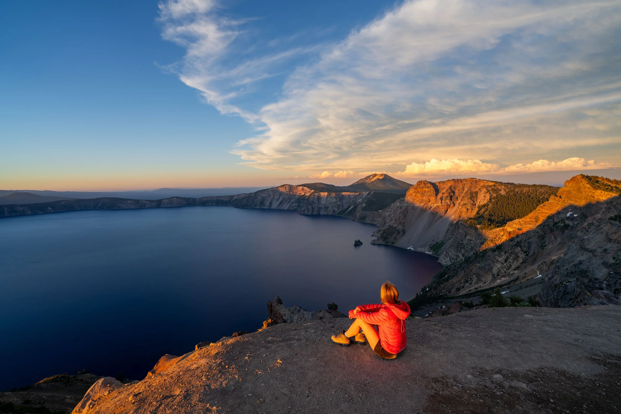
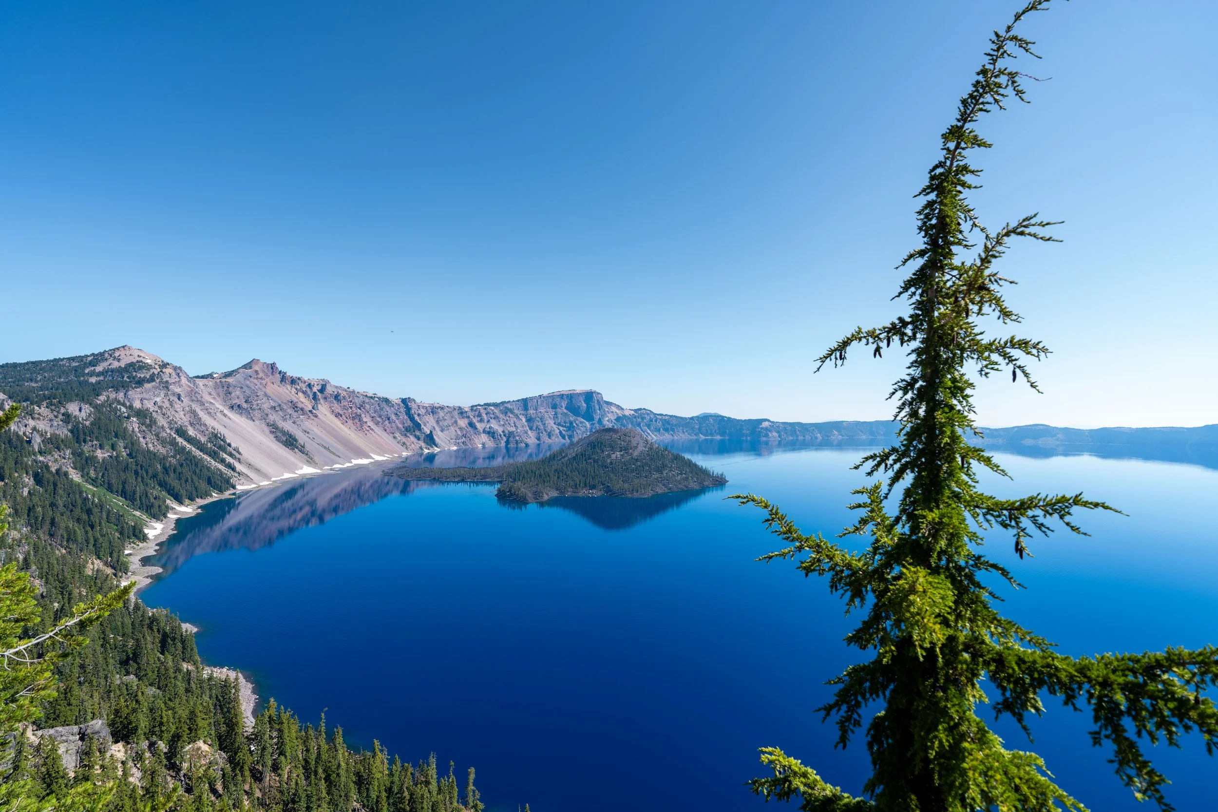
The Sun Notch Trail, also called the Sun Notch Loop Trail in Crater Lake National Park, is one of the best easy day hikes on any side of the caldera rim, because it’s the best trail to see Crater Lake’s lesser-known island, the Phantom Ship.
In short, the Phantom Ship is a 170-ft. (52 m) tall island located just a few hundred feet off the rim of Crater Lake that bears a striking resemblance to a ship on the water when viewed from the right angle.
This is truly what makes the Sun Notch Trail so special, as it—along with the Phantom Ship Overlook just up the road—is one of the best places to see the island if you don’t have reservations for a boat tour on Crater Lake.
Sun Notch Trailhead Parking
Parking for the Sun Notch Trail is located in a roadside parking area directly off East Rim Drive, just 1.3 miles (2.1 km) up the road from Vidae Falls.
Before arriving, know that the Sun Notch Trail is one of the more popular day hikes on the south side of Crater Lake, meaning that during the busy summer travel season, finding a spot to park may be difficult to come by.
Google Maps Directions: Sun Notch Trailhead
Hiking Checklist - Crater Lake
Here is a complete list of must-have things that you will want for any hike in Crater Lake National Park.
That said, there are Black Bears in Crater Lake National Park, and while carrying bear spray is allowed, encounters with hikers are considerably rare.
Hiking the Sun Notch Trail
The Sun Notch Trail begins on a relatively flat path until it reaches the start of the loop, just a short distance into the hike.
Sun Notch Loop Trail
After a little more than 0.1 miles (0.2 km), the Sun Notch Trail splits into the loop that leads to the best viewpoints along the caldera rim.
Personally, I don’t think that hiking the loop in either direction makes much of a difference in terms of having a better experience, but on this hike, I chose to go right.
After the split, the Sun Notch Trail will begin its gradual ascent to the viewpoints along the rim of Crater Lake, gaining roughly 100 ft. (30.5 m) to the highest part of the loop.
This is as steep as the Sun Notch Trail ever gets.
Sun Notch
When the loop reaches the top of the hill, the Sun Notch Trail will pass a series of viewpoints along the rim of Crater Lake.
That said, this first viewpoint—when hiking counterclockwise—is the highest point on the Sun Notch Trail, meaning the rest of the hike, from this point to the trailhead, is all downhill.
According to the National Park Service, the Sun Notch is "named because of its sunny position on the rim at the head of Sand Creek."
This is where the Sun Notch Loop Trail noticeably begins its descent back to the trailhead.
Sun Notch Loop Junction
After roughly 0.7 miles (1.1 km), the Sun Notch Trail returns to the original loop split from the beginning.
From here, go right to continue back to the parking area off East Rim Drive.