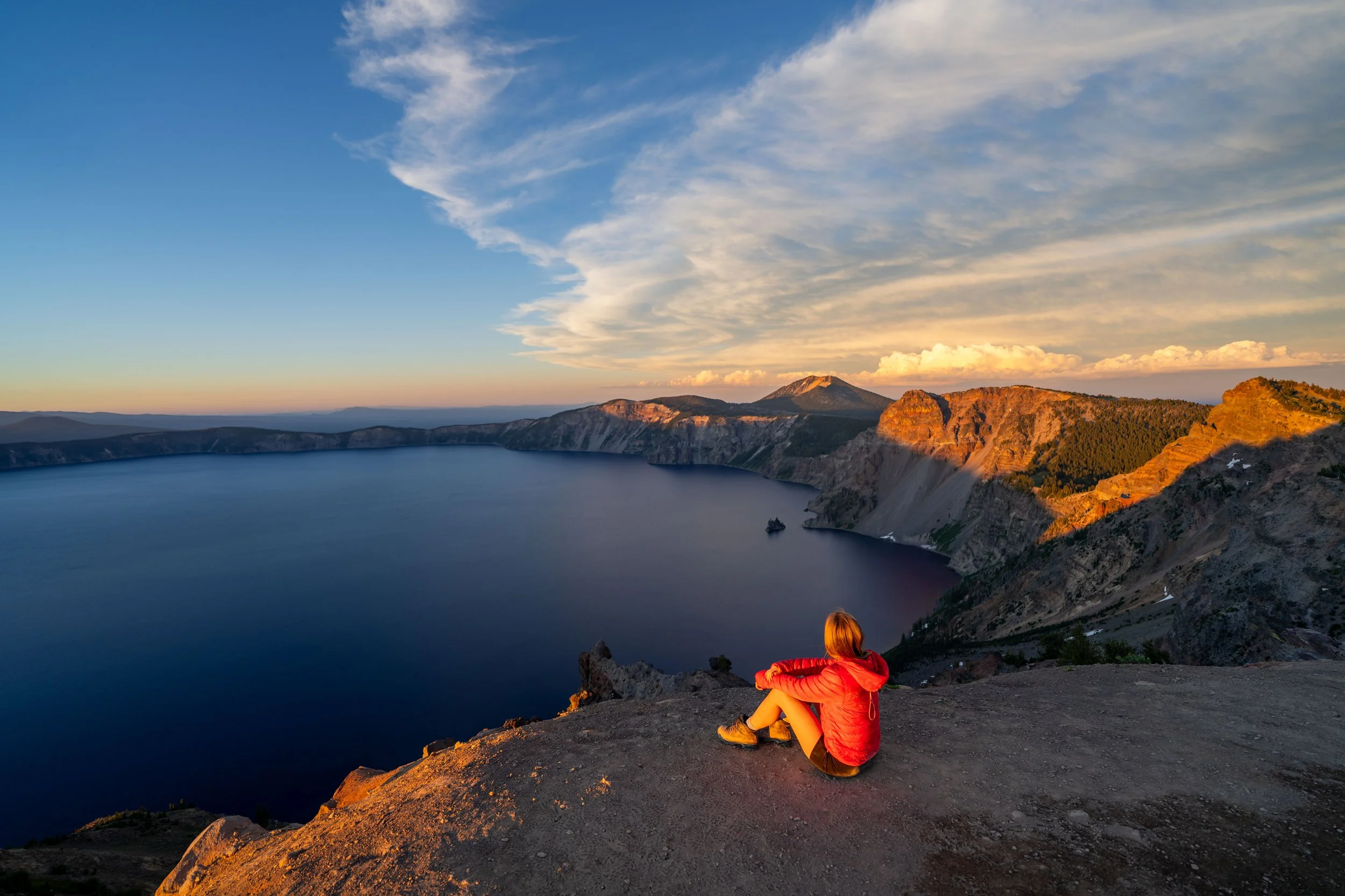
Hiking the Rim Trail in Crater Lake National Park
Distance (One Way): 8.6 miles / 13.8 km
The Rim Trail, also called the Crater Lake Rim Trail, in Crater Lake National Park is a long out-and-back or one-way adventure that connects Discovery Point on the south side of the caldera rim to the Pacific Crest Trail (PCT) at the Red Cone Trailhead off North Entrance Road.
Along this 8.6-mile (13.8 km) one-way adventure, the Rim Trail passes by some of the best and most iconic viewpoints in the park, like the Watchman and Merriam Point, along with countless other, less busy viewpoints in the sections between.
That said, the vast majority of those who visit Crater Lake National Park will not hike more than a few short sections of the Rim Trail—let alone the full thing as shown here.
This is why I wanted to include the pop-up bubble in the right-hand corner of the page, as it is the easiest way to navigate this long article in order to find the sections you’re most interested in seeing.
Rim Trailhead Parking
Parking for the Crater Lake Rim Trail could quite literally be anywhere along West Rim Drive, where the Rim Trail passes by a viewpoint or parallels the road.
However, the two most common starting points are Discovery Point at the southern terminus, or the Red Cone Trailhead at the northern.
Google Maps Directions: Rim Trailhead (Discovery Point) / Rim Trailhead (Red Cone)
Hiking Checklist - Crater Lake
Here is a complete list of must-have things that you will want for any hike in Crater Lake National Park.
That said, there are Black Bears in Crater Lake National Park, and while carrying bear spray is allowed, encounters with hikers are considerably rare.
Hiking the Rim Trail
Discovery Point
The Crater Lake Rim Trail could begin at any number of places, such as a viewpoint, a trailhead, or even random spots where the Rim Trail crosses or parallels West Rim Drive.
That said, this article begins at Discovery Point and heads north to the Red Cone Trailhead, just to the west of Grouse Hill Camp.
On that note, there is the option hike even further by combining the Discovery Point Trail with the Rim Trail for a total of 9.6 miles (15.4 km), connecting Rim Village with the Red Cone Trailhead.
To learn more, click the link below to see all the details about the Discovery Point Trail in my separate post.
Read My Separate Post: Discovery Point Trail
Over the course of the first 3.6 miles (5.8 km) to the Watchman and beyond to Hillman Peak, the Rim Trail is a bit hilly.
However, these hills level out significantly after Hillman Peak, as the Rim Trail becomes much flatter near Merriam Point and out to the Red Cone Trailhead.
This is an unnamed pullover viewpoint along the southwest side of Crater Lake.
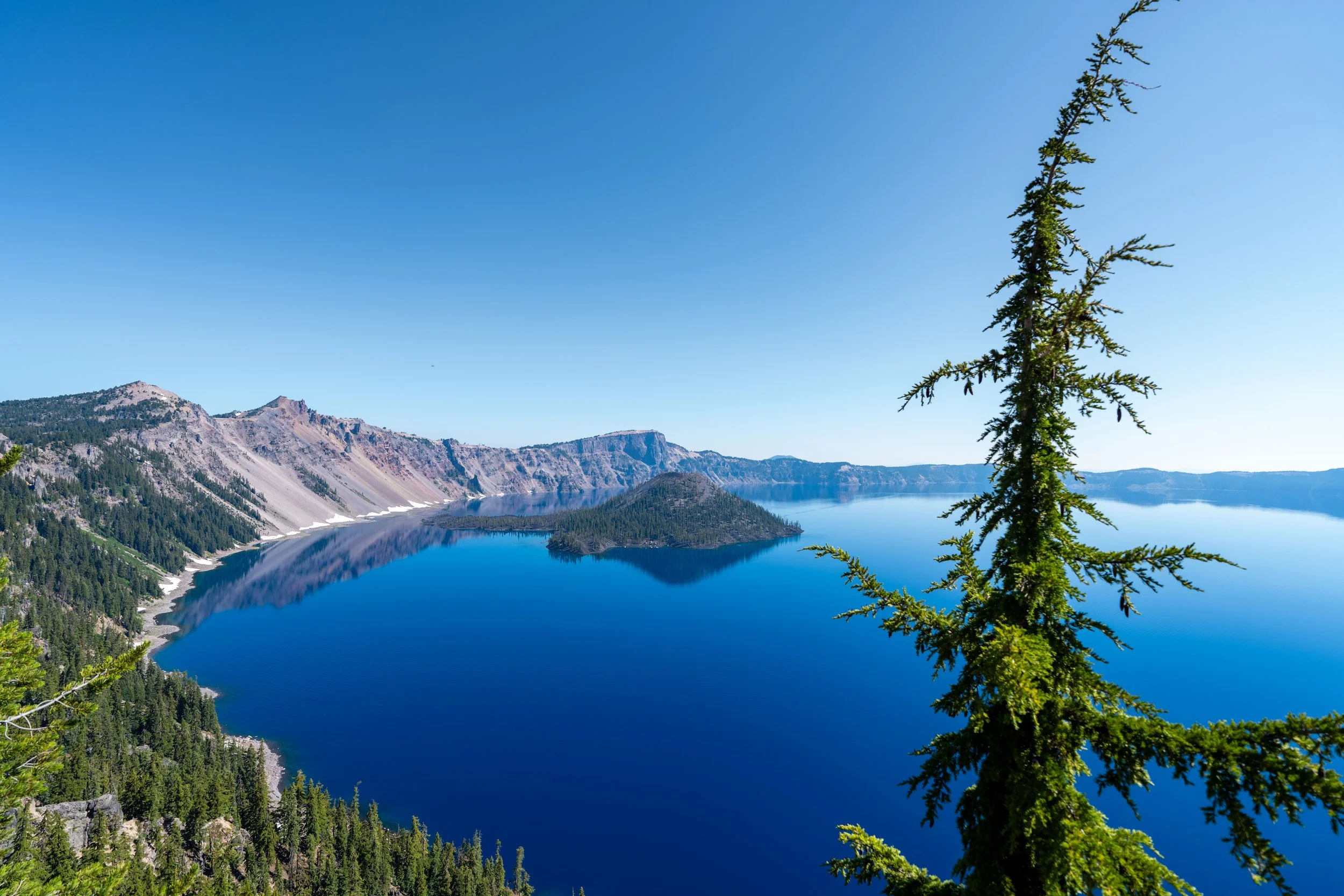
These views of Wizard Island change quickly, from this point to the Watchman Overlook, as the angle of the island seems to shift with every new viewpoint.
These hills near the beginning of the Rim Trail are about as steep as it gets between Discovery and Merriam Point.
Since the beginning hilly sections between Discovery Point and the Watchman are among the most popular, some hikers may prefer to carry trekking poles on the Rim Trail, which can certainly be useful here and for steep trails across Crater Lake National Park, like Garfield Peak.
The peak that can be seen in the distance is the Watchman, which is exactly why the first 2.8 miles (4.5 km) between Discovery Point and the Watchman are the busiest section of the entire Rim Trail.
Lightning Springs Trailhead
This large pullout, along with the parking area just off the road in the distance, is where the Lightning Springs Trail begins.
That said, Lightning Springs is nothing more than a connector between West Rim Drive and the Pacific Crest Trail, which is why it’s not one of the more popular trails in Crater Lake National Park—except among PCT hikers.
After the Lightning Springs Trailhead, the Rim Trail continues for another 1.1 miles (1.8 km) to the Watchman Trail, and 1.5 miles (2.4 km) to the Watchman Overlook shortly thereafter.
This split is simply a shortcut between the Rim Trail and the Lightning Springs Picnic Area, just to the left.
That said, go right to continue on the Rim Trail toward the Watchman.
Rim-Lightning Springs Picnic Junction
Almost immediately after the split above, the Rim Trail reaches the official junction for the Lightning Springs Picnic Area.
From here, go straight and the south side of Watchman Peak will start to become visible through the trees just a short distance ahead.
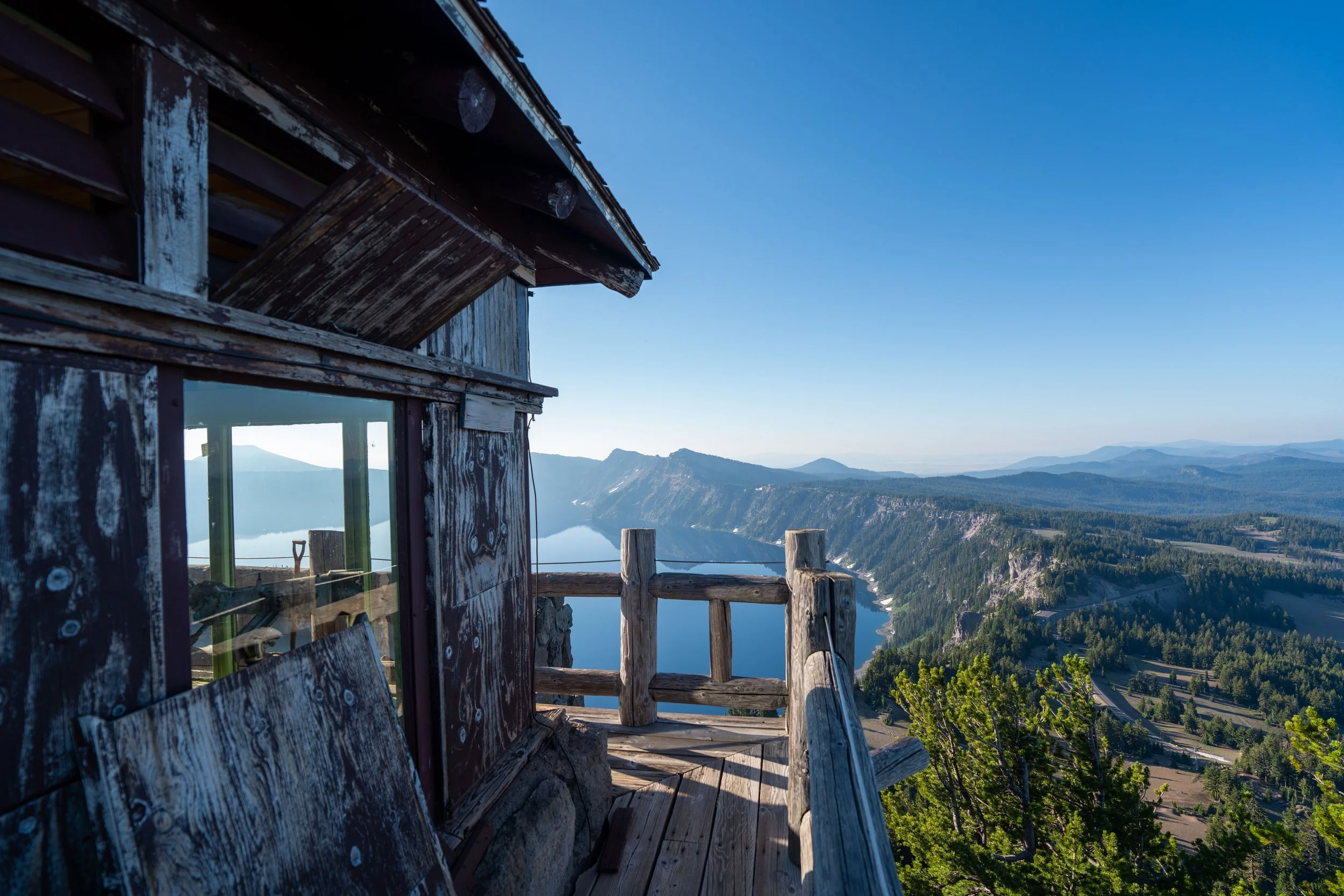
This is the south side of the Watchman, where the fire lookout at the summit can be seen much more clearly, along with hikers who have made their way up the switchbacks to the top.
When the Rim Trail reaches the base of the Watchman, the hike begins heading uphill, which continues until the Watchman Peak Trail splits off toward the summit about 0.5 miles (0.8 km) ahead.
Rim-Watchman Peak Junction
When the Rim Trail reaches the top of the hill on the north side of the Watchman, go straight to continue to the Watchman Overlook, just 0.4 miles (0.6 km) down the hill.
Note that this short stretch between the Watchman Peak Trail and the Watchman Overlook is typically one of the busiest sections of the entire Rim Trail.
Read My Separate Post: Watchman Peak Trail
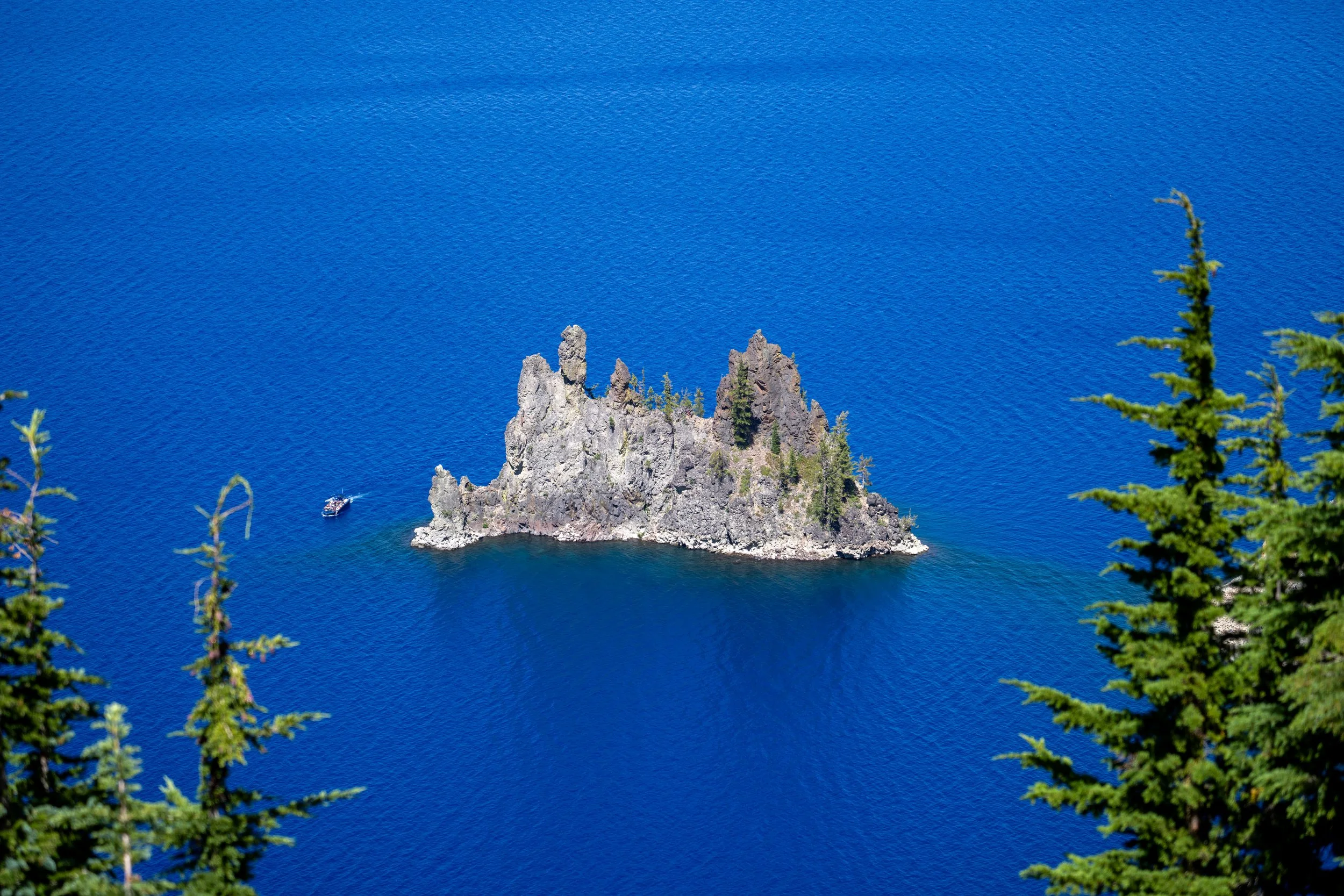
This is the view looking toward Fumarole Bay on Wizard Island.
Watchman Overlook
When the Rim Trail reaches the Watchman Overlook parking lot, go right to continue on the Crater Lake Rim Trail toward the viewpoint.
At this point, the Rim Trail continues to the left, but I recommend walking straight ahead to check out the overlook before hiking further.
After the Watchman Overlook, the Rim Trail continues straight up the hill to begin the hike around Hillman Peak.
That said, this is the last and most significant hill on the entire 8.6-mile (13.8 km) Rim Trail.
Once on the west side of Hillman Peak, the Crater Lake Rim Trail levels out significantly compared to the beginning of the hike.
In fact, the Rim Trail actually loses about 1,180 ft. (360 m) from this point to the Red Cone Trailhead, making the final 5.0 miles (8.0 km) between Hillman Peak and the Red Cone Trailhead the easiest section of the full one-way adventure.
The west side of Hillman Peak typically holds snow much longer than other areas of Crater Lake, and know that these photos were taken in late July, following an average winter season in the Cascades.
With that in mind, micro-spikes may be necessary on trails throughout Crater Lake National Park if you plan to visit around mid-July or earlier.
Other than micro-spikes, I highly recommend wearing a hooded sun shirt on the Crater Lake Rim Trail, as much of the hike is very exposed because the volcanic pumice soil around the lake creates large barren areas like this, where trees do not grow well to provide shade.
When Llao Rock becomes visible in the distance, the Rim Trail is nearing the Devil’s Backbone, with Merriam Point just beyond.
This is the view looking toward Mt. Scott on the east side of Crater Lake.
The grouping of trees and the ridge to the right in the distance straight ahead is the Devil’s Backbone.
Rim-Devil’s Backbone Junction
The Devil’s Backbone is nothing more than a short side trail up this steep hill along the Rim Trail, leading to a prominent ridge that juts out toward Crater Lake.
That said, go straight to continue to Merriam Point, or turn right to walk up the hill to see the Devil’s Backbone.
For the next 0.5 miles (0.8 km), the Rim Trail passes by a number of busy east-facing overlooks, until it reaches Merriam Point, where the Rim Trail heads away from the busiest areas that surround Crater Lake.
This is what I meant about the views of Wizard Island changing quickly along the beginning few miles of the Rim Trail.
Go right when the Rim Trail meets the road for the second time, to continue north toward Merriam Point.
Merriam Point
Merriam Point is the last viewpoint of Crater Lake on the Rim Trail, as this is where the trail leaves the caldera rim and heads north toward Grouse Hill Camp and the PCT.
On a different note, Merriam Point, along with the Watchman Overlook, are two of the best viewpoints off the Rim Trail to catch the sunrise overlooking Crater Lake!
East Rim Drive
On the far side of Merriam Point, cross East Rim Drive to find where the Rim Trail continues toward the Pacific Crest Trail.
The final 3.1 miles (5.0 km) between Merriam Point and the Pacific Crest Trail are the most untrafficked section of the entire Rim Trail.
This is because there are no more views of Crater Lake from this point on, not to mention turning back to Discovery Point from here makes a lot more sense for most hikers who don’t have a pick-up as opposed to continuing to the Red Cone Trailhead.
That said, the total roundtrip distance by turning back at this point is 11.0 miles (17.7 km), whereas the total roundtrip distance from the Red Cone Trailhead is 17.2 miles (27.7 km).
Since this final section of the Rim Trail is so untrafficked, the only other hikers typically found here are PCT thru-hikers making their way between the trail and Rim Village.
Once again, I could not recommend wearing a hooded sun shirt more—even if you don’t plan to hike the full Crater Lake Rim Trail as shown here.
If you planned to get a ride from the Red Cone Trailhead, note that when the Rim Trail leaves Crater Lake, cell service typically disappears at the same time.
This means that, if you have the ability, it’s best to send one last text to your ride around Merriam Point, stating that you have about 3.1 miles (5.0 km) left to reach the Red Cone Trailhead.
On this final remote section, be aware that the road is furthest from the Rim Trail than at any other point of the hike thus far.
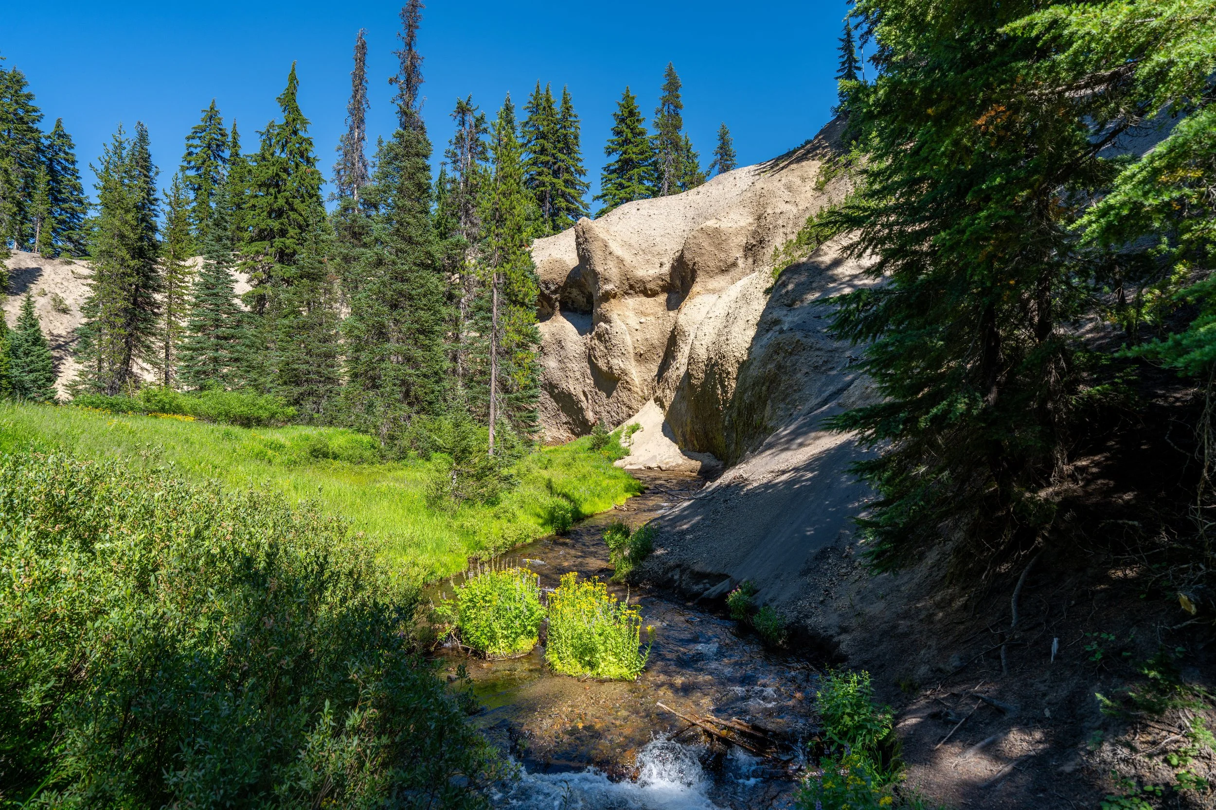
This is what makes these remote miles on the Rim Trail great places to look for wildlife—especially since Black Bears are not very common around the busy caldera rim, as they are here and in other places throughout the 'Green Tunnel' that makes up much of Crater Lake National Park, like the Union Peak Trail.
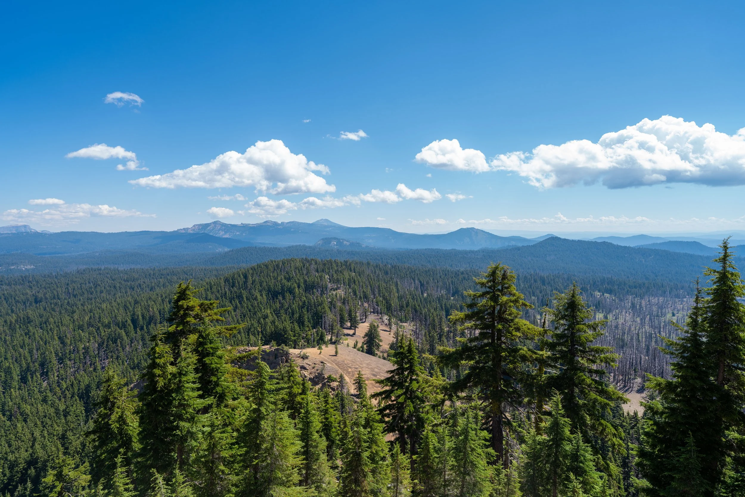
This is the view looking out toward the Pumice Desert, with Mt. Thielsen in the background.
This peak in the distance is Mt. Bailey, an 8,000 ft. (2,438 m) peak just west of Mt. Thielsen.
When the Rim Trail starts to descend this hill, it’s a nice sign that the hike is nearing Grouse Hill Camp, and the end of the Rim Trail shortly thereafter.
Grouse Hill Camp
Grouse Hill Camp is the only named campsite off the Crater Lake Rim Trail, and it’s a popular among those thru-hiking the PCT, as the Pacific Crest Trail is located just a short distance away.
That said, Grouse Hill is only open to PCT thru-hikers, meaning other visitors are not allowed to camp here. However, those wishing to camp in the area may seek a backcountry permit for dispersed camping nearby.
After turning left, there is only 0.4 miles (0.6 km) left to hike between Grouse Hill Camp and the Pacific Crest Trail.
Rim-Pacific Crest (PCT) Junction
The Pacific Crest Trail (PCT) is the end of the Crater Lake Rim Trail.
From here, go left at this junction to finish the remaining 0.1 miles (0.2 km) to the Red Cone Trailhead off North Entrance Road.
Red Cone Trailhead
This is the end of the long 8.6-mile (13.8 km) one-way adventure on the Rim Trail from Discovery Point to the Red Cone Trailhead.
As shown at the beginning of this article, the Red Cone parking area is located directly across the highway, but be careful when crossing, as cars traveling between the north entrance and Crater Lake move pretty fast along this stretch.
On a different note, I again want to state once again that having cellphone service at the Red Cone Trailhead is unlikely. This means that if you’re waiting for a pick-up from someone in your party, it’s unlikely that you’ll have the ability to reach them this far away from the caldera rim.