Hiking the Mt. Scott Trail in Crater Lake National Park
Distance: 4.4 miles / 7.1 km
The Mt. Scott Trail in Crater Lake National Park is a relatively easy day hike on the east side of Crater Lake that climbs to the highest summit in the National Park!
By this, I mean that, for what climbing to the highest summit in the park could be, Mt. Scott is a fairly easy day hike—even easier than the much lower but much more remote Union Peak on the south side of Crater Lake.
I say this because, for lack of a better term, there’s no bull$#%t. There’s no approach and no unnecessary elevation gains and losses—meaning that the Mt. Scott Trail is straight to the point, which is reflected by the very close trailhead located right at the base of the peak.
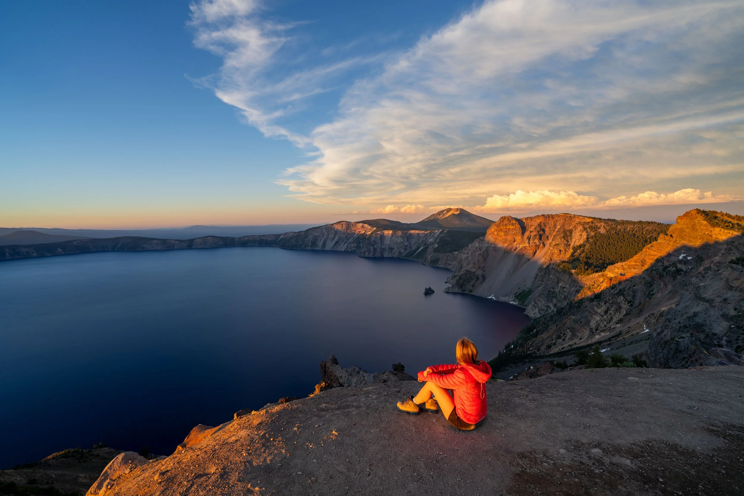
This is why I think the Mt. Scott Trail is one of the best all-around sunrise and sunset hikes in Crater Lake National Park, because at only 2.2 miles (3.5 km) each way, the hike in the dark isn’t terribly long, so long as you bring a good headlamp.
Mt. Scott Trailhead Parking
Parking for the Mt. Scott Trail is located directly off East Rim Drive, just a 10-minute drive from the Cleetwood Cove Trail on the north side of Crater Lake.
I mention this because the two can make for great back-to-back adventures—especially if you’re looking for a great sunset hike to finish the day!
Google Maps Directions: Mt. Scott Trailhead
Hiking Checklist - Crater Lake
Here is a complete list of must-have things that you will want for any hike in Crater Lake National Park.
That said, there are Black Bears in Crater Lake National Park, and while carrying bear spray is allowed, encounters with hikers are considerably rare.
Hiking the Mt. Scott Trail
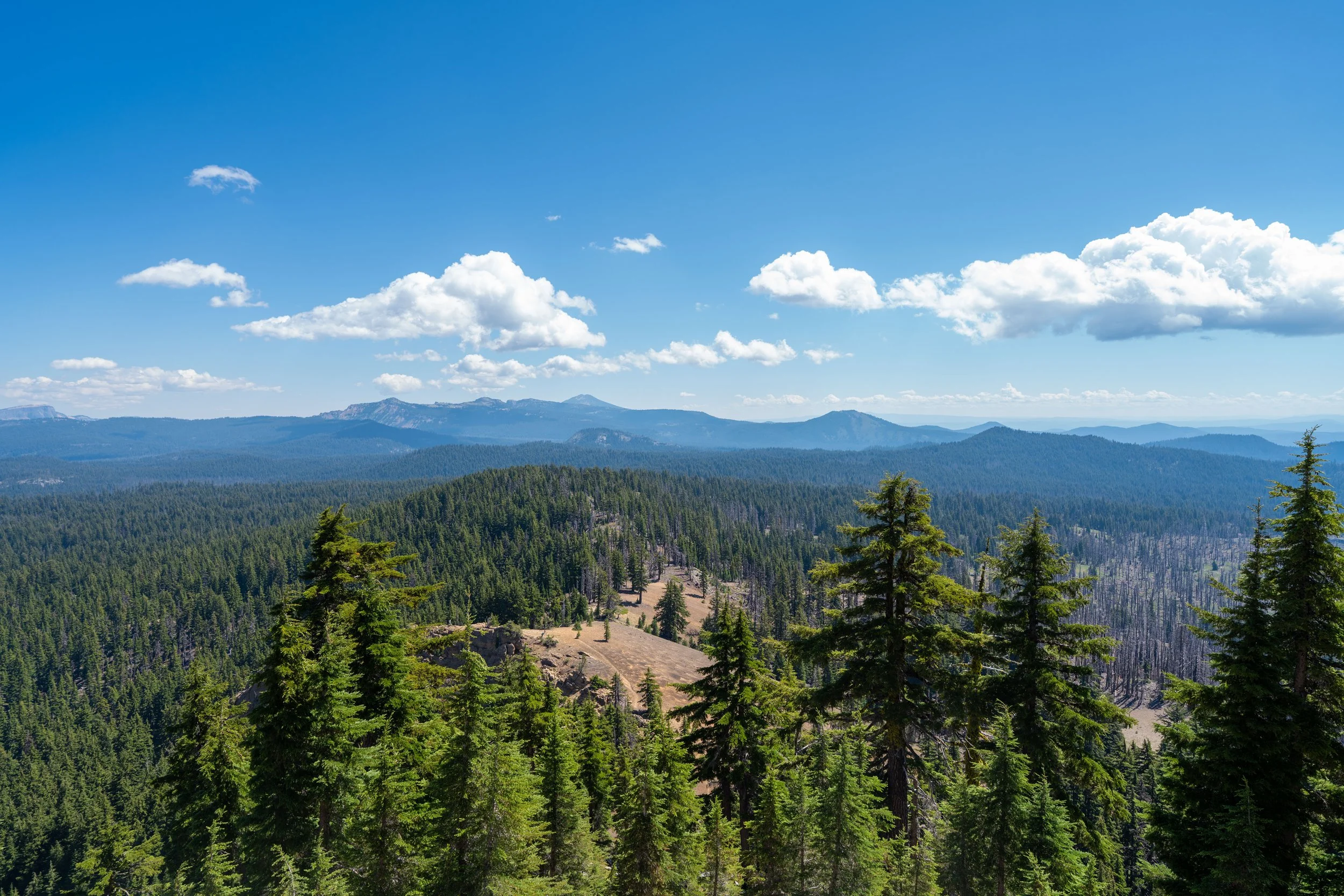
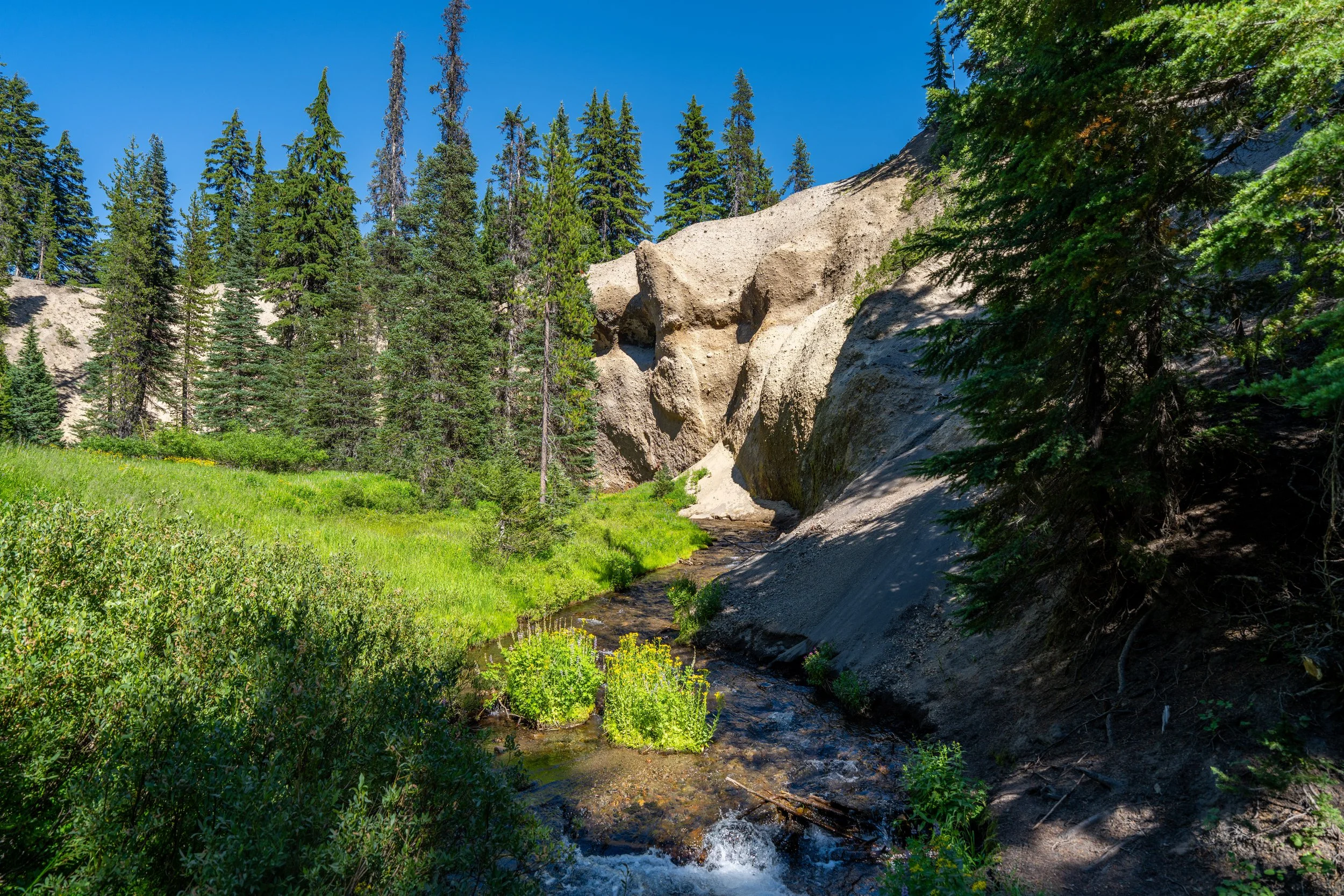
The Mt. Scott Trail begins just up the hill from the parking area, where it parallels the summit ridge on Mt. Scott, until it begins ascending the switchbacks on the south side of the mountain.
I’m usually pretty good at identifying plants across the Mountain West, but this one got me.
My best guess is an Asclepias species, but if you know otherwise, please leave a comment below. I’d love to know more!
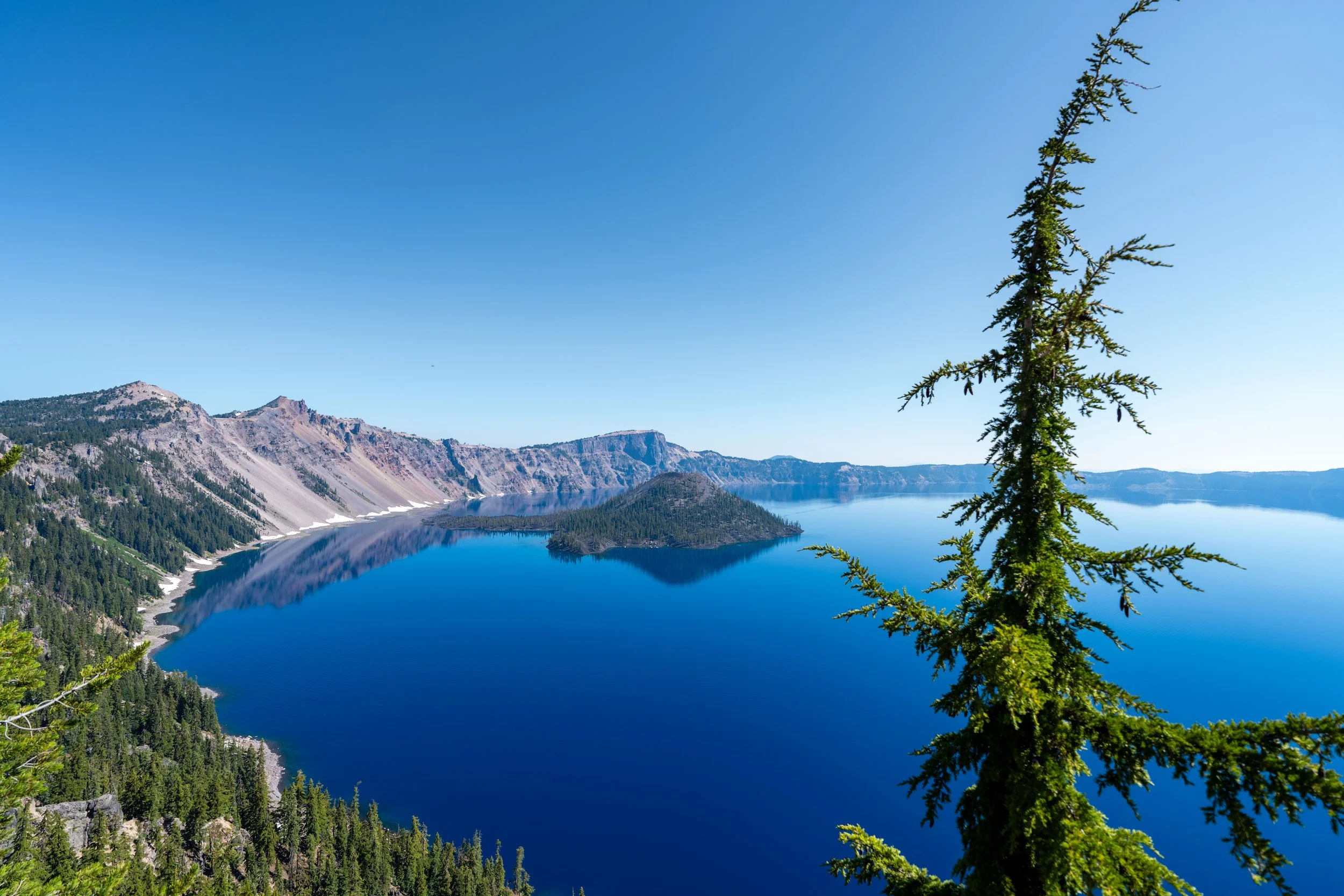
From the very beginning, the fire lookout at the summit of Mt. Scott can be seen on a clear day, which is exactly what I meant about the hike being straight to the point!
When the Mt. Scott Trail enters the forest on the southwest side of the peak, it begins climbing a series of five or six switchbacks—depending on how you count—to reach the summit ridge just below the fire lookout at the top.
In total, the Mt. Scott Trail climbs about 1,200 ft. (366 m) from the trailhead to the summit, which is why some hikers may prefer to carry trekking poles, as the elevation gain remains nearly constant after the initial 0.3 miles (0.5 km) before the forested sections.
In addition to poles, a hooded sun shirt can also be very useful, since the shade from the Lodgepole-Hemlock forest only does so much at these higher elevations.
While the ascent is nearly constant, Mt. Scott is certainly not the hardest summit in southern Oregon—not to mention it’s considerably less steep than the final ascent up Union Peak.
Storms like this are exactly why timing a visit to Crater Lake National Park is so challenging.
By this, I mean that I think Crater Lake, along with Lassen Volcanic National Park, are two of the most challenging parks to visit in the U.S., because timing either is all about going right after most of the snow melts and the trails open, but before peak wildfire season kicks off in August.
In fact, I was watching lightning strikes constantly from this storm around the third week of July, which is to say, you really never know which storm will create a wildfire with thick smoke that makes visiting either park a lot less desirable.
Once the Mt. Scott Trail turns the corner on the first switchback, the remaining switchbacks get a lot shorter, meaning the summit ridge starts to feel much closer once the trail begins climbing in the other direction.
This second switchback is located just 0.25 miles (0.4 km) past the first, and they only continue to get shorter as the Mt. Scott Trail climbs higher.
As a general rule of thumb, it’s never safe to ascend a summit like Mt. Scott if a storm, like the one in the distance, is any closer.
However, the wind wasn’t blowing it in my direction, and I made sure to check the Mountain Forecast for Mt. Scott before starting the hike.
It certainly was fun to watch the lightning, knowing I was far enough away to not have to worry about it!
This is where the Mt. Scott Trail turns the corner to begin the final 0.25-mile (0.4 km) summit ridge to the fire lookout at the top!
Anywhere along this final stretch can make for a great place to watch the sunrise or sunset!
Mt. Scott
According to the National Park Service, the summit of Mt. Scott stands at 8,929 ft. (2,722 m), or about 2,750 ft. (838 m) above the surface of Crater Lake.
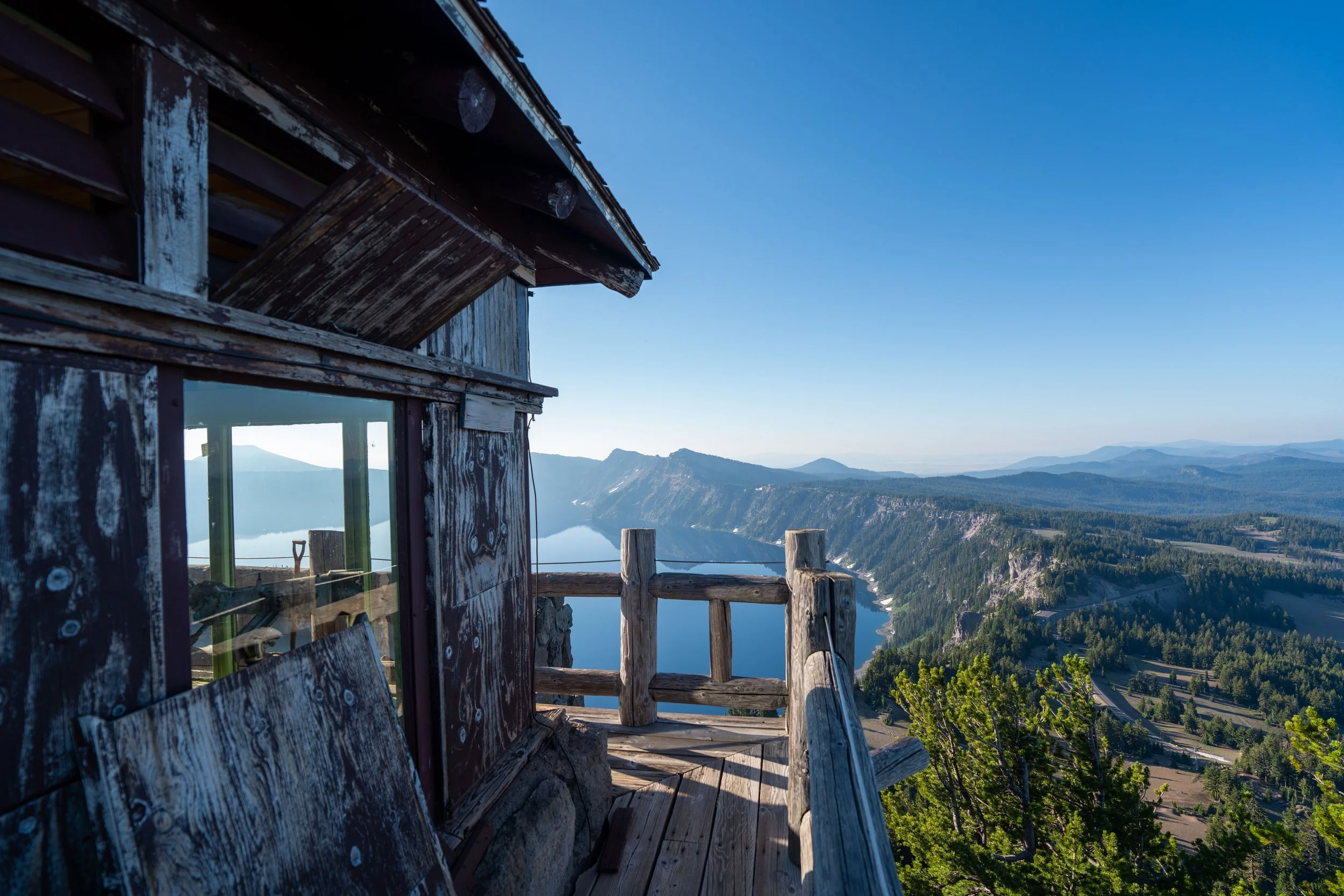
For those interested in standing on the true summit, the summit marker can be found on the big rock on the trail side of the fire lookout.
Mt. Scott Fire Lookout
The Mt. Scott Fire Lookout in Crater Lake National Park was originally constructed in the early to mid-1920s, but the one on the summit today is actually from a reconstruction project in 1952.
However, harsh winter conditions in Crater Lake did not keep the lookout open for long, which is why the Mt. Scott Fire Lookout is not staffed today, though it is still used by the USGS for monitoring seismic activity.
The storm really made for a stunning sunset on the hike down!
That said, don’t forget to hike with a good headlamp if catching sunrise or sunset here, or elsewhere like Garfield Peak, is something you’re interested in.