Hiking the Ring Arch Trail in Arches National Park
Distance: 3.0 miles / 4.8 km
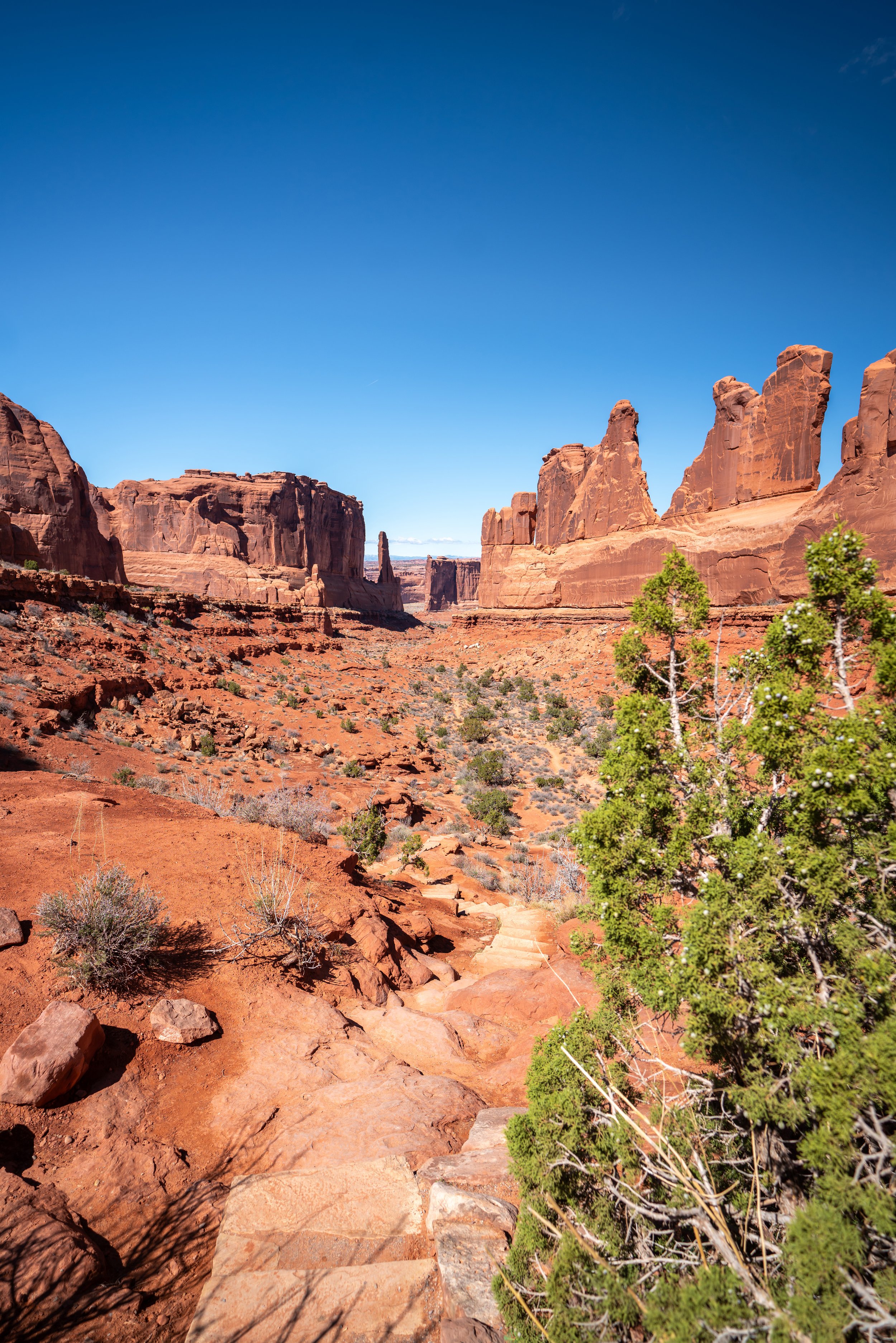
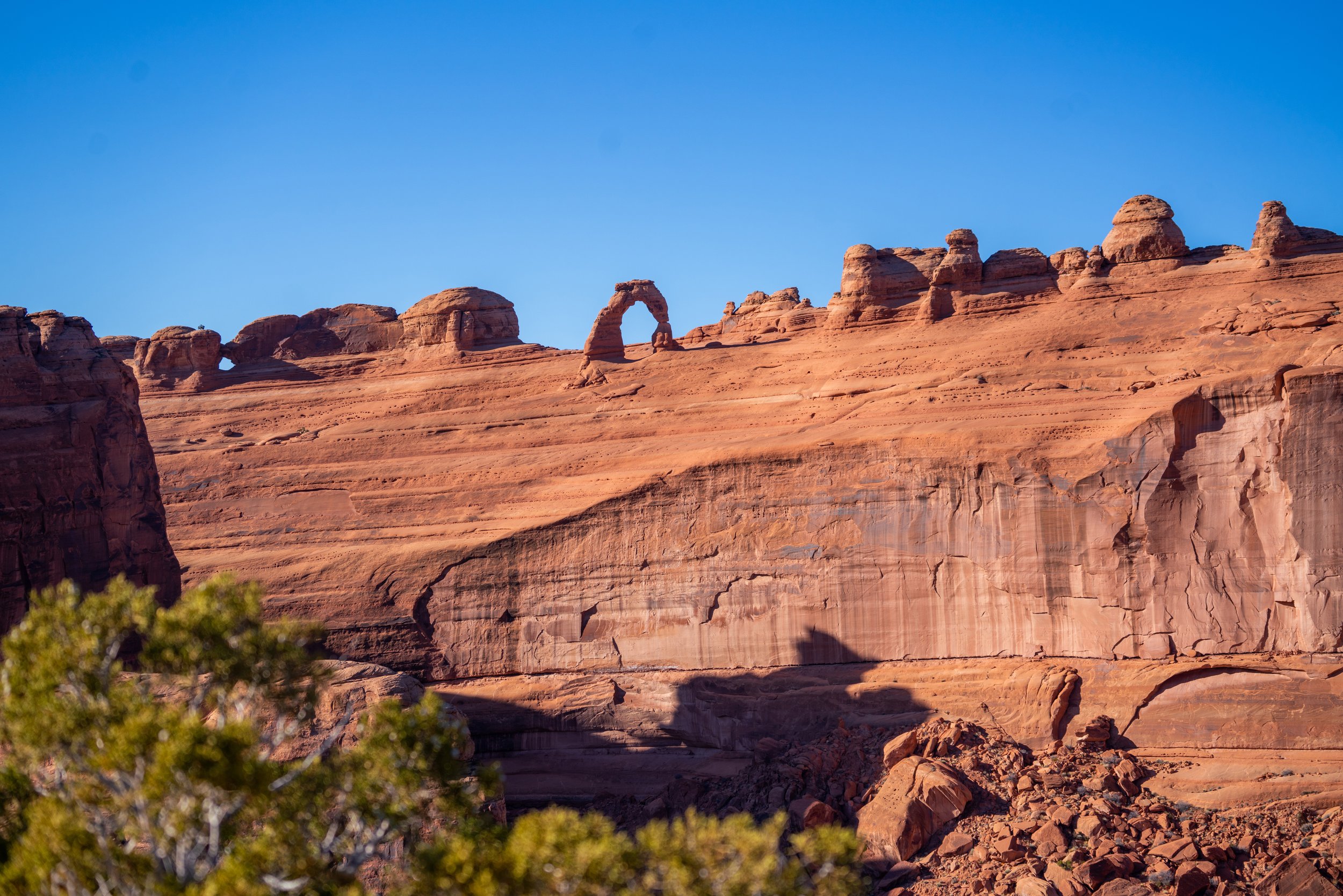
The Ring Arch Trail in Arches National Park is a little-known day hike to a hidden arch near the beginning of Arches National Park Road, one of several adventures in the park that does not follow a designated or maintained trail by the National Park Service.
That said, the Ring Arch Trail is what’s known as a 'social trail,' which often feels like a hidden gem compared to all the more popular maintained trails through the park. For those who may be familiar, social trails are actually more common than you may think, as there are countless well-known adventures across National Parks that all fall under this designation, such as the Delta Lake Trail in Grand Teton National Park, the South Ariel Peak Trail in Zion National Park, and even the Bar Island Loop Trail in Acadia National Park.
With all this in mind, I personally think that the Ring Arch Trail is a great and fun option to enjoy Arches National Park without the crowds, especially first thing in the morning, as it is one of the first adventures off the 18.4-mile (29.6 km) main park road.
Ring Arch Trailhead Parking
Parking for the Ring Arch Trailhead is located in a small turnout on the left-hand side of Arches National Park Road, just after Courthouse Wash, when driving in from Moab.
When visited to hike the trail first thing in the morning, there weren’t any other cars parked for the hike. However, when I returned, this small turnout began to fill up with cars parked for the Ring Arch and other adventures that branch off of this same trail.
Google Maps Directions: Ring Arch Trailhead
Hiking Checklist - Arches
Here is a complete list of must-have things that you will want for any hike in Arches National Park.
Hiking the Ring Arch Trail
The Ring Arch Trail begins at this unmarked trailhead adjacent to the pullout just after Courthouse Wash when driving into the park from the visitor center.
Initially, the hike begins on a mostly flat trail, as it parallels the Courthouse Wash for the first 0.5 miles (0.8 km) before crossing.
Even though the Ring Arch Trail gets close to the Courthouse Wash, it does not cross over until it passes by the sandstone cliff off in the distance.
After passing by the base of the cliff, the Ring Arch Trail should leave it behind to cross over the Courthouse Wash and the grasslands immediately following.
That said, go left to cut straight across the Courthouse Wash when the Ring Arch Trail splits, as shown below.
Courthouse Wash
The Ring Arch Trail should cut straight across the Courthouse Wash to the other side.
Ring Arch Loop Trail
When the Ring Arch Trail splits, you can either go right or left, as both sides of the loop meet again about 0.5 miles (0.8 km) down the trail.
I chose to go left, which is what is shown in the following sections.
Second Ring Arch Loop Junction
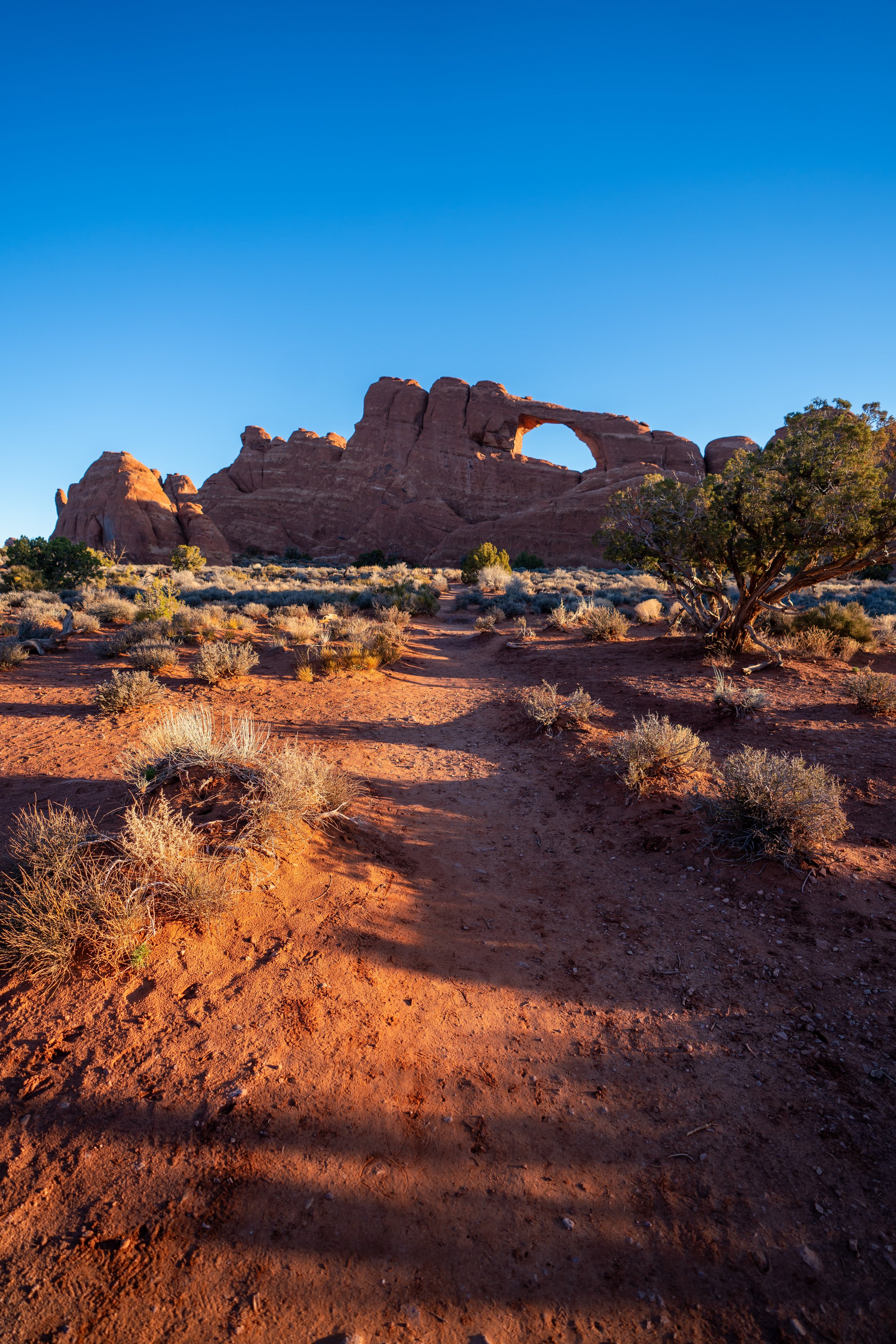
This is where both sides of the Ring Arch Loop become one trail again, and it’s where the Ring Arch starts to become visible for the first time, off in the distance.
At this point, the Ring Arch Trail leads almost directly in the direction of the arch, located about 0.3 miles (0.5 km) away.
As the Ring Arch Trail approaches the arch at the very end, stay to the left in order to take the easiest route for the final scramble up to the base of the arch.
These are Utah Junipers, and according to the National Park Service, the berries are considered to be edible for humans.
However, I have yet to try them for myself.
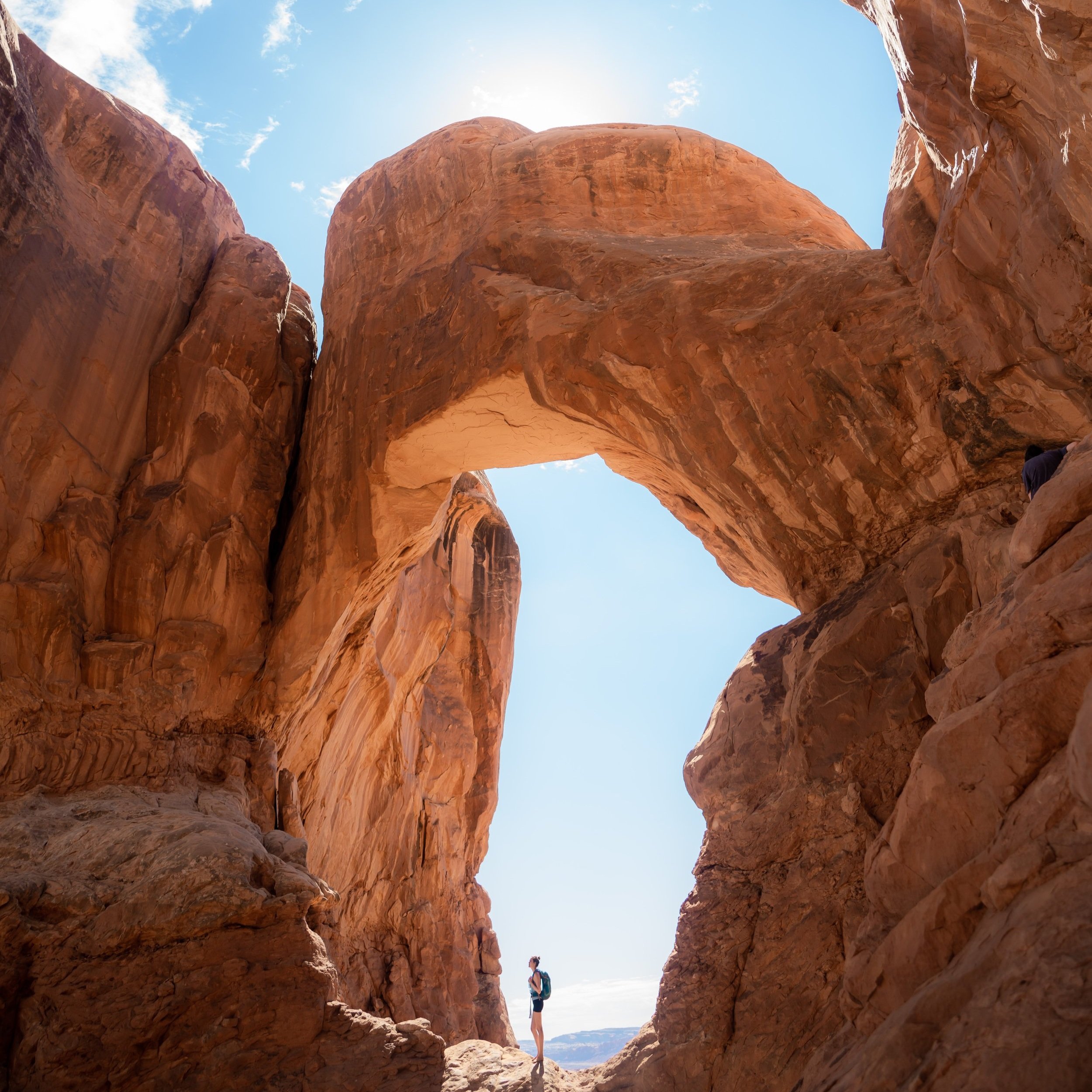
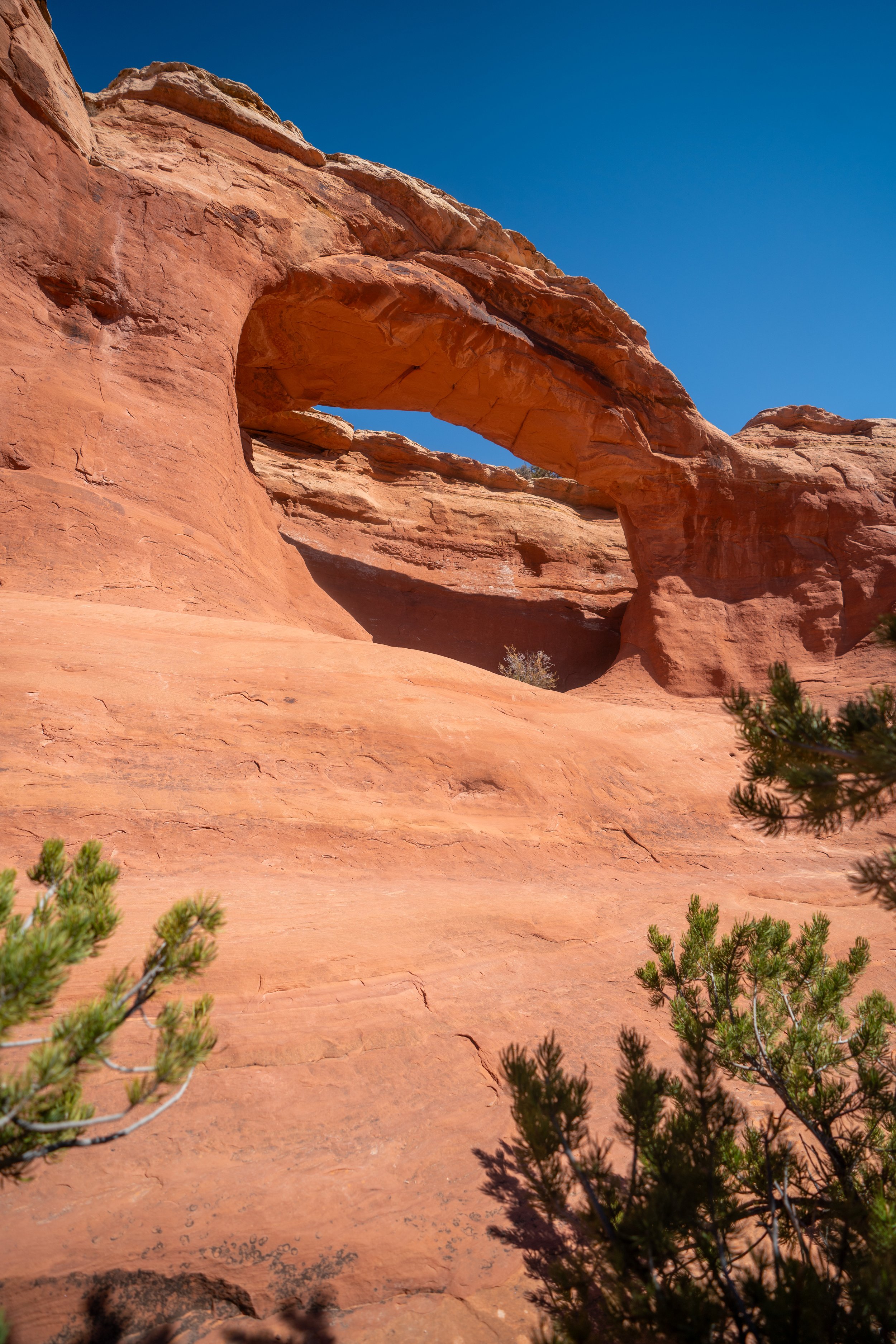
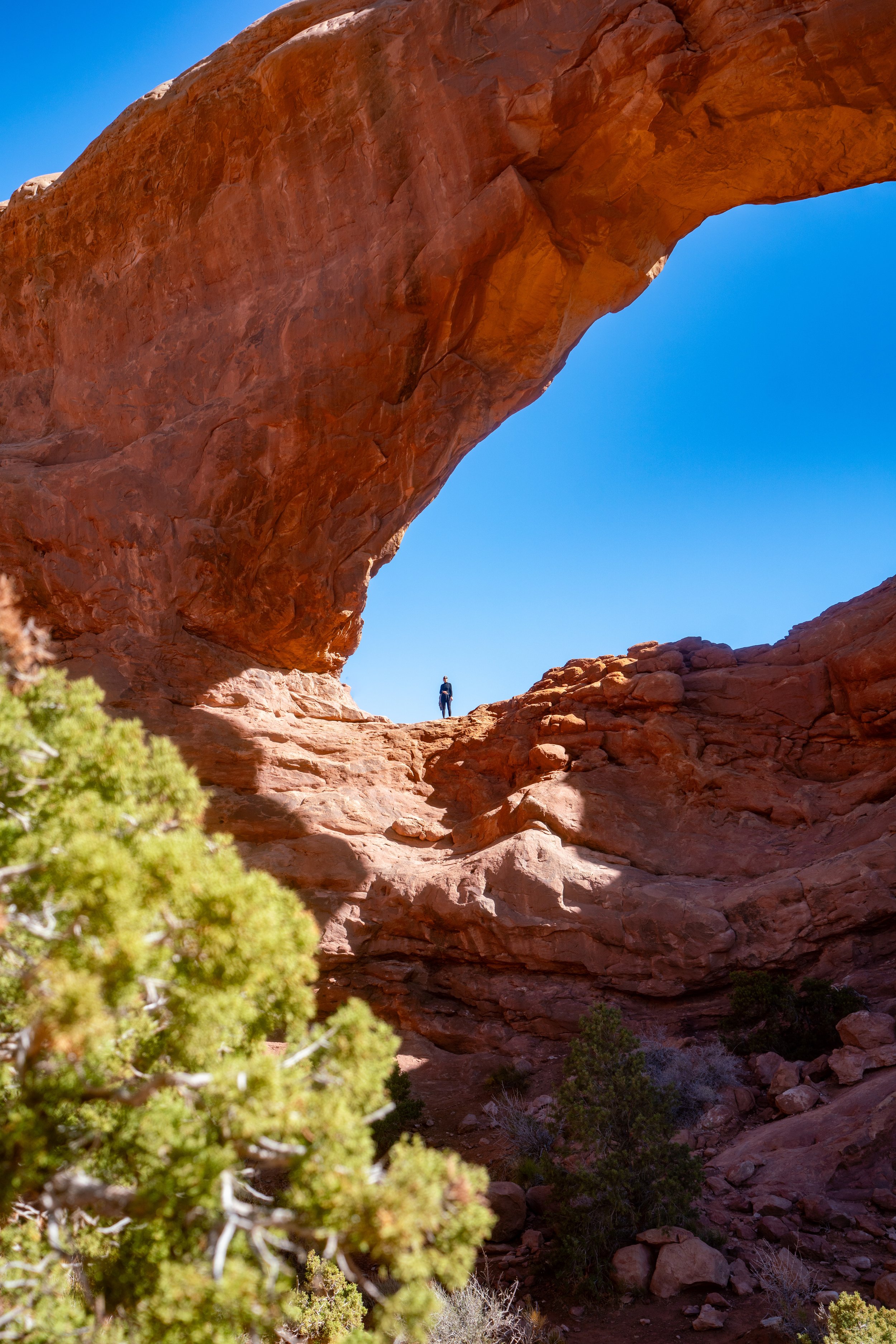
Ring Arch
After 1.5 miles (2.4 km), the Ring Arch Trail ends below the arch, towering high above the base of the cliff from where these photos were taken.
In my opinion, the narrow Ring Arch doesn’t appear as though it will stand forever, as the small bridge has numerous large rocks beneath it that seem to be sections that have broken away in the past.
In any case, the Ring Arch makes for a great adventure in Arches National Park for those seeking an alternative trail to some of the park's busiest day hikes.