Hiking the Little Sugarloaf Summit Trail in Sedona, Arizona
Distance: 1.1 miles / 1.8 km
The Little Sugarloaf Summit Trail, also called the Little Sugarloaf Mountain Trail, in Sedona, Arizona, is a short and relatively easy day hike that leads to a beautiful panoramic viewpoint above the city, which is why Little Sugarloaf Summit is one of the best all-around sunrise and sunset hikes in Sedona!
In fact, both sunrise and sunset are truly the only times of the day that I recommend hiking the Little Sugarloaf Summit Trail, which I largely believe because this is when the colors are the most beautiful—particularly on the nearby Capitol Butte. In addition, the easy trail to the summit of Little Sugarloaf makes hiking in the dark—either before sunrise or after sunset—relatively quick, which is certainly something that cannot be overstated during the hotter summer months.
All this goes without saying, the final 0.2 miles (0.3 km) of the hike to the top of Little Sugarloaf Mountain is deceivingly steep, so be sure to read to the end to learn more, as the hike doesn’t appear to be nearly as challenging as it is from the trailhead or the beginning sections.
Little Sugarloaf Summit Trailhead Parking
Parking for Little Sugarloaf Summit is located at the Thunder Mountain Trailhead, a small parking lot just north of town that is popular among those hiking, biking, and trail running because of the loops that can be created around both Little Sugarloaf and Chimney Rock.
Before arriving, be aware that the most trailheads in Sedona are considered U.S. Fee Areas, meaning that hikers are required to pay to park or leave a valid federal recreation pass—like the ones commonly used for National Park entry—in the dash of your vehicle.
Google Maps Directions: Little Sugarloaf Summit Trailhead (Thunder Mountain)
Southwest Hiking Checklist
Here is a complete list of must-have things that you will want for any hike in the Southwest U.S.
Hiking the Little Sugarloaf Summit Trail
The Little Sugarloaf Summit Trail begins at the Thunder Mountain Trailhead, where it follows both the Thunder Mountain Trail and the Lower Chimney Rock Trail, before finally splitting away toward the summit of Sugarloaf Mountain—about 0.4 miles (0.6 km) into the hike.
Lower Thunder Mountain-Chimney Rock Junction
This is where the trail splits with the Lower Chimney Rock Loop, which circles Little Sugarloaf Summit.
That said, both routes lead to the summit trail on the north side of the mountain, but the route to the right is the fastest way to reach this junction.
Regarding my thoughts above, I chose to go right.
Upper Thunder Mountain-Chimney Rock Junction
This second junction is where the Lower Chimney Rock Trail and the Thunder Mountain Trail split, with the route up to Little Sugar Loaf Summit continuing on the Lower Chimney Rock Loop.
Here, go left to continue toward the north side of the mountain, where the trail to the summit can be found about 0.2 miles (0.3 km) ahead.
Lower Chimney Rock-Chimney Rock Pass Junction
Just before the Little Sugarloaf Trail branches away toward the summit, the Lower Chimney Rock Trail comes to two back-to-back splits, with the first junction beginning the Chimney Rock Pass Trail that leads around Chimney Rock.
That said, go left (straight) to continue toward the split immediately ahead, which leads up to the summit of Little Sugarloaf.
Little Sugarloaf Summit-Lower Chimney Rock Junction
This is the second junction, immediately following the one above.
Here, the true Little Sugarloaf Summit Trail begins to the left, with the Lower Chimney Rock Loop Trail continuing around Little Sugarloaf to the right.
This is why I mentioned in the beginning that both routes lead to this junction, which can make for a nice return loop, adding about 0.6 miles (1.0 km) or 1.0 mile (1.6 km) total—compared to 0.4 miles (0.6 km) to return to the Thunder Mountain Trailhead on the way back down.
From the Chimney Rock junction above, the Little Sugarloaf Summit Trail begins climbing much more steeply than at the beginning of the hike, gaining most of its elevation—about 155 ft. (47 m) in total—in the final 0.2 miles (0.3 km).
The final ascent up Little Sugarloaf Summit is quite steep, which is one main reason I only see it as a sunrise or sunset hike—especially during the hotter summer months!
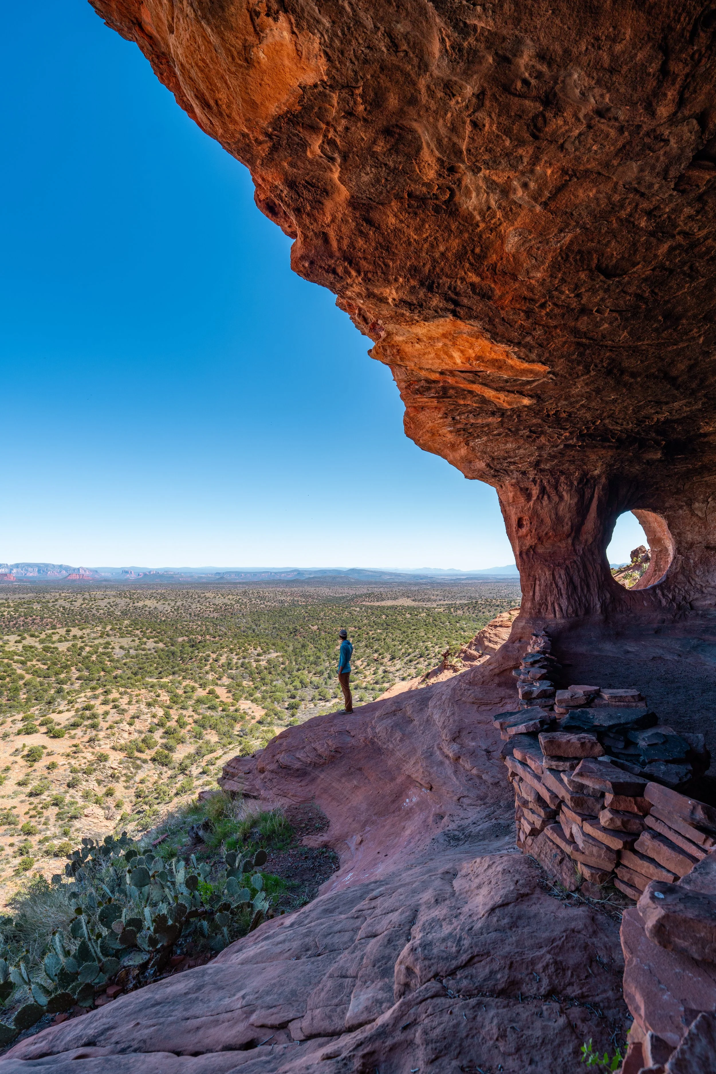
Little Sugarloaf Summit
After just over 0.5 miles (0.8 km), the trail finally reaches Little Sugarloaf Summit, which stands at about 4,822 ft. (1,470 m), or about 350 ft. (107 m) above the neighborhoods below.
These panoramic views are what make Little Sugarloaf Summit such a great sunrise or sunset hike, but again, be sure to pack a good headlamp, which will certainly be useful here and on countless different day hikes across Sedona, like Cathedral Rock and the Bell Rock Trail.