Hiking the Hope Creek–Ten Taypo Loop Trail in Prairie Creek Redwoods State Park, California
Distance: 3.7 miles / 6.0 km
The Hope Creek–Ten Taypo Loop Trail in Prairie Creek Redwoods State Park is two separate day hikes that form one beautiful, quiet loop off Newton B. Drury Scenic Parkway, passing countless towering Redwoods, various wildflowers, and unique tunnels formed by falling trees and hollowed-out Redwoods!
That said, there really is no point in looking at the Hope Creek Trail and the Ten Taypo Trail as two separate adventures, as the two are essentially synonymous—together forming one 3.7-mile (6.0 km) loop.
I say this because when the trail reaches the far eastern end of the loop, it doesn’t make much sense to turn back on one trail or the other—especially when the loop is hiked counterclockwise, as outlined in this post.
By this, I mean that the Ten Taypo side of the loop is much longer and more tedious, while the Hope Creek Trail is much shorter and therefore moves much quicker.
All this to say, the Hope Creek–Ten Taypo Loop Trail is one of my favorite day hikes in Prairie Creek Redwoods when it comes to escaping some of the busier areas within the park—not to mention, the Redwoods are just as, if not more, beautiful than all the surrounding day hikes off the scenic parkway!
How Long is the Hope Creek–Ten Taypo Loop Trail?
For an easy breakdown of both trails, I wanted to provide the distances below to help with planning some or all of the full Hope Creek–Ten Taypo Loop Trail.
Hope Creek–Ten Taypo Loop Distances:
Hope Creek Trailhead to the Start of the Loop Trail: 0.3 miles (0.5 km)
Ten Taypo Trail (South Side) to the East Loop Junction: 1.9 miles (3.1 km)
Hope Creek Trail (North Side) to the Start of the Loop Trail: 1.2 miles (1.9 km)
Total Distance: 3.7 miles (6.0 km)
Hope Creek–Ten Taypo Loop Trailhead Parking
Parking for the Hope Creek–Ten Taypo Loop Trail is located at the Hope Creek Trailhead, directly off Newton B. Drury Scenic Parkway in the Prairie Creek Redwoods, about 5.7 miles (9.2 km) north of the Prairie Creek Visitor Center.
That said, the Hope Creek Trailhead is a joint parking area that serves both the Hope Creek–Ten Taypo Loop Trail and the Ossagon Trail across the road, which is why this parking area tends to be a little busier than most off the scenic parkway.
Google Maps Directions: Hope Creek–Ten Taypo Loop Trailhead
Hiking Checklist - Redwoods
Here is a complete list of must-have things that you will want for any hike in Redwood National & State Parks.
Hiking the Hope Creek–Ten Taypo Loop Trail
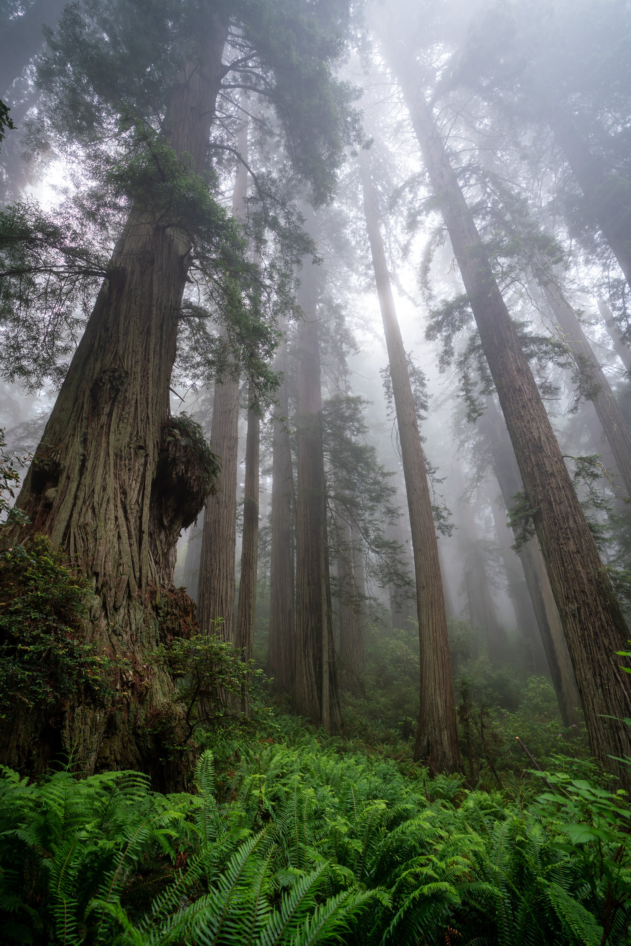
The Hope Creek–Ten Taypo Loop Trail begins on the Hope Creek Trail, where the hike climbs a gradual uphill path for the first 0.3 miles (0.5 km) until it reaches the start of the loop.
These switchbacks are about as steep as the full Hope Creek–Ten Taypo Loop Trail ever gets, which is why it is such a fun, easy hike and a great trail-running loop in the Redwoods!
If you are interested in a good shoe that works well for both road and trail running here and elsewhere, consider the ones I love to use, linked below.
If you’re lucky, you may catch the Rhododendrons flowering in the forest understory, which is very common to see during the early summer months—the best time of year to visit the Coastal Redwoods!
Hope Creek–Ten Taypo Loop Trail
After 0.3 miles (0.5 km), the Hope Creek Trail reaches the start of the Hope Creek–Ten Taypo Loop, with the Hope Creek Trail continuing on the north side (left) and the Ten Taypo Trail beginning on the south side (right).
That said, I personally recommend going right on the Ten Taypo Trail because it is the much longer 'half' of the hike, meaning that once the Hope Creek Trail is reached again on the far eastern end, the rest of the hike back to the beginning feels very quick, easy, and best of all, direct!
Regarding my thoughts above, I chose to go right in the counterclockwise direction to begin the Ten Taypo Trail.
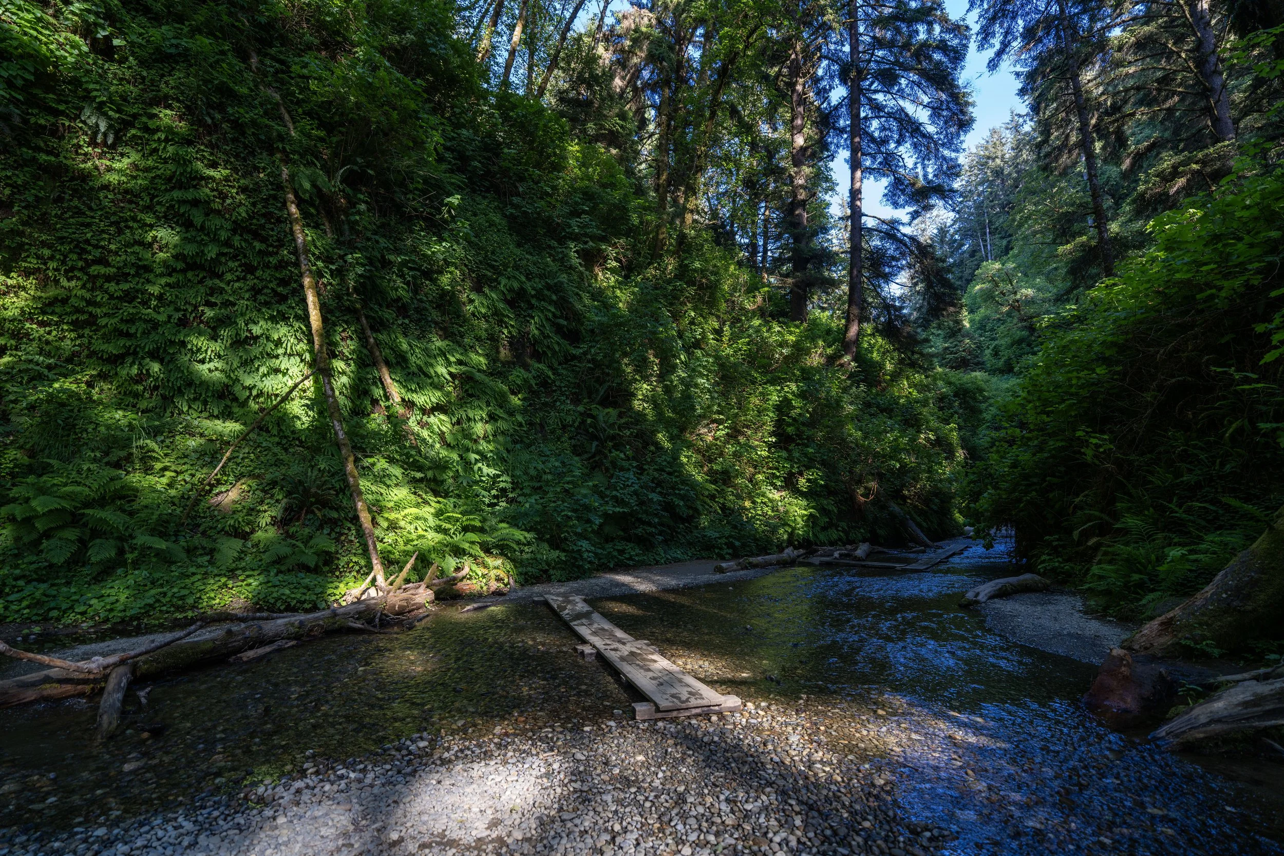
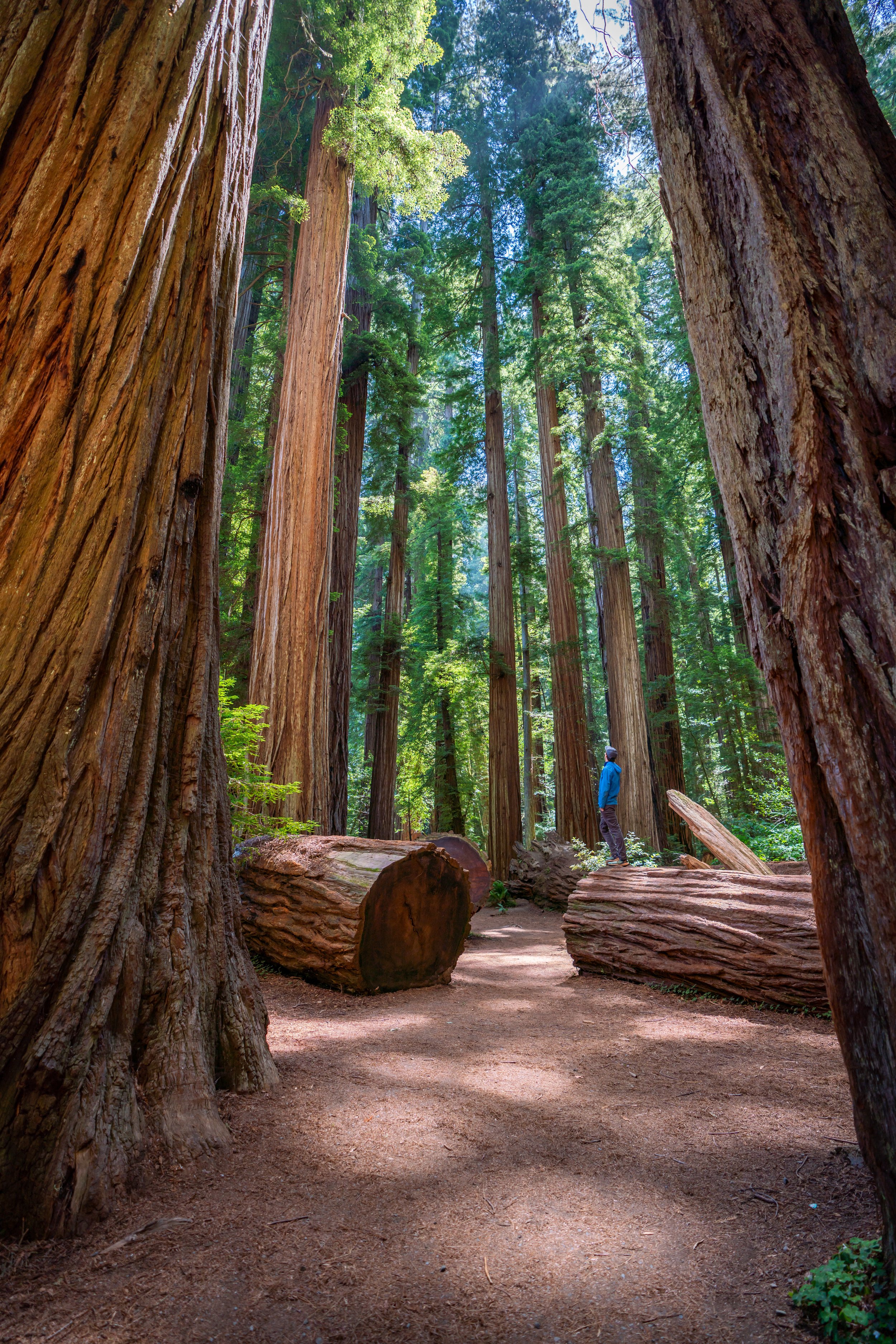
One of my favorite things about hiking in the Redwoods is that it doesn’t feel like a place where the majority of visitors are after one spot or one photo, with the exception of Fern Canyon.
I say this because visiting the California Redwoods really is just about picking any trail, and there are always beautiful, unique ways to take photos throughout, like this spot with the fallen trees in the cover photo above!
Leopard Lilies, also called Tiger Lilies, are certainly one of the most beautiful flowers in the California Redwoods and up the Oregon Coast!
This is where the Ten Taypo Trail starts winding its way in and out of numerous small drainages along the hillside as it approaches Ten Taypo Creek and beyond.
All of these sections that wind their way along the hillside above Ten Taypo Creek are what, in my opinion, make the south side of the hike mentally feel much longer than the Hope Creek Trail on the north side.
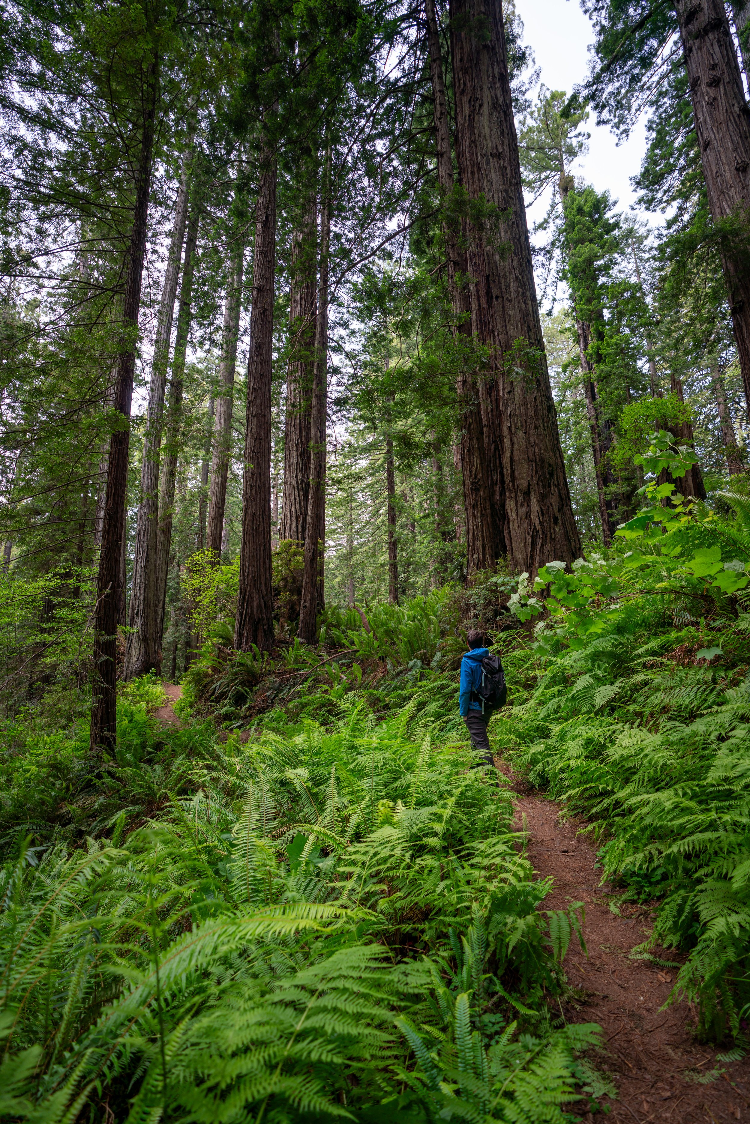
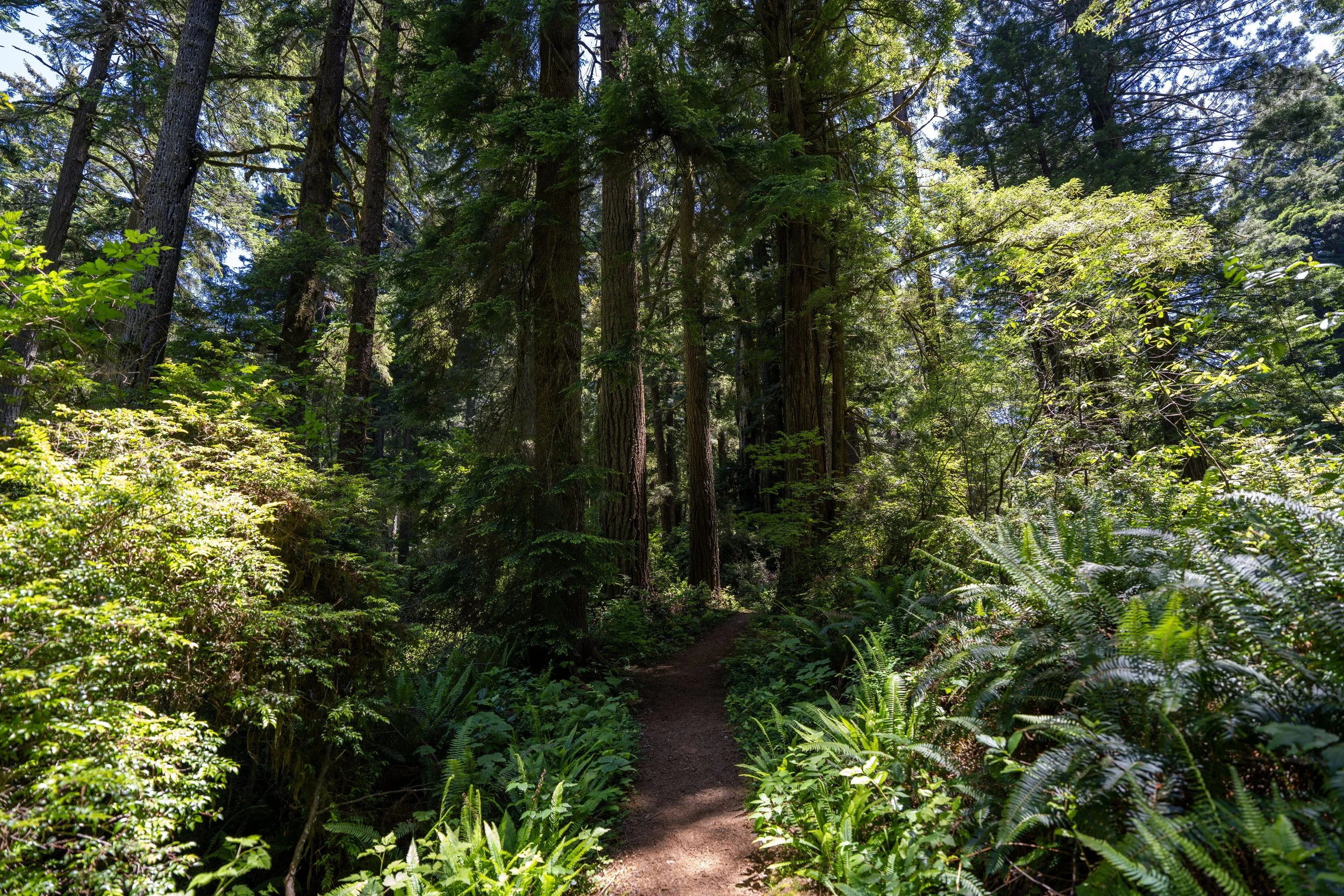
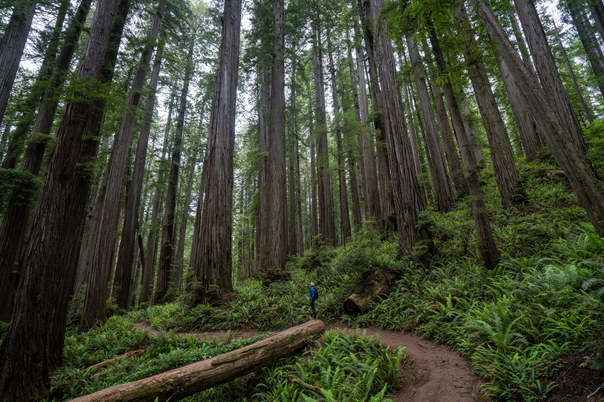
While many of the photos on the Hope Creek–Ten Taypo Loop Trail look very similar, I hope they show that the full 3.7-mile (6.0 km) hike is not a difficult adventure by any means, as the elevation changes are very mild, which is why I think it’s such a great family-friendly and trail-running adventure!
This short incline along the western side of the loop is, again, as steep as the full Hope Creek–Ten Taypo Loop ever gets!
This sharp switchback on the Ten Taypo Trail is a nice sign that there are only about 0.6 miles (1.0 km) left until the trail reaches the Hope Creek side of the loop.
For those planning to visit the Coastal California Redwoods outside of the sunniest summer months, I always recommend bringing with a good rain jacket, as much of the year in the southernmost portions of the Pacific Northwest is very wet and rainy.
That said, I do not write this to discourage visiting the Redwoods during the off-season, as cool, moody, rainy hikes on the Oregon Coast and in the California Redwoods are a really fun time! However, it’s important to be prepared based more on the time of year than on what a specific forecast might say.
East Hope Creek–Ten Taypo Loop Junction
This is the very far eastern end of the Hope Creek–Ten Taypo Loop Trail, and it’s where the Ten Taypo Trail officially switches over to the Hope Creek Trail, which continues for the rest of the hike back to the trailhead.
However, there is really no difference in terms of difficulty or terrain on either side of the loop, except that the Hope Creek side is much shorter and more direct at 1.2 miles (1.9 km) to the start of the loop, compared to 1.9 miles (3.1 km) on the Ten Taypo side.
It’s hard not to love the beautiful Rhododendron flowers during the most beautiful summer months, like this hike in June, which is when I always try to visit the Coastal Redwoods when I can!
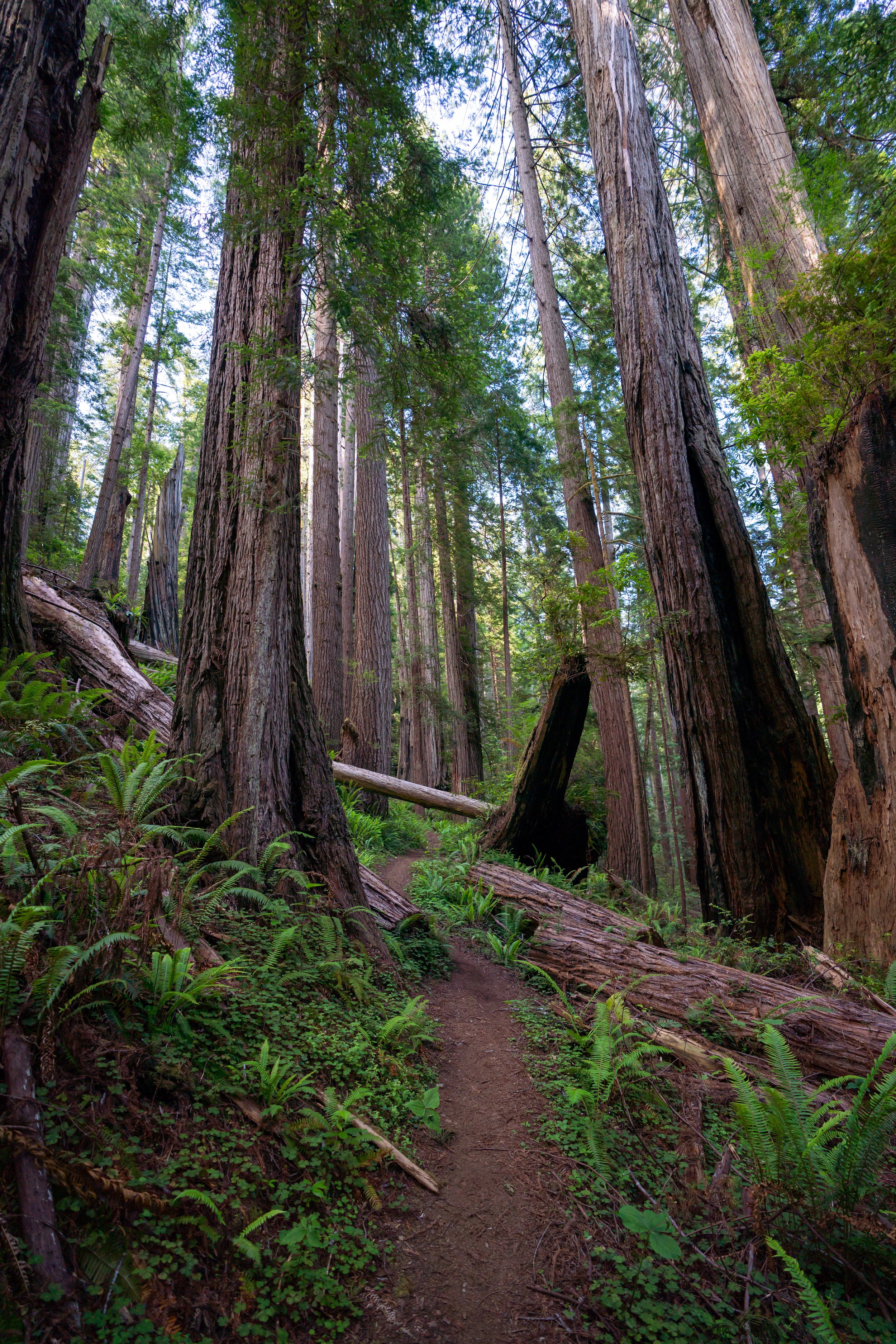
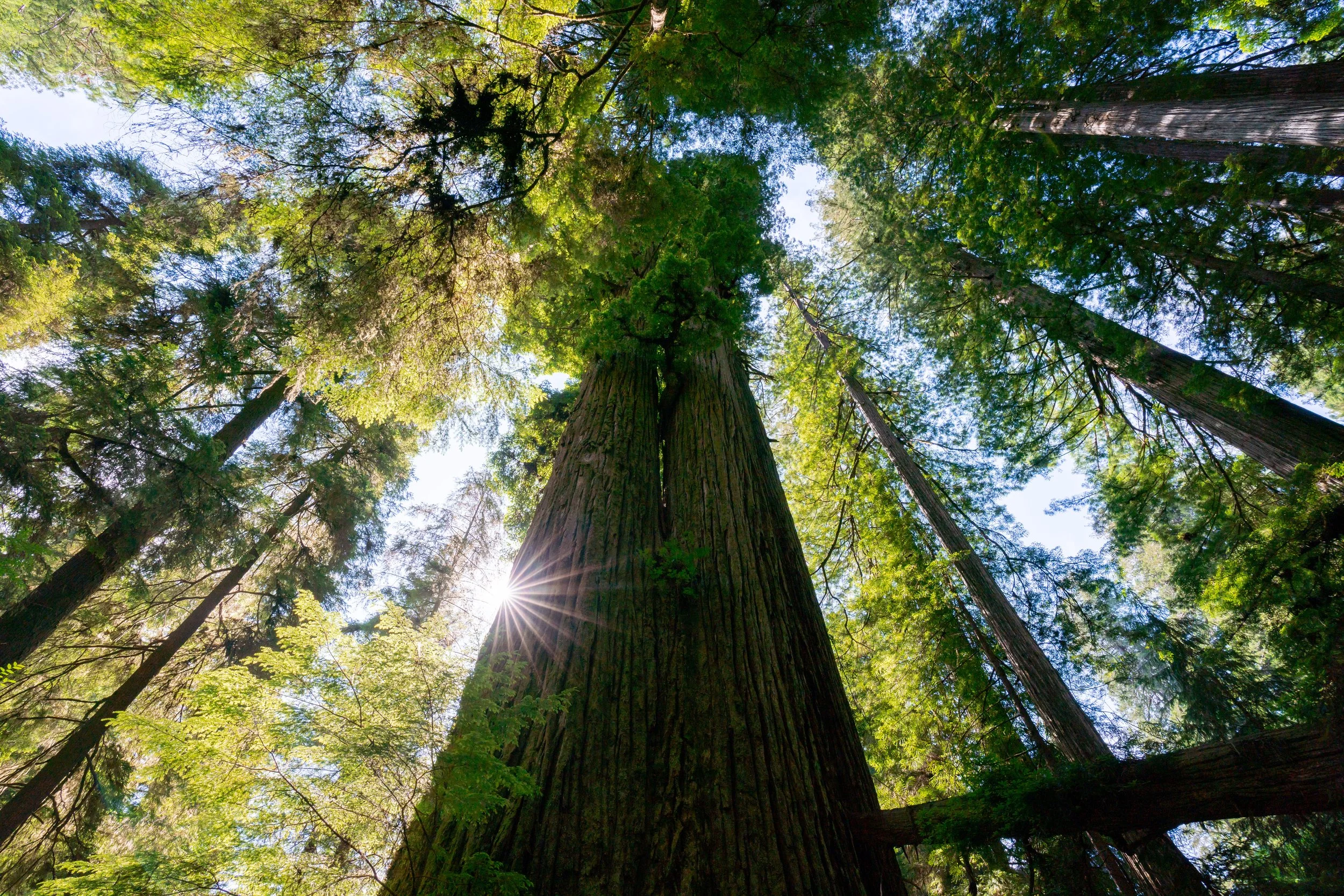
In the late afternoon light, I think this is one of the more beautiful stretches for photos among the towering Redwood trees!
This beautiful Clintonia species is endemic only to the Redwood Coast in southern Oregon and Northern California!
The nice thing about returning on the Hope Creek Trail, as opposed to the Ten Taypo Trail, is that the final 0.8 miles (1.3 km) to the start of the loop are all downhill, which only reinforces why I believe that hiking the loop counterclockwise is the best choice!
This hollowed-out Redwood is always one of my favorite parts of hiking the full Hope Creek–Ten Taypo Loop Trail!
This memorial bench is a nice mental checkpoint that the initial Hope Creek–Ten Taypo Loop junction is not far ahead!
Hope Creek-Ten Taypo Loop Junction
After 3.1 miles (5.0 km) around the loop, the Hope Creek Trail finally returns to the initial junction shown at the very beginning of this article.
From here, go right at this split to return to the Hope Creek Trailhead off Newton B. Drury Scenic Parkway, located just 0.3 miles (0.5 km) from this point.
Del Norte Coast Redwoods
Jedediah Smith Redwoods
Prairie Creek Redwoods