Hiking the Damnation Creek Trail in Del Norte Coast Redwoods State Park, California
Distance: 4.2 miles / 6.8 km
Elevation Change (Highest Point to Ocean): 1,170 ft. (357 m)
The Damnation Creek Trail in Del Norte Coast Redwoods State Park is an outlier among day hikes in the Redwoods, as the majority of trails throughout the various State and National Parks have fairly minimal elevation change.
This is largely because Redwoods do not grow well near the coast, nor do they grow very high up in the mountains—one notable exception being Redwood Meadow on the Mineral King Loop Trail in Sequoia National Park.
However, the Damnation Creek Trail is one of a few exceptions to this sentiment about elevation change in the Coastal Redwoods, as the trail descends over 1,170 ft. (357 m) from the parking area off Highway 101 to the coast where the trail ends.
This inevitably makes the Damnation Creek Trail one of the more challenging day hikes in the Redwoods, but it also comes with the benefit of being one of the least crowded day hikes among the various parks!
Damnation Creek Trailhead Parking
Parking for the Damnation Creek Trail is located directly off U.S. 101 on the left-hand side if you’re driving north or right-hand side if you’re driving south.
That said, cars traveling on Highway 101 tend not to slow down around the Damnation Creek Trailhead, which I mention to remind everyone to stay off the road when starting or ending the hike.
Google Maps Directions: Damnation Creek Trailhead
Hiking Checklist - Redwoods
Here is a complete list of must-have things that you will want for any hike in Redwood National & State Parks.
Hiking the Damnation Creek Trail
While the Damnation Creek Trail is most noted for its near-constant descent, the first 0.2 miles (0.3 km) of the hike actually follow a gradual uphill path before the long descent to the mouth of the creek begins.
This initial ascent climbs roughly 135 ft. (41 m) in the first 0.2 miles (0.3 km), which is hardly significant over this distance.
This is roughly the 0.2-mile (0.3 km) mark, where the Damnation Creek Trail reaches the top of the short ascent at the beginning of the hike.
That said, this is where the trail starts to make the long, nearly 1,170-ft. (357 m) descent down the rugged California coast to the mouth of Damnation Creek.
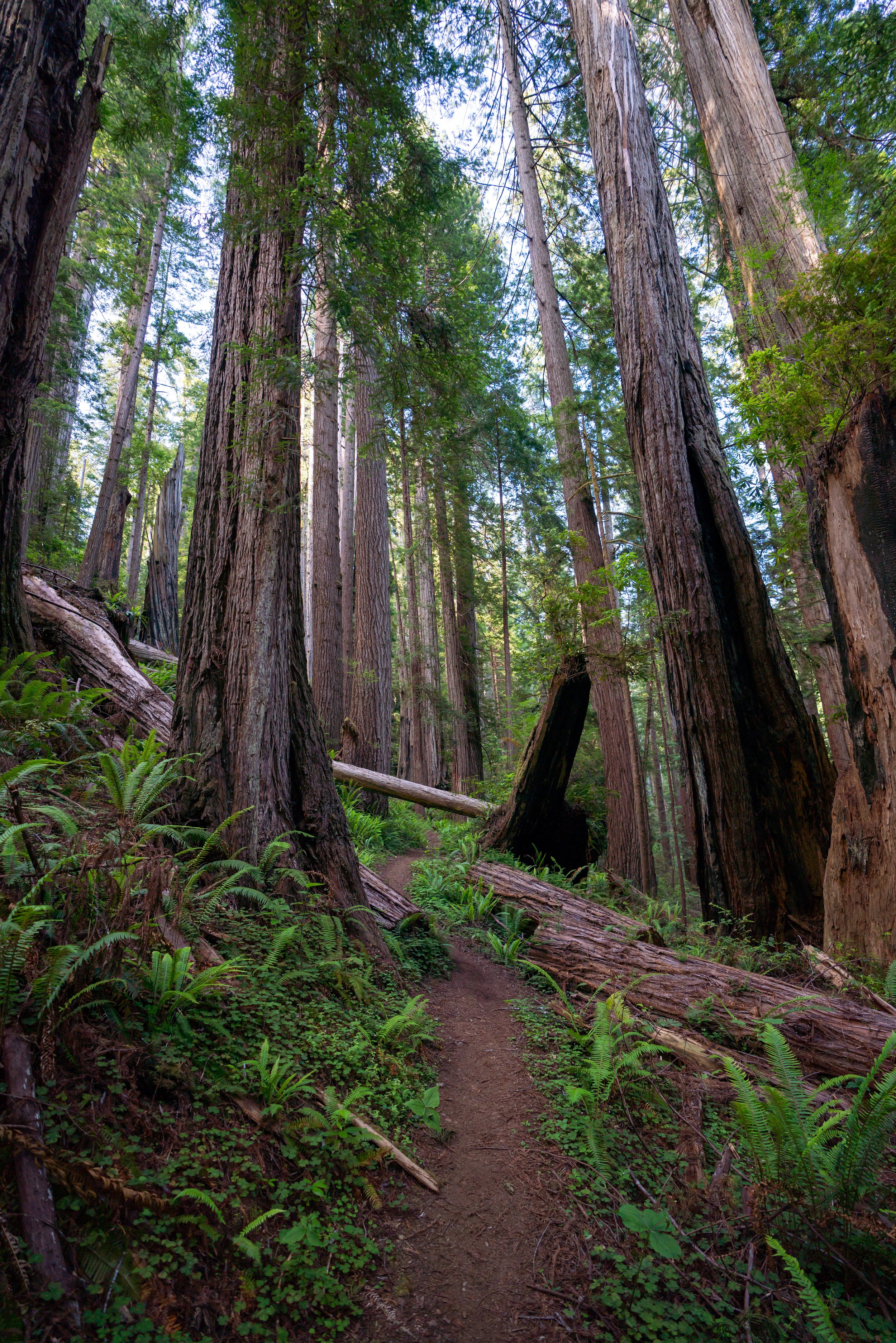
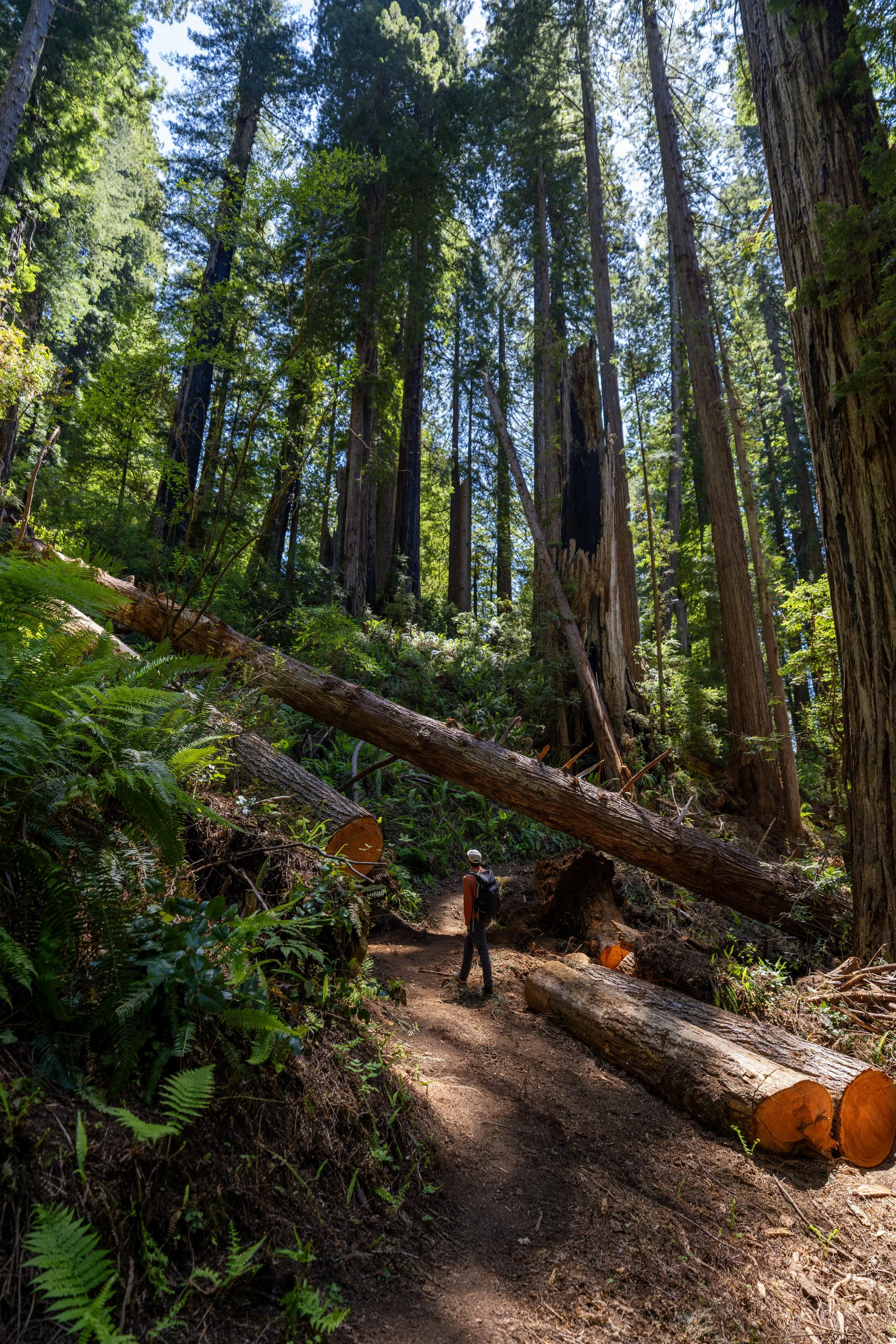
From the top of the hill, the Damnation Creek Trail descends roughly 17 switchbacks—depending on what you count as a switchback—until the point where the trail starts paralleling Damnation Creek to the water.
Leopard Lilies, also called Tiger Lilies, are certainly one of the most beautiful flowers in the California Redwoods and up the Oregon Coast!
Damnation Creek-Coastal Junction
This is where the Damnation Creek Trail crosses the Coastal Trail, which is the only junction on the entire hike.
Once here, go right on the Coastal Trail, and the split where the Damnation Creek Trail continues down to the water will be found just a few steps ahead on the left-hand side.
This is where the Damnation Creek Trail leaves the Coastal Trail.
After the Coastal Trail, the Damnation Creek Trail will begin descending the remaining 17 switchbacks, which will dominate the majority of the hike until the trail reaches Damnation Creek.
If you’re lucky, you may catch the Rhododendrons flowering in the forest understory, which is very common to see during the early summer months—the best time of year to visit the Coastal Redwoods!
Since both the descent and ascent back out are nearly constant on the Damnation Creek Trail, some hikers may want to bring trekking poles for the hike, which can certainly be useful for countless other adventures, especially those in Redwood National Park.
This is where the Damnation Creek Trail reaches some of the tightest, shortest switchbacks on the entire hike.
According to the National Park Service, Salmonberries are considered edible, though the taste is quite different from a traditional Raspberry.
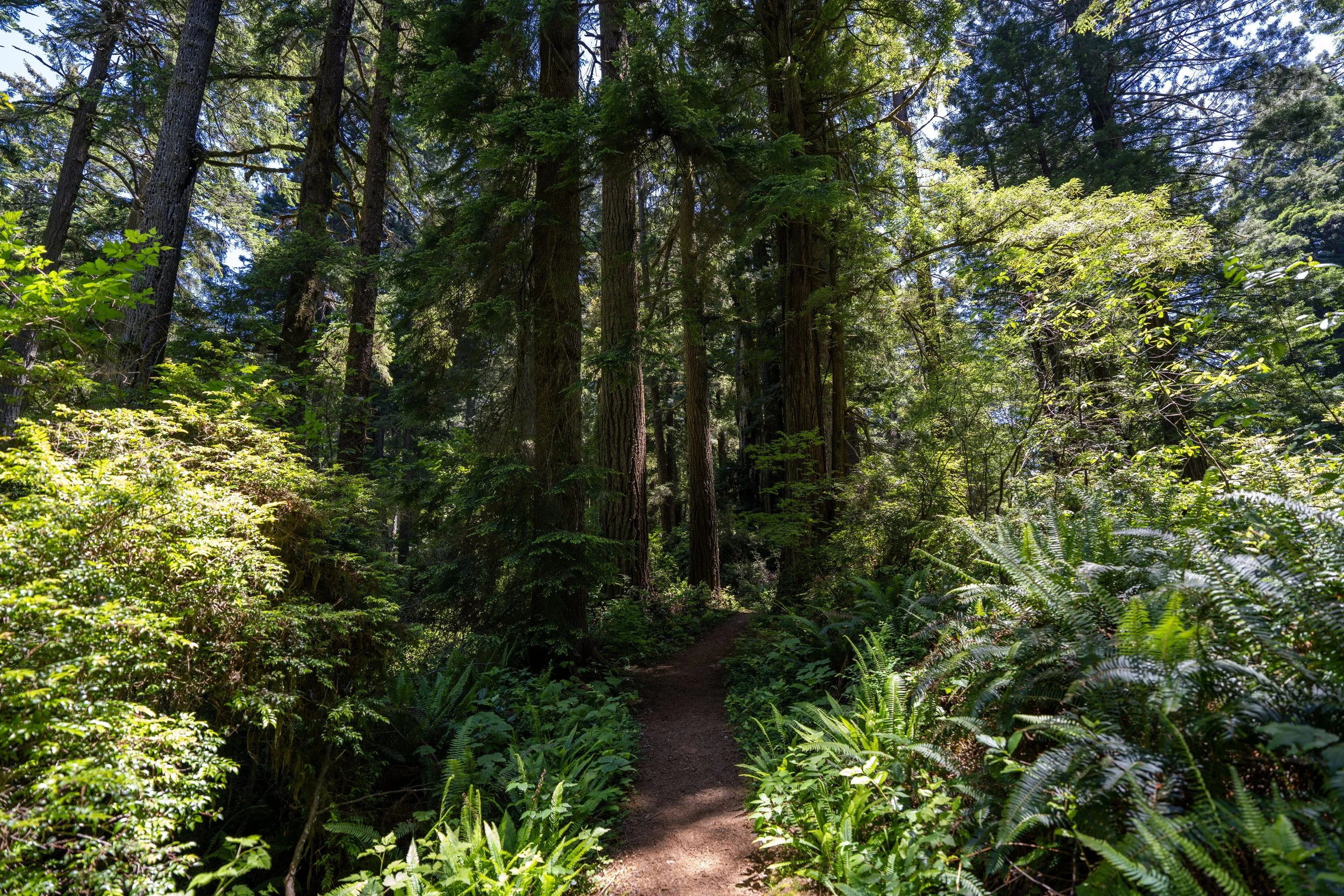
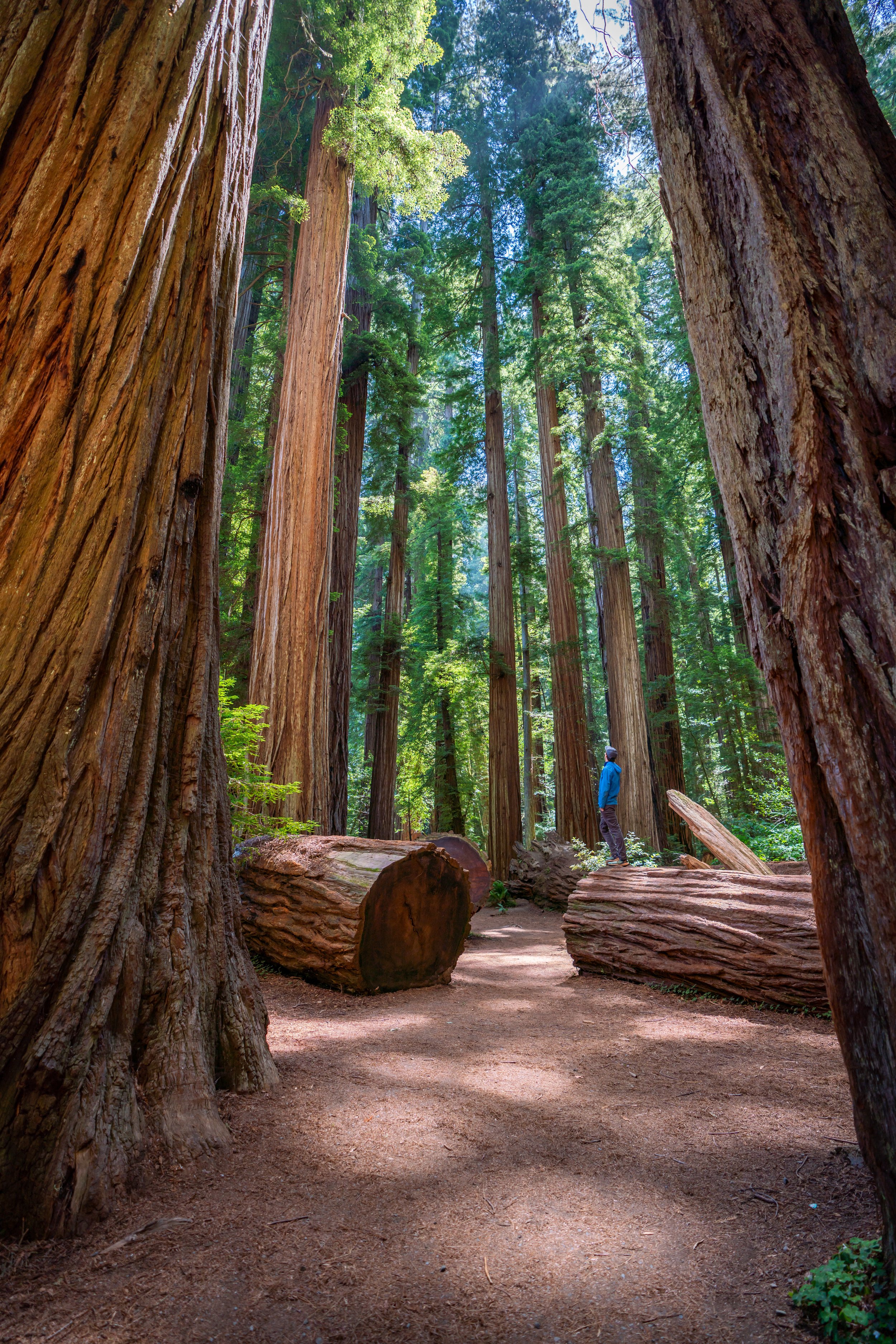
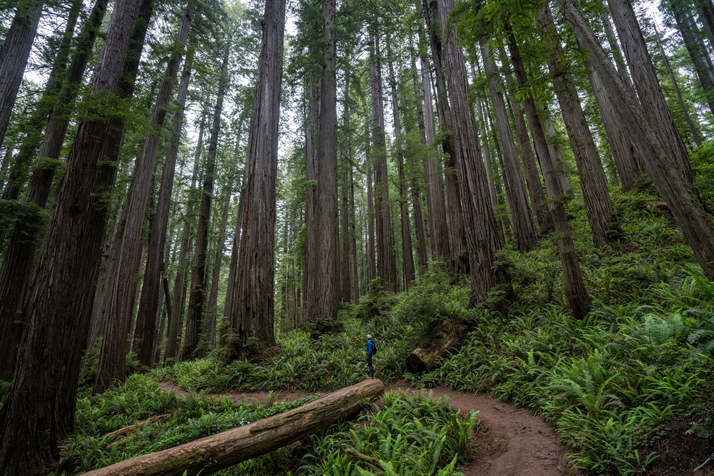
While it may or may not be obvious from these photos of the trail, the Redwoods along the Damnation Creek Trail thin and decrease in size quite drastically as the trail nears the ocean.
This is a trend that I constantly try to mention throughout my articles about the Redwoods, which is quite noticeable here on the Damnation Creek Trail, as well as others such as the Ossagon Trail in the Prairie Creek Redwoods.
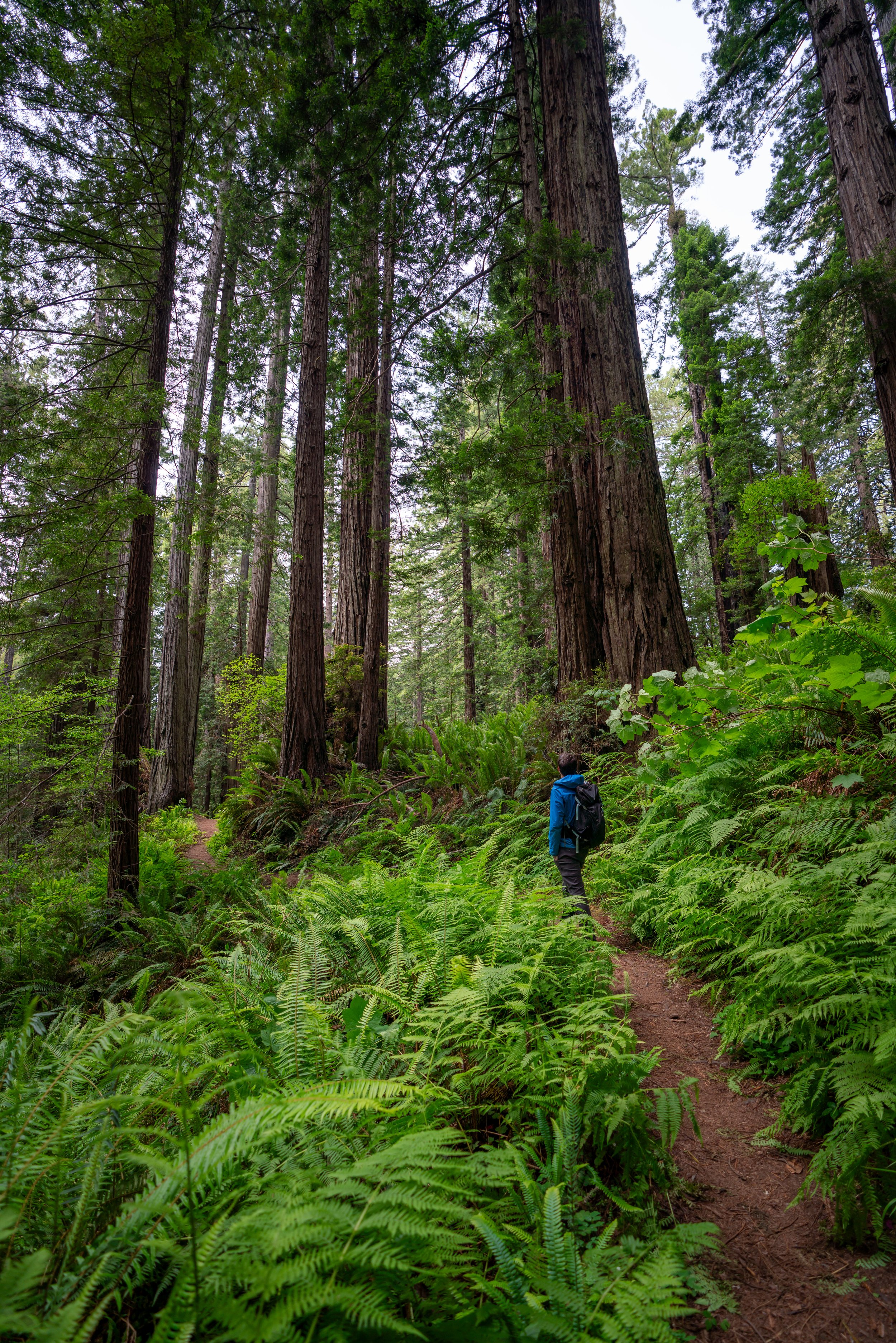
That said, the biggest Redwoods on the Damnation Creek Trail all exist within the first 0.8 miles (1.3 km) to the Coastal Trail junction, which hopefully is helpful if you’re only interested in seeing the best of the trees before heading elsewhere!
This is the final switchback on the Damnation Creek Trail, meaning there are only 0.3 miles (0.5 km) left on the hike, as the trail descends the final steep sections that parallel Damnation Creek.
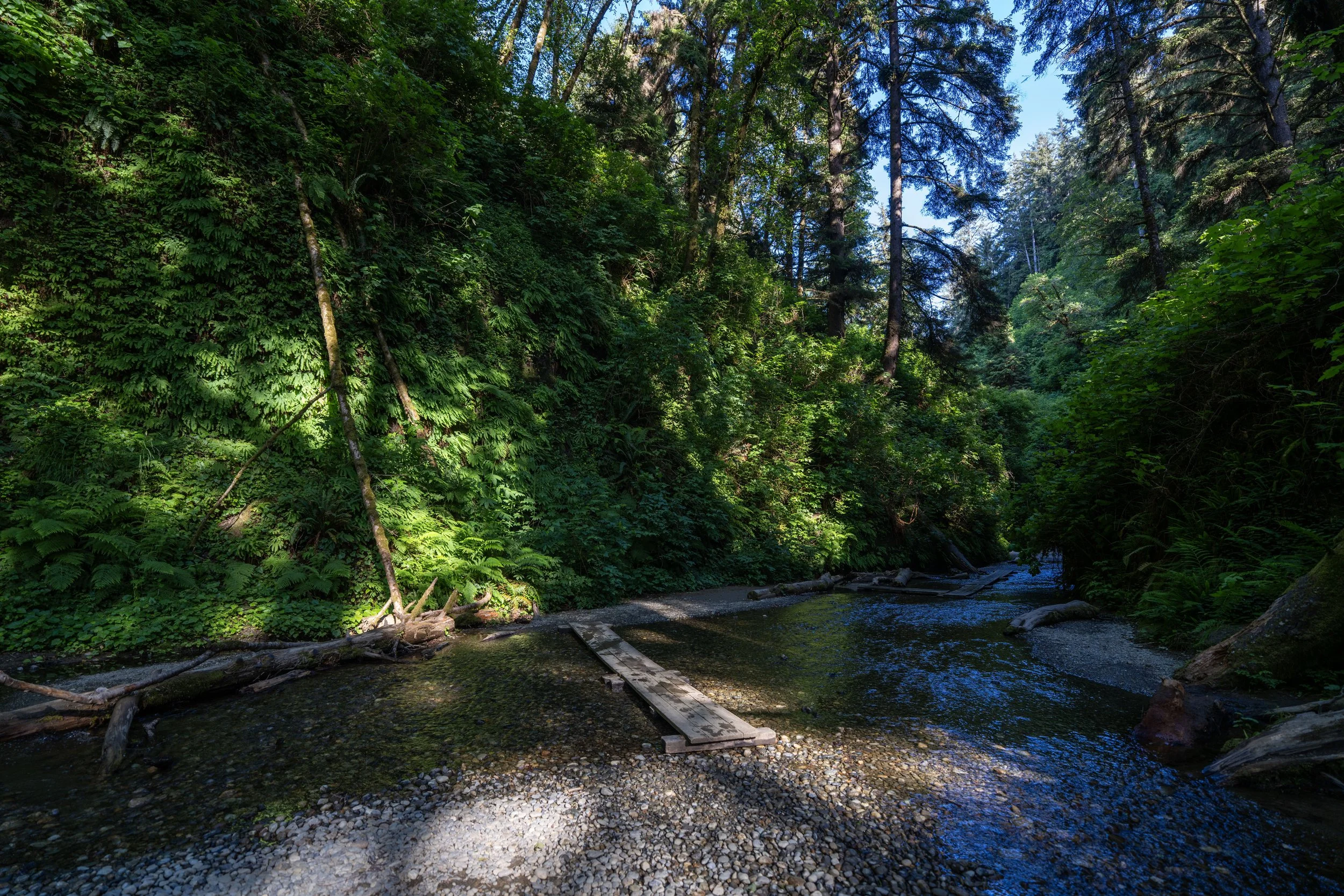
Both bridges on the lower elevations of the Damnation Creek Trail do not cross Damnation Creek.
Instead, these are smaller drainages, as the trail doesn’t actually reach the creek until the very end of the hike, where it meets the ocean.
This is the second and final bridge on the Damnation Creek Trail.
When the Damnation Creek Trail reaches the coast, the trail drops down a very steep, narrow section toward the mouth of the creek.
That said, this is the steepest and arguably most difficult part of the hike, which is another reason why some hikers may want to use trekking poles on the Damnation Creek Trail.
Damnation Creek Beach
The end of the Damnation Creek Trail is this rocky, rugged shoreline just to the south of Midway Point and the Sister Rocks, which can be seen just offshore.
Typically, hikers spend some time down here exploring the seemingly endless coastline before heading back up the trail, but I caution against getting in the water, as the Northern California coast is known for its rough ocean conditions and rogue waves, sometimes called sneaker waves.
This natural arch really creates quite a weird, almost fake-looking illusion in photos!
Jedediah Smith Redwoods
Prairie Creek Redwoods