


Hiking the Rim to Rim Trail (South Kaibab to North Kaibab) in Grand Canyon National Park
Distance (One Way): 21.0 miles / 33.8 km
Elevation Change (South Kaibab TH to River): 4,780 ft / 1,457 m
The South Kaibab Trail to the North Kaibab Trail, more commonly known as Rim to Rim, in Grand Canyon National Park, is one of the most beautiful and iconic backcountry hikes in the country, and being the case, permits to hike either Rim-to-Rim Trail are among the most competitive—much like the nearby Havasupai Trail just outside of the park.
That said, hiking from the South Rim to the North Rim of the Grand Canyon is not as straightforward as it may initially seem, because reserving overnight permits is all about piecing together an itinerary with the campgrounds scattered throughout each corridor, as opposed to following one cut-and-dry approach to hike from Rim to Rim.
This is largely because hikers have the option to either descend the Bright Angel Trail or the South Kaibab Trail on the South Rim—or, in rare cases, hike Rim to Rim to Rim, which is generally only done by trail runners, totaling about 43.9 miles (70.7 km) roundtrip.
All this to say, I’ve been fortunate to hike all three routes, including the Bright Angel Trail, the South Kaibab Trail, and the North Kaibab Trail—which is why I highly recommend reading my side-by-side comparison of Bright Angel vs. the South Kaibab Trail below.
Bright Angel Trail vs. South Kaibab Trail
If you’re planning to hike from Rim to Rim but are uncertain about which trail on the South Rim to descend, consider my thoughts here to hopefully clear things up.
First, I suggest against making this decision based on the differences in distance or elevation change between the South Rim and the Colorado River. There’s only a 400-ft. (122 m) difference in elevation change between the two, and the Bright Angel Trail is only longer by 2.5 miles (4.0 km), which feels negligible if you decide to camp at Havasupai Gardens on the way down.
Rather, I recommend making your decision based on whether you would like to spend the night at Havasupai Gardens to break up the descent—similar to how Cottonwood Campground feels on the North Kaibab Trail—or if you would rather hike all the way to Bright Angel Campground/ Phantom Ranch in one day via the South Kaibab Trail.
What I feel I can confidently say is that the South Kaibab Trail is undoubtedly more beautiful than the Bright Angel Trail, as Ooh Aah Point truly lives up to its name. I say this because the views on the Bright Angel Trail feel much more sheltered, while the views from South Kaibab are far more expansive—not to mention prettier in the early morning light—which is why Ooh Aah Point and Cedar Ridge are such great places to catch the sunrise!
All that being said, my Rim-to-Rim experiences may be identical to or completely different from yours, but at the very least, both of my Rim-to-Rim Trail articles will help you understand what the hike is like through each of the major Grand Canyon corridors.
Read My Separate Post: Rim to Rim Trail (Bright Angel to North Kaibab)
My Print - South Kaibab Trail
How to Get Rim-to-Rim Permits in Grand Canyon?
As previously mentioned, Rim to Rim is not a straightforward booking process, meaning that finding consecutive overnight permits in the order and direction you want to hike is one of the most challenging parts of planning Rim to Rim. In one instance, our group wanted to stay at every campground along the way, which is how we ended up starting at the Bright Angel Trailhead and finishing at the North Kaibab Trailhead.
Nevertheless, hikers piece together Rim to Rim in other ways—because they either weren’t able to secure a certain campground, preferred to hike in a certain direction, did or did not want to use the Rim-to-Rim shuttle, or simply weren’t able to secure any permits, which is typically when hikers become trail runners to complete Rim to Rim—or Rim to Rim to Rim—in one day.
In any case, permits are reserved through the advanced lottery or by claiming what’s left over after the lottery on Recreation.gov using the link below. Typically, the most competitive times of the year to book are the spring and fall months, avoiding June–August, when the temperatures at the bottom of the canyon are the most dangerous!
That said, it’s important to follow the posted dates for each application period—and if you’re awarded an early-access time slot, to book yours on time!
With all that in mind, the dates and campgrounds you want to book need to be available in consecutive order, like in the photo below. If one of the checked dates didn’t have enough slots available, this itinerary wouldn’t have been possible. In addition, our group didn’t actually use my awarded date on January 19 to book our permits because a friend in the same group was awarded January 11. This is how we were able to get Memorial Day, and by the time my awarded date on the 19th came around, most of May was already booked up.
This is all to say, hopefully one member of your group will be awarded an ideal time slot, but if that doesn’t work, all unclaimed permits will be released to the general public after the early access period—which can be a good last resort.
Book Here: Grand Canyon Backcountry Permits

Rim to Rim Permits
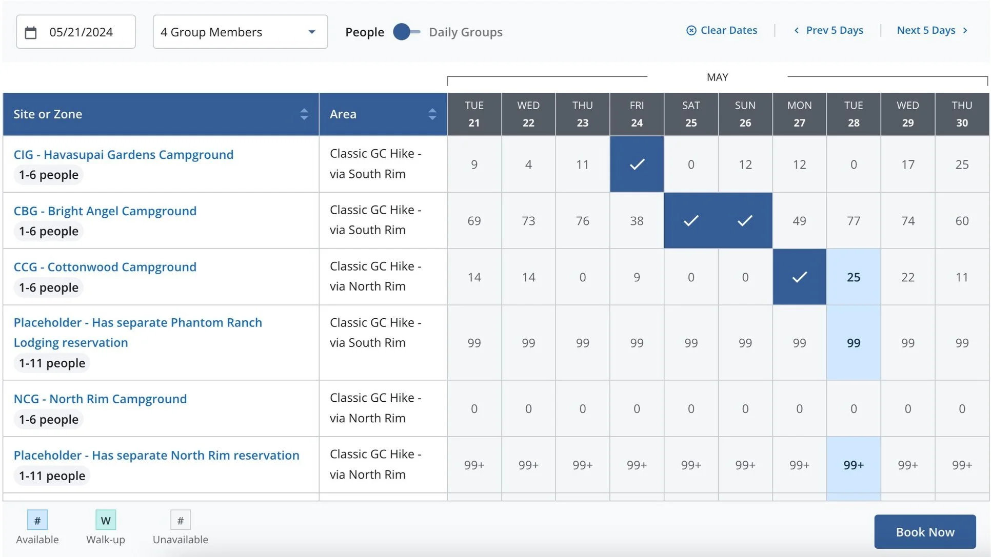
Rim to Rim Permits
Rim-to-Rim Trailhead Parking
Depending on exactly which side of the Grand Canyon you choose to begin, parking will look a little different.
On the North Rim, trailhead parking is fairly straightforward, as there is only one place to go. However, trailhead parking on the South Rim for the South Kaibab Trail is much more confusing.
What I mean is that the National Park Service doesn’t have designated overnight parking for backpackers in Grand Canyon Village. In fact, trailhead parking on the South Rim is a bit of a free-for-all—not to mention that parking is not allowed at the South Kaibab Trailhead parking lot or Yaki Point. However, there is parking for the South Kaibab Trail, which is located in one of two places.
First, parking can be found along Desert View Drive, adjacent to the Pipe Creek Vista viewpoint, or at the Grand Canyon Visitor Center.
If you decide to park at the Grand Canyon Visitor Center, the free Grand Canyon Shuttle can take you and your group to the South Kaibab Trailhead to begin the hike—granted that you aren’t hiking the trail before sunrise, as the buses typically don’t run that early.
Google Maps Directions: South Kaibab Trailhead / North Kaibab Trailhead
Hiking Checklist - Grand Canyon
Obviously, for camping, you will need general backpacking gear. For this reason, I wrote a separate post about what backpacking gear is worth the money, from my experience, and what the best alternatives are to save you money.
Read My Separate Post: Best Ultralight Backpacking Gear
In addition, here is a complete list of must-have things that you will want for any hike in Grand Canyon National Park.
Hiking the Rim-to-Rim Trail (South Kaibab to North Kaibab)
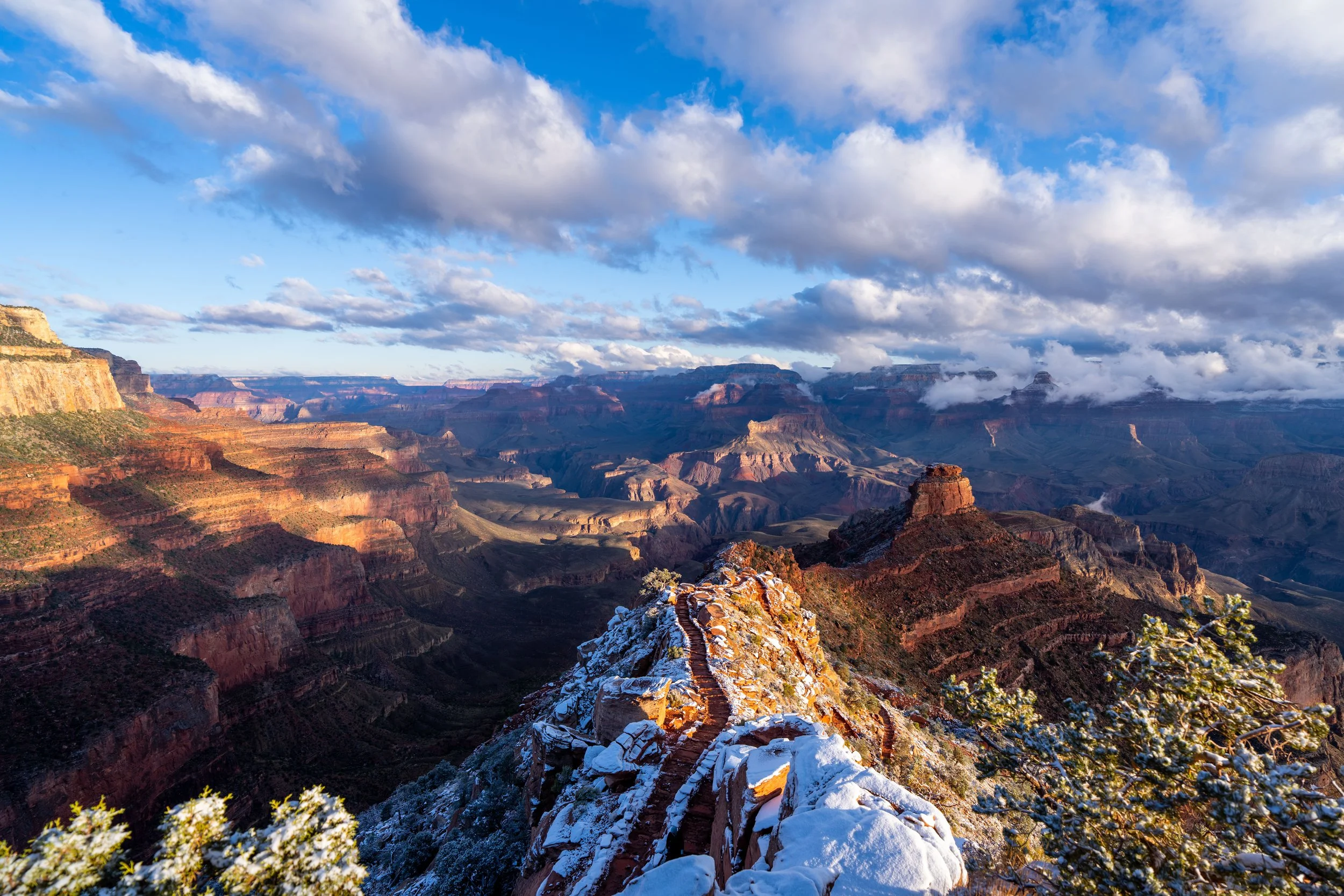
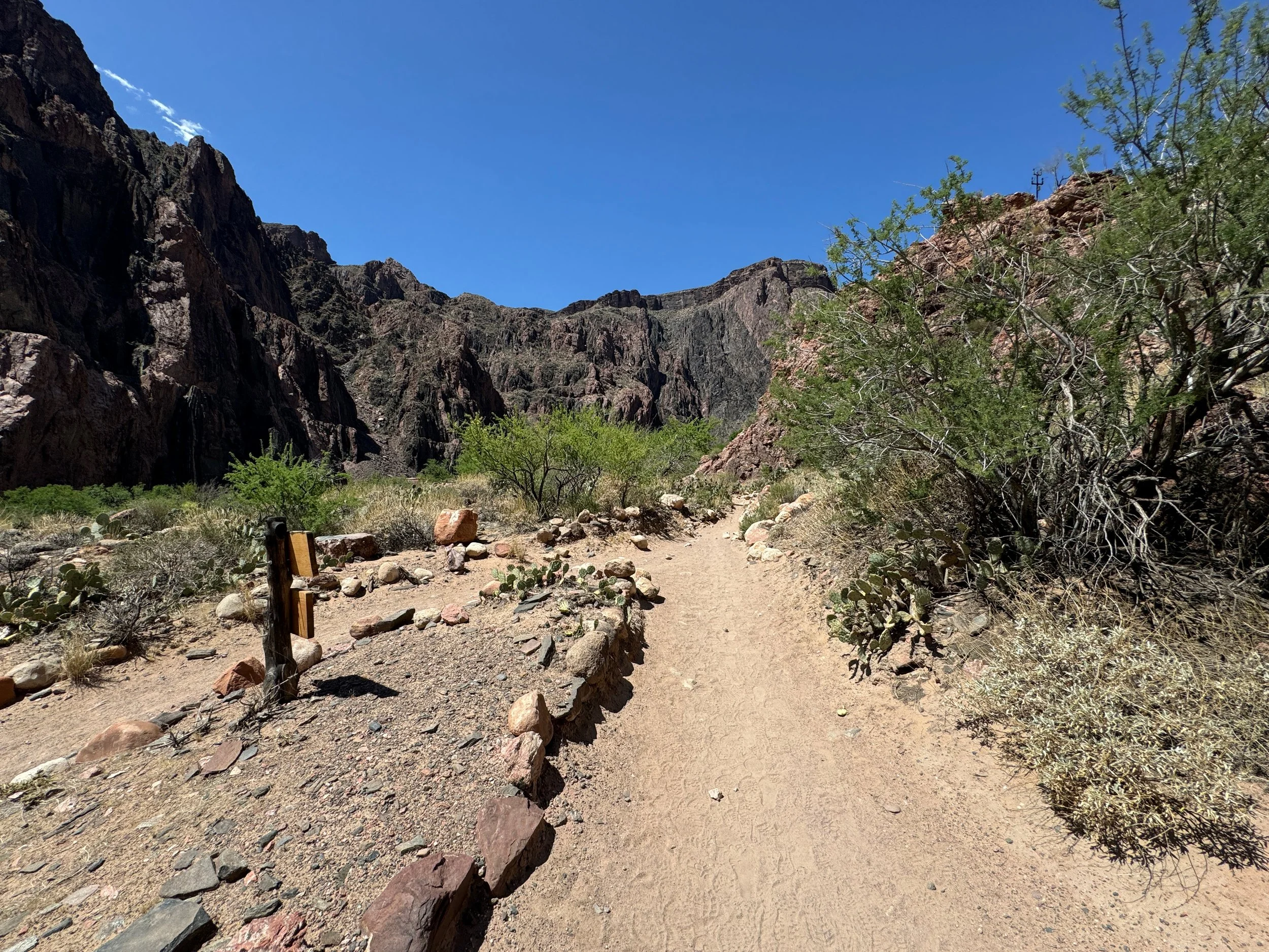
The South Kaibab Trail begins at the origins of Pipe Creek Canyon, where the trail immediately starts its 4,780-ft. (1,457 m) descent from the canyon rim to the Colorado River at the bottom.
While this sentiment is certainly only true during the off-season months (October - April) and on the uppermost elevations of the Grand Canyon, the importance of wearing micro-spikes on any of the steep descents below the rim certainly cannot be overstated.
I say this from my own experiences hiking in the winter off-season, when the trails below the rim are significantly more challenging and more dangerous than the warmer months.
Initially, the South Kaibab Trail descends 10 short but steep switchbacks, losing about 200 ft. (61 m) in the first 0.3 miles (0.5 km).
Shaded area just like this are notorious for hanging onto to snow, which often turns into slick ice in the spring when temperatures climb above freezing during the day but drop again overnight.
Some hikers may prefer to hike with trekking poles, which can certainly be useful for both the steep descent and the climb out.
After the 10th switchback, the South Kaibab Trail becomes much straighter as it winds its way along the cliffs below Yaki Point to Ooh Aah Point, about 0.6 miles (1.0 km) away.
Signs just like this can be found on a variety of routes below the rim of the Grand Canyon, which I can confidently say come from a good place.
I have seen hikers rescued during the heat of summer, as well as airlifted from the bottom of the canyon during the cooler, off-season months, because people of all abilities severely underestimate their hiking abilities and the elevation change, since the descent is so easy!
All this to say, know your limits before hiking below the rim of Grand Canyon.
If you know where to look down Pipe Creek Canyon, you can see the Bright Angel Trail making its way to the Colorado River, as the entire lower third of the trail follows this corridor.
The South Kaibab Trail to Ooh Aah Point is the busiest section of the entire trail, as the hike only drops about 790 ft. (241 m) over the first 0.9 miles (1.4 km) from the canyon rim.
After rounding this corner at the 0.7-mile (1.1 km) mark, Ooh Aah Point becomes visible in the distance for the first time!
Ooh Ahh Point
After 0.9 miles (1.4 km), the South Kaibab Trail reaches Ooh Ahh Point, which is renowned as one of the most iconic and beautiful viewpoints across all of Grand Canyon National Park—especially when hiked for sunrise or sunset!
That said, both sunrise and sunset are easily the two best times to visit Ooh Ahh Point. However, there is certainly some debate over the better time to visit, which is why I encourage you to read my thoughts about both below.
What is the Best Time of Day to Hike to Ooh Ahh Point?
There’s certainly no question that both sunrise and sunset are the two best times to hike to Ooh Ahh Point, because golden hour brings out the best of the colors in Grand Canyon! However, of these two, I think the answer is easy!
Sunrise is without a doubt the best and most beautiful time of day to hike to Ooh Ahh Point, because of the way it lights up Cedar Ridge, O'Neill Butte, and the Grand Canyon at large—compared to sunset, when these nearby landmarks are more shaded.
On top of this, sunrise is also the least crowded time to visit Ooh Ahh Point, as the South Kaibab Trail sees far fewer day hikers and trail runners compared to midday and sunset.
In either case, be sure to pack a good headlamp for the steep hike in the dark.
Past Ooh Ahh Point, the South Kaibab Trail continues to wind its way below Yaki Point to Cedar Ridge, which is only 0.6 miles (1.0 km) between the two.
The straight section below this stretch is one of the best and most iconic ways to frame a photo on the South Kaibab Trail.
However, if you’re a photographer hiking midday, I highly recommend packing a good polarizer, as this is easily the best way to get beautiful desert photos in the harsh midday light.
From this switchback, both Ooh Aah Point above, as well as the beginning of Cedar Ridge below, can be seen.
So I’ve been told, these markings on this rock are fossilized lizard footprints, which can be seen directly along the South Kaibab Trail, about 0.25 miles (0.4 km) above Cedar Ridge.
Cedar Ridge
Since Cedar Ridge is located only 0.6 miles (1.0 km) past Ooh Aah Point, it is the second most popular turnaround point on the South Kaibab Trail, and it’s where the number of day hikers descending the South Kaibab Trail typically drops off precipitously.
This is only one of two restrooms on the way down the South Kaibab Trail, with the other located at the East Tonto Trail junction (Tip-Off Point).
If you happen to catch sunrise at Ooh Ahh Point before hiking further, these beginning portions above O'Neill Butte are the prettiest, in my opinion, because of the way the light hits Cedar Ridge in the morning!
As the South Kaibab Trail nears O'Neill Butte, it leaves the ridgeline to navigate around the east side of the peak, where Skeleton Point becomes visible once on the far side.
This stretch between Cedar Ridge and Skeleton Point measures roughly 1.5 miles (2.4 km) each way.
After sunrise at Ooh Ahh Point, it was pretty hard to put my real camera back in its bag through this stretch—which I didn’t do until I made it to Skeleton Point—because there were so many unique angles both above and below O'Neill Butte!
When the South Kaibab Trail turns to the left below O'Neill Butte, Skeleton Point can be seen in the distance for the first time!
All this water on the trail is not rain; rather, it’s late spring snowmelt that could not hang on once first light hit at these mid-elevations.
Skeleton Point
After 3.0 miles (4.8 km), the South Kaibab Trail reaches Skeleton Point, which is honestly nothing more than a mental checkpoint before the switchbacks to come.
I say this because there are no restrooms, shelters, or trail junctions—just an open clearing before the South Kaibab Trail begins its steep descent down to the East Tonto Trail at Tip-Off Point.
Past Skeleton Point, the South Kaibab Trail begins a steep descent down a series of 18 switchbacks, dropping some 670 ft. (204 m) in just 0.8 miles (1.3 km), to the point where the trail levels out significantly around the Natural Arch.
There are a few random points along the South Kaibab Trail where the Colorado River is visible, but below Skeleton Point, views of the river become more and more frequent compared to the sections above.
This is where the majority of the switchbacks below Skeleton Point are found—15 in total!
Personally, I don’t think these trail distances are a useful way to break up the South Kaibab Trail mentally, because most hikers are primarily focused on the steep elevation change.
Instead, I recommend breaking the hike into sections. First, there is the South Kaibab Trailhead to Cedar Ridge, at 1.5 miles (2.4 km). Then, Cedar Ridge to Skeleton Point, for another 1.5 miles (2.4 km). Next, Skeleton Point to the East Tonto Trail—also called Tip-Off Point—for another 1.4 miles (2.3 km). Finally, Tip-Off Point to the Bright Angel Campground, for another 2.6 miles (4.2 km), totaling 7.0 miles (11.3 km) and 4,780 ft (1,457 m) of elevation change.
Again, I highly recommend hiking the Rim-to-Rim Trail in a hooded sun shirt, which can be one of the most important gear items for both a day hike, as well as a multi-day trip.
This is the 18th switchback below Skeleton Point, and it’s a nice sign that the South Kaibab Trail is going to level off significantly, as the descent to Tip-Off Point becomes much more gradual from here.
After rounding this corner, the South Kaibab–East Tonto junction (Tip-Off Point) becomes visible in the distance for the first time.
The buildings that can be seen in the distance are the second restroom on the South Kaibab Trail and the shade shelter at Tip-Off Point.
South Kaibab-East Tonto Junction (Tip-Off Point)
This is the East Tonto Trail junction, more commonly called Tip-Off Point, and it’s a popular place where hikers often leave the South Kaibab Trail to begin hiking west over to the Bright Angel Trail—effectively making one big loop, which can be either be done on the free Grand Canyon Shuttle or the Rim Trail once back at the top.
That said, there’s roughly 2.0 miles (3.2 km) left to reach the Colorado River and the South Kaibab Suspension Bridge.
This shade shelter is quite popular during the hottest times of year!
About 0.2 miles (0.3 km) below the East Tonto Trail junction, Bright Angel Campground and Phantom Ranch — which is mostly out of view — can be seen for the first time!
This is where the hike really started to get pretty again—much like the section between Ooh Ahh Point and Skeleton Point!
After the bend above, the South Kaibab Trail descends roughly 14 switchbacks to reach the Kaibab Suspension Bridge, also called the Black Bridge.
With roughly 0.8 miles (1.3 km) remaining before the end of the South Kaibab Trail, the Kaibab Trail Suspension Bridge becomes visible for the first time!
Mule teams on any of the three trails between Phantom Ranch and the canyon rim are fairly common to see, and in all of my experiences I’ve been told where to stand off to the side as they pass.
It’s always great to see the Prickly Pear Cactus flowers open, as they typically close overnight, so catching them is not always a guarantee.
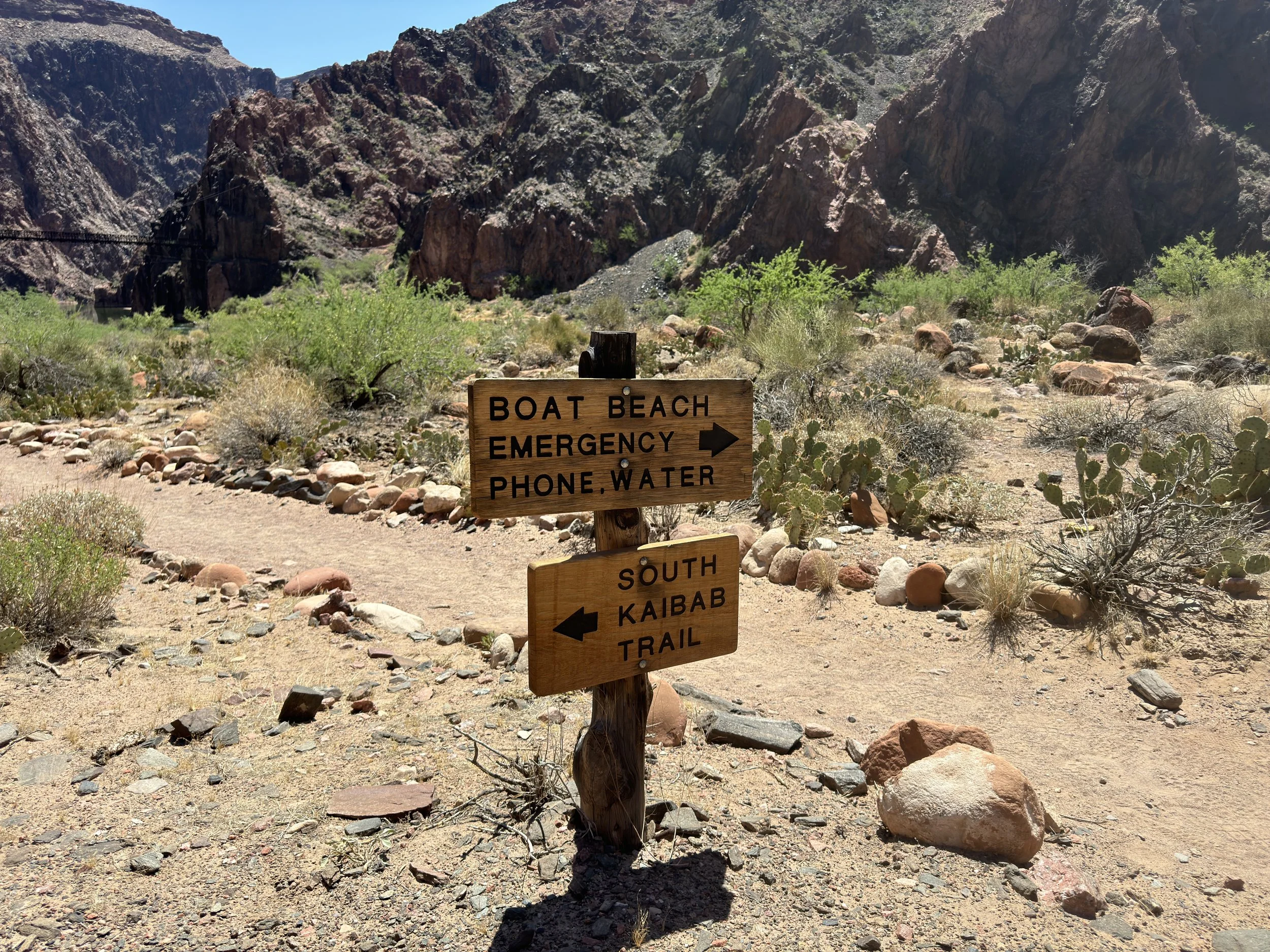
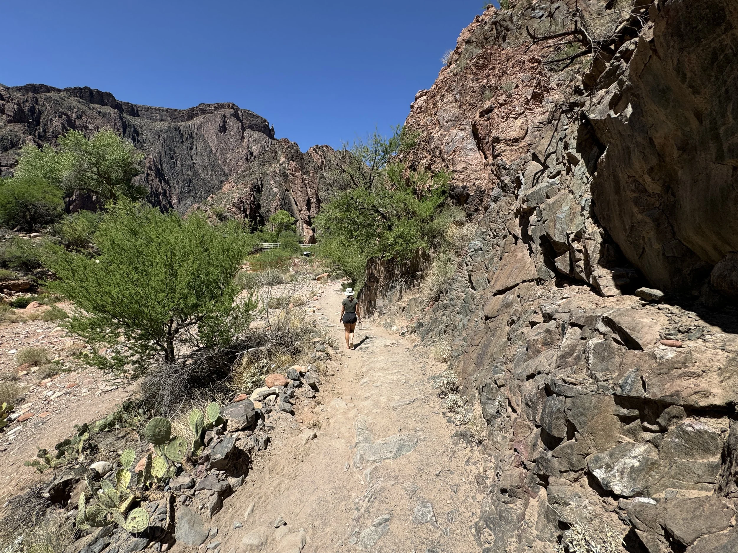
South Kaibab-River Loop Junction
With about 0.2 miles (0.3 km) left before the Kaibab Trail Suspension Bridge, the South Kaibab Trail comes to an end where it meets the River Trail—also called the River Loop Trail—because it creates a 1.3-mile (2.1 km) loop along both sides of the Colorado River, crossing here and again at the Bright Angel Bridge to the west.
That said, go right here to continue down to the Kaibab Trail Suspension Bridge, the fastest route over to Phantom Ranch.
River Loop Trail
If you’re spending more than one night camping at the Bright Angel Campground or staying at Phantom Ranch, I highly recommend coming back to hike the full River Loop Trail.
This is what we did on our second day at Bright Angel, which made for a nice day hike, as we found different viewpoints and hidden, calmer swimming holes in the Colorado River.
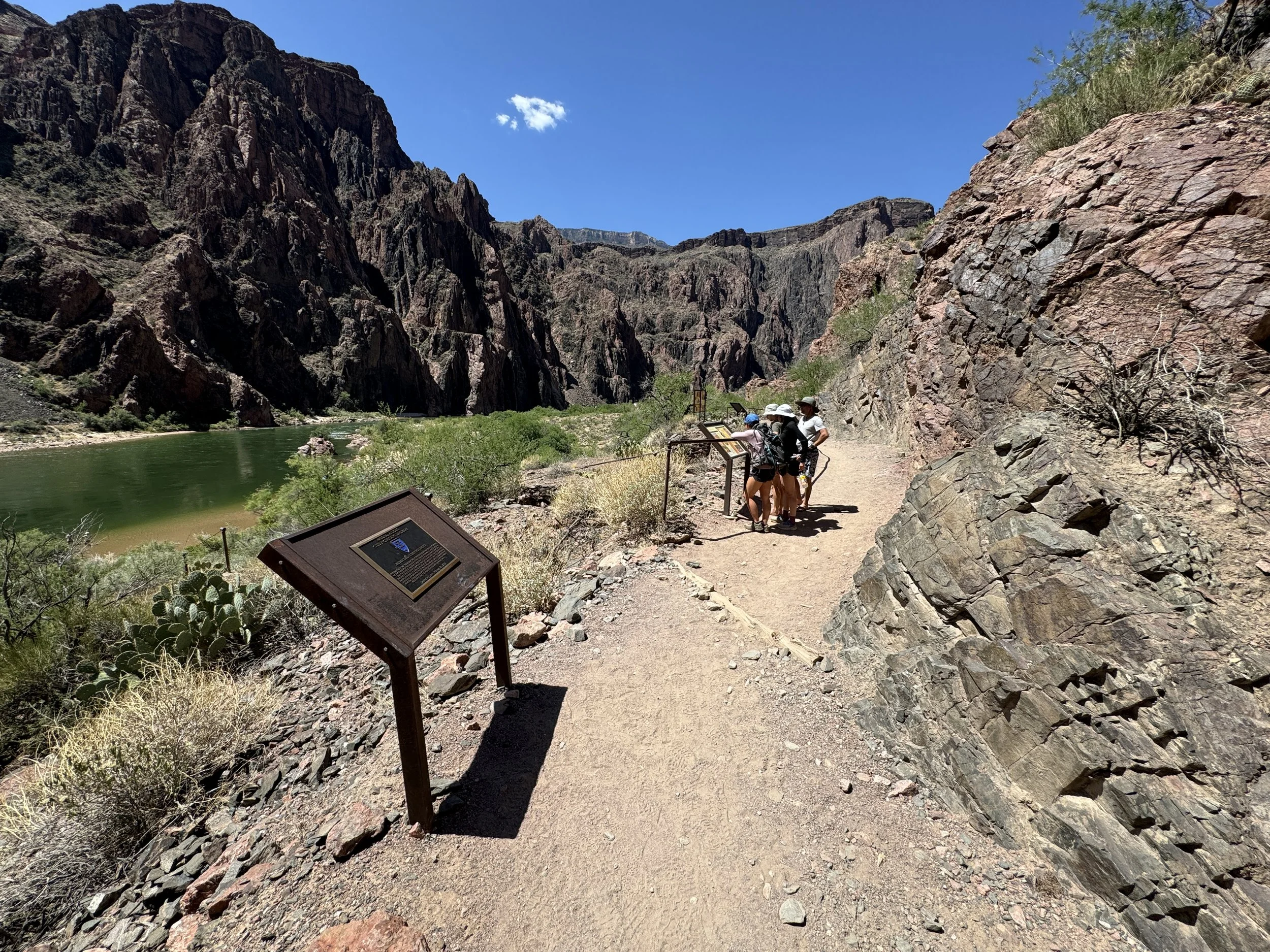
Kaibab Trail Suspension Bridge
Passing through the cave and onto the 1920s-era Kaibab Trail Suspension Bridge is one of the best feelings after a long, steep descent into the Grand Canyon!
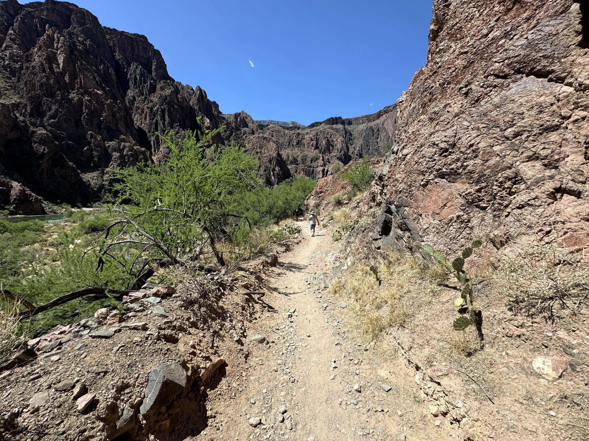
Along the north side of the Colorado River, the River Trail stays mostly flat as it winds its way over to the campground.
River Loop Trail
River Loop Trail
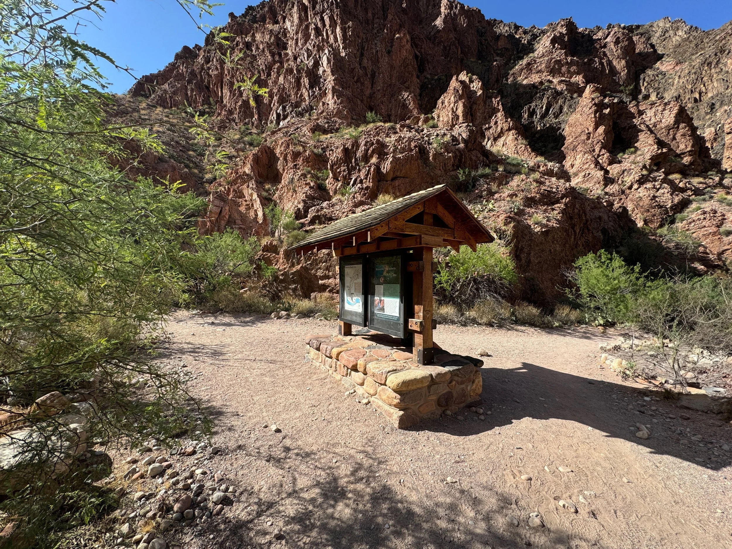
River Loop-Boat Beach Junction
Just before completing the River Loop, the trail passes by Boat Beach, which is a very popular landing spot for those rafting the Colorado River, as well as a popular spot for campers to visit and enjoy the ice-cold waters of the Colorado River.
That said, the National Park Service advises against swimming in the Colorado River because of the strong currents.
River Loop Trail
Bright Angel Campground-North Kaibab Junction
This is the split that crosses over Bright Angel Creek to the North Kaibab Trail.
Here, go left to hike through the Bright Angel Campground, or go right to cross over Bright Angel Creek to begin the North Kaibab Trail.
I went to the left because we were staying at Bright Angel Campground.
Bright Angel Campground
The Bright Angel Campground is a 0.25-mile (0.4 km) campground that parallels Bright Angel Creek and the North Kaibab Trail on the far side.
Finding a campsite with good shade proved to be the most difficult at the Bright Angel Campground, being that it is the most popular campground on the entire Rim-to-Rim Trail.
This was the temperature midday over Memorial Day weekend!
North Kaibab Trail
This is where the trail through the campground meets back up with the North Kaibab Trail.
Here, go left to hike to Phantom Ranch, which is a great place to hang out during the heat of the day!
Phantom Ranch
At first, the North Kaibab Trail passes by the Phantom Ranch Ranger Station, which I recommend visiting to sign the hikers’ log inside.
At this split, go right to continue hiking through Phantom Ranch, or left to bypass the busier sections of the trail.
Phantom Ranch Canteen
The Phantom Ranch Canteen is truly one of the best places to hang out during the hotter summer months.
It is here where you can buy snacks, drink cold beer, mail a postcard, and borrow games while enjoying the shade under one of the many Cottonwood trees surrounding the canteen.
That said, be sure to hike in with cash in case—for some reason—cards aren’t being accepted.
Phantom Ranch Steak Dinner
The canteen is also where you have the opportunity to eat the famous Phantom Ranch steak dinner, but this needs to be reserved in advance, as seats are limited and typically sell out during the busiest hiking seasons.
On this trip, we booked ours for our second night at Bright Angel because we thought it would be more rewarding further into our hike.
Book Here: Phantom Ranch Canteen Reservations
'Secret Beach' (Colorado River)
While not advised, swimming in the Colorado River or the Bright Angel Creek was easily the best way to cool off throughout the day!
'Secret Beach' in particular ended up being our favorite, especially as golden hour made the colors on the canyon walls come out toward sunset!
Then, later that night, as we were sitting around camp talking and playing games, this little visitor literally dropped into our campsite.
When I say 'dropped,' the snake literally slithered down the cliffs of the adjacent wall and hung out in our camp for at least 10-15 minutes before moving on!
We learned from a ranger who happened to pass by that this is the Grand Canyon Rattlesnake, which is endemic to Grand Canyon National Park—endemic meaning it is found nowhere else on earth! So, while this was quite the shock at first, it was a pretty cool wildlife encounter, to say the least!
River Loop Trail (Bright Angel Bridge)
On our second day at Bright Angel, we decided to hike the 1.3-mile (2.1 km) River Loop Trail in order to walk both bridges that cross the Colorado River.
River Loop-South Kaibab Junction
After 0.6 miles (1.0 km), the River Trail returns to the South Kaibab Trail junction, about 0.2 miles (0.3 km) above the Kaibab Trail Suspension Bridge.
Here, go left to hike back across the Colorado River.
Kaibab Trail Suspension Bridge
In my opinion, the Kaibab Trail Suspension Bridge was cooler than the Bright Angel Bridge because of the tunnel through the rock, and the Black Bridge also had better views of the canyon.
Phantom Ranch
Elevation Change (River to North Kaibab TH): 5,760 ft / 1,756 m
After our second night, we woke up early to get a head start on the heat, which was on our minds because this was our first day making our way back up the canyon.
On a different note, from this point on, my South Kaibab and Bright Angel Rim-to-Rim Trail articles will mirror one another.
Bright Angel Canyon (North Kaibab Trail)
Upon leaving Phantom Ranch, the North Kaibab Trail begins a very gradual climb up Bright Angel Canyon, gaining roughly 1,600 ft. (488 m) from Bright Angel to Cottonwood Campground.
However, the elevation change is hardly noticeable for most of the hike because it is spread out over the course of 7.2 miles (11.6 km).
North Kaibab-Clear Creek Junction
The Clear Creek junction is the only split in the North Kaibab Trail before Ribbon Falls.
That said, stay straight (left) to continue up Bright Angel Canyon.
'The Box'
It was fairly universal that 'The Box', the section just north of Phantom Ranch, was one of the most beautiful parts of Bright Angel Canyon and the entire Rim-to-Rim Trail, similar to Pipe Creek Canyon and Ooh Ahh Point on the south side.
To this point, I strongly believe that the entire North Kaibab Trail is prettier than the Bright Angel Trail, especially on the upper-elevation switchbacks past Cottonwood Campground.
Hikers are considered lucky to see Sacred Datura, as the flowers are known to open in the late afternoon/ evening and close by mid-morning the following day.
After about 4.2 miles (6.8 km), Bright Angel Canyon begins to open up, which is a nice sign that you’re getting closer to the first Ribbon Falls junction.
North Kaibab-Ribbon Falls Creek Junction
Whether you choose to visit Ribbon Falls via the Creek Trail and return to North Kaibab via the Bridge Trail, or hike to Cottonwood first and return later, I highly recommend visiting Ribbon Falls at some point during your hike!
We chose the latter of the two scenarios, which I preferred because we had it all to ourselves in the late afternoon when all the day hikers had cleared out.
In any case, go right to continue on the North Kaibab Trail toward Cottonwood Campground.
After the first Ribbon Falls junction, the North Kaibab Trail climbs a bit of an annoying hill before dropping down to the second Ribbon Falls junction.
North Kaibab-Ribbon Falls Bridge Junction
This is the second Ribbon Falls junction, and it’s the route we took later in the day to get to Ribbon Falls.
In any case, go right to hike the remaining 1.1 miles (1.8 km) to Cottonwood Campground.
Wall Creek
If you’re in need of water, I recommend passing by Wall Creek and continuing on to Cottonwood, unless it’s an emergency.
I say this because a reliable water station can be found near the Cottonwood Ranger Station at the beginning of the campground, about 0.7 miles (1.1 km) away from Wall Creek.
Cottonwood Campground
Cottonwood Campground is the final campground on the Rim-to-Rim Trail before the North Rim Trailhead, located about 6.8 miles (10.9 km) away.
With that in mind, Cottonwood was our least favorite campground, but in my experience, it was the least crowded of the three.
However, I’m happy that we stayed here because it allowed us to enjoy Ribbon Falls without the day hikers that we could see when we passed by early in the day.
If you walk down to Bright Angel Creek for a swim, remember to hang up your bags to prevent them from being damaged by the squirrels.
Bright Angel Creek
This was the little swimming hole that we enjoyed in the creek, as we waited for the sun to pass over before hiking back to Ribbon Falls.
Ribbon Falls Trail
Regardless of which junction you take to get to the Ribbon Falls Trail, the final stretch ends up being a fun little scramble to get up to the waterfall.
Ribbon Falls
After only 0.3 miles (0.5 km) from either North Kaibab junction, the trail ends at the 100-ft. (30.5 m) Ribbon Falls, which, to me, made me think of my time at Havasupai, located further down the Grand Canyon.
In any case, I can confidently say that Ribbon Falls was much more beautiful than it appears from the North Kaibab Trail, and it was even better that we got to enjoy it all to ourselves!
Cottonwood Campground
The next morning, we got up the earliest we had all trip to begin hiking up to the North Rim.
In fact, we were even late compared to other groups leaving Cottonwood.
At first, the North Kaibab Trail simply continues up Bright Angel Canyon, but it isn’t until Manzanita that the elevation gain becomes much more noticeable.
First light was truly something to enjoy on both mornings that we hiked early up the North Kaibab Trail, but be sure to come prepared with a good headlamp for these early days!
Manzanita
Manzanita is truly nothing more than a place to take a break and refill water.
However, it is the signifier that the steeper climbing is about to begin.
With that in mind, there’s about 4,160 ft. (1,268 m) of climbing from the Cottonwood Campground to the North Rim, with about 3,640 ft. (1,109 m) of that from Manzanita to the North Kaibab Trailhead.
North Kaibab-Roaring Springs Junction
After Manzanita, the Roaring Springs junction is the only split in the North Kaibab Trail before the North Rim.
That said, go left to continue up to the North Rim, but you can see what the Roaring Springs Trail looks like from my photos below.
Roaring Springs Trail
Let’s just say, I hiked the Roaring Springs Trail, so that you don’t have to.
It was pointless; I thought there would be something to see, but just be happy that my curiosity saved you this 0.6-mile (1.0 km) roundtrip trek.
This is the end of the Roaring Springs Trail, and needless to say, it was pretty disappointing.
However, if you hike downstream to the waterfall, it may be better than simply hiking down to the creek.
North Kaibab-Roaring Springs Junction
Once back at the North Kaibab junction, I continued back up to the rim.
It was from here to the top that I finally began to hike in the sun.
This is where the North Kaibab Trail really begins to get pretty and bear a striking resemblance to somewhere in Zion National Park.
In total, there are 49 switchbacks, depending on how you count, from the Roaring Springs junction to the top of the North Rim.
With that in mind, they aren’t all at once, and only certain sections are more condensed, most notably the final sections following the Supai Tunnel.
Some of these sections along the edge are absolutely no-fall zones!
Roaring Canyon Bridge
It was sections like the Roaring Canyon Bridge that made the hike up the North Rim much prettier than the south, in my opinion.
Then, all of a sudden, this little Desert Centipede crossed right in front of me—and while it was cool to see, it’s important to leave them alone, as they are venomous and do bite humans!
Supai Tunnel
Located roughly 1.7 miles (2.7 km) below the North Kaibab Trailhead, the Supai Tunnel is one of the best mental checkpoints on the hike up to the North Rim.
At this split, go right to continue up to the North Rim.
In my experience, this is where the North Rim started to feel closer, as the white Coconino sandstone layer atop the North Rim is the last section to climb.
This is where the heat, at only 8:30 a.m., began to make the ascent feel more difficult than it would have been otherwise.
That said, comments were made to our group like 'I wouldn’t want to be you' or 'I hope that camera was worth it,' referring to our climb back up the North Rim. However, I personally didn’t find the ascent to be all that difficult.
The only part that made it harder than it would have otherwise been was the mid-May heat, but other than that, the North Rim provided much more shade than the south, which is why I truly didn’t mind the extra elevation gain.
However, hiking in a good sun shirt was the best thing I could have worn!
Coconino Overlook
Finally, the North Kaibab Trail passes by the Coconino Overlook, which is a popular day hiking destination for hikers visiting the North Rim.
It is here that you can see Humphreys Peak, the highest peak in Arizona, off in the distance on a clear day!
After the Coconino Overlook, there is only 0.7 miles (1.1 km) and 790 ft. (241 m) of climbing to reach the North Rim!
These Aspen trees were a nice sign that I was near the uppermost elevations of the trail.
This is the 49th and final switchback before reaching the top!
North Kaibab Trailhead (North Rim)
Finally, after about 30+ miles (48.3 km) of hiking, including separate day hikes, we finished on the North Rim after an enjoyable 5-day, 4-night trip.
For those familiar with backcountry adventures elsewhere, I think it’s worth mentioning that the Rim-to-Rim corridor in Grand Canyon National Park is one of the most manicured and commercialized 'backcountry' trips I’ve ever done. I say 'backcountry' because calling Rim to Rim backcountry is a bit loose in terms of what the word typically means.
That said, I’ve always enjoyed hiking Rim to Rim, but it was a common sentiment among our group of five that we don’t see ourselves doing it again. Personally, I guess I just don’t like seeing an endless supply of other hikers, mostly day hikers, when I go into the backcountry, but I understand that I’m a bit spoiled after having other amazing backcountry experiences, like the Mineral King Loop Trail in Sequoia National Park.
I know that the amount of hikers largely had to do with the fact that our permits for this hike were over Memorial Day weekend, but nonetheless, the trail is often just as busy throughout the cooler months of the year.
In any case, we booked the North-to-South Rim shuttle to get back to Grand Canyon Village, in which the afternoon pickup seemed to be the most popular option for returning backpackers. With that in mind, I highly recommend making your pickup location the North Grand Canyon Lodge if you plan to get to the trailhead in the morning before the scheduled pickup time, because it’s a much better place to get some food and kill a few hours compared to the trailhead—which you can hopefully hitch a ride over to, like we did!
Read My Separate Post: Rim to Rim Trail (Bright Angel to North Kaibab)


