Hiking the Muliwai Trail to Waimanu Valley on the Big Island of Hawaiʻi
The Hawaiʻi County mayor’s emergency order regarding Waipiʻo Valley has inadvertently blocked access to the Muliwai Trail on the far side of the beach—and believe me, I’m just as angry about this as anyone else!
So far, it has been a one-man show—me—to try to get the mayor to consider hikers in the order, but I’ve hit roadblock after roadblock with government officials, so now I’m turning to you, the public, to help me out! I need your voices!
What Does the Mayor’s Current Emergency Order Do?
No one, including hikers, is allowed to walk down Waipiʻo Valley Road to access the Muliwai Trail on the far side of the valley, which was previously permitted.
Only Hawaiʻi Island residents with a Hawaiʻi Island address on their license are allowed to drive down Waipiʻo Valley Road.
All those wishing to get down the 1.3-mile (2.1 km) Waipiʻo Valley Road are now required to pay $67—on top of your camping permits—to take a shuttle designed for out-of-state visitors to get to the beach. It’s not designed for hikers, nor is it designed to pick you up in a few days when you hike back out.
No hiker should have to spend this kind of money, which is considerably more expensive than the Hāʻena State Park shuttle for out-of-state residents on Kauaʻi.
How to Help Open Trail Access to Waimanu Valley?
To help me out, please click the button below to email the appropriate representatives, and please be respectful, while focusing on the some of the solutions I’ve outlined below.
Advocate to either open the road for hikers with a valid permit to walk down or to drive down. Forcing hikers to spend more money for a shuttle on top of their valid state camping permits is not an appropriate solution.
Advocate for a designated hikers-only parking area, either near the Waipiʻo Valley Lookout if hikers are allowed to walk down, or at the bottom of Waipiʻo Valley if they have to drive down.
Focus on the fact that the limited number of Waimanu Valley camping permits issued by the Hawaiʻi Department of Land and Natural Resources (DLNR) already limits the number of hikers passing through Waipiʻo Valley. Hiker’s have never been the driving factor behind the crowds trying to get to the black sand beach.
Distance (Roundtrip): 19.9 miles / 32.0 km
The Muliwai Trail to Waimanu Valley, commonly called the Z Trail, is a beautiful backcountry adventure along the rugged Kohala Coast on the Big Island of Hawaiʻi.
That said, Waimanu Valley is often considered by locals to be one of the best backpacking trips in all of Hawaiʻi—similar to the Kalalau Trail on Kauaʻi’s Nāpali Coast, the Haleakalā Cabins on Maui, and the Mauna Loa Trail to Puʻu ʻUlaʻula in Hawaiʻi Volcanoes National Park.
This is largely because the Muliwai Trail is not only one of the most beautiful backcountry hikes in Hawaiʻi, but also one of the least known—which is why it feels like such a hidden gem compared to the others mentioned above!
How to Get Waimanu Valley Permits?
Waimanu Valley permits can only be purchased up to 30 days in advance, and being that the Muliwai Trail is one of the least-competitive camping permits in Hawaiʻi, it typically doesn’t sell our right when they are released.
Note that only the first date of your trip needs to be at least 30 days out, meaning 31 days and beyond can be reserved on the same permit, so long as the dates are consecutive.
Book Here: Waimanu Valley
Waimanu Valley Trailhead Parking
Parking for Waimanu Valley is located at the very end of Honokaʻa-Waipiʻo Road, which is the same parking area as the Waipiʻo Valley Lookout.
That being said, parking can be very difficult here, as the lookout is one of the most popular locations that people visiting the Big Island come to see.
Therefore, if you have the opportunity, I recommend arriving early in the morning, so that you can park your vehicle somewhere safe over the course of your trip.
Google Maps Directions: Waipiʻo Valley Lookout
My Hawaiʻi Hiking Checklist
Obviously, for camping, you will need general backpacking gear. For this reason, I wrote a separate post about what backpacking gear is worth the money, from my experience, and what the best alternatives are to save you money.
Read My Separate Post: Best Ultralight Backpacking Gear
In addition, here is a complete list of must-have things that you will want for any hike on the Big Island.
Hiking to Waimanu Valley
From the parking area, the hike begins down the steep Waipiʻo Valley Road.
If you’re lucky, you may be able to hitch a ride down into Waipiʻo Valley, but bring cash if this is something that you want to try. This could be a huge luxury if you catch a ride on the hike back out.
Once at the bottom of the valley, you’ll likely want to take off your shoes for the Wailoa Stream crossing.
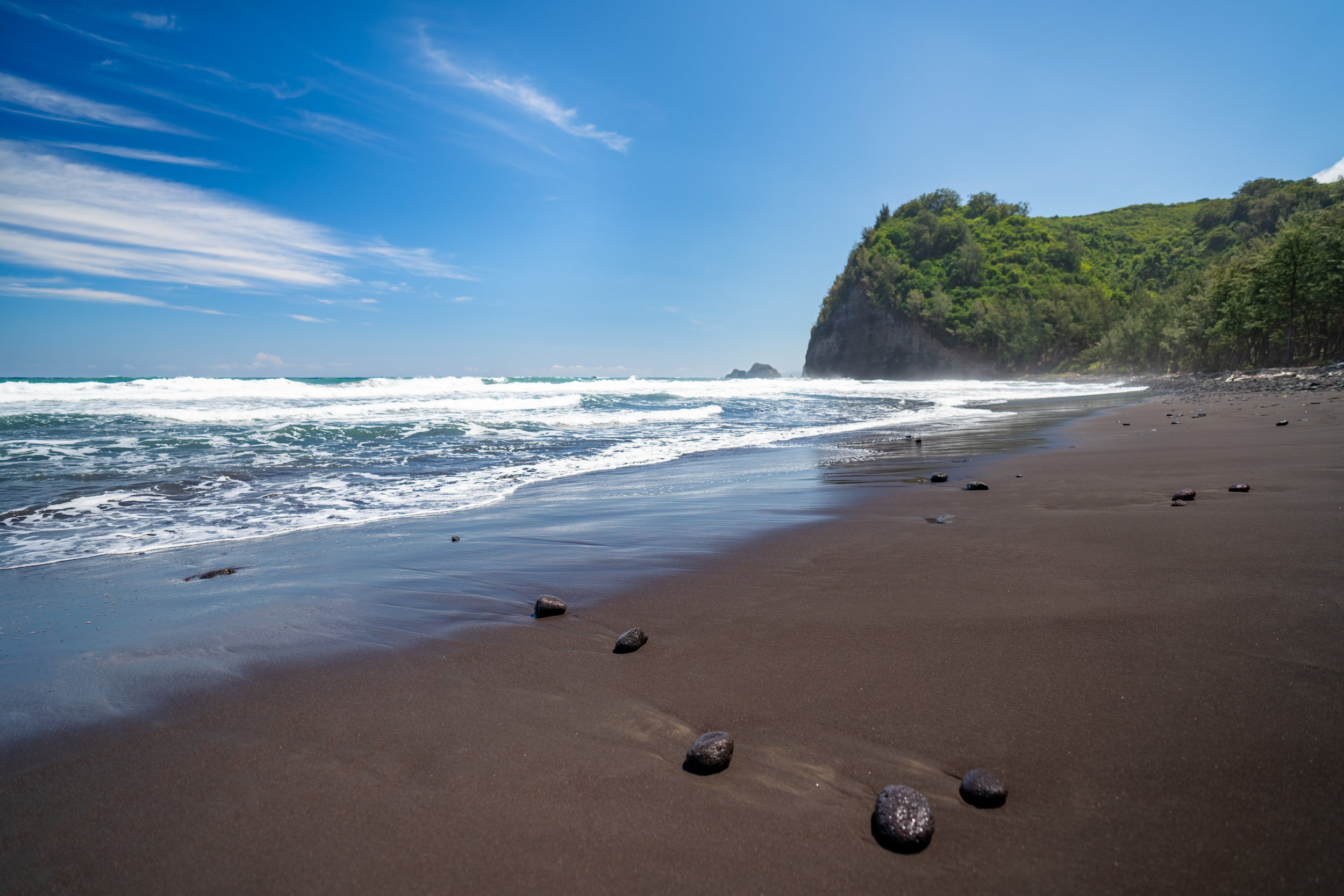
Then, hike across the Waipiʻo Black Sand Beach, either on the sand or through the Ironwood trees, to reach the start of the Muliwai Trail, also called the Z-Trail.
Muliwai Trail
The Muliwai Trail is the bulk of the hike to Waimanu Valley.
Initially, the Z-Trail climbs about 1,300 ft. (396 m) up the switchbacks from the beach to the beginning of the plateau.
If you end up waiting for your friends at the top of the Z-Trail, know that the mosquitoes can be bad at this spot, and for this reason, you may want to pack this cheap bug net below. It may come in handy more than once.
Waipāhoehoe Plateau
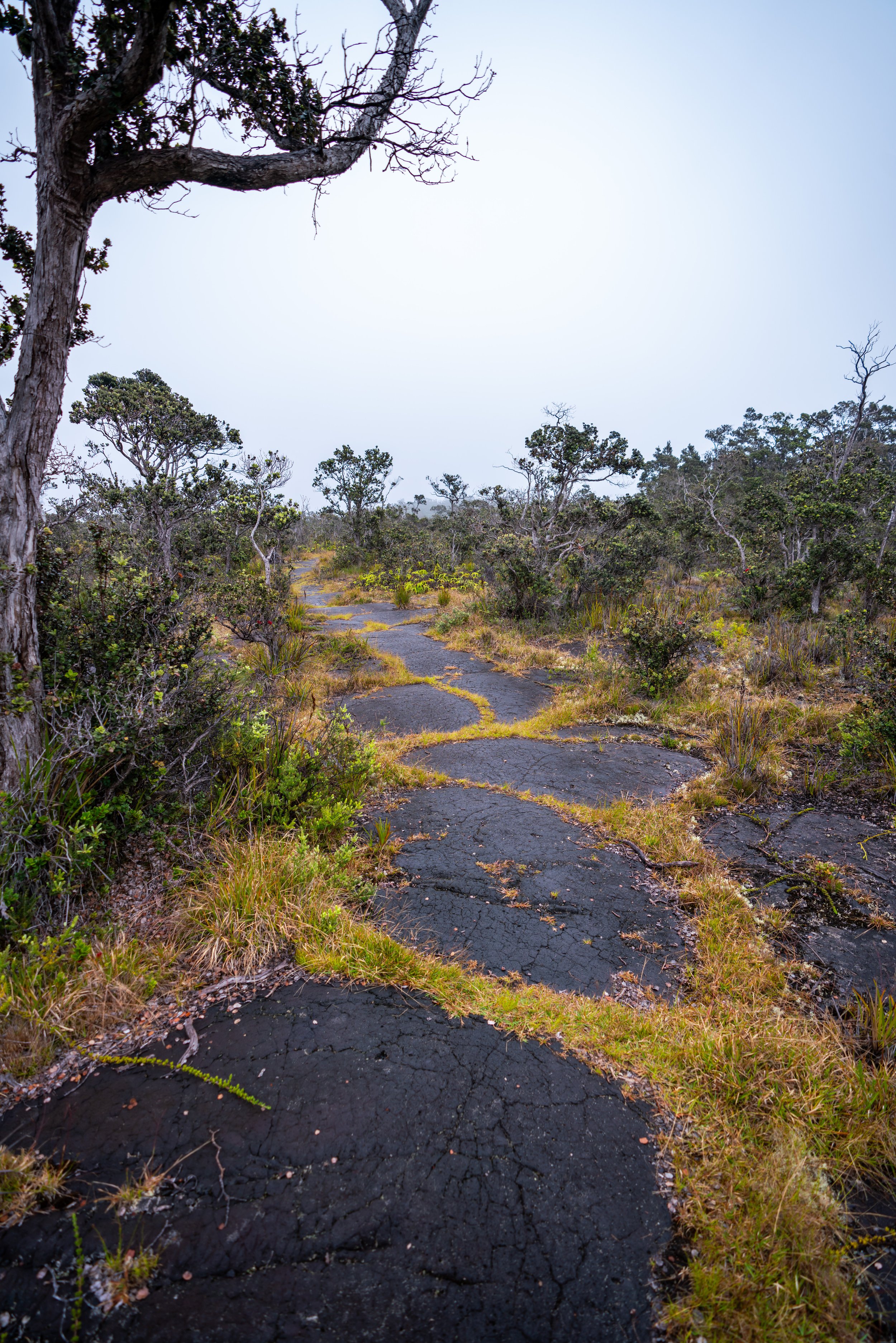
From the top of the Z-Trail, the Muliwai Trail winds its way across the Waipāhoehoe Plateau for the next 5.5 miles (8.9 km) until you reach the descent into Waimanu Valley.
At the start of the decent into Waimanu Valley, you’ll get your first views of Waiʻilikahi Falls; the waterfall in the photo below.
Additionally, know that this decent down the final switchbacks into Waimanu is covered in Lau Hala leaves, which can make the final sections a little slippery.
Waimanu Valley
Once you reach the valley floor, you’ll likely want to take off your shoes again to cross the Waimanu Stream.
Campsite 1 is closest to the stream, and the numbers slowly get higher toward the far end of the valley.
That being said, campsite two is the best location for views of the valley, but the campsites toward the far end of the valley are beachfront for the black sand beach. So, it’s truly a toss-up for whichever you think is best.
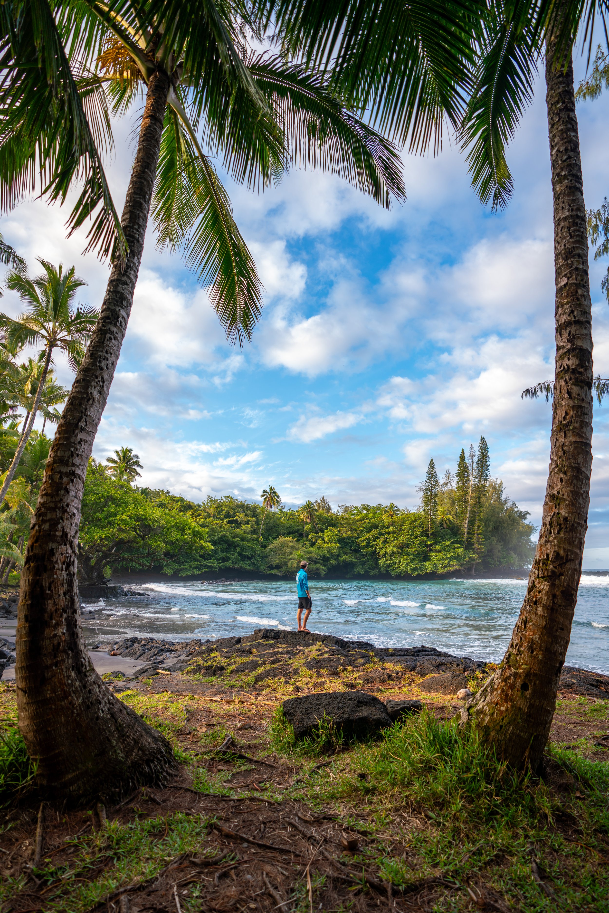
Waimanu Black Sand Beach
Since there is so much to do within Waimanu Valley, including the waterfalls, the black sand beach, fishing, hunting, etc., I recommend a minimum of three nights, so that you have time to relax, explore, and simply enjoy your stay.
That being said, the black sand beach is a fun place to swim, but be careful about swimming too far away from shore, as there is obviously no help should something go wrong.
Waiʻilikahi Falls
To hike up Waimanu Valley, the trailhead can be found near campsite nine, which is about 1.2 miles (1.9 km) each way to Waiʻilikahi Falls—the first and most accessible waterfall.
Kākāʻaukī Falls
From Waiʻilikahi Falls, it’s another 1 mile (1.6 km) to reach Kākāʻaukī Falls, which is noticeably more difficult than the first 1.2 miles (1.9 km) up the valley.
By this, I mean that the distances from waterfall to waterfall, past Waiʻilikahi Falls, are not good indicators of how long they will each take to hike.
In any case, hiking to Kākāʻaukī is really all about finding the best trail. When you leave Waiʻilikahi, you will contour around this big hillside. Then, the hike should be mostly 'straightforward' and flat toward the back of the marsh. When you come to the next stream, simply follow it up a short distance to reach the pool for Kākāʻaukī Falls.
If you’re visiting in March, bring an empty bag for the orange trees just outside of the falls. We hiked back with probably 30 oranges from two out of four trees that we found!
Lahomene Falls
From Kākāʻaukī Falls, Lahomene Falls is only another 0.8 miles (1.3 km) away.
In my experience, the hike was mostly flat, as it passed through some grass and trees, but we never found it to be too overgrown.
However, toward the end, the hike got a little tricky up the final part of the stream. My best advice is to follow the stream because trying to stay out of it only made the hiking slower.
Waihīlau Falls
We did not hike past Lahomene, but if you choose to go further, keep in mind the time it will take you to get back, as it ends up being a very long day to try and stay at each waterfall equally.
Waimanu Valley Food
As previously mentioned, we found a bunch of oranges right next to Kākāʻaukī Falls, and on top of this, our neighbors were hunting and fishing in the valley, which they ended up sharing with us!
READ THIS STORY!
There’s not another trail in Hawaiʻi that I would say this for, but you need to be concerned about your physical safety on the Muliwai Trail and in Waimanu Valley. I have no idea if this threat is still credible, but if I didn’t include this information, I wouldn’t be doing my job.
Back when I first did the hike in 2020, there were signs everywhere for a missing hiker along the Muliwai Trail. The missing hiker never returned and was never found, even with all the search efforts that ensued. In news reports, he was described as a very experienced hiker.
Fast forward to our trip about 6 months later, and we were talking to a group of people who were from the Big Island camping at another site. We were asking them about their thoughts on the situation, and they basically summed it up as fowl play. They confirmed that the missing hiker was very experienced, and they added that he had a drone with him. They said that if he was lost, he could have flown the drone to figure out his whereabouts, but the story doesn’t stop with just him.
On our first full day in the valley, a strange man just appeared out of nowhere. No one had any idea if he hiked in on the trail or came from somewhere deeper in the valley. I would describe him as someone that lives there because of his long crazy hair and obvious lack of hygiene.
This man then took over campsite nine, which was already occupied by two younger women who had the permit for campsite nine. However, they were forced to move and probably for their own good because the man wasn’t going to move. The oldest person from the group of local Big Island residents walked over to the three of them, and asked them all who had the permit? The girls obviously said that they did, but the man never spoke a word. He never said anything to anybody from the second we all noticed him.
I wish this story stopped here, but it gets worse. About a month after our trip, there was an attempted stabbing on the trail. The woman who was being threatened thankfully escaped and provided a description of the man in this article.
Unfortunately, based on the description, this is not the same man that we saw in the valley, unless the drawing is that inaccurate. However, this leads me to believe that there are multiple people living in the valley and along the trail.
All said, for your own safety, I would never leave the sight of everyone in your group. This was a mistake that we made, as we spread out to hike at our own pace. Both instances happened to hikers that were hiking alone, so the bigger the group, the better. I would even go as far to say that everyone in your group should also be carrying an easily accessible knife.
I wish I didn’t have to finish an article about this amazing place like this, but it is necessary information that is worth being aware of.
Waimanu Valley Weather
Generally speaking, Waimanu Valley sees normal trade wind weather, meaning that showers typically blow in from the east and are quick-moving.
However, this image below is what we narrowly avoided just after hiking out, and the weather was coming from the west, which is not typical for Hawaiʻi.
We knew there was rain in the forecast around the end of our trip, but we had no idea how lucky we got until we made it back in service.
All in all, check the local weather before setting off, and be aware that flash floods can happen at any time in Hawaiʻi. Outside of the two stream crossings in Waipiʻo and Waimanu, there’s a bunch of smaller ones along the Waipāhoehoe Plateau that could surely swell in size.
Native Plants in Waimanu Valley
The most common native plant that you will find in Waimanu Valley is the indigenous Hala tree.
From the switchbacks descending down to the valley floor, Hala dominates much of the valley, and leaves can be useful for starting a fire, as they are quite literally everywhere.
If you’d like to learn more about Hala and tons of other native Hawaiian plants from across the islands, I encourage you to check out my separate post linked below.
Read My Separate Post: Native Hawaiian Plant Guide


