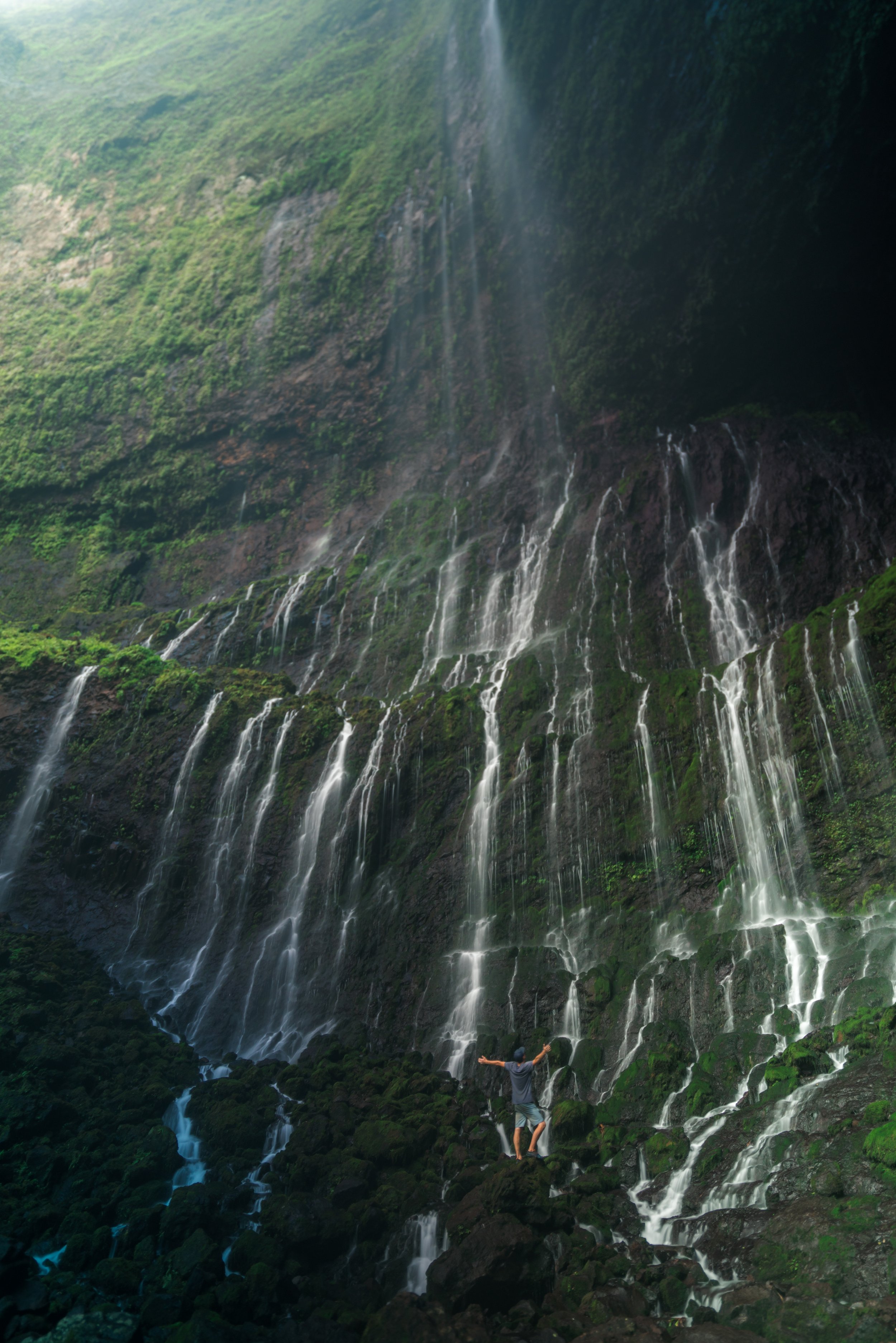
Hiking the Kalalau Trail on Kauaʻi’s Nāpali Coast
Distance (Roundtrip): 22.0 miles / 35.4 km
The Kalalau Trail, on the Nāpali Coast of Kauaʻi, is a world-renowned backcountry adventure along the rugged sea cliffs of the island’s North Shore that is often regarded as not only one of the best and most beautiful hikes in all of Hawaiʻi, but the entire world!
However, on account of the Kalalau Trail’s inherent popularity, planning and making the amazing 11.0-mile (17.7 km) one-way backpacking trip a reality has become more and more challenging over the years—particularly for out-of-state residents.
That said, to make all aspects of the trail, the permits, and the parking/ shuttle reservations easily understandable, I highly recommend reading through all the details in the following sections.
Hāʻena State Park Reservations
Why Are Reservations Required at Hāʻena State Park?
As much as you might think that reservations for Hāʻena State Park are annoying, the State of Hawaiʻi (truly the residents on Kauaʻi) did an amazing job at cleaning up the horrible Hāʻena State Park free-for-all of the past.
By this, I mean that prior to the historic floods in April of 2018, Hāʻena State Park had no limit on the number of people/ cars that could visit each day, meaning the park saw an unrestricted +3,000 visitors per day, essentially making the beautiful Nāpali Coast one of the least-desirable places to visit on Kauaʻi because visiting was such a hassle.
However, after the floods completely cut off Kūhiō Highway, the community came together and implemented a long overdue Master Plan to make Hāʻena State Park what it is today, finally prioritizing Hawaiʻi residents!
Who Needs/ What Are the Different Types of Reservations at Hāʻena State Park?
All individuals planning to hike or camp past Hanakāpīʻai Stream on the Kalalau Trail must have an overnight permit through the Hawaiʻi Department of Land and Natural Resources (DLNR).
Book Here: Nāpali Coast Wilderness State Park Permits
As for parking within Hāʻena State Park, here’s what you need to know: 70 stalls are available for visitor reservations, and 30 stalls are set aside for Hawaiʻi residents.
Hawaiʻi Residents - This is your home, and generally speaking, there should always be a parking spot open for you! Simply show your Hawaiʻi State ID to the folks working as you drive in, and you are free to park and enjoy everything within Hāʻena State Park and the Kalalau Trail, as far as Hanakāpīʻai Falls, without a reservation.
Visitors/ Non-Hawaiʻi Residents - All non-residents wishing to visit Hāʻena State Park/ the Kalalau Trail must have an advanced reservation to either park within the state park or take the shuttle from Waipā in Hanalei. In summary, advanced parking reservations are extremely competitive and hard to come by, but shuttle reservations from Hanalei are much easier to book closer to the date that you plan to visit.
Note that out-of-state visitors accompanying State of Hawaiʻi residents are not exempt from the entry requirements, and those checking IDs have been known to turn around vehicles with passengers who are out-of-state residents.
Book Here: Hāʻena Advanced Reservations
Waipā Park & Ride - Hāʻena State Park Shuttle Address
5-5631 Kuhio Hwy, Hanalei, HI 96714
How to Get Kalalau Trail Permits?
Kalalau Trail permits can be purchased up to 90 days in advance, and being that the Nāpali Coast is one of the most competitive camping permits in Hawaiʻi, it’s best to reserve your permits right when they are released—which is especially true over any holiday or weekend.
Note that only the first date of your trip needs to be at least 90 days out, meaning 91 days and beyond can be reserved on the same permit, so long as the dates are consecutive.
Book Here: Nāpali Coast Wilderness State Park Permits
Hāʻena State Park (Kalalau Trail) Parking
Parking for the Kalalau Trail is located within Hāʻena State Park at the very end of Kūhiō Highway on the North Shore of Kauaʻi.
That being said, be sure to read the previous sections in order to come prepared before arriving at Hāʻena.
Additionally, all parking along Kūhiō Highway prior to Hāʻena State Park is now illegal, which includes Limahuli Valley, even if you have a botanical garden reservation. The only exception to this rule is the Limahuli Stream (Cold Pond), but that is limited to an hour, so that visitors won’t try to park at the stream for the Kalalau Trail.
Finally, parking and walking in from Hāʻena Beach Park is also not allowed.
Moreover, all of these rules are now strictly enforced, so that Hawaiian residents, especially the North Shore community, can avoid the overcrowded and overrun days of the past.
Google Maps Directions: Hāʻena State Park
My Hawaiʻi Hiking Checklist
Obviously, for camping, you will need general backpacking gear. For this reason, I wrote a separate post about what backpacking gear is worth the money, from my experience, and what the best alternatives are to save you money.
Read My Separate Post: Best Ultralight Backpacking Gear
In addition, here is a complete list of must-have things that you will want for any hike on Kauaʻi.
Hiking the Kalalau Trail (Nāpali Coast)
Before visiting, be aware that the Hawaiʻi Division of State Parks may close the Kalalau Trail (Nāpali Coast) at any time if conditions are too dangerous at the stream crossings.
I have experienced this before, which is more typical in the wetter winter months.
In any case, the Kalalau Trail begins on a boardwalk through Hāʻena State Park to get to the true trailhead, located shortly ahead.
Hawaiʻi Trail Alerts: Kalalau Trail
Coming from a Hawaiʻi resident, this restoration work is incredible, as opposed to how overrun Hāʻena once was in the past.
Kalalau Trailhead
On the far side of Hāʻena State Park, the true Kalalau Trailhead can be found adjacent to Kēʻē Beach.
From the trailhead, the Kalalau Trail almost immediately begins climbing high above Kēʻē Beach, which is just the start, indicating how the next 11.0 miles (17.7 km) will be.
Furthermore, these first 2.0 miles (3.2 km) can be very muddy, due in large part to all the foot traffic the Kalalau Trail receives up to Hanakāpīʻai Valley.
The area in the photo below is one of the most iconic views along the Nāpali Coast, and in my opinion, it makes for one of the best places to catch the sunset on a day hike from Hāʻena State Park.
Try to keep moving through these helicopter landing zones, as rescues happen more often than you might think on the popular Hanakāpīʻai Falls Trail.
As the Kalalau Trail nears the 2.0-mile (3.2 km) mark, the trail begins descending back down to sea level, which is the only time this happens on the entire hike, outside of the two terminuses at Hāʻena State Park and Kalalau Valley.
Hanakāpīʻai Stream
The Hanakāpīʻai Stream may be much higher or lower than the photo here, which is what can prompt a trail closure, as previously mentioned.
That being said, the easiest place to cross is generally toward the beach, but there are other places to cross if you don’t mind getting your shoes wet.
On the far side of Hanakāpīʻai, go upstream to find where the Kalalau Trail continues.
Hanakāpīʻai Falls Junction
At the Hanakāpīʻai Falls junction, go right toward the restrooms to continue on the Kalalau Trail.
This is where the Kalalau Trail begins to see far fewer hikers than the first 2.0 miles (3.2 km), as the sections to follow are reserved for permit holders only.
Read My Separate Post: Hanakāpīʻai Falls Trail
Kalalau Permit Zone
The remaining 9.0 miles (14.5 km) of the Kalalau Trail past Hanakāpīʻai Stream is accessible by permit only.
That being said, the Department of Land and Natural Resources does enforce this at random, even for day hikers.
Book Here: Nāpali Coast Wilderness State Park Permits
What Happens If You Get Caught Without a Permit on the Kalalau Trail?
The Kalalau Trail within Hāʻena and the Nāpali Coast Wilderness State Park is one of the most heavily-enforced trails in the State of Hawaiʻi.
That being said, getting caught past the Hanakāpīʻai Stream without a permit will result in a steep fine, a mandatory court appearance (factor in travel expenses if you are not from Kauaʻi), and if you elect to have an attorney represent you instead of your appearance, then factor in lawyer fees.
Furthermore, it’s pretty obvious who has a permit on the trail and who does not, but what I can say from a local’s perspective is that there are very obvious points in the trail where enforcement is likely, should the officers choose to be out on the trail that day.
Once past the Hanakāpīʻai Stream, the Kalalau Trail begins climbing about 14 or 15 switchbacks, depending on how you count, gaining roughly 700 ft. (213 m) to the start of the Hoʻolulu Valley.
In my experience, as well as the experience of others I’ve hiked with, these mile markers may not be exactly correct, but for the sake of this Kalalau Trail article, they are the easiest way to reference the trail.
It’s always great to see native species, like the endemic Kokolau, growing along the cliffs of the Nāpali Coast, which is exactly why I’ve highlighted a number of them throughout this article in an otherwise heavily-invaded environment.
To further this thought, the Kalalau Trail has a number of beautiful native plants that hikers can expect to see. However, as with any heavily-trafficked trail, the hike is lined with non-native/ invasive plants that pose a threat to these natives, such as this Kokolau, which can only be found on the island of Kauaʻi.
Hoʻolulu Valley (HonoʻOnāpali Natural Reserve Area)
Hoʻolulu Valley is a bit of an unrecognizable valley in the scheme of the entire Kalalau Trail, but I can almost guarantee that you will remember the switchbacks that immediately follow this ungulate-exclusion fence on the hike out.
By this, I mean that the switchbacks out of Hoʻolulu Valley are among the longest, steepest, and most annoying, especially after hiking roughly 8.0 miles (12.9 km) from Kalalau Valley to get to this point.
From the start of Hoʻolulu Valley, there’s about 8 or 9 switchbacks that descend down to the stream, depending on how you count.
Kāwelu is one of Hawaiʻi’s few native grass species, but it is prominent in the Waimea Canyon and along the Nāpali Coast.
Words of wisdom: Don’t pick up the mice; they have fleas!
Waiʻahuʻakua Valley
After Hoʻolulu, Waiʻahuʻakua Valley can be found shortly after, and it’s generally where spirits are lifted again, as the turn into the valley features one of the most beautiful viewpoints on the entire Kalalau Trail.
On a different note, Waiʻahuʻakua Valley is also the source of water for the beautiful sea cave known as 'Double Door,' accessible only by zodiac boat on a Nāpali Coast boat tour.
If this is something you may be interested in, I encourage you to learn more about the entire adventure in my separate article.
Read My Separate Post: Nāpali Coast Boat Tour
Waiʻahuʻakua Stream
Compared to Hanakāpīʻai and Hānakoa, the Waiʻahuʻakua Stream is typically a bit easier to cross, but this can quickly change if the Nāpali Coast has been seeing a lot of rain.
Mile five is always a nice sight on the Kalalau Trail because, for some, it means only one more mile until taking a break for the night in Hānakoa, but for others hiking all the way to Kalalau, Hānakoa Valley feels like a bit of a 'halfway' point, even though it’s slightly further.
If you’re wondering what all these weird trees with long, sharp leaves on the ground are, these are Hala trees, and they are a native indigenous tree in Hawaiʻi.
Hānakoa Valley
Along the entire 11.0-mile (17.7 km) Kalalau Trail, Hānakoa Valley is generally the most notable valley because for some, it serves as an overnight stopping point; for others, a day hike to the waterfall; and, as previously mentioned, the valley feels like a mental 'halfway' point on the long and tiring trail.
Hānakoa Campsites
According to the Department of Land and Natural Resources, camping in Hānakoa Valley is only allowed on the first and last night of a Kalalau permit, so as to free up space for future hikers.
That being said, there are places to camp on both side of the Hānakoa Stream.
Hānakoa Stream
In my experience, Hanakāpīʻai, as well as Hānakoa Stream, are the two most variable stream crossings on the entire Kalalau Trail.
What I mean is that water levels can change by the hour, or even by the minute, during a flash flood, and I have experienced both ends of this extreme.
In any case, the photo below shows Hānakoa Stream when one would be able to make their way across without getting wet.
Hānakoa Falls Junction
On the far side (west side) of the Hānakoa Stream, the Hānakoa Falls Trail can be found heading up the valley.
Hānakoa Falls is typically a day hike for those staying the night in the valley, but for those continuing on to Kalalau or hiking out to Hāʻena, Hānakoa Falls is typically debated upon whether or not it’s worth adding an extra 1.0 miles (1.6 km) onto an already long day.
In any case, the Hānakoa Falls Trail is not as straightforward as one might think, which is why I encourage you to check out my separate article if you’re interested in making the hike up to the falls.
Read My Separate Post: Hānakoa Falls Trail
Crawler’s Ledge
Among most first-time Kalalau hikers, Crawler’s Ledge is typically the most dreaded part of the entire trail.
That being said, some will find absolutely no difficulty crossing Crawler’s Ledge, and others may feel extremely uncomfortable along the steep sea cliffs with a heavy bag; hence, the name Crawler’s Ledge.
Warning
There’s no easy way to say it, but a fall down the sea cliffs at Crawler’s Ledge would likely be fatal, and falls off the Kalalau Trail have had this result before.
I have to imagine that finding a way to get your heavy backpack off, along with getting out of the water where there are no beaches, are among the biggest concerns, should one survive a fall.
That being said, there are many other high-exposure areas on the Kalalau Trail where the same could be said, but the difference generally is that there is more vegetation surrounding the trail.
As for Crawler’s Ledge, the trail is wide enough for one hiker to pass by the narrowest section at a time. If you must turn around for any reason, always turn with your person toward the cliffs. I have seen what can happen when one forgets how big their bag is, and they get a bump from a quick turn in the wrong direction!
This is the narrowest section on Crawler’s Ledge.
Once past Crawler’s Ledge, it’s important to note that there are yet many more high-exposure sections on the trail, which will continue until the descent into Kalalau Valley.
Following mile eight, the Kalalau Trail enters an unnamed valley, shown in the photo below.
This portion of the Kalalau Trail, through the valley, climbs an entirely and seemingly never-ending uphill section, which abruptly comes to an end where it pops out of the forest at Bowser Rock.
Bowser Rock
Bowser Rock is an unmistakable rock feature on the Kalalau Trail, located a little before mile nine.
From here, the Kalalau Trail traverses in and out of a few more unnamed ravines before arriving at the beautiful descent into Kalalau Valley.
Kalalau Valley
The start of Kalalau Valley and the viewpoint to the west is generally regarded as one of the most beautiful places along the entire trail, especially if you catch it during the late afternoon light.
After a long day on the trail, this 550 ft. (168 m) descent into Kalalau Valley is one of the most rewarding, but it also becomes one of the most dreaded uphill climbs on the return hike back to Hāʻena.
Once at the bottom of the hill, the Kalalau Trail enters the forest, which will continue for the majority of the hike to Kalalau Beach.
Kalalau Stream
Shortly before the campsites, the Kalalau Trail will cross the Kalalau Stream, located about 0.25 miles (0.4 km) from the start of the forest.
Kalalau Valley Junction
Immediately after the Kalalau Stream, the Kalalau Trail will pass by the Kalalau Valley Trail junction.
In short, the Kalalau Valley Trail is a separate day hike that I recommend exploring when you have two or more nights planned in Kalalau Valley.
That being said, the valley trail is easily the most confusing day hike off the Kalalau Trail, which is why I highly encourage you to check out my separate article to learn more.
Read My Separate Post: Kalalau Valley Trail
Just prior to the campsites at Kalalau Beach, the trail will split, with one path paralleling the coastline and the other passing through the forest.
Personally, I recommend going left to stay on the easier and typically less muddy of the two trails, but in either case, they both join shortly after the restroom shown below.
These restrooms are among a few along Kalalau Beach.
This is where both the forest trail and coastal trail come back together.
Kalalau Beach (Campsites)
The very end of the Kalalau Trail is Kalalau Beach, which is where all the best campsites are located.
If you have the time, I personally recommend a 4-day, 3-night trip so that you can relax, spend some time hiking to the waterfalls within Kalalau Valley, and if the tide/ surf are right, make the journey over to Honopū Valley/ Beach (summer only).
The closest tent in the photo below is my preferred backcountry tent and has been for many years.
To learn more about why and to compare it with the other most popular model, I encourage you to check out my separate article.
Read My Separate Post: Big Agnes Copper Spur vs. MSR Hubba Hubba
The restrooms are nothing special, so make sure to bring a small hand sanitizer!
Hoʻoleʻa Falls
Hoʻoleʻa Falls is the waterfall at the very far end of Kalalau Beach, and this natural spring-fed waterfall is the primary water source for campers at Kalalau Beach.
However, this goes without saying that goats have been known to kick rocks down from the cliffs above, which is why the rockfall danger can be much more likely than just natural occurrences.
Kalalau Beach Cave
Past Hoʻoleʻa Falls, the Kalalau Beach Cave can be found, but it is only accessible during the calmer summer months, as the journey during the winter can be quite dangerous with the high surf.
Honopū Beach
Past the Kalalau Beach Cave, Honopū Valley/ Beach is the next notable landmark, but it is typically only accessible during the summer and by swimming the final portion to the beach.
Warning
That being said, one could easily get trapped at Honopū Beach if the ocean conditions were to change, which is why making your way there should only be attempted by those with the most experience in Hawaiʻi’s ocean conditions.
To this point, the entire Nāpali Coast directly receives much of an open-ocean swell, especially during the winter, making the walk/ swim to Honopū very dangerous, to say the least. I would even go as far to say that it’s impossible during the winter.
Therefore, I only recommend considering it if the surf and tide are low, you’re a very good swimmer, and you make it there mostly by walking along the coast, considering that you always have to get back.
There are no rescue services and no cell phone service this far out, which is again why I caution against making your way to Honopū.
Native Plants on the Kalalau Trail
As previously mentioned, the Kalalau Trail is a heavily-invaded trail, with non-native/ invasive species spread throughout by the amount of foot traffic that the trail sees.
However, the Kalalau Trail is still a great place to see a variety of native Hawaiian plants, from the trailhead within Hāʻena State Park to Kalalau Beach. Some of these include ʻŌhiʻa lehua, Koa, Alaheʻe, Lama, Hala, Palaʻā, Naupaka, Hōʻawa, Kāwelu, Palapalai, and Kokolau, to truly only name a few.
If you would like to know more about these and tons of other native Hawaiian plants from across the islands, I encourage you to check out my separate post linked below.
Read My Separate Post: Native Hawaiian Plant Guide


