Hiking the East Rosebud Trail to Rainbow Lake in the Beartooth Mountains, Montana
Distance: 26.0 miles / 41.8 km
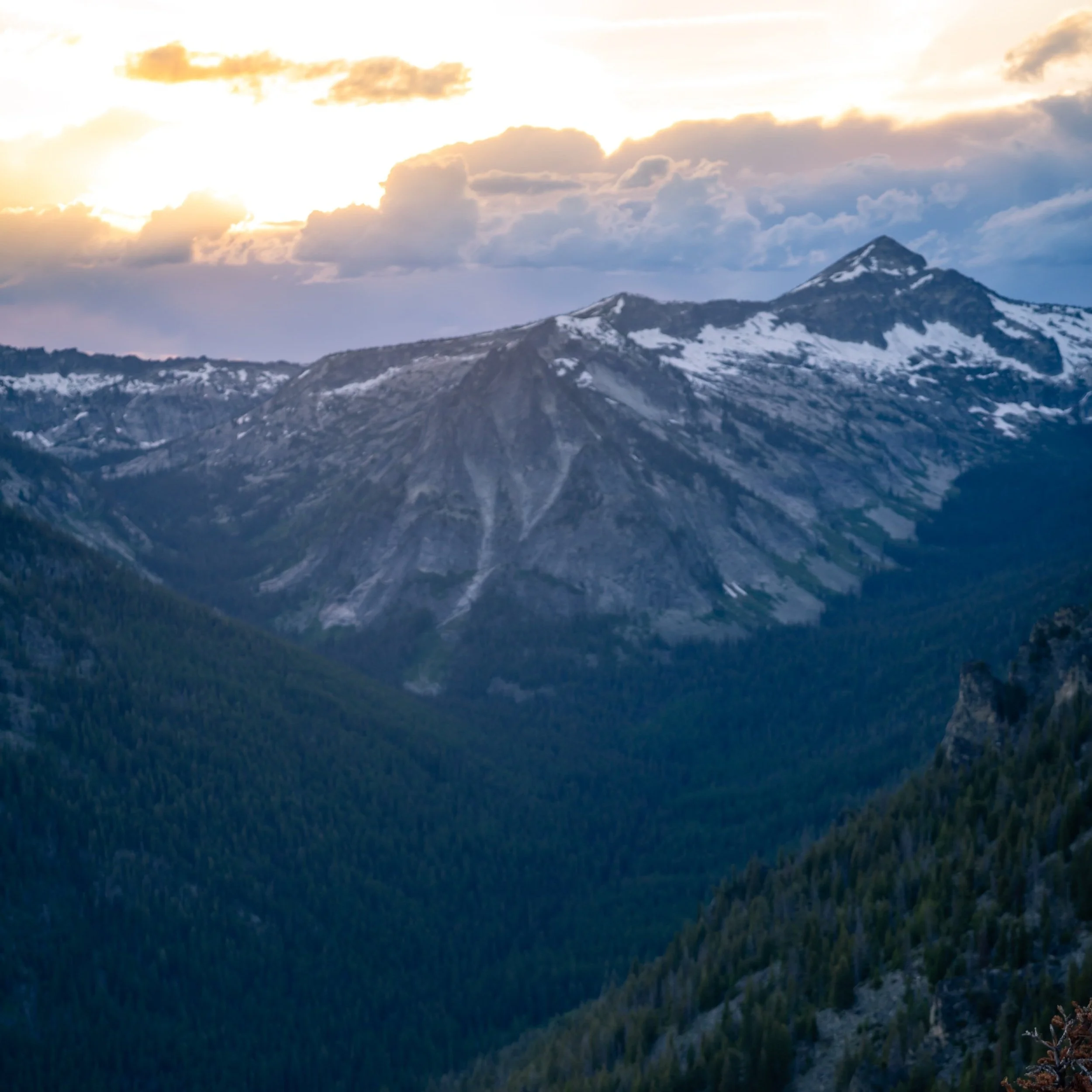
The East Rosebud-Russel Creek Trail, commonly referred to as 'The Beaten Path,' in Montana, is a one-way backpacking adventure through the heart of the Absaroka-Beartooth Mountain Range—a backcountry wilderness that many regard as being even more beautiful than Glacier National Park!
This is because the Beartooth Range is renowned for having even more glaciers than Glacier National Park, high-elevation peaks—including the tallest peak in Montana—and lakes filled with trout, fed by glacial streams and waterfalls, that truly feel untouched compared to other, more popular areas across the Mountain West.
That said, the hike can begin at either the East Rosebud Lake Trailhead on the northern end or the Clarks Fork Trailhead just outside of Cooke City off the Beartooth Highway, with most out-of-state hikers opting for a one-way shuttle to get to and from the trailheads at the end.
Now, due to circumstances unrelated to this adventure, my friend and I didn’t have the time to complete the full thru-hike, which is why this article is only about the East Rosebud Trail as far as Rainbow Lake. However, I have every intention of coming back to hike the full trail, and I’m honestly looking for any excuse—most notably the right hiking group—to buy a last-second, one-way flight back to Bozeman to finish the hike!

My Print - Rainbow Lake
Rainbow Lake Trailhead Parking
Parking for the East Rosebud Trailhead is located at the very end of East Rosebud Road in Roscoe, Montana.
That said, the last few miles on East Rosebud Road can be a bit long and bumpy on the dirt road to get there, but it should generally be passable for most 2WD vehicles, granted that the road is snow-free.
Google Maps Directions:East Rosebud Trailhead / Clarks Fork Trailhead
Hiking Checklist - Beartooths
Obviously, for camping, you will need general backpacking gear. For this reason, I wrote a separate post about what backpacking gear is worth the money, from my experience, and what the best alternatives are to save you money.
Read My Separate Post: Best Ultralight Backpacking Gear
In addition, here is a complete list of must-have things that you will want for any hike in the Beartooth Mountains, including bear spray, as the Beartooth Range is both black and grizzly bear territory.
Hiking the Rainbow Lake Trail
Beginning from the East Rosebud Trailhead in the Custer-Gallatin National Forest, the hike begins up one of America’s newest federally protected rivers under the Wild and Scenic Act.
In any case, the hike up East Rosebud Creek to Rainbow Lake is about as stunning as a backcountry trip can be!
By this, I mean that the higher you hike up East Rosebud to Elk Lake and beyond, the more the canyon you’re in narrows until you’re surrounded by towering granite walls on both sides!
That said, there are a number of stream crossings to navigate before Rimrock Lake, which can be tricky to keep your shoes dry—especially when the snowmelt is more significant in the early summer season.
Past Elk Lake, the East Rosebud Trail gains somewhere between 800-900 ft. (244-274 m) of elevation on the switchbacks leading up to Rimrock Lake.
It’s at this point that the canyon really starts to narrow, which, in my opinion, was the most beautiful section of the trail prior to Rainbow Lake.

My Print - East Rosebud Trail
Rimrock Lake
The East Rosebud Trail approaches Rimrock Lake on the left (east) side before descending and crossing over East Rosebud Creek at the mouth of the lake.
Then, past Rimrock Lake, the trail will gain roughly another 200 ft. (61 m), which will be the first time you get a view of Rainbow Lake at about 7.8 miles (12.6 km) into the hike.
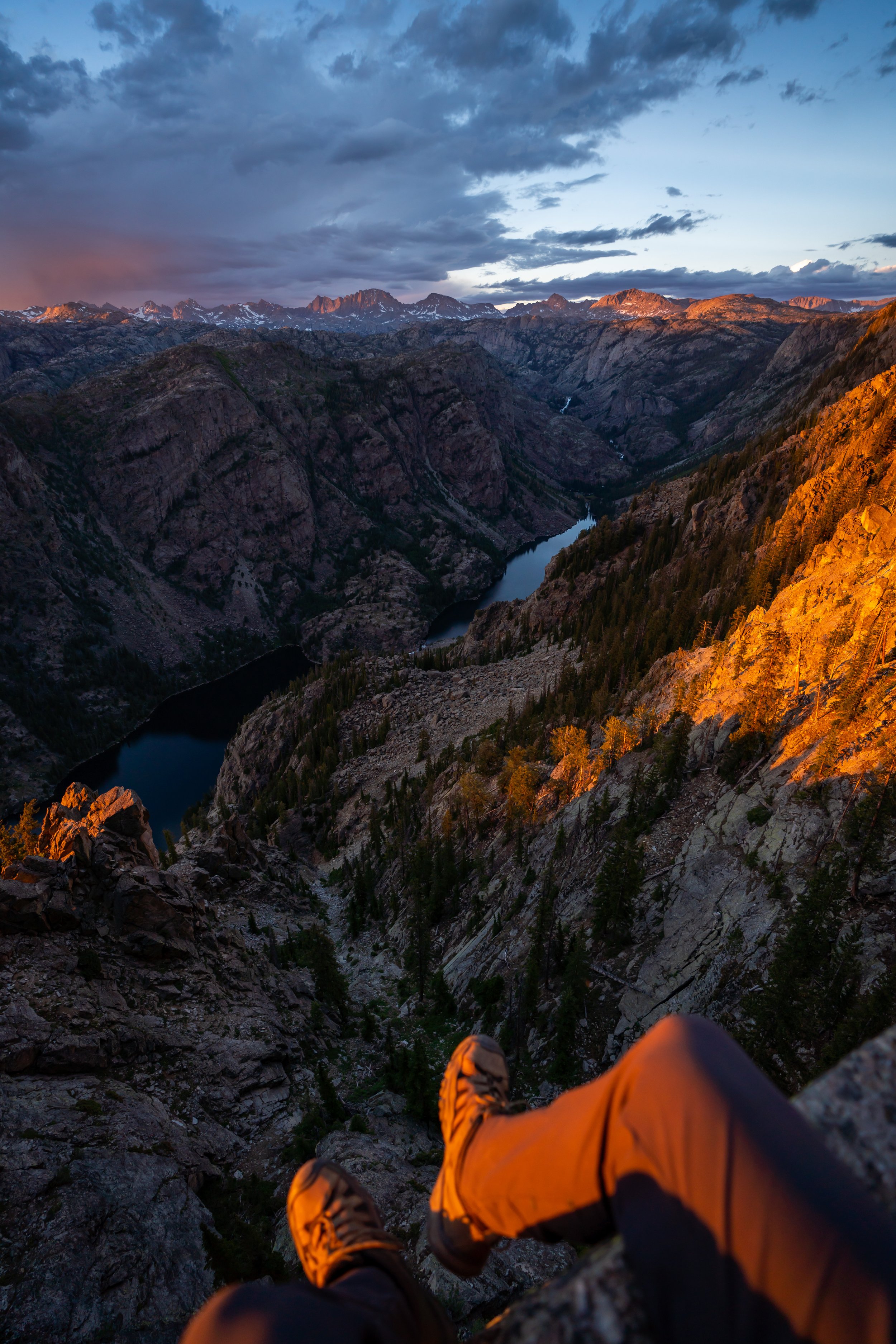
Rainbow Lake
From the start of Rainbow Lake, it’s only another 0.8 miles (1.3 km) to reach the Rainbow Lake campsites, located at the far (south) end of the lake.
Rainbow Lake Campsite
In total, the East Rosebud Trail to the Rainbow Lake campsite is roughly 8.6 miles (13.8 km) each way.
That said, make sure that you are aware of the current fire restrictions, as different areas of the Beartooths tend to follow different rules.
The Beaten Path to Clarks Fork
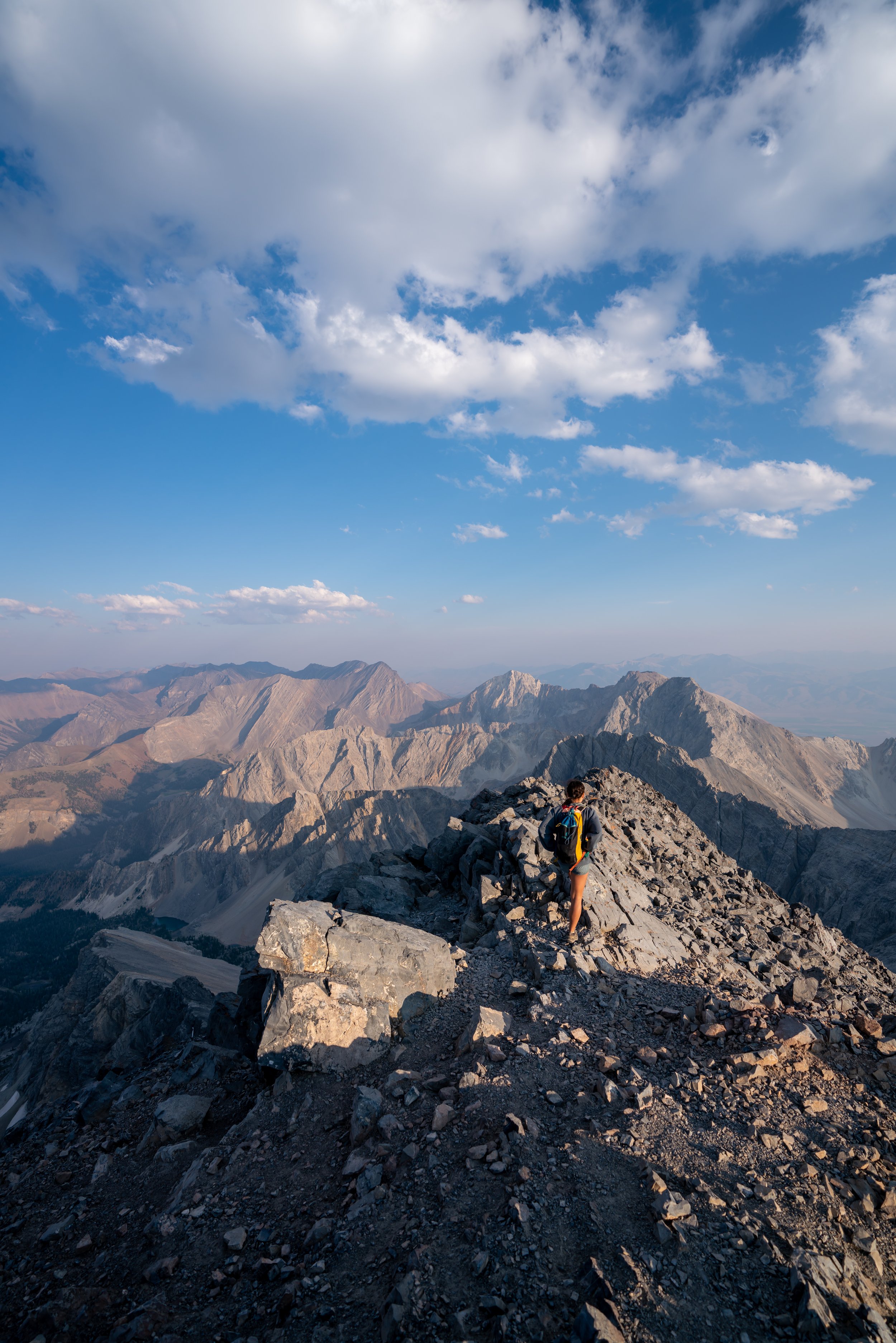
As previously mentioned, I only had the opportunity to hike as far as Rainbow Lake, but one of the coolest things about starting from the East Rosebud Trailhead is that you can thru-hike it all the way to the Beartooth Highway!
From Rainbow Lake, the East Rosebud Trail will climb to Lake at Falls, past a few more lakes until it reaches the 10,000 ft. (3,048 m) mark at Fossil Lake. Then, the trail begins descending down to the Beartooth Highway on the Russel Creek Trail, where the hike ends at the Clarks Fork Trailhead.
Overall, The Beaten Path is a stunning 26-mile (41.8 km) one-way hike if you choose to thru-hike it from either East Rosebud or the Clarks Fork Trailhead.
However, the benefit of starting at the Clarks Fork Trailhead over East Rosebud is that you will only have to climb about 2,000 ft. (610 m) to the trail’s crest, whereas by hiking from the East Rosebud Trailhead, you will start lower and have to climb just under 4,000 ft. (1,219 m) to the trail’s crest at Fossil Lake.
This is all to say that there are a variety of Beartooth shuttle services to look into, which allow hikers to thru-hike The Beaten Path and have a ride back to either trailhead.
AllTrails: The Beaten Path
Additional Early Season Gear
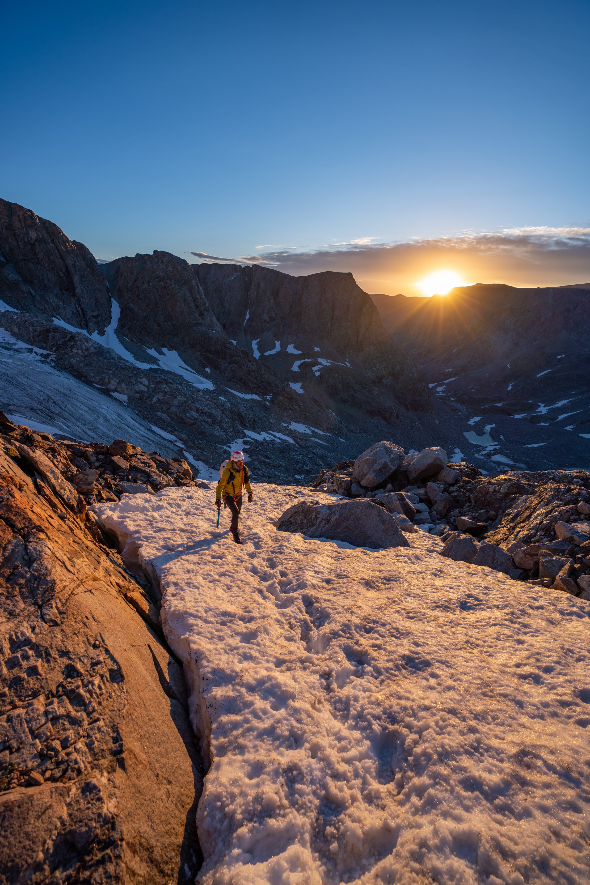
Depending on the winter snowpack, upper-elevation areas can be covered in snow into the middle of July or even early August.
For this reason, micro-spikes may be a necessity across many upper-elevation areas throughout the Beartooths, like The Beaten Path.
I personally use the Yaktrax below.