Hiking the Crater Rim Trail in Hawaiʻi Volcanoes National Park
Distance (One Way): 7.6 miles / 12.2 km
The Crater Rim Trail in Hawaiʻi Volcanoes National Park is one of the most beautiful and diverse day hikes near Kīlauea Caldera—not to mention, it’s one of my all-time personal favorites!
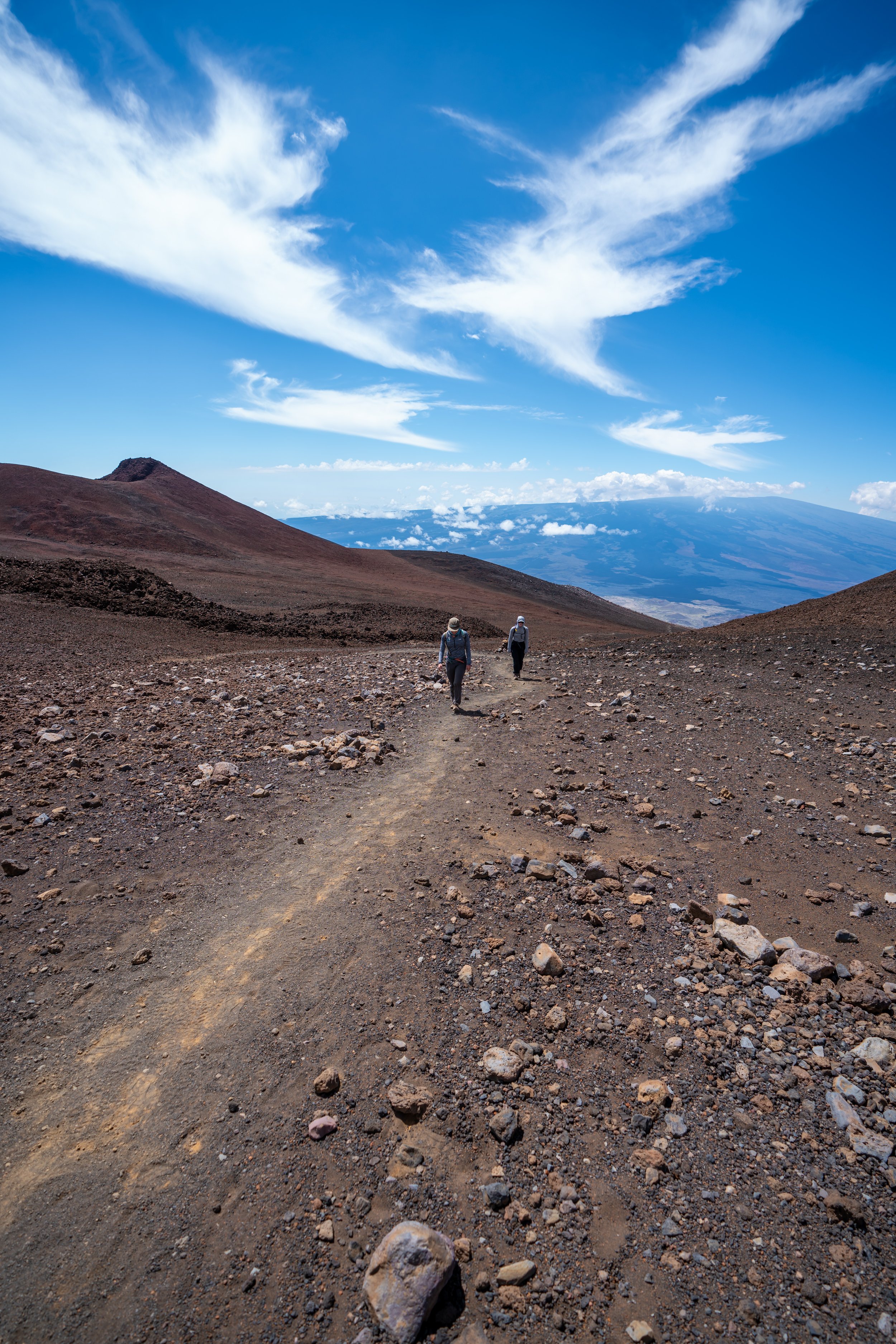
I say this because the Crater Rim Trail truly has it all in Hawaiʻi Volcanoes! From the origins of the Kaʻū Desert at Uēkahuna to the lush rainforests east of Kīlauea and back to the Kaʻū Desert, the Crater Rim Trail passes through the best of the best in Hawaiʻi Volcanoes National Park!
On top of this, the Crater Rim Trail can be an all-downhill adventure if you have the opportunity to get dropped off and picked up elsewhere by someone in your party—effectively seeing the entire rim while cutting the hike in half at the same time!
However, even if you don’t have someone who can drop you off at the summit and pick you up at the end of the hike, I still highly recommend hiking the full Crater Rim Trail—or, at the very least, using this post to pick out the areas of the Crater Rim Trail that sound most interesting to you. This is because the Crater Rim Trail passes by a number of different trailheads along the way, making the best parts of the trail easily accessible on a short out-and-back hike at various points around Kīlauea.
All this to say, most visitors don’t hike the entire Crater Rim Trail around Kīlauea, but if you have the time, I highly recommend exploring as much as you can, as there’s no doubt in my mind that the best of Hawaiʻi Volcanoes can be seen here and on the Kīlauea Iki Trail.
Why Doesn’t the Crater Rim Trail Make a Full Loop?
The short answer is, it used to!
However, in 2008, the National Park Service closed the entire southwestern portion of the Crater Rim Trail and Crater Rim Drive because of a new volcanic vent that opened within Halemaʻumaʻu Crater.
Then, a decade later, in 2018, the change became permanent during the dramatic Kīlauea Summit collapse. During this time, between May and August 2018, the caldera floor dropped significantly, and massive sections of the rim—including the physical path of the trail and the road—collapsed into the expanding crater.
This is was the event that made the changes permanent, and it’s why the Crater Rim Trail will most likely never be a full loop again, unless the National Park Service decides to expand the loop further into the Kaʻū Desert and away from the most active portions along Halemaʻumaʻu Crater.
Crater Rim Trailhead Parking
While the Crater Rim Trail could begin from either Uwēkahuna (Kīlauea Summit), Wahinekapu (Steam Vents), the Kīlauea Visitor Center, the Kīlauea Iki Overlook, Nākuku (Thurston Lava Tube), or finally, where the trail cross the Chain of Craters Road, I highly encourage starting from Uwēkahuna, which is where this post begins.
It’s the trailhead that makes the most sense for a one-way adventure because, as previously mentioned, the hike from the summit is nearly all downhill from this direction.
Google Maps Directions: Uwēkahuna Trailhead
Hiking the Crater Rim Trail
Distance to the Haʻakulamanu (Sulphur Banks): 1.8 miles / 2.9 km
Regarding my thoughts above, the Crater Rim Trail could begin from any number of trailheads, but it makes the most sense to hike one way if possible—beginning from the Thomas A. Jaggar Museum at Uēkahuna Summit—which is exactly where this post begins.
Uēkahuna Overlook
Almost immediately after the trailhead, the Crater Rim Trail passes by the popular Uēkahuna Overlook, which is the first of two overlooks that most visitors stop.
Kīlauea Overlook
Then, a little past the Uēkahuna Overlook, the Crater Rim Trail reaches the Kīlauea Overlook located a little past the summit.
From here, the Crater Rim becomes much less busy until the Kīlauea Visitor Center located 2.0 miles (3.2 km) down the trail.
When the paved trail splits with this dirt path, go right to continue hiking along the Crater Rim Trail.
Kīlauea Military Camp Junction
The next junction along the trail is for the Kīlauea Military Camp.
Since parking at the camp is for guests only, starting the Crater Rim Trail from here is the least practical for most park visitors.
Crater Rim-Haʻakulamanu (Sulphur Banks) Junction
Distance to the Kīlauea Visitor Center: 0.5 miles / 0.8 km
After the Kīlauea Military Camp, the next split along the Crater Rim is for Haʻakulamanu (Sulphur Banks), which makes for a nice short loop trail from the Kīlauea Visitor Center as a separate hike.
Read My Separate Post: Haʻakulamanu (Sulphur Banks) Trail
You may notice that the time of day has shifted in these photos, and that's because I completed the Crater Rim Trail over a few separate hikes since I didn’t have a ride for a one-way adventure, as I suggest doing.
In the early morning hours, these forested sections through the ʻŌhiʻa are an amazing place to listen for various native Hawaiian birds that you can't find in places like Hilo.
Halemaʻumaʻu Junction
After about 0.5 miles (0.8 km), the Crater Rim Trail splits with the Halemaʻumaʻu Trail that leads down to the edge of the native forest within Kīlauea Crater.
Go straight/ up the stairs at this junction to continue hiking the Crater Rim Trail toward the Kīlauea Visitor Center and the Volcano House.
Kīlauea Visitor Center Junction
Distance to the Kīlauea Iki Junction: 1.1 miles / 1.8 km
At the next junction, go straight once again to continue on the Crater Rim Trail toward the Volcano House.
The trail to the left leads out to the Kīlauea Visitor Center.
At the far end of the Volcano House, go straight along the fence to continue hiking along the Crater Rim Trail to get to Kūpinaʻi Pali, also known as Waldron Ledge.
The Crater Rim Trail will eventually meet with another junction from the Kīlauea Visitor Center/ Volcano House.
At this split, go right to continue on the Crater Rim Trail to Waldron Ledge.
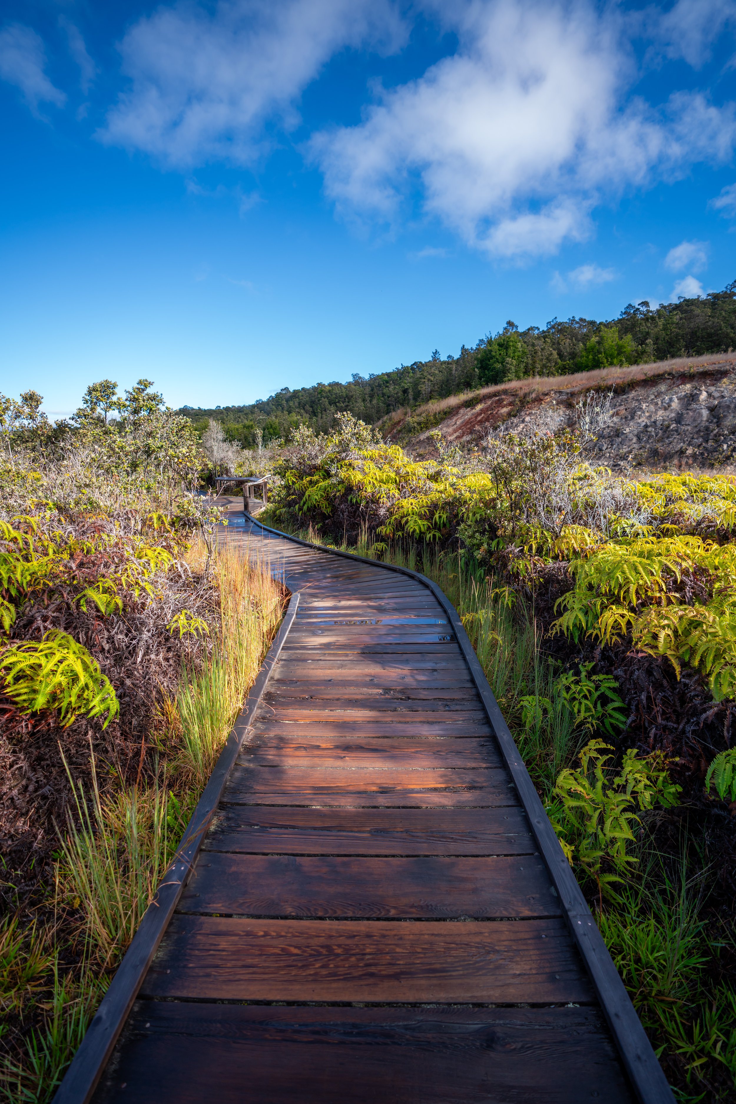
This old section of Crater Rim Road is one the easiest sections of the hike around the entire Kīlauea Caldera.
It’s also one of my favorite sections of the Crater Rim Trail, as I believe there are a lot of cool opportunities for beautiful photos along this stretch.
Go straight at this split a little before Waldron Ledge.
Kūpinaʻi Pali (Waldron Ledge)
If you’re interested in seeing the view at Waldron Ledge, go right at this fork, or you can go straight to continue on the fastest route around Kīlauea.
This is where the little turnout for Waldron Ledge rejoins with the Crater Rim Trail.
Crater Rim-Research Center Road Junction
At roughly 0.3 miles (0.5 km) past Waldron Ledge, the Crater Rim Trail splits to the right toward the Kīlauea Iki Crater.
Kīlauea Iki Junction
Distance to the Kīlauea Iki Overlook: 0.7 miles / 1.1 km
Shortly after the Research Center Road junction, the Crater Rim Trail joins with the Kīlauea Iki Trail.
If you didn’t want to hike this section of the trail twice, I highly recommend hiking the Kīlauea Iki Trail as a separate adventure. In my opinion, Kīlauea Iki is one of the best day hikes in all of Hawaiʻi Volcanoes.
Read My Separate Post: Kīlauea Iki Trail
This short section along Kīlauea Iki, quite literally meaning "little Kīlauea," is one of the places with the best views along the trail, as you can see the main Kīlauea Caldera erupting just past Kīlauea Iki.
Kīlauea Iki Overlook
Distance to Nāhuku (Thurston Lava Tube): 0.5 miles / 0.8 km
After this short stretch along the north rim of Kīlauea Iki, the Crater Rim Trail passes by the Kīlauea Iki Overlook, which is my prefered trailhead to begin to beautiful loop down into Kīlauea Iki.
However, the Kīlauea Iki Overlook is not only a popular trailhead for the overlook and the trail itself, but it tends to be a busier area along the Crater Rim, as it acts as a spill-over parking lot for the popular Nākuku Lava Tube located just 0.5 miles (0.8 km) down the trail.
Nāhuku (Thurston Lava Tube)
Distance to the Chain of Craters Road: 2.3 miles / 3.7 km
With the exception of where the Crater Rim Trail crosses the Chain of Craters Road, Nāhuku is really the last trailhead, or at least the last popular trailhead, along the Crater Rim Trail.
Very few park visitors begin hiking the Crater Rim Trail at the Chain of Craters Road crossing. Therefore, from Nāhuku until the end of the hike, you can expect to see very few park visitors compared to other more popular sections of the trail.
Read My Separate Post: Nāhuku (Thurston Lava Tube) Trail
Once on the Nāhuku Loop Trail, go right at the first split immediately after the trailhead.
Nāhuku (Thurston Lava Tube) Junction
At the next split with the trail that leads down to the lava tube, go right to continue on the Crater Rim Trail.
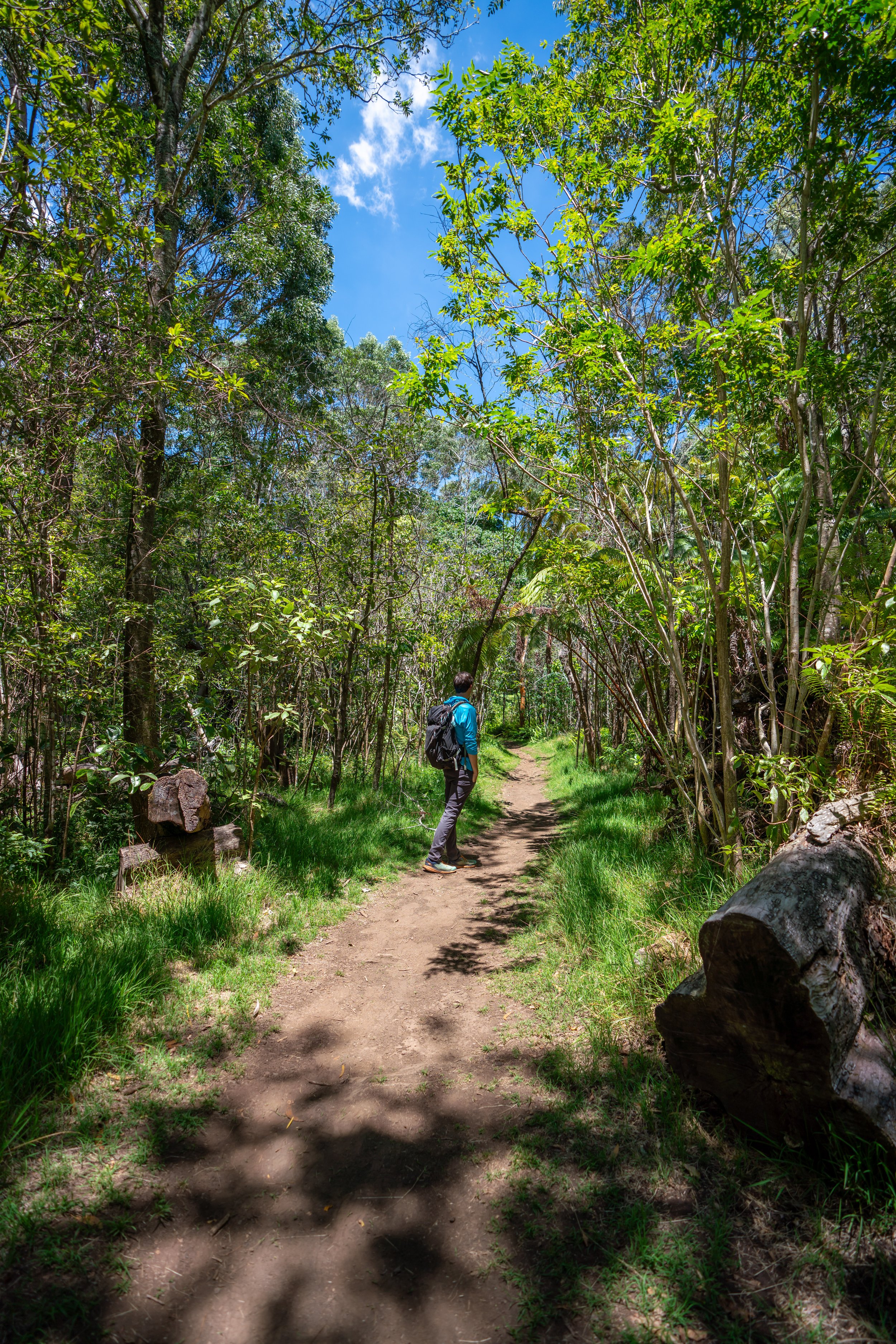
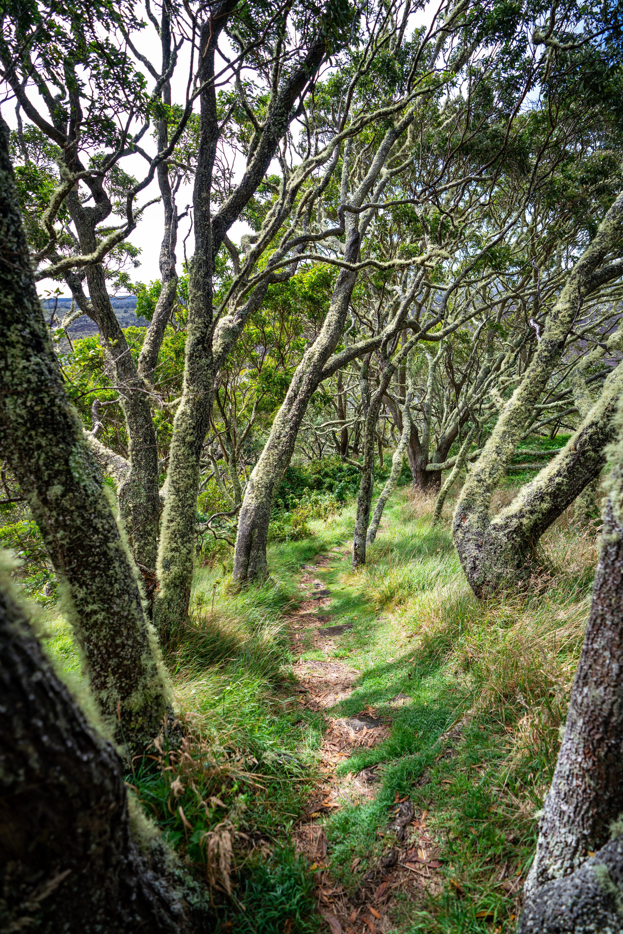
Personally speaking, this is my favorite stretch of the entire Crater Rim Trail, as the sections through the native forest to come are beyond beautiful when the light is shining through!
Please close the gate.
Fences such as this in Hawaiʻi are used to keep non-native ungulates out, which are essential for protecting our most pristine native Hawaiian forests.
Crater Rim-Escape Road Junction
Shortly after walking down the service road, the Crater Rim Trail splits to the right, which is the last junction on the entire rest of the trail.
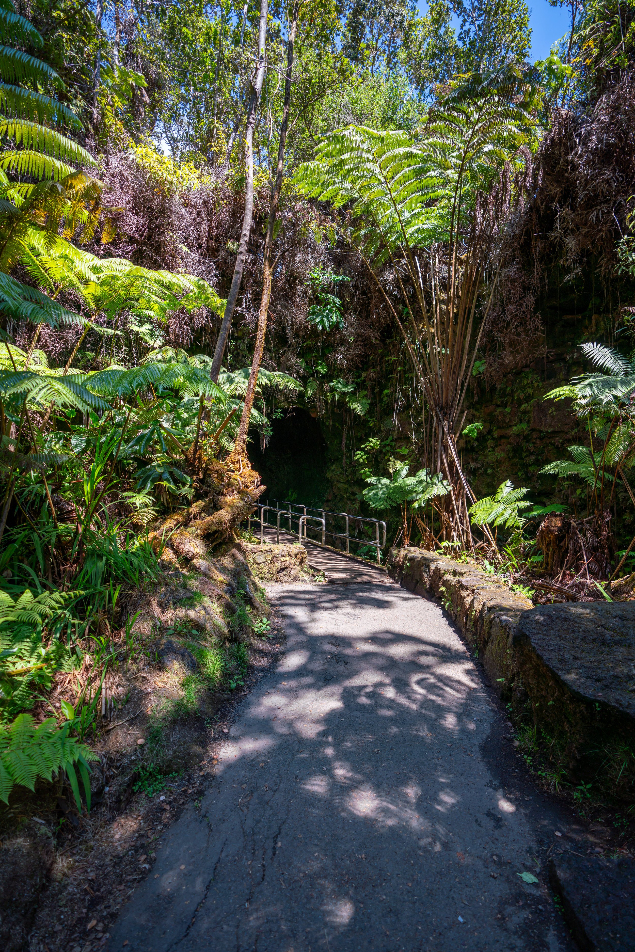
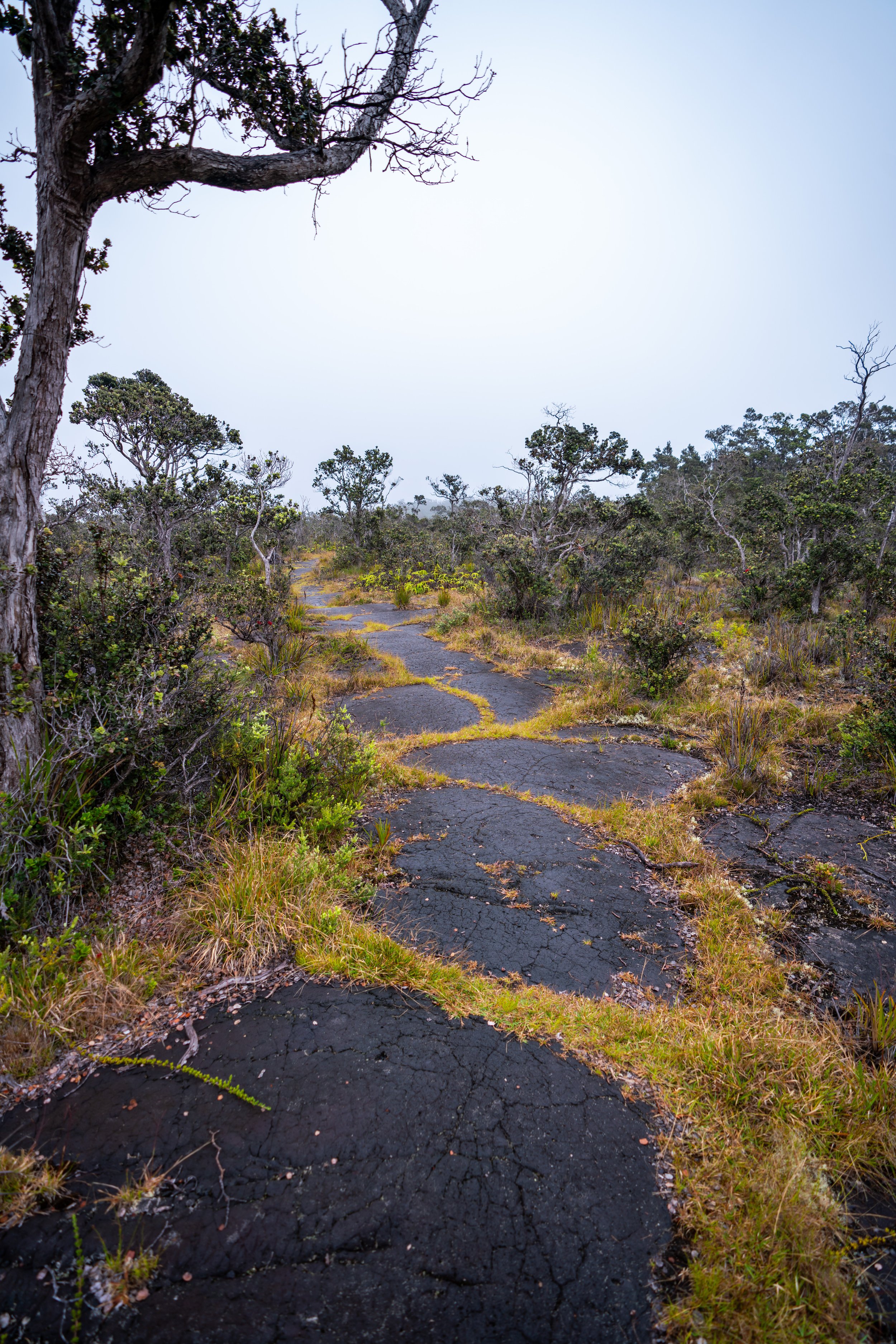
This stretch of the Crater Rim Trail between Escape and the Chain of Craters Road is, in my opinion, the most beautiful section of the entire hike, as you pass by countless Hāpuʻu ferns along the trail.
As the Crater Rim Trail descends and turns toward Kīlauea to the west, the forest will noticeably get drier and drier over a very short distance as you hike back to the Kaʻū Desert.
This sudden shift in rainfall gradients in such a short distance is truly quite remarkable when you realize how quickly it changes as you walk.
Chain of Craters Road
Distance to the Keanakākoʻi Crater: 0.7 miles / 1.1 km
When trail crosses the Chain of Craters Road, you begin the final section on the Crater Rim hike.
This is also where you want to get picked up if you planned on hiking the Crater Rim Trail as a one-way hike.
Google Maps Directions: Chain of Craters Road Junction
On this short 0.7-mile (1.1 km) section out to the Keanakākoʻi Crater, the forest will get thinner and thinner until disappearing altogether right before the end.
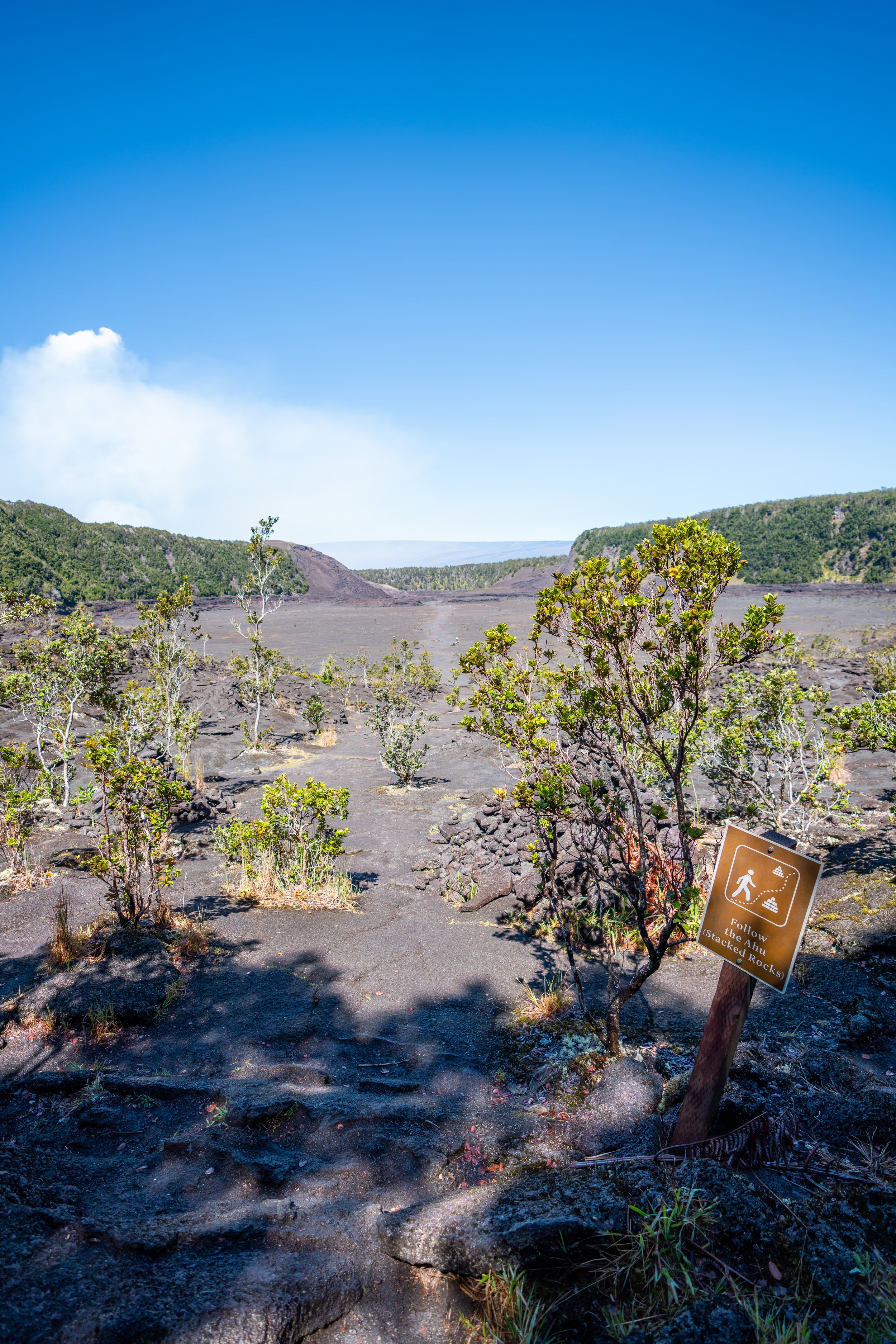
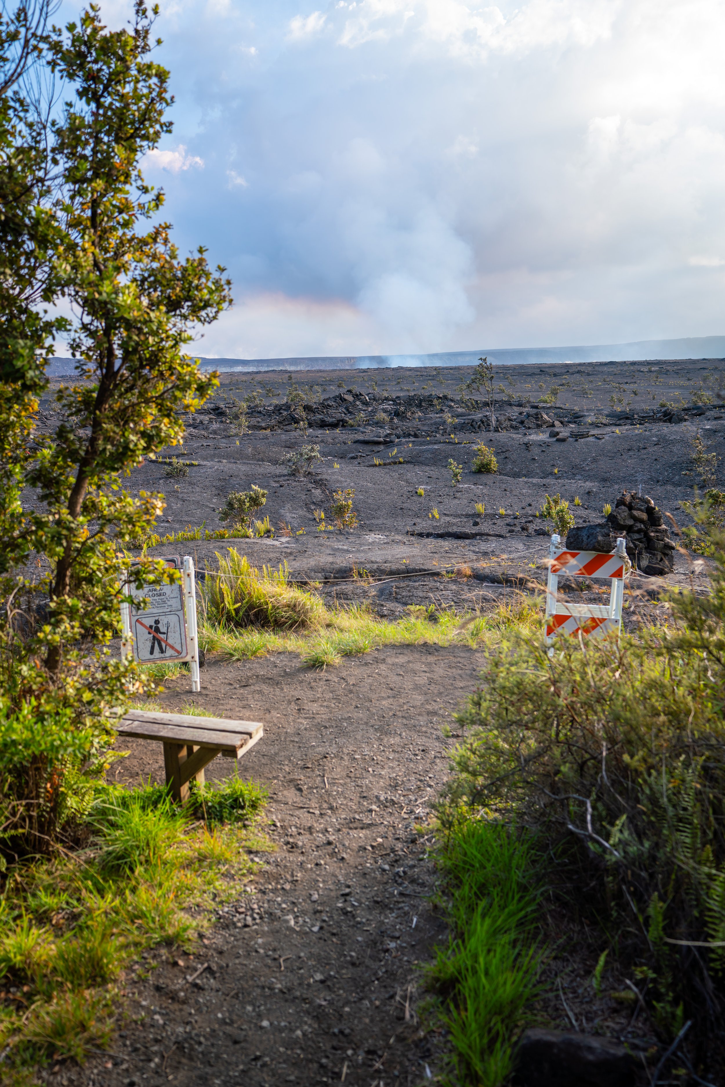
When the forest ends, go left and follow the rock cairns or Ahu for the next 0.25 miles (0.4 km) until you reach the Keanakākoʻi Crater.
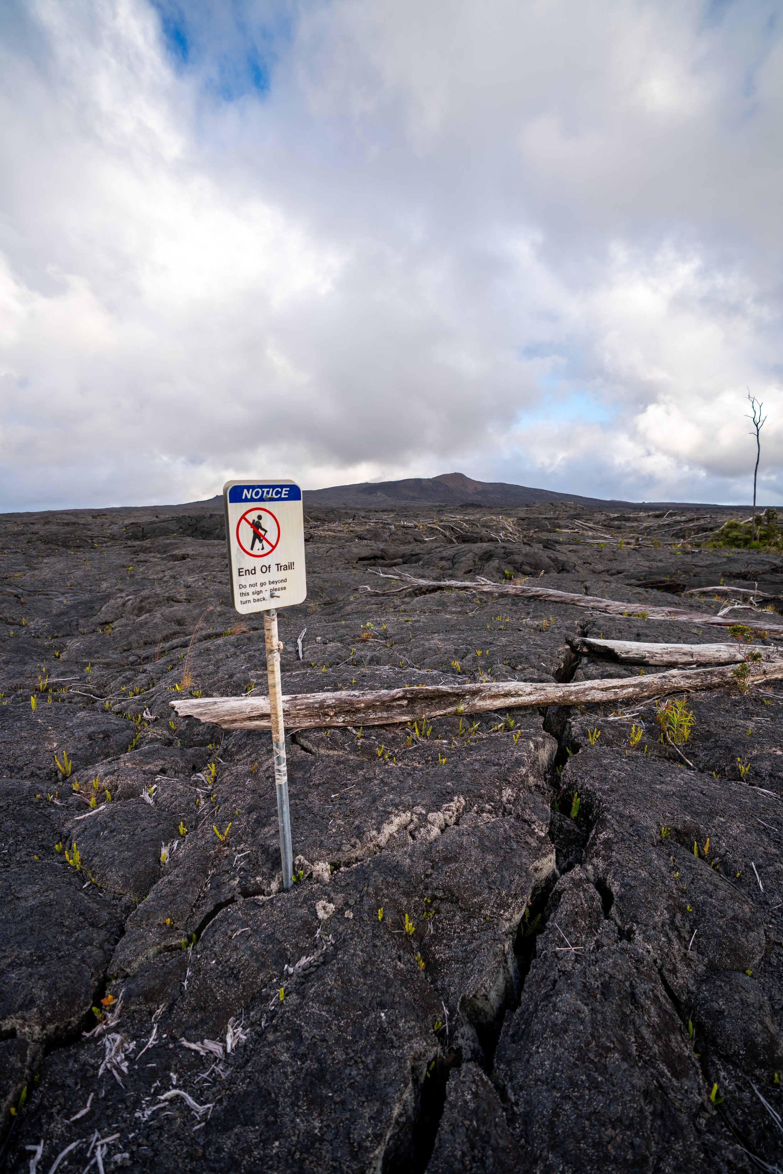
Keanakākoʻi Crater
The Keanakākoʻi Crater is the end of the long Crater Rim Trail, as well as the beginning of the Kaʻū Desert, just as when the hike began at Uēkahuna.
If you took my advice and hiked the Crater Rim Trail with the intention of hiking it as a one-way trail, then you only need to hike back 0.7 miles (1.1 km) to reach the Chain of Craters Road, where you can get picked up.
Overall, the Crater Rim Trail is an 8.3-mile (13.4 km) one-way hike or a 15.2-mile (24.5 km) roundtrip adventure. However, even though the trail is a bit long, it doesn’t feel nearly as long as it sounds because the trail moves extremely fast, and there are nearly no steep sections on the entire hike.
Native Plants on the Crater Rim Trail
From the Kaʻū Desert to the rainforest and back to the Kaʻū Desert, the Crater Rim Trail passes through a number of different native environments.
On the hike, you can expect to pass by ʻAʻaliʻi, Koa, ʻIliahi, Hāpuʻu, Pilo, ʻUhaloa, Lapalapa, ʻŌhiʻa lehua, and Kāwaʻu to truly only name a few!
If you would like to learn more about these and tons of other native Hawaiian plants from across the islands, I encourage you to read more about the subject in my separate post.
Read My Separate Post: Native Hawaiian Plant Guide