Hiking the Navajo Loop Trail in Bryce Canyon National Park
Distance: 1.5 miles / 2.4 km
Elevation Change: ~515 ft. / 157 m
The Navajo Loop Trail is arguably the best day hike in Bryce Canyon National Park, and on top of this, the trail one of the better kid-friendly hikes in Bryce Canyon, granted that the trail is snow-free.
To this point, if you’re planning on visiting Bryce Canyon when you expect there to be snow and ice on the ground, bring micro-spikes! I say this because many of the trails in the park descend steeply from the canyon rim, which can be especially dangerous come spring when the snow is melting during the day and freezing again at night.
All said, the mico-spikes below are the two best brands on the market, but I personally use the Yaktrax below.
Navajo Loop Trailhead Parking
Parking for the Navajo Loop Trail is located at the very end of Sunset Point Road, which is both a popular starting point for a number of trails and the lookout itself.
Therefore, expect the trailhead to be one of the busiest in Bryce Canyon, meaning it may be best to hike earlier rather than later, since the lot fills up so quickly.
Google Maps Directions: Navajo Loop Trailhead (Sunset Point)
Hiking Checklist - Bryce Canyon
Here is a complete list of must-have things that you will want for any hike in the Southwest U.S.
Hiking the Navajo Loop Trail
Two Bridges/ Thor’s Hammer Section (East Switchbacks)
The Navajo Loop Trail can either descend on the Two Bridges/ Thor’s Hammer (east) side of the loop or on the Wall Street switchbacks (west). However, I personally recommend starting on the east side because, in my opinion, the Wall Street Switchbacks are one of the best parts of the trail to slow down and take photos on the way out.
While this inevitably leaves the steeper Wall Street switchbacks for the very end, I recommend hiking in this direction because it’s likely that to be going slower through this section to take photos, as it’s easily one of the most scenic parts of the entire trail!
At the bottom of Two Bridges/ Thor’s Hammer switchbacks, the Navajo Loop Trail levels out as it passes beneath the many beautiful hoodoos that you can see from above along the canyon rim.
On a different note, all of these photos were taken during the late afternoon, which gave us the best light for this beautiful orange glow on the hoodoos.
Wall Street Section (West Switchbacks)
In all, the Navajo Loop took my friend and me about an hour and 30 minutes to hike, but that’s mostly because we were hiking slowly, while taking countless photos.
That being said, the Navajo Loop could easily be hiked much faster, as the whole trail is only 1.5 miles (2.4 km) roundtrip.
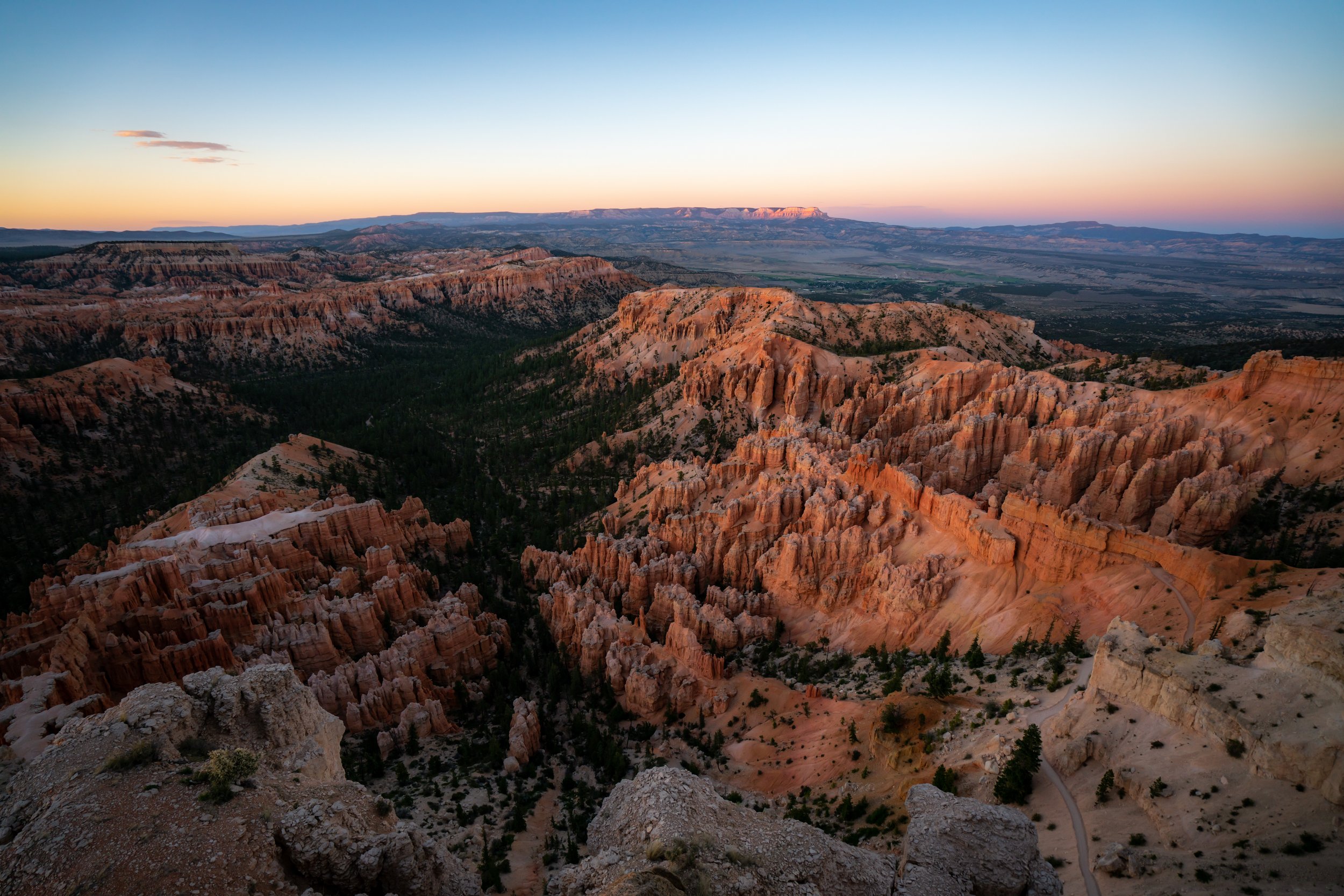
My Print - Bryce Canyon National Park