Hiking the Historic Blue Forest Trail in Petrified Forest National Park
Distance: 2.6 miles / 4.2 km
The Historic Blue Forest Trail in Petrified Forest National Park is a beautiful out-and-back day hike that leads hikers on a little-known route through the Blue Mesa Badlands, connecting Petrified Forest Road to the popular Blue Mesa Trail!
This is exactly why I think the Historic Blue Forest Trail is such a hidden gem in Petrified Forest—not to mention that only a fraction of visitors hike the Historic Trail compared to the popular Blue Mesa Loop!
Why is it Called the Historic Blue Forest Trail?
The Historic Blue Forest Trail carries the name 'historic' because it was once a road and trail constructed in the mid-1930s to connect both the Upper and Lower Blue Mesa Roads.
However, in 1955, both were closed and replaced by the current Blue Mesa Trail until 2013, when the Blue Forest Trail, including the old road, was reopened to park visitors!
In my opinion, the Blue Mesa and Historic Blue Forest Trails are two of the best day hikes in all of Petrified Forest National Park and can be connected to make one longer day hike beginning from either trailhead!
Historic Blue Forest Trailhead Parking
The Historic Blue Forest Trailhead can be found at the South Teepees Pullout, about 13.8 miles (22.2 km) south of the Painted Desert Visitor Center.
Here, parking can be found directly on the left-hand side of Petrified Forest Road when driving south through the park.
Google Maps Directions: Historic Blue Forest Trailhead
Hiking Checklist - Petrified Forest
Here is a complete list of must-have things that you will want for any hike in Petrified Forest National Park.
Hiking the Historic Blue Forest Trail
The Historic Blue Forest Trail begins on the old 1930s-era Lower Blue Mesa Road, which begins adjacent to the parking area.
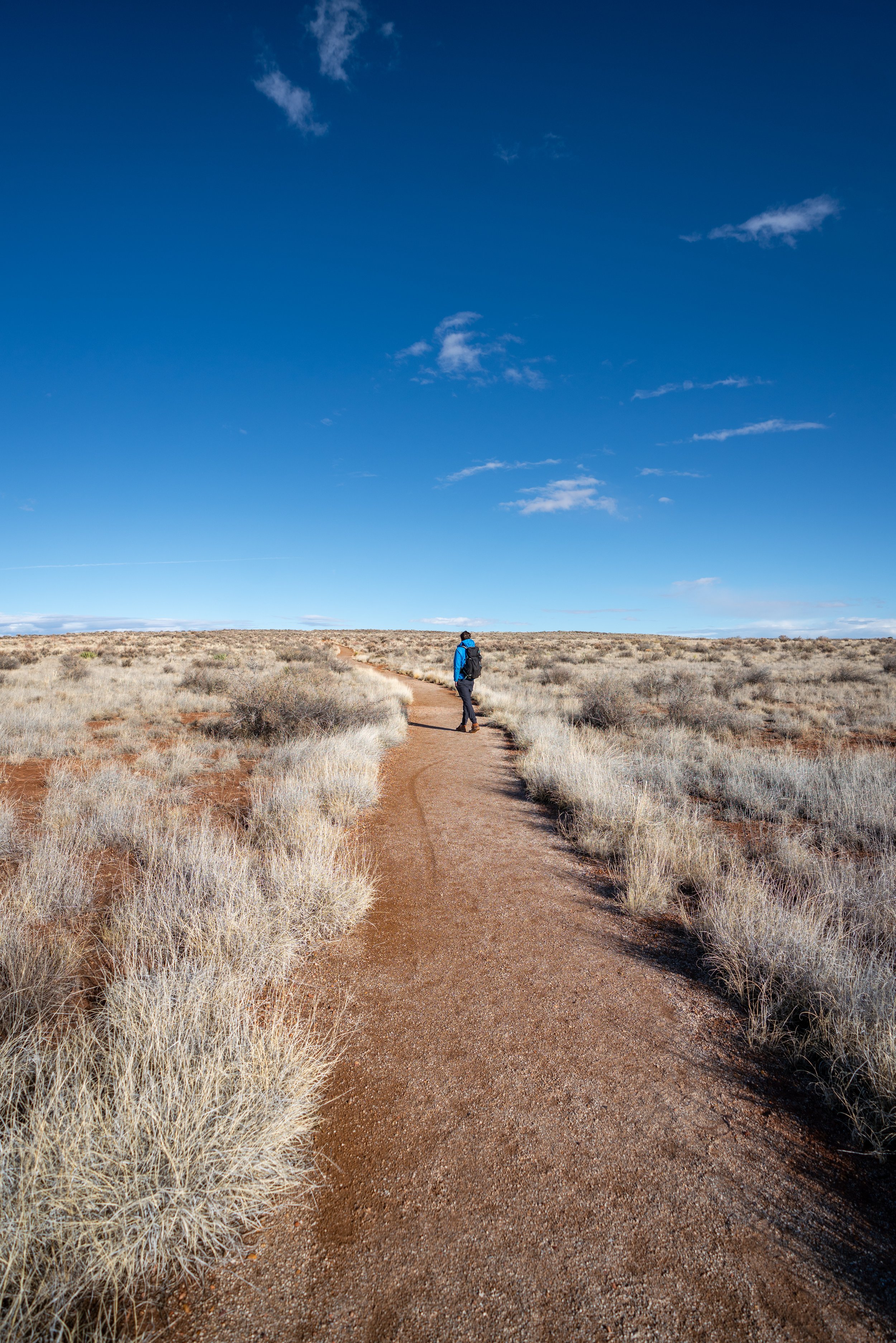
Following the trailhead, the Historic Blue Forest Trail follows a flat trail until it reaches the base of the badlands, about 0.5 miles (0.8 km) away.
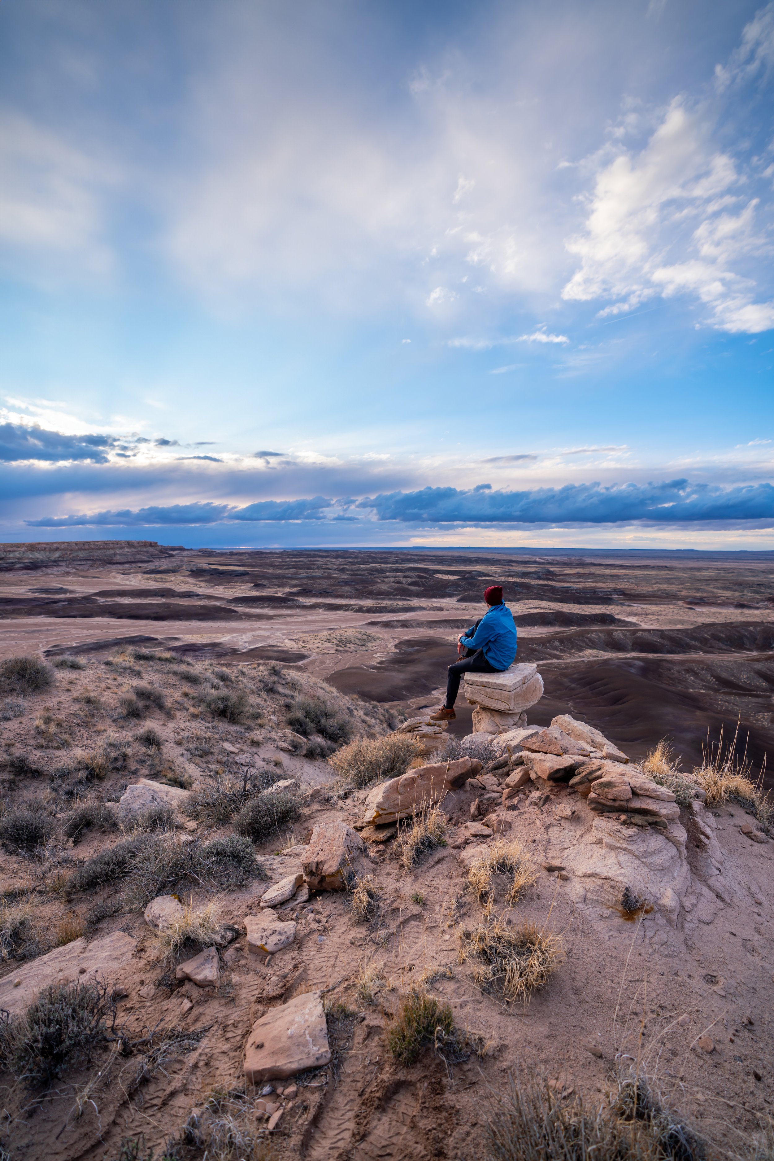
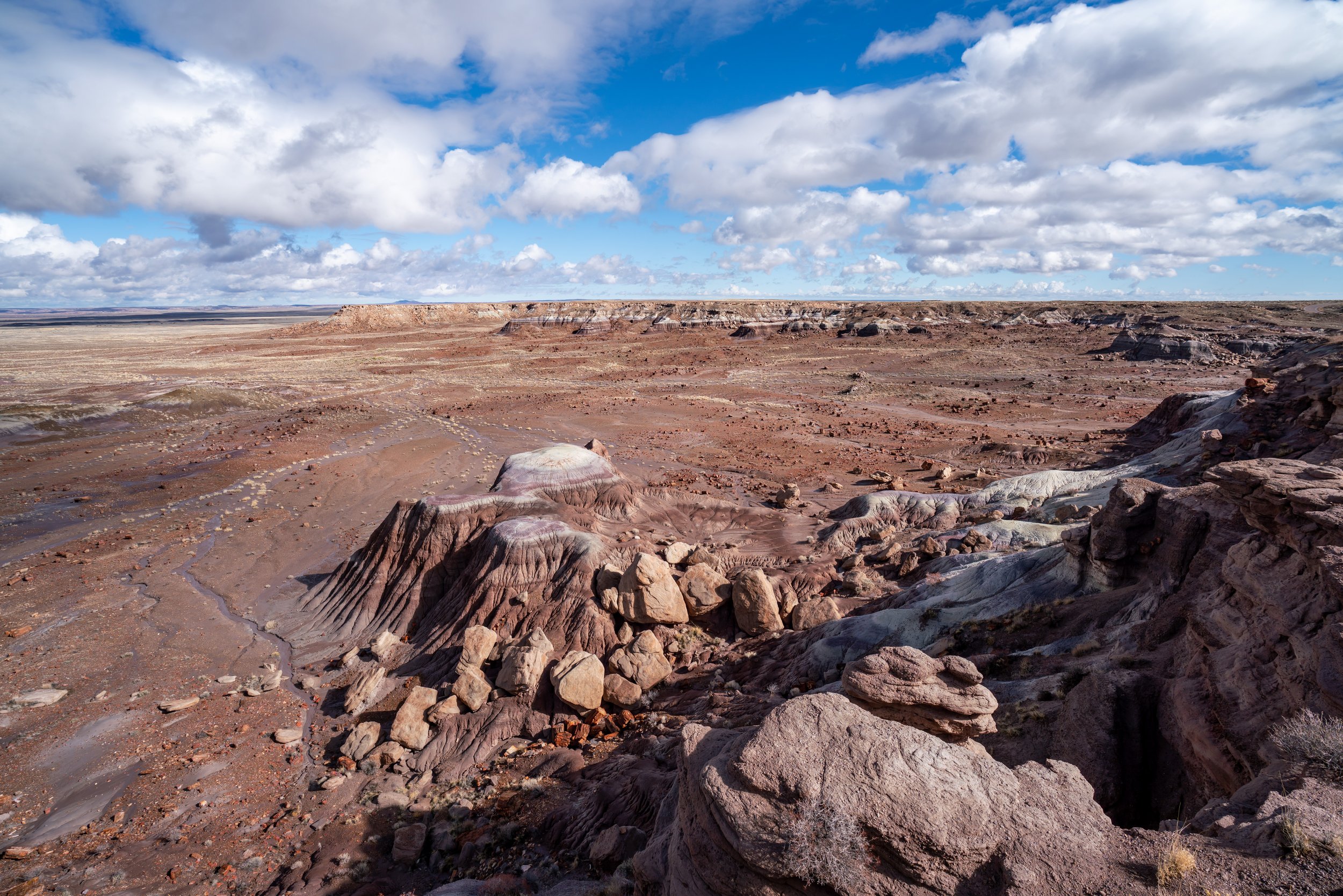
This is where the Historic Blue Forest Trail reaches the Blue Mesa Badlands, which is also where the trail will begin climbing up a number of switchbacks.
This is the view looking west at the flat part of the Blue Forest Trail.
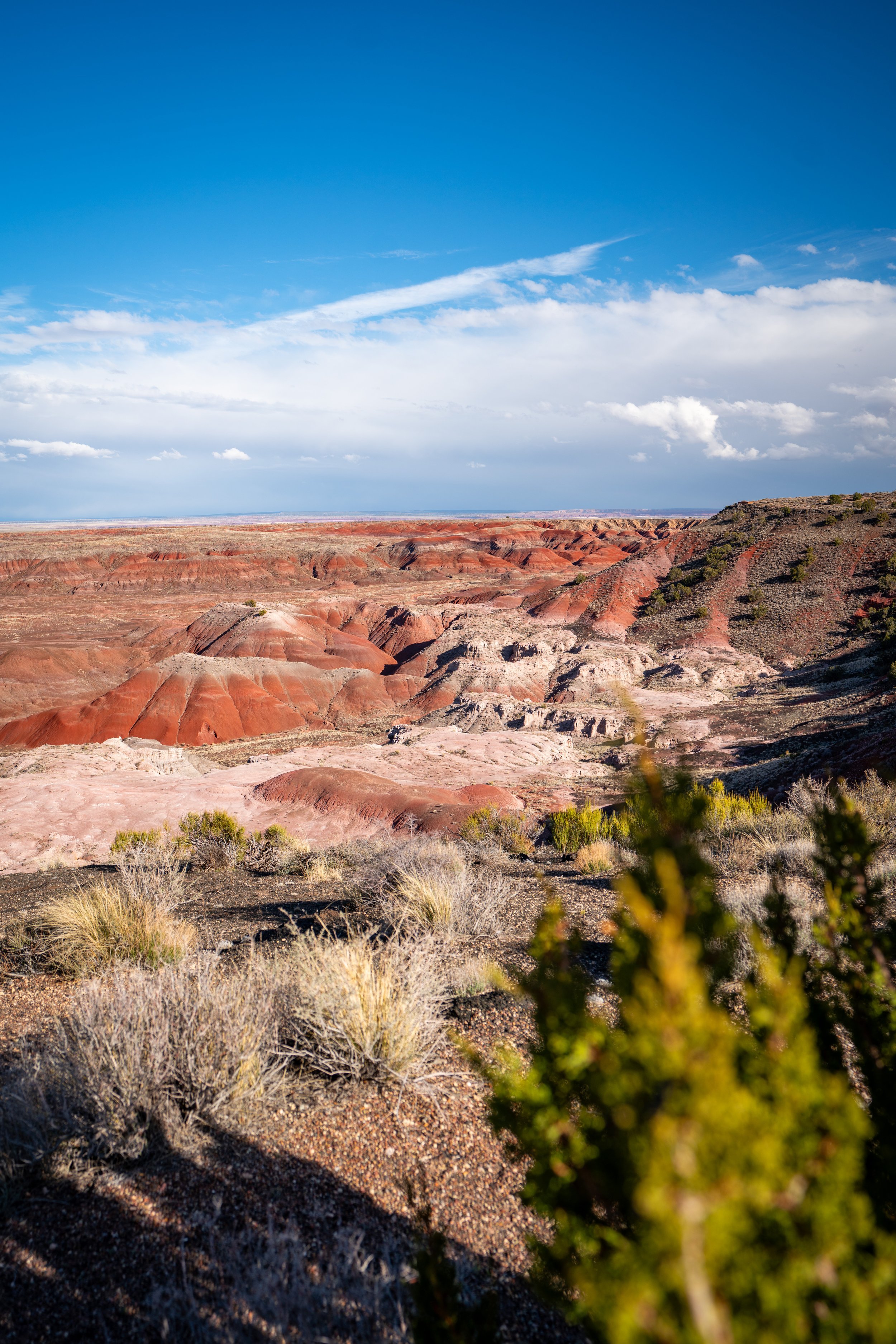
After this initial ascent, the Historic Blue Forest Trail will level out again, following a series of rolling hills until it reaches the steeper badlands that can be seen off in the distance.
At this split, go left to continue on the Historic Blue Forest Trail.
The trail to the right simply leads to the top of the peak in the photo below, but I recommend continuing on the Historic Blue Forest Trail, as it climbs a bit higher than this first optional summit.
In my opinion, these next sections were the most beautiful parts of the entire Historic Blue Forest Trail!
Next, the Historic Blue Forest Trail will climb another series of switchbacks, with the final one being the most difficult and dangerous if Petrified Forest has seen any recent rain.
This is the final switchback up to the top, and this slippery, muddy ascent was, by far, more difficult to walk up than the photo below may make it seem.
On top of this, the cliff to the right is steeper than it may appear, which is why I recommend turning back if you’re having any difficulty climbing up.
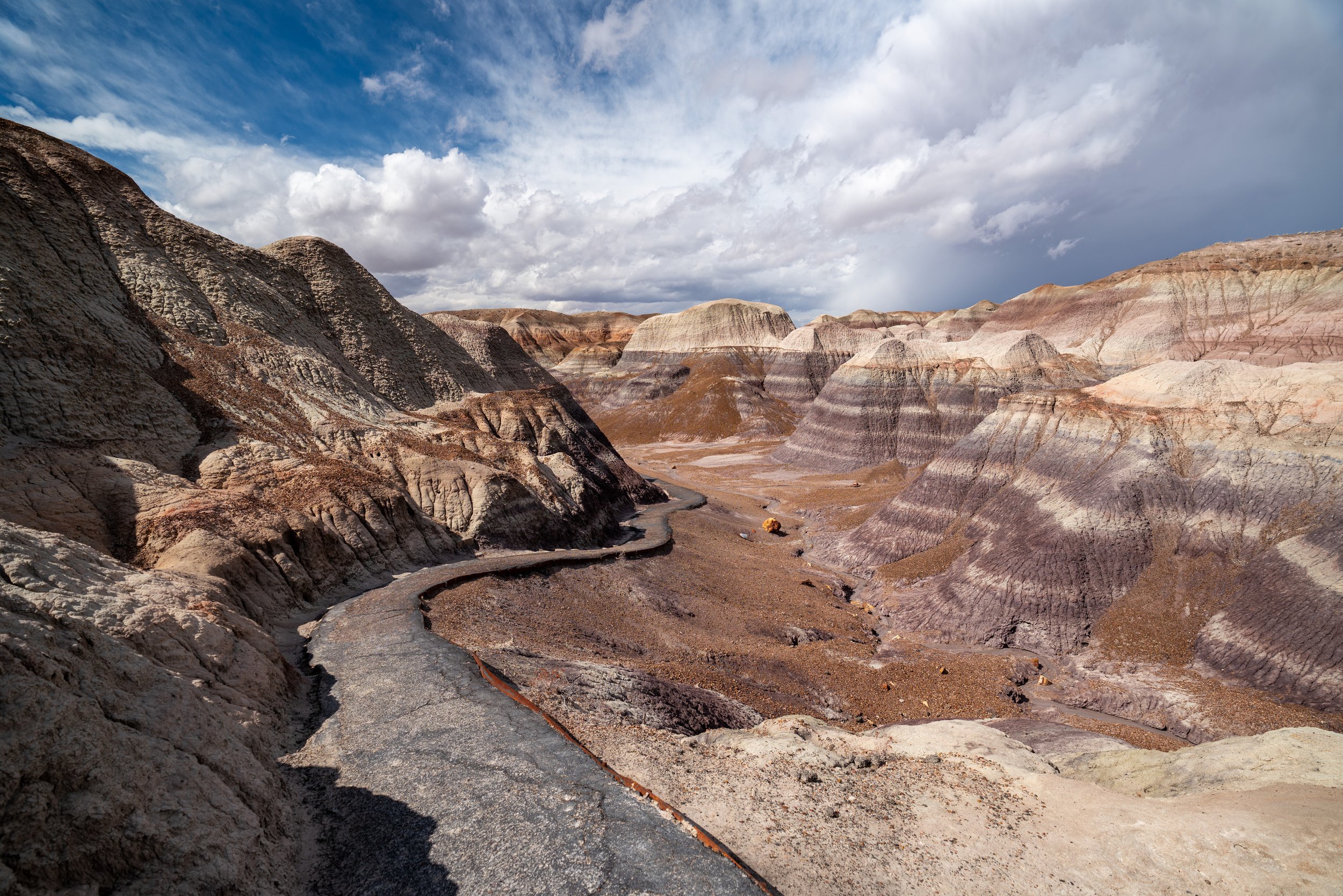
Once at the top, the Historic Blue Forest Trail follows the crest of the ridge before dropping down to the Blue Mesa Loop Trail within the heart of the badlands shortly ahead.
This is where the Historic Blue Forest Trail begins the descent down to the Blue Mesa Trail.
That said, if you plan to hike the Blue Mesa Trail as a separate day hike, it may not make sense to continue further.
However, what I can say is that this short connection down to the loop trail leads into the best parts of the Blue Mesa Trail, meaning that it makes for a great option to feel like you’re completing two hikes in one, should you choose to continue further.
Blue Mesa-Historic Blue Forest Junction
Finally, the Historic Blue Forest Trail ends where the Blue Mesa Loop Trail begins.
If you were interested in hiking further, the paved loop only adds another 0.5 miles (0.8 km), which I encourage you to learn more about in my separate article linked below.
Read My Separate Post: Blue Mesa Trail